The SK22 postcode district is a postal district located in the SK Stockport postcode area with a population of 12,074 residents according to the 2021 England and Wales Census.
The area of the SK22 postcode district is 18.27 square miles which is 47.33 square kilometres or 11,695.23 acres.
Currently, the SK22 district has about 387 postcode units spread across 4 geographic postcode sectors.
Given that each sector allows for 400 unique postcode combinations, the district has a capacity of 1,600 postcodes. With 387 postcodes already in use, this leaves 1213 units available.
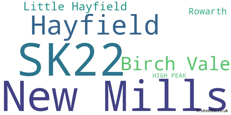
The largest settlement in the SK22 postal code is New Mills followed by Hayfield, and Birch Vale.
The SK22 Postcode shares a border with S33 (Bamford, Bradwell, Hope), SK6 (Marple, Romiley, Bredbury), SK12 (Poynton, Disley), SK13 (GLOSSOP, Hadfield, Tintwistle) and SK23 (Chapel-en-le-Frith, Whaley Bridge, Chinley).
The primary settlement in the SK22 postcode district is New Mills, which is located in the county of Derbyshire. Other significant settlements in the district include Birch Vale and Rowarth. The post town for the SK22 postcode district is High Peak.
For the district SK22, we have data on 5 postcode sectors. Here's a breakdown: The sector SK22 1, covers Birch Vale and Rowarth in Derbyshire. The sector SK22 2, covers Hayfield and Little Hayfield in Derbyshire. The sector SK22 3, covers New Mills in Derbyshire. The sector SK22 4, covers New Mills in Derbyshire. The sector SK22 9 is non-geographic. It's often designated for PO Boxes, large organisations, or special services.

Map of the SK22 Postcode District
Explore the SK22 postcode district by using our free interactive map.

When it comes to local government, postal geography often disregards political borders. However, for a breakdown in the SK22 District: the district mostly encompasses the High Peak District (B) (379 postcodes), and finally, the Stockport District (B) area (4 postcodes).
Recent House Sales in SK22
| Date | Price | Address |
|---|---|---|
| 22/09/2023 | £152,500 | Hibbert Street, New Mills, High Peak, SK22 3JJ |
| 14/09/2023 | £440,000 | Wood Lane, Hayfield, High Peak, SK22 2PA |
| 08/09/2023 | £560,000 | Low Leighton Road, New Mills, High Peak, SK22 4PG |
| 01/09/2023 | £278,000 | Church Road, New Mills, High Peak, SK22 4PF |
| 01/09/2023 | £260,000 | Hyde Bank Road, New Mills, High Peak, SK22 4BF |
| 31/08/2023 | £195,000 | Park Road, New Mills, High Peak, SK22 4NZ |
| 24/08/2023 | £475,000 | Hall Street, New Mills, High Peak, SK22 3BR |
| 24/08/2023 | £400,000 | New Mills Road, Hayfield, High Peak, SK22 2EU |
| 24/08/2023 | £358,000 | Lea Road, Hayfield, High Peak, SK22 2HE |
| 24/08/2023 | £275,000 | Bridge Street, New Mills, High Peak, SK22 4DJ |
Weather Forecast for SK22
Press Button to Show Forecast for New Mills
| Time Period | Icon | Description | Temperature | Rain Probability | Wind |
|---|---|---|---|---|---|
| 12:00 to 15:00 | Light rain | 7.0°C (feels like 5.0°C) | 51.00% | N 7 mph | |
| 15:00 to 18:00 | Cloudy | 8.0°C (feels like 6.0°C) | 35.00% | NNW 7 mph | |
| 18:00 to 21:00 | Cloudy | 8.0°C (feels like 6.0°C) | 5.00% | NE 4 mph | |
| 21:00 to 00:00 | Cloudy | 5.0°C (feels like 3.0°C) | 9.00% | E 7 mph |
Press Button to Show Forecast for New Mills
| Time Period | Icon | Description | Temperature | Rain Probability | Wind |
|---|---|---|---|---|---|
| 00:00 to 03:00 | Clear night | 3.0°C (feels like 1.0°C) | 3.00% | E 4 mph | |
| 03:00 to 06:00 | Partly cloudy (night) | 1.0°C (feels like -1.0°C) | 4.00% | ESE 4 mph | |
| 06:00 to 09:00 | Sunny day | 2.0°C (feels like 0.0°C) | 1.00% | E 4 mph | |
| 09:00 to 12:00 | Cloudy | 6.0°C (feels like 5.0°C) | 5.00% | ENE 4 mph | |
| 12:00 to 15:00 | Overcast | 8.0°C (feels like 7.0°C) | 9.00% | E 4 mph | |
| 15:00 to 18:00 | Cloudy | 9.0°C (feels like 9.0°C) | 6.00% | ENE 2 mph | |
| 18:00 to 21:00 | Cloudy | 9.0°C (feels like 8.0°C) | 9.00% | NE 4 mph | |
| 21:00 to 00:00 | Partly cloudy (night) | 5.0°C (feels like 3.0°C) | 4.00% | E 9 mph |
Press Button to Show Forecast for New Mills
| Time Period | Icon | Description | Temperature | Rain Probability | Wind |
|---|---|---|---|---|---|
| 00:00 to 03:00 | Partly cloudy (night) | 4.0°C (feels like 1.0°C) | 5.00% | E 7 mph | |
| 03:00 to 06:00 | Partly cloudy (night) | 3.0°C (feels like 1.0°C) | 5.00% | E 4 mph | |
| 06:00 to 09:00 | Partly cloudy (day) | 4.0°C (feels like 1.0°C) | 5.00% | E 7 mph | |
| 09:00 to 12:00 | Cloudy | 8.0°C (feels like 5.0°C) | 7.00% | E 9 mph | |
| 12:00 to 15:00 | Overcast | 9.0°C (feels like 7.0°C) | 14.00% | E 9 mph | |
| 15:00 to 18:00 | Cloudy | 10.0°C (feels like 7.0°C) | 17.00% | E 9 mph | |
| 18:00 to 21:00 | Cloudy | 9.0°C (feels like 7.0°C) | 16.00% | ENE 9 mph | |
| 21:00 to 00:00 | Cloudy | 7.0°C (feels like 4.0°C) | 16.00% | ENE 9 mph |
Press Button to Show Forecast for New Mills
| Time Period | Icon | Description | Temperature | Rain Probability | Wind |
|---|---|---|---|---|---|
| 00:00 to 03:00 | Cloudy | 6.0°C (feels like 3.0°C) | 15.00% | NE 9 mph | |
| 03:00 to 06:00 | Cloudy | 6.0°C (feels like 3.0°C) | 15.00% | NE 9 mph | |
| 06:00 to 09:00 | Light rain | 6.0°C (feels like 3.0°C) | 50.00% | NE 9 mph | |
| 09:00 to 12:00 | Light rain | 7.0°C (feels like 4.0°C) | 53.00% | NNE 11 mph | |
| 12:00 to 15:00 | Light rain | 8.0°C (feels like 6.0°C) | 56.00% | NNE 11 mph | |
| 15:00 to 18:00 | Heavy rain | 9.0°C (feels like 6.0°C) | 73.00% | NNE 11 mph | |
| 18:00 to 21:00 | Light rain shower (day) | 9.0°C (feels like 7.0°C) | 41.00% | NNW 7 mph | |
| 21:00 to 00:00 | Clear night | 7.0°C (feels like 5.0°C) | 13.00% | NW 7 mph |
Where is the SK22 Postcode District?
The data indicates that the postcode district SK22 is located in the town of High Peak. It is surrounded by several nearby towns, including Glossop to the north (3.61 miles away), Hyde to the northwest (6.95 miles away), Stockport to the west (8.56 miles away), Buxton to the south (9.74 miles away), and Macclesfield to the southwest (10.83 miles away). Additionally, the distance from the district to the center of London is approximately 150.81 miles.
The district is within the post town of HIGH PEAK.
The sector has postcodes within the nation of England.
The SK22 Postcode District is covers the following regions.
- South and West Derbyshire - Derbyshire and Nottinghamshire - East Midlands (England)
- Greater Manchester South East - Greater Manchester - North West (England)
| Postcode Sector | Delivery Office |
|---|---|
| SK22 1 | Birchvale Scale Payment Delivery Office |
| SK22 1 | Stockport Central Delivery Office |
| SK22 2 | Stockport Central Delivery Office |
| SK22 2 | Hayfield Scale Payment Delivery Office |
| SK22 3 | Stockport Central Delivery Office |
| SK22 3 | Stockport 1 Delivery Office |
| SK22 4 | Stockport Central Delivery Office |
| SK22 4 | Stockport 1 Delivery Office |
| S | K | 2 | 2 | - | X | X | X |
| S | K | 2 | 2 | Space | Numeric | Letter | Letter |
Current Monthly Rental Prices
| # Bedrooms | Min Price | Max Price | Avg Price |
|---|---|---|---|
| 1 | £650 | £650 | £650 |
| 2 | £799 | £895 | £847 |
| 3 | £1,100 | £1,100 | £1,100 |
Current House Prices
| # Bedrooms | Min Price | Max Price | Avg Price |
|---|---|---|---|
| £50,000 | £1,000,000 | £391,667 | |
| 1 | £150,000 | £205,000 | £175,000 |
| 2 | £150,000 | £525,000 | £233,154 |
| 3 | £195,000 | £595,000 | £328,777 |
| 4 | £295,000 | £950,000 | £493,956 |
| 5 | £599,950 | £975,000 | £799,988 |
| 6 | £1,300,000 | £1,300,000 | £1,300,000 |
| 9 | £850,000 | £850,000 | £850,000 |
Estate Agents who Operate in the SK22 District
| Logo | Name | Brand Name | Address | Contact Number | Total Properties |
|---|---|---|---|---|---|
 | New Mills | Sutherland Reay | 37-39 Union Road New Mills High Peak Derbyshire SK22 3ER | 01663 790523 | 62 |
 | New Mills | Jordan Fishwick | 2 Union Road, New Mills, High Peak, SK22 3ES | 01663 790522 | 26 |
 | Disley | Bridgfords | 3 Fountain Square Disley SK12 2AB | 01663 790544 | 15 |
 | High Lane | Ian Tonge Property Services Limited | 150 Buxton Road, High Lane, SK6 8EA | 0161 524 7425 | 3 |
 | Marple | Julian Wadden | 2 The Hollins, Marple, SK6 6AY | 0161 524 4844 | 2 |
| Type of Property | 2018 Average | 2018 Sales | 2017 Average | 2017 Sales | 2016 Average | 2016 Sales | 2015 Average | 2015 Sales |
|---|---|---|---|---|---|---|---|---|
| Detached | £365,149 | 41 | £328,187 | 49 | £354,942 | 56 | £334,910 | 47 |
| Semi-Detached | £224,688 | 61 | £209,781 | 67 | £198,395 | 58 | £197,740 | 58 |
| Terraced | £175,856 | 95 | £170,961 | 78 | £150,924 | 105 | £142,946 | 125 |
| Flats | £120,171 | 17 | £113,216 | 16 | £89,347 | 17 | £110,575 | 20 |