The SN12 postcode district is a postal district located in the SN Swindon postcode area with a population of 28,538 residents according to the 2021 England and Wales Census.
The area of the SN12 postcode district is 22.23 square miles which is 57.59 square kilometres or 14,229.96 acres.
Currently, the SN12 district has about 804 postcode units spread across 3 geographic postcode sectors.
Given that each sector allows for 400 unique postcode combinations, the district has a capacity of 1,200 postcodes. With 804 postcodes already in use, this leaves 396 units available.
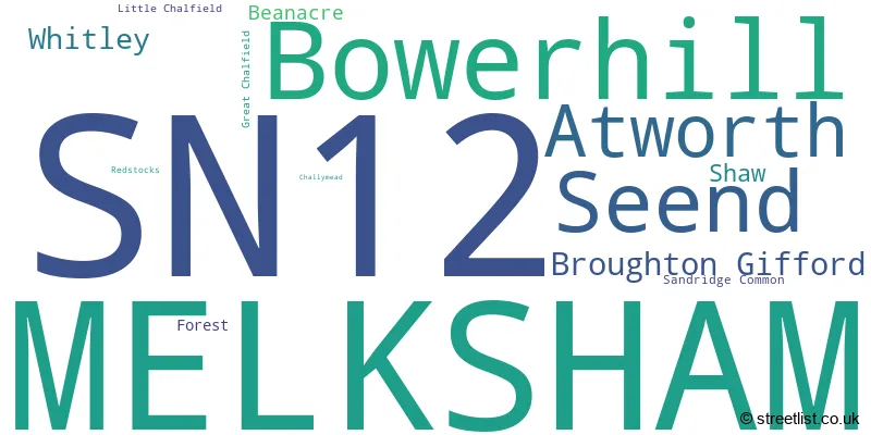
The largest settlement in the SN12 postal code is MELKSHAM followed by Bowerhill, and Seend.
The SN12 Postcode shares a border with SN10 (DEVIZES, Market Lavington, Potterne), BA14 (TROWBRIDGE, Hilperton, Southwick), SN13 (CORSHAM, Box, Neston) and SN15 (CHIPPENHAM, Lyneham, Bromham).
The primary settlement in the SN12 postcode district is Melksham, located in the county of Wiltshire, England. Other significant settlements include Bowerhill, Seend, Beanacre, Atworth, Broughton Gifford, and Shaw. The most significant post town in the district is Melksham.
For the district SN12, we have data on 4 postcode sectors. Here's a breakdown: The sector SN12 6, covers Melksham and Bowerhill and Seend in Wiltshire. The sector SN12 7, covers Melksham in Wiltshire. The sector SN12 8, covers Melksham and Atworth and Broughton Gifford and Whitley in Wiltshire. The sector SN12 9 is non-geographic. It's often designated for PO Boxes, large organisations, or special services.

Map of the SN12 Postcode District
Explore the SN12 postcode district by using our free interactive map.

When it comes to local government, postal geography often disregards political borders. However, for a breakdown in the SN12 District: the district mostly encompasses the Wiltshire area with a total of 822 postcodes.
Recent House Sales in SN12
| Date | Price | Address |
|---|---|---|
| 27/10/2023 | £272,500 | Queensway, Melksham, SN12 7JZ |
| 20/10/2023 | £255,000 | Pennine Close, Melksham, SN12 7RX |
| 10/10/2023 | £250,000 | Eden Grove, Whitley, Melksham, SN12 8QJ |
| 06/10/2023 | £395,000 | Wellington Square, Bowerhill, Melksham, SN12 6QX |
| 06/10/2023 | £390,000 | Primrose Drive, Melksham, SN12 6GD |
| 29/09/2023 | £330,000 | The Spa, Melksham, SN12 6QL |
| 29/09/2023 | £336,000 | Bradford Road, Atworth, Melksham, SN12 8HY |
| 26/09/2023 | £150,000 | Brookfield Rise, Whitley, Melksham, SN12 8QP |
| 21/09/2023 | £430,000 | St Athan Close, Bowerhill, Melksham, SN12 6XP |
| 19/09/2023 | £450,000 | Cranesbill Road, Melksham, SN12 7GG |
Weather Forecast for SN12
Press Button to Show Forecast for Melksham
| Time Period | Icon | Description | Temperature | Rain Probability | Wind |
|---|---|---|---|---|---|
| 09:00 to 12:00 | Overcast | 12.0°C (feels like 9.0°C) | 11.00% | NW 13 mph | |
| 12:00 to 15:00 | Cloudy | 13.0°C (feels like 10.0°C) | 12.00% | NNW 16 mph | |
| 15:00 to 18:00 | Cloudy | 13.0°C (feels like 10.0°C) | 5.00% | NNW 16 mph | |
| 18:00 to 21:00 | Sunny day | 12.0°C (feels like 9.0°C) | 1.00% | NNW 11 mph | |
| 21:00 to 00:00 | Partly cloudy (night) | 8.0°C (feels like 6.0°C) | 2.00% | N 9 mph |
Press Button to Show Forecast for Melksham
| Time Period | Icon | Description | Temperature | Rain Probability | Wind |
|---|---|---|---|---|---|
| 00:00 to 03:00 | Partly cloudy (night) | 7.0°C (feels like 5.0°C) | 1.00% | N 7 mph | |
| 03:00 to 06:00 | Partly cloudy (night) | 4.0°C (feels like 2.0°C) | 1.00% | NNE 4 mph | |
| 06:00 to 09:00 | Cloudy | 5.0°C (feels like 4.0°C) | 5.00% | NNE 4 mph | |
| 09:00 to 12:00 | Sunny day | 8.0°C (feels like 6.0°C) | 2.00% | NNE 9 mph | |
| 12:00 to 15:00 | Overcast | 11.0°C (feels like 9.0°C) | 8.00% | N 9 mph | |
| 15:00 to 18:00 | Overcast | 12.0°C (feels like 10.0°C) | 9.00% | N 9 mph | |
| 18:00 to 21:00 | Cloudy | 11.0°C (feels like 9.0°C) | 5.00% | NNE 7 mph | |
| 21:00 to 00:00 | Cloudy | 7.0°C (feels like 6.0°C) | 5.00% | NE 4 mph |
Press Button to Show Forecast for Melksham
| Time Period | Icon | Description | Temperature | Rain Probability | Wind |
|---|---|---|---|---|---|
| 00:00 to 03:00 | Clear night | 5.0°C (feels like 4.0°C) | 1.00% | ENE 4 mph | |
| 03:00 to 06:00 | Clear night | 4.0°C (feels like 2.0°C) | 1.00% | N 4 mph | |
| 06:00 to 09:00 | Partly cloudy (day) | 6.0°C (feels like 4.0°C) | 1.00% | NNE 4 mph | |
| 09:00 to 12:00 | Cloudy | 10.0°C (feels like 8.0°C) | 5.00% | NE 7 mph | |
| 12:00 to 15:00 | Cloudy | 12.0°C (feels like 10.0°C) | 6.00% | NE 9 mph | |
| 15:00 to 18:00 | Overcast | 12.0°C (feels like 10.0°C) | 10.00% | NE 9 mph | |
| 18:00 to 21:00 | Cloudy | 11.0°C (feels like 9.0°C) | 6.00% | NE 9 mph | |
| 21:00 to 00:00 | Cloudy | 8.0°C (feels like 6.0°C) | 4.00% | NE 7 mph |
Press Button to Show Forecast for Melksham
| Time Period | Icon | Description | Temperature | Rain Probability | Wind |
|---|---|---|---|---|---|
| 00:00 to 03:00 | Partly cloudy (night) | 6.0°C (feels like 4.0°C) | 2.00% | NE 7 mph | |
| 03:00 to 06:00 | Clear night | 5.0°C (feels like 2.0°C) | 3.00% | NE 7 mph | |
| 06:00 to 09:00 | Partly cloudy (day) | 5.0°C (feels like 3.0°C) | 2.00% | NNE 7 mph | |
| 09:00 to 12:00 | Partly cloudy (day) | 9.0°C (feels like 7.0°C) | 3.00% | NE 9 mph | |
| 12:00 to 15:00 | Cloudy | 11.0°C (feels like 9.0°C) | 7.00% | NE 9 mph | |
| 15:00 to 18:00 | Cloudy | 11.0°C (feels like 9.0°C) | 9.00% | NNE 11 mph | |
| 18:00 to 21:00 | Cloudy | 10.0°C (feels like 8.0°C) | 10.00% | NE 9 mph | |
| 21:00 to 00:00 | Partly cloudy (night) | 7.0°C (feels like 5.0°C) | 5.00% | NNE 7 mph |
Where is the SN12 Postcode District?
The data reveals that the SN12 postcode district is located in the town of Melksham. Melksham is surrounded by several nearby towns, including Trowbridge to the South West, Corsham to the North West, Devizes to the East, Chippenham to the North, Calne to the North East, Westbury to the South, and Bath to the West. Additionally, the distance from Melksham to the center of London is approximately 87.4 miles.
The district is within the post town of MELKSHAM.
The sector has postcodes within the nation of England.
The SN12 Postcode District is in the Wiltshire region of Gloucestershire, Wiltshire and Bath/Bristol area within the South West (England).
| Postcode Sector | Delivery Office |
|---|---|
| SN12 6 | Melksham Delivery Office |
| SN12 7 | Melksham Delivery Office |
| SN12 8 | Melksham Delivery Office |
| S | N | 1 | 2 | - | X | X | X |
| S | N | 1 | 2 | Space | Numeric | Letter | Letter |
Tourist Attractions within the Postcode Area
We found 1 visitor attractions within the SN12 postcode area
| Great Chalfield Manor |
|---|
| Historic Properties |
| Historic House / House and Garden / Palace |
| View Great Chalfield Manor on Google Maps |
Current Monthly Rental Prices
| # Bedrooms | Min Price | Max Price | Avg Price |
|---|---|---|---|
| 1 | £450 | £650 | £550 |
| 2 | £650 | £900 | £808 |
| 4 | £1,600 | £3,000 | £2,067 |
| 5 | £2,600 | £2,600 | £2,600 |
Current House Prices
| # Bedrooms | Min Price | Max Price | Avg Price |
|---|---|---|---|
| £3,250,000 | £3,250,000 | £3,250,000 | |
| 1 | £99,950 | £200,000 | £127,490 |
| 2 | £85,000 | £350,000 | £209,458 |
| 3 | £180,000 | £800,000 | £342,861 |
| 4 | £250,000 | £1,695,000 | £472,523 |
| 5 | £445,000 | £850,000 | £604,167 |
| 6 | £1,750,000 | £1,750,000 | £1,750,000 |
Estate Agents who Operate in the SN12 District
| Logo | Name | Brand Name | Address | Contact Number | Total Properties |
|---|---|---|---|---|---|
 | Melksham | Kingstons Melksham | 11 High Street, Melksham, SN12 6JR | 01225 435194 | 25 |
 | Melksham | Chase Buchanan | 13 High Street, Melksham, SN12 6JY | 01225 436712 | 21 |
 | Melksham | Lock & Key Independent Estate Agents | 5 Church Street, Melksham, SN12 6LS | 01225 431825 | 17 |
 | covering Swindon | Purplebricks | Suite 7 First Floor Cranmore Drive Shirley Solihull B90 4RZ | 020 3840 3396 | 7 |
 | Corsham | Allen & Harris | 28 High Street, Corsham, Wiltshire, SN13 0HB | 01249 479065 | 7 |
| Type of Property | 2018 Average | 2018 Sales | 2017 Average | 2017 Sales | 2016 Average | 2016 Sales | 2015 Average | 2015 Sales |
|---|---|---|---|---|---|---|---|---|
| Detached | £347,637 | 184 | £322,436 | 169 | £318,946 | 166 | £312,551 | 158 |
| Semi-Detached | £245,256 | 168 | £234,034 | 172 | £223,476 | 141 | £203,113 | 142 |
| Terraced | £197,301 | 126 | £198,808 | 136 | £190,219 | 152 | £176,864 | 133 |
| Flats | £185,533 | 69 | £116,188 | 43 | £126,080 | 68 | £97,827 | 52 |
Hotels within the Postcode Area
We found 10 hotels and guest houses within the SN12 postcode area
Beechfield House Hotel and Restaurant
Beechfield House,, Beanacre, Wiltshire, beanacre, SN12 7PU.
View detailsRew Farm Country & Equestrian Accommodation
Rew Farm, Seend Cleeve, Seend, Melksham, melksham, SN12 6PS.
View detailsWhitley Coach House
214 Corsham Road, Whitley, Melksham, Wiltshire, Whitley, whitley-gb, SN12 8QF.
View details