The SN16 postcode district is a postal district located in the SN Swindon postcode area with a population of 14,761 residents according to the 2021 England and Wales Census.
The area of the SN16 postcode district is 57.18 square miles which is 148.09 square kilometres or 36,592.78 acres.
Currently, the SN16 district has about 517 postcode units spread across 2 geographic postcode sectors.
Given that each sector allows for 400 unique postcode combinations, the district has a capacity of 800 postcodes. With 517 postcodes already in use, this leaves 283 units available.
The largest settlement in the SN16 postal code is MALMESBURY followed by Minety, and Sherston.
The SN16 Postcode shares a border with GL7 (CIRENCESTER, South Cerney, FAIRFORD), SN5 (Purton, Toothill, Freshbrook), GL8 (TETBURY, Avening, Westonbirt), SN6 (Highworth, Cricklade, Shrivenham), SN14 (CHIPPENHAM, Colerne, Marshfield) and SN15 (CHIPPENHAM, Lyneham, Bromham).
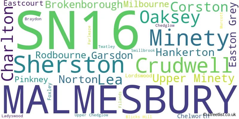
The primary settlement in the SN16 postcode district is Malmesbury, located in the county of Wiltshire, England. There are also several other significant settlements in this district, including Brokenborough, Corston, Easton Grey, Foxley, Norton, Pinkney, Rodbourne, Sherston, and Twatley. The most significant post town in this district is Malmesbury.
For the district SN16, we have data on 3 postcode sectors. Here's a breakdown: The sector SN16 0, covers Malmesbury and Sherston in Wiltshire. The sector SN16 1 is non-geographic. It's often designated for PO Boxes, large organisations, or special services. The sector SN16 9, covers Malmesbury and Minety and Crudwell in Wiltshire.

Map of the SN16 Postcode District
Explore the SN16 postcode district by using our free interactive map.

When it comes to local government, postal geography often disregards political borders. However, for a breakdown in the SN16 District: the district mostly encompasses the Wiltshire area with a total of 522 postcodes.
Recent House Sales in SN16
| Date | Price | Address |
|---|---|---|
| 04/10/2023 | £186,000 | Arches Lane, Malmesbury, SN16 0ED |
| 29/09/2023 | £352,500 | Bonners Close, Malmesbury, SN16 9UF |
| 29/09/2023 | £385,000 | Street Cottages, Oaksey, Malmesbury, SN16 9SZ |
| 27/09/2023 | £620,000 | Milbourne, Malmesbury, SN16 9JB |
| 21/09/2023 | £440,000 | Strongs Close, Sherston, Malmesbury, SN16 0NU |
| 20/09/2023 | £495,000 | John Betjeman Close, Malmesbury, SN16 9TZ |
| 15/09/2023 | £340,000 | St Aldhelms Close, Malmesbury, SN16 0DJ |
| 14/09/2023 | £775,000 | Hornbury Close, Minety, Malmesbury, SN16 9YE |
| 11/09/2023 | £372,500 | Cartmell Close, Malmesbury, SN16 9GQ |
| 11/09/2023 | £635,000 | Ron Golding Close, Malmesbury, SN16 9XR |
Weather Forecast for SN16
Press Button to Show Forecast for Malmesbury
| Time Period | Icon | Description | Temperature | Rain Probability | Wind |
|---|---|---|---|---|---|
| 00:00 to 03:00 | Cloudy | 5.0°C (feels like 3.0°C) | 4.00% | SSW 4 mph | |
| 03:00 to 06:00 | Clear night | 4.0°C (feels like 2.0°C) | 1.00% | W 7 mph | |
| 06:00 to 09:00 | Cloudy | 4.0°C (feels like 2.0°C) | 5.00% | W 4 mph | |
| 09:00 to 12:00 | Light rain | 8.0°C (feels like 6.0°C) | 43.00% | W 9 mph | |
| 12:00 to 15:00 | Cloudy | 10.0°C (feels like 8.0°C) | 35.00% | W 9 mph | |
| 15:00 to 18:00 | Cloudy | 11.0°C (feels like 9.0°C) | 32.00% | NW 9 mph | |
| 18:00 to 21:00 | Cloudy | 9.0°C (feels like 8.0°C) | 9.00% | NNE 4 mph | |
| 21:00 to 00:00 | Cloudy | 7.0°C (feels like 5.0°C) | 5.00% | NE 7 mph |
Press Button to Show Forecast for Malmesbury
| Time Period | Icon | Description | Temperature | Rain Probability | Wind |
|---|---|---|---|---|---|
| 00:00 to 03:00 | Cloudy | 5.0°C (feels like 3.0°C) | 4.00% | NE 7 mph | |
| 03:00 to 06:00 | Cloudy | 5.0°C (feels like 2.0°C) | 5.00% | ENE 7 mph | |
| 06:00 to 09:00 | Cloudy | 5.0°C (feels like 2.0°C) | 6.00% | ENE 7 mph | |
| 09:00 to 12:00 | Cloudy | 7.0°C (feels like 4.0°C) | 7.00% | ENE 9 mph | |
| 12:00 to 15:00 | Overcast | 10.0°C (feels like 8.0°C) | 13.00% | ENE 7 mph | |
| 15:00 to 18:00 | Overcast | 10.0°C (feels like 9.0°C) | 16.00% | ENE 7 mph | |
| 18:00 to 21:00 | Cloudy | 9.0°C (feels like 8.0°C) | 15.00% | ENE 7 mph | |
| 21:00 to 00:00 | Cloudy | 6.0°C (feels like 4.0°C) | 14.00% | ENE 7 mph |
Press Button to Show Forecast for Malmesbury
| Time Period | Icon | Description | Temperature | Rain Probability | Wind |
|---|---|---|---|---|---|
| 00:00 to 03:00 | Cloudy | 5.0°C (feels like 3.0°C) | 14.00% | ENE 7 mph | |
| 03:00 to 06:00 | Cloudy | 4.0°C (feels like 2.0°C) | 13.00% | ENE 7 mph | |
| 06:00 to 09:00 | Cloudy | 5.0°C (feels like 2.0°C) | 20.00% | NE 9 mph | |
| 09:00 to 12:00 | Light rain | 7.0°C (feels like 4.0°C) | 52.00% | NE 9 mph | |
| 12:00 to 15:00 | Overcast | 10.0°C (feels like 8.0°C) | 21.00% | ENE 11 mph | |
| 15:00 to 18:00 | Overcast | 11.0°C (feels like 9.0°C) | 20.00% | ENE 11 mph | |
| 18:00 to 21:00 | Cloudy | 10.0°C (feels like 8.0°C) | 21.00% | NE 11 mph | |
| 21:00 to 00:00 | Light rain | 8.0°C (feels like 5.0°C) | 53.00% | NE 13 mph |
Press Button to Show Forecast for Malmesbury
| Time Period | Icon | Description | Temperature | Rain Probability | Wind |
|---|---|---|---|---|---|
| 00:00 to 03:00 | Light rain | 7.0°C (feels like 4.0°C) | 54.00% | NE 11 mph | |
| 03:00 to 06:00 | Heavy rain | 7.0°C (feels like 4.0°C) | 73.00% | NE 11 mph | |
| 06:00 to 09:00 | Heavy rain | 7.0°C (feels like 4.0°C) | 73.00% | NNE 9 mph | |
| 09:00 to 12:00 | Light rain | 9.0°C (feels like 6.0°C) | 52.00% | NE 11 mph | |
| 12:00 to 15:00 | Light rain shower (day) | 10.0°C (feels like 7.0°C) | 41.00% | NE 11 mph | |
| 15:00 to 18:00 | Overcast | 10.0°C (feels like 8.0°C) | 25.00% | NNW 11 mph | |
| 18:00 to 21:00 | Light rain shower (day) | 10.0°C (feels like 8.0°C) | 36.00% | WNW 9 mph | |
| 21:00 to 00:00 | Cloudy | 7.0°C (feels like 5.0°C) | 7.00% | WNW 7 mph |
Where is the SN16 Postcode District?
The data provided indicates that the SN16 postcode district is located in Malmesbury. Malmesbury is a town in close proximity to several nearby towns, including Tetbury to the North West, Cirencester to the North East, Chippenham to the South West, Calne to the South, Wotton-under-Edge to the West, and Swindon to the East. Additionally, the distance from the SN16 postcode district to the center of London is approximately 84.2 miles.
The district is within the post town of MALMESBURY.
The sector has postcodes within the nation of England.
The SN16 Postcode District is covers the following regions.
- Wiltshire - Gloucestershire, Wiltshire and Bath/Bristol area - South West (England)
- Gloucestershire - Gloucestershire, Wiltshire and Bath/Bristol area - South West (England)
| Postcode Sector | Delivery Office |
|---|---|
| SN16 0 | Malmesbury Delivery Office |
| SN16 9 | Malmesbury Delivery Office |
| S | N | 1 | 6 | - | X | X | X |
| S | N | 1 | 6 | Space | Numeric | Letter | Letter |
Tourist Attractions within the Postcode Area
We found 1 visitor attractions within the SN16 postcode area
| Athelstan Museum |
|---|
| Museums & Art Galleries |
| Museum and / or Art Gallery |
| View Athelstan Museum on Google Maps |
Current Monthly Rental Prices
| # Bedrooms | Min Price | Max Price | Avg Price |
|---|---|---|---|
| £604 | £1,250 | £927 | |
| 2 | £900 | £900 | £900 |
| 3 | £1,350 | £3,000 | £1,933 |
Current House Prices
| # Bedrooms | Min Price | Max Price | Avg Price |
|---|---|---|---|
| £1 | £1 | £1 | |
| 1 | £160,000 | £895,000 | £309,395 |
| 2 | £114,000 | £695,000 | £307,422 |
| 3 | £130,800 | £965,000 | £462,808 |
| 4 | £350,000 | £2,500,000 | £770,047 |
| 5 | £725,000 | £1,950,000 | £1,109,333 |
| 6 | £895,000 | £2,250,000 | £1,572,500 |
Estate Agents who Operate in the SN16 District
| Logo | Name | Brand Name | Address | Contact Number | Total Properties |
|---|---|---|---|---|---|
 | Malmesbury | Blount & Maslin | 50 High Street, Malmesbury, SN16 9AT | 01666 337147 | 22 |
 | Malmesbury | Strakers | 53 High Street Malmesbury Wiltshire, SN16 9AG | 01666 337165 | 21 |
 | Cotswolds | James Pyle & Co | The Barn Swan Barton Sherston Malmesbury Wiltshire SN16 0LJ | 01666 337183 | 18 |
 | Malmesbury | Lockstones Estate Agents | 52 High Street, Malmesbury, SN16 9AT | 01666 337163 | 17 |
 | Tetbury | Perry Bishop | 3 Church Street, Tetbury, GL8 8JG | 01666 330790 | 8 |
- Brokenborough
- Charlton Heath
- Charlton
- Chelworth
- Cloatley
- Corston
- Crudwell
- Easton Grey
- Garsdon
- Hankerton
- Lea
- Long Newnton
- Malmesbury
- Milbourne
- Minety Common
- Minety
- Norton
- Oaksey
- Rodbourne Bottom
- Rodbourne
- Royal Wootton Bassett
- Sherston
- Sherston Parva / Pinkney
- Shipton Moyne
- Somerford Keynes
- Stopper's Hill
- Upper Minety
| Type of Property | 2018 Average | 2018 Sales | 2017 Average | 2017 Sales | 2016 Average | 2016 Sales | 2015 Average | 2015 Sales |
|---|---|---|---|---|---|---|---|---|
| Detached | £530,216 | 145 | £491,540 | 106 | £467,610 | 89 | £528,771 | 89 |
| Semi-Detached | £326,046 | 51 | £324,460 | 89 | £289,973 | 64 | £263,842 | 42 |
| Terraced | £284,106 | 66 | £320,260 | 76 | £257,101 | 73 | £268,377 | 82 |
| Flats | £220,506 | 39 | £202,712 | 41 | £187,122 | 43 | £175,250 | 18 |