The SN8 postcode district is a postal district located in the SN Swindon postcode area with a population of 24,926 residents according to the 2021 England and Wales Census.
The area of the SN8 postcode district is 168.02 square miles which is 435.16 square kilometres or 107,531.44 acres.
Currently, the SN8 district has about 932 postcode units spread across 4 geographic postcode sectors.
Given that each sector allows for 400 unique postcode combinations, the district has a capacity of 1,600 postcodes. With 932 postcodes already in use, this leaves 668 units available.
The largest settlement in the SN8 postal code is MARLBOROUGH followed by Ramsbury, and Aldbourne.
The SN8 Postcode shares a border with SN4 (Royal Wootton Bassett, Wroughton, Chiseldon), SN10 (DEVIZES, Market Lavington, Potterne), SN11 (CALNE, Derry Hill, Hilmarton), SP4 (Amesbury, Durrington, Larkhill), RG17 (HUNGERFORD, Lambourn, Kintbury), SN9 (PEWSEY, Upavon, Enford), SP11 (ANDOVER, Ludgershall, Picket Piece) and SP9 (TIDWORTH, Shipton Bellinger).
The primary settlement in the SN8 postcode district is Marlborough, located in the county of Wiltshire in England. Other significant settlements in the district include Avebury, Beckhampton, Fyfield, Manton, Ogbourne St. Andrew, Ogbourne St. George, Rockley, West Kennett, and West Overton. The main post town in the district is Marlborough.
For the district SN8, we have data on 5 postcode sectors. Here's a breakdown: The sector SN8 1, covers Marlborough and Ogbourne St. George in Wiltshire. The sector SN8 2, covers Ramsbury and Aldbourne and Marlborough and Baydon and Mildenhall in Wiltshire. The sector SN8 3, covers Burbage and Great Bedwyn and Collingbourne Ducis and Shalbourne in Wiltshire. The sector SN8 4, covers Marlborough in Wiltshire. The sector SN8 9 is non-geographic. It's often designated for PO Boxes, large organisations, or special services.

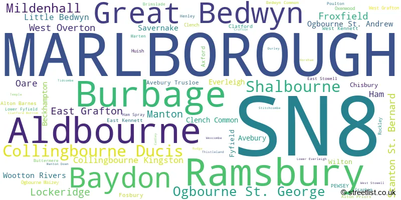
Map of the SN8 Postcode District
Explore the SN8 postcode district by using our free interactive map.

When it comes to local government, postal geography often disregards political borders. However, for a breakdown in the SN8 District: the district mostly encompasses the Wiltshire area with a total of 943 postcodes.
Recent House Sales in SN8
| Date | Price | Address |
|---|---|---|
| 27/10/2023 | £430,000 | Canning Place, Marlborough, SN8 4FJ |
| 29/09/2023 | £335,000 | Priory Court, Marlborough, SN8 4FE |
| 29/09/2023 | £572,000 | Ashley Piece, Ramsbury, Marlborough, SN8 2QE |
| 07/09/2023 | £425,000 | The Thorns, Marlborough, SN8 1DY |
| 05/09/2023 | £279,000 | White Horse Road, Marlborough, SN8 2FE |
| 05/09/2023 | £390,000 | Aubrey Close, Marlborough, SN8 1TS |
| 04/09/2023 | £275,000 | Beech Terrace, Baydon, Marlborough, SN8 2HT |
| 31/08/2023 | £510,000 | Baywater, Marlborough, SN8 1DX |
| 31/08/2023 | £245,000 | Foxbury Place, Great Bedwyn, Marlborough, SN8 3PL |
| 30/08/2023 | £1,300,000 | Brook Street, Great Bedwyn, Marlborough, SN8 3LZ |
Weather Forecast for SN8
Press Button to Show Forecast for Marlborough
| Time Period | Icon | Description | Temperature | Rain Probability | Wind |
|---|---|---|---|---|---|
| 00:00 to 03:00 | Partly cloudy (night) | 5.0°C (feels like 3.0°C) | 1.00% | NE 4 mph | |
| 03:00 to 06:00 | Partly cloudy (night) | 3.0°C (feels like 2.0°C) | 0.00% | N 4 mph | |
| 06:00 to 09:00 | Partly cloudy (day) | 4.0°C (feels like 3.0°C) | 1.00% | NNW 4 mph | |
| 09:00 to 12:00 | Partly cloudy (day) | 8.0°C (feels like 5.0°C) | 1.00% | N 9 mph | |
| 12:00 to 15:00 | Cloudy | 10.0°C (feels like 8.0°C) | 4.00% | N 11 mph | |
| 15:00 to 18:00 | Cloudy | 11.0°C (feels like 9.0°C) | 4.00% | N 9 mph | |
| 18:00 to 21:00 | Cloudy | 10.0°C (feels like 9.0°C) | 4.00% | NNE 7 mph | |
| 21:00 to 00:00 | Cloudy | 7.0°C (feels like 6.0°C) | 4.00% | NNE 4 mph |
Press Button to Show Forecast for Marlborough
| Time Period | Icon | Description | Temperature | Rain Probability | Wind |
|---|---|---|---|---|---|
| 00:00 to 03:00 | Cloudy | 5.0°C (feels like 4.0°C) | 3.00% | NE 4 mph | |
| 03:00 to 06:00 | Partly cloudy (night) | 4.0°C (feels like 3.0°C) | 1.00% | NNE 4 mph | |
| 06:00 to 09:00 | Cloudy | 5.0°C (feels like 3.0°C) | 4.00% | NNE 4 mph | |
| 09:00 to 12:00 | Overcast | 7.0°C (feels like 5.0°C) | 8.00% | NNE 9 mph | |
| 12:00 to 15:00 | Overcast | 9.0°C (feels like 7.0°C) | 7.00% | NNE 9 mph | |
| 15:00 to 18:00 | Overcast | 10.0°C (feels like 8.0°C) | 9.00% | NNE 9 mph | |
| 18:00 to 21:00 | Overcast | 9.0°C (feels like 7.0°C) | 10.00% | NNE 9 mph | |
| 21:00 to 00:00 | Cloudy | 6.0°C (feels like 4.0°C) | 6.00% | NE 7 mph |
Press Button to Show Forecast for Marlborough
| Time Period | Icon | Description | Temperature | Rain Probability | Wind |
|---|---|---|---|---|---|
| 00:00 to 03:00 | Clear night | 4.0°C (feels like 2.0°C) | 3.00% | NE 7 mph | |
| 03:00 to 06:00 | Partly cloudy (night) | 3.0°C (feels like 1.0°C) | 3.00% | NNE 4 mph | |
| 06:00 to 09:00 | Partly cloudy (day) | 4.0°C (feels like 2.0°C) | 6.00% | NNE 4 mph | |
| 09:00 to 12:00 | Cloudy | 7.0°C (feels like 6.0°C) | 10.00% | NE 4 mph | |
| 12:00 to 15:00 | Overcast | 9.0°C (feels like 7.0°C) | 16.00% | N 7 mph | |
| 15:00 to 18:00 | Cloudy | 8.0°C (feels like 7.0°C) | 19.00% | NNW 7 mph | |
| 18:00 to 21:00 | Light rain | 8.0°C (feels like 6.0°C) | 47.00% | NNW 7 mph | |
| 21:00 to 00:00 | Light rain | 7.0°C (feels like 5.0°C) | 43.00% | N 4 mph |
Press Button to Show Forecast for Marlborough
| Time Period | Icon | Description | Temperature | Rain Probability | Wind |
|---|---|---|---|---|---|
| 00:00 to 03:00 | Cloudy | 6.0°C (feels like 4.0°C) | 11.00% | NNE 4 mph | |
| 03:00 to 06:00 | Cloudy | 5.0°C (feels like 3.0°C) | 9.00% | NE 4 mph | |
| 06:00 to 09:00 | Cloudy | 6.0°C (feels like 4.0°C) | 8.00% | N 7 mph | |
| 09:00 to 12:00 | Cloudy | 8.0°C (feels like 6.0°C) | 7.00% | N 9 mph | |
| 12:00 to 15:00 | Overcast | 10.0°C (feels like 8.0°C) | 9.00% | N 9 mph | |
| 15:00 to 18:00 | Overcast | 11.0°C (feels like 9.0°C) | 12.00% | NNE 9 mph | |
| 18:00 to 21:00 | Cloudy | 10.0°C (feels like 9.0°C) | 10.00% | NNE 7 mph | |
| 21:00 to 00:00 | Clear night | 7.0°C (feels like 6.0°C) | 5.00% | NNE 7 mph |
Where is the SN8 Postcode District?
The postcode district SN8 is located in Marlborough. It is situated near several towns: Pewsey is to the South West, Hungerford is to the East, Tidworth is to the South, Swindon is to the North, Devizes is to the West, Andover is to the South East, and Wantage is to the North East. The distance to London from this postcode district is approximately 67.56 miles.
The district covers the post towns of MARLBOROUGH, PEWSEY.
The sector has postcodes within the nation of England.
The SN8 Postcode District is covers the following regions.
- Wiltshire - Gloucestershire, Wiltshire and Bath/Bristol area - South West (England)
- Berkshire - Berkshire, Buckinghamshire and Oxfordshire - South East (England)
- Swindon - Gloucestershire, Wiltshire and Bath/Bristol area - South West (England)
| Postcode Sector | Delivery Office |
|---|---|
| SN8 1 | Marlborough Delivery Office |
| SN8 2 | Marlborough Delivery Office |
| SN8 3 | Marlborough Delivery Office |
| SN8 3 | Burbage Scale Payment Delivery Office |
| SN8 4 | Marlborough Delivery Office |
| S | N | 8 | - | X | X | X |
| S | N | 8 | Space | Numeric | Letter | Letter |
Tourist Attractions within the Postcode Area
We found 1 visitor attractions within the SN8 postcode area
| Avebury Stone Circle |
|---|
| Historic Properties |
| Historic Monument / Archaeological Site |
| View Avebury Stone Circle on Google Maps |
Current Monthly Rental Prices
| # Bedrooms | Min Price | Max Price | Avg Price |
|---|---|---|---|
| £1,167 | £6,250 | £3,709 | |
| 1 | £1,300 | £1,650 | £1,475 |
| 2 | £850 | £1,550 | £1,246 |
| 3 | £1,000 | £3,500 | £1,694 |
| 4 | £1,800 | £3,500 | £2,858 |
Current House Prices
| # Bedrooms | Min Price | Max Price | Avg Price |
|---|---|---|---|
| £95,000 | £6,000,000 | £958,500 | |
| 1 | £80,000 | £395,000 | £184,906 |
| 2 | £48,750 | £750,000 | £314,667 |
| 3 | £275,000 | £1,100,000 | £488,752 |
| 4 | £350,000 | £1,175,000 | £679,274 |
| 5 | £525,000 | £3,750,000 | £1,229,200 |
| 6 | £1,150,000 | £1,150,000 | £1,150,000 |
| 7 | £1,450,000 | £4,000,000 | £2,725,000 |
| 8 | £2,500,000 | £5,600,000 | £4,050,000 |
Estate Agents who Operate in the SN8 District
| Logo | Name | Brand Name | Address | Contact Number | Total Properties |
|---|---|---|---|---|---|
 | Marlborough | Carter Jonas | 93 High Street, Marlborough, SN8 1HD | 01672 550801 | 32 |
 | Marlborough | Hamptons Sales | 20 High Street, Marlborough, SN8 1AA | 01672 555806 | 28 |
 | Marlborough | Jones Robinson | 139B High Street, Marlborough, SN8 1HN | 01671 907300 | 27 |
 | Marlborough | Brearley & Rich | 1 London Road, Marlborough, SN8 1PH | 01672 550673 | 25 |
 | Marlborough | Winkworth | 97 High Street, Marlborough, Wiltshire, SN8 1HD | 01672 550548 | 19 |
- Aldbourne
- Alton Barnes
- Alton Priors
- Aughton
- Avebury
- Avebury Trusloe
- Axford
- Baydon
- Beckhampton
- Beechingstoke
- Berwick Bassett
- Broad Hinton
- Burbage
- Buttermere
- Cadley
- Chisbury
- Chiseldon
- Clatford
- Collingbourne Ducis
- Collingbourne Kingston
- Draycot Foliat
- East Grafton
- East Kennett
- Everleigh
- Fox Hill
- Froxfield
- Fyfield
- Great Bedwyn
- Ham
- Lambourn Woodlands
- Little Bedwyn
- Lockeridge
- Lower Green
- Ludgershall
- Manton
- Marlborough
- Mildenhall
- Oare
- Ogbourne Maizey
- Ogbourne St Andrew
- Ogbourne St George
- Oxenwood
- Ramsbury
- Rivar
- Shalbourne
- Stanton St Bernard
- Stitchcombe
- Upper Chute
- Vernham Dean
- West Kennett
- West Overton
- Wilcot
- Wilton
- Wootton Rivers
| Type of Property | 2018 Average | 2018 Sales | 2017 Average | 2017 Sales | 2016 Average | 2016 Sales | 2015 Average | 2015 Sales |
|---|---|---|---|---|---|---|---|---|
| Detached | £628,194 | 122 | £571,701 | 190 | £587,902 | 172 | £548,570 | 162 |
| Semi-Detached | £355,310 | 56 | £365,195 | 85 | £375,845 | 87 | £352,086 | 57 |
| Terraced | £288,762 | 72 | £318,991 | 94 | £311,194 | 108 | £312,186 | 97 |
| Flats | £345,414 | 70 | £250,517 | 29 | £266,044 | 45 | £259,464 | 42 |
Hotels within the Postcode Area
We found 19 hotels and guest houses within the SN8 postcode area
Parklands Hotel
High Street, Ogbourne St George, Marlborough Nr Swindon, ogbourne-saint-george, SN8 1SL.
View detailsThe Inn With The Well
Malborough Road, Ogbourne St. George, Marlborough, marlborough, SN8 1SQ.
View detailsB&B Haven At Avebury
13, Trusloe Cottages, Avebury Trusloe, Wiltshire, Avebury, avebury, SN8 1QZ.
View details