The SO20 postcode district is a postal district located in the SO Southampton postcode area with a population of 8,065 residents according to the 2021 England and Wales Census.
The area of the SO20 postcode district is 58.54 square miles which is 151.63 square kilometres or 37,468.25 acres.
Currently, the SO20 district has about 342 postcode units spread across 2 geographic postcode sectors.
Given that each sector allows for 400 unique postcode combinations, the district has a capacity of 800 postcodes. With 342 postcodes already in use, this leaves 458 units available.
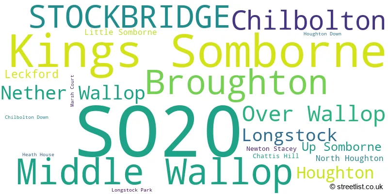
The largest settlement in the SO20 postal code is Kings Somborne followed by Middle Wallop, and STOCKBRIDGE.
The SO20 Postcode shares a border with SP11 (ANDOVER, Ludgershall, Picket Piece), SP5 (Downton, Winterslow, Alderbury), SO21 (Colden Common, Sutton Scotney, Twyford) and SO51 (ROMSEY, West Wellow, Ampfield).
The primary settlement in the SO20 postcode district is Stockbridge, located in the county of Hampshire. Other significant settlements in this district include Chattis Hill, Chilbolton, Houghton, Kings Somborne, Leckford, Little Somborne, Longstock, Newton Stacey, North Houghton, Up Somborne, Broughton, Middle Wallop, Nether Wallop, and Over Wallop. The most significant post town in this district is Stockbridge in Hampshire.
For the district SO20, we have data on 2 postcode sectors. Here's a breakdown: The sector SO20 6, covers Kings Somborne and Stockbridge and Chilbolton in Hampshire. The sector SO20 8, covers Middle Wallop and Broughton and Over Wallop and Nether Wallop in Hampshire.

Map of the SO20 Postcode District
Explore the SO20 postcode district by using our free interactive map.

When it comes to local government, postal geography often disregards political borders. However, for a breakdown in the SO20 District: the district mostly encompasses the Test Valley District (340 postcodes), and finally, the Winchester District (B) area (3 postcodes).
Recent House Sales in SO20
| Date | Price | Address |
|---|---|---|
| 05/10/2023 | £380,000 | Fine Acres Rise, Over Wallop, Stockbridge, SO20 8DL |
| 15/09/2023 | £820,000 | Trout Lane, Nether Wallop, Stockbridge, SO20 8EP |
| 08/09/2023 | £485,000 | Paynes Lane, Broughton, Stockbridge, SO20 8AH |
| 08/09/2023 | £385,000 | The Gorrings, Kings Somborne, Stockbridge, SO20 6NT |
| 01/09/2023 | £12,000 | King Lane, Over Wallop, Stockbridge, SO20 8JQ |
| 31/08/2023 | £980,000 | Camp Field, Kings Somborne, Stockbridge, SO20 6QB |
| 22/08/2023 | £657,500 | Furzedown Cottages, Kings Somborne, Stockbridge, SO20 6QJ |
| 22/08/2023 | £1,053,000 | Station Road, Chilbolton, Stockbridge, SO20 6AW |
| 18/08/2023 | £3,400,000 | Houghton, Stockbridge, SO20 6LY |
| 18/08/2023 | £2,100,000 | Nether Wallop, Stockbridge, SO20 8HA |
Weather Forecast for SO20
Press Button to Show Forecast for Houghton Lodge
| Time Period | Icon | Description | Temperature | Rain Probability | Wind |
|---|---|---|---|---|---|
| 15:00 to 18:00 | Cloudy | 11.0°C (feels like 9.0°C) | 8.00% | N 7 mph | |
| 18:00 to 21:00 | Cloudy | 10.0°C (feels like 9.0°C) | 4.00% | N 4 mph | |
| 21:00 to 00:00 | Cloudy | 6.0°C (feels like 5.0°C) | 4.00% | SSW 4 mph |
Press Button to Show Forecast for Houghton Lodge
| Time Period | Icon | Description | Temperature | Rain Probability | Wind |
|---|---|---|---|---|---|
| 00:00 to 03:00 | Cloudy | 6.0°C (feels like 5.0°C) | 4.00% | S 4 mph | |
| 03:00 to 06:00 | Overcast | 6.0°C (feels like 5.0°C) | 8.00% | SSW 4 mph | |
| 06:00 to 09:00 | Sunny day | 5.0°C (feels like 3.0°C) | 1.00% | WNW 7 mph | |
| 09:00 to 12:00 | Partly cloudy (day) | 10.0°C (feels like 8.0°C) | 5.00% | WNW 7 mph | |
| 12:00 to 15:00 | Light rain | 11.0°C (feels like 9.0°C) | 52.00% | WNW 9 mph | |
| 15:00 to 18:00 | Heavy rain | 10.0°C (feels like 8.0°C) | 74.00% | W 9 mph | |
| 18:00 to 21:00 | Cloudy | 9.0°C (feels like 8.0°C) | 39.00% | WSW 7 mph | |
| 21:00 to 00:00 | Cloudy | 7.0°C (feels like 6.0°C) | 8.00% | N 4 mph |
Press Button to Show Forecast for Houghton Lodge
| Time Period | Icon | Description | Temperature | Rain Probability | Wind |
|---|---|---|---|---|---|
| 00:00 to 03:00 | Cloudy | 7.0°C (feels like 5.0°C) | 5.00% | NE 7 mph | |
| 03:00 to 06:00 | Cloudy | 6.0°C (feels like 4.0°C) | 7.00% | NE 7 mph | |
| 06:00 to 09:00 | Cloudy | 6.0°C (feels like 3.0°C) | 8.00% | ENE 7 mph | |
| 09:00 to 12:00 | Cloudy | 8.0°C (feels like 5.0°C) | 9.00% | ENE 9 mph | |
| 12:00 to 15:00 | Overcast | 10.0°C (feels like 9.0°C) | 18.00% | E 7 mph | |
| 15:00 to 18:00 | Overcast | 11.0°C (feels like 9.0°C) | 19.00% | E 7 mph | |
| 18:00 to 21:00 | Overcast | 10.0°C (feels like 9.0°C) | 14.00% | ENE 7 mph | |
| 21:00 to 00:00 | Cloudy | 7.0°C (feels like 5.0°C) | 15.00% | E 7 mph |
Press Button to Show Forecast for Houghton Lodge
| Time Period | Icon | Description | Temperature | Rain Probability | Wind |
|---|---|---|---|---|---|
| 00:00 to 03:00 | Cloudy | 6.0°C (feels like 4.0°C) | 15.00% | ENE 7 mph | |
| 03:00 to 06:00 | Light rain | 6.0°C (feels like 3.0°C) | 51.00% | ENE 7 mph | |
| 06:00 to 09:00 | Cloudy | 6.0°C (feels like 3.0°C) | 18.00% | NE 9 mph | |
| 09:00 to 12:00 | Cloudy | 9.0°C (feels like 6.0°C) | 14.00% | ENE 11 mph | |
| 12:00 to 15:00 | Overcast | 12.0°C (feels like 10.0°C) | 18.00% | E 11 mph | |
| 15:00 to 18:00 | Light rain | 12.0°C (feels like 10.0°C) | 51.00% | ENE 11 mph | |
| 18:00 to 21:00 | Light rain | 11.0°C (feels like 8.0°C) | 54.00% | ENE 11 mph | |
| 21:00 to 00:00 | Heavy rain | 9.0°C (feels like 7.0°C) | 75.00% | NE 11 mph |
Press Button to Show Forecast for Houghton Lodge
| Time Period | Icon | Description | Temperature | Rain Probability | Wind |
|---|---|---|---|---|---|
| 00:00 to 03:00 | Light rain | 8.0°C (feels like 6.0°C) | 58.00% | NE 11 mph | |
| 03:00 to 06:00 | Heavy rain shower (night) | 8.0°C (feels like 6.0°C) | 62.00% | ENE 9 mph | |
| 06:00 to 09:00 | Cloudy | 9.0°C (feels like 7.0°C) | 19.00% | E 7 mph | |
| 09:00 to 12:00 | Light rain shower (day) | 11.0°C (feels like 9.0°C) | 43.00% | NE 9 mph | |
| 12:00 to 15:00 | Light rain shower (day) | 12.0°C (feels like 10.0°C) | 41.00% | W 11 mph | |
| 15:00 to 18:00 | Light rain shower (day) | 12.0°C (feels like 9.0°C) | 41.00% | W 11 mph | |
| 18:00 to 21:00 | Light rain shower (day) | 11.0°C (feels like 9.0°C) | 32.00% | W 9 mph | |
| 21:00 to 00:00 | Clear night | 8.0°C (feels like 6.0°C) | 6.00% | WSW 7 mph |
Where is the SO20 Postcode District?
The postcode district for SO20 is located in the town of Stockbridge. It is situated in close proximity to several nearby towns: Andover to the North (6.68 miles away), Romsey to the South (8.56 miles away), Winchester to the East (9.27 miles away), Tidworth to the North West (10.65 miles away), Eastleigh to the South East (11.84 miles away), Whitchurch to the North East (11.95 miles away), and Salisbury to the West (12.60 miles away). Additionally, the district is approximately 65.52 miles away from the center of London.
The district is within the post town of STOCKBRIDGE.
The sector has postcodes within the nation of England.
The SO20 Postcode District is in the Central Hampshire region of Hampshire and Isle of Wight within the South East (England).
| Postcode Sector | Delivery Office |
|---|---|
| SO20 6 | Winchester Delivery Office |
| SO20 6 | Stockbridge Scale Payment Delivery Office |
| SO20 8 | Broughton Scale Payment Delivery Office |
| SO20 8 | Over Wallop Scale Payment Delivery Office |
| S | O | 2 | 0 | - | X | X | X |
| S | O | 2 | 0 | Space | Numeric | Letter | Letter |
Current Monthly Rental Prices
| # Bedrooms | Min Price | Max Price | Avg Price |
|---|---|---|---|
| £3,750 | £3,750 | £3,750 | |
| 2 | £900 | £1,250 | £1,075 |
| 4 | £3,300 | £3,950 | £3,625 |
| 5 | £3,750 | £3,750 | £3,750 |
Current House Prices
| # Bedrooms | Min Price | Max Price | Avg Price |
|---|---|---|---|
| £15,000 | £275,000 | £133,571 | |
| 1 | £125,000 | £430,000 | £266,667 |
| 2 | £375,000 | £475,000 | £425,000 |
| 3 | £350,000 | £875,000 | £614,154 |
| 4 | £525,000 | £1,850,000 | £1,013,750 |
| 5 | £545,000 | £3,250,000 | £1,323,750 |
| 6 | £1,250,000 | £2,950,000 | £1,870,000 |
| 7 | £4,000,000 | £4,000,000 | £4,000,000 |
Estate Agents who Operate in the SO20 District
| Logo | Name | Brand Name | Address | Contact Number | Total Properties |
|---|---|---|---|---|---|
 | Stockbridge | Evans & Partridge | Agriculture House,High Street, Stockbridge, SO20 6HF | 01264 810702 | 13 |
 | Winchester | Knight Frank | 14/15 Jewry Street, Winchester, SO23 8RZ | 01962 571599 | 7 |
 | Winchester | BCM | The Old Dairy, Winchester Hill, Sutton Scotney, Winchester, Hampshire, SO21 3NZ | 01962 571575 | 4 |
 | Stockbridge | Myddelton & Major | The Old Police House High Street, Stockbridge, SO20 6HE | 01264 312502 | 4 |
 | Winchester | Carter Jonas | 9 Jewry Street, Winchester, SO23 8RZ | 01962 571543 | 4 |
| Type of Property | 2018 Average | 2018 Sales | 2017 Average | 2017 Sales | 2016 Average | 2016 Sales | 2015 Average | 2015 Sales |
|---|---|---|---|---|---|---|---|---|
| Detached | £833,016 | 46 | £740,169 | 73 | £688,849 | 57 | £698,016 | 51 |
| Semi-Detached | £359,119 | 28 | £374,576 | 31 | £357,898 | 20 | £327,816 | 22 |
| Terraced | £345,625 | 20 | £360,105 | 19 | £348,740 | 25 | £331,253 | 18 |
| Flats | £204,056 | 9 | £260,000 | 1 | £248,750 | 6 | £297,250 | 4 |