The SO21 postcode district is a postal district located in the SO Southampton postcode area with a population of 20,875 residents according to the 2021 England and Wales Census.
The area of the SO21 postcode district is 104.68 square miles which is 271.13 square kilometres or 66,997.59 acres.
Currently, the SO21 district has about 733 postcode units spread across 3 geographic postcode sectors.
Given that each sector allows for 400 unique postcode combinations, the district has a capacity of 1,200 postcodes. With 733 postcodes already in use, this leaves 467 units available.
The largest settlement in the SO21 postal code is Colden Common followed by Sutton Scotney, and Twyford.
The SO21 Postcode shares a border with RG28 (WHITCHURCH, Hurstbourne Priors, Laverstoke), SP11 (ANDOVER, Ludgershall, Picket Piece), SO22 (WINCHESTER, Littleton), SO23 (WINCHESTER, Kings Worthy, Headbourne Worthy), SO32 (Bishops Waltham, Botley, Swanmore), SO50 (EASTLEIGH, Bishopstoke, Fair Oak), SO53 (Chandler's Ford), SO24 (ALRESFORD, Ropley, Cheriton), RG25 (Overton, North Waltham, Upton Grey), SO20 (Kings Somborne, Middle Wallop, STOCKBRIDGE) and SO51 (ROMSEY, West Wellow, Ampfield).
In the SO21 postcode district in Hampshire, the primary settlement is Winchester, which has the highest count of 18. Other significant settlements in this district include Colden Common, Owslebury, and Twyford. The most significant Postal Town in this district is Winchester. The county in which this district lies is Hampshire, which is in England.
For the district SO21, we have data on 3 postcode sectors. Here's a breakdown: The sector SO21 1, covers Colden Common and Twyford and Owslebury in Hampshire. The sector SO21 2, covers Otterbourne and Sparsholt and Hursley and Compton and Crawley in Hampshire. The sector SO21 3, covers Sutton Scotney and South Wonston and Micheldever and Barton Stacey in Hampshire.

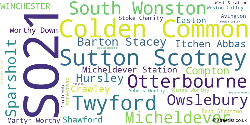
Map of the SO21 Postcode District
Explore the SO21 postcode district by using our free interactive map.

When it comes to local government, postal geography often disregards political borders. However, for a breakdown in the SO21 District: the district mostly encompasses the Winchester District (B) (685 postcodes), followed by the Test Valley District area (43 postcodes), and finally, the Basingstoke and Deane District (B) area (8 postcodes).
Recent House Sales in SO21
| Date | Price | Address |
|---|---|---|
| 15/09/2023 | £565,000 | Lime Close, Colden Common, Winchester, SO21 1WN |
| 15/09/2023 | £610,000 | Hazel Close, Colden Common, Winchester, SO21 1DL |
| 15/09/2023 | £380,000 | Spring Lane, Colden Common, Winchester, SO21 1SB |
| 30/08/2023 | £375,000 | Blackthorn Close, South Wonston, Winchester, SO21 3BU |
| 30/08/2023 | £400,000 | Burns Close, South Wonston, Winchester, SO21 3HG |
| 25/08/2023 | £340,000 | The Avenue, Sutton Scotney, Winchester, SO21 3JN |
| 24/08/2023 | £460,000 | Fernhurst Close, Colden Common, Winchester, SO21 1FN |
| 23/08/2023 | £158,500 | Roberts Road, Barton Stacey, Winchester, SO21 3RY |
| 21/08/2023 | £870,000 | Baybridge, Owslebury, Winchester, SO21 1JN |
| 08/08/2023 | £500,000 | Compton Street, Compton, Winchester, SO21 2AS |
Where is the SO21 Postcode District?
The postcode district SO21 is located in Winchester. It is a district town in close proximity to several nearby towns. To the east is Alresford, located approximately 5.9 miles away. To the west is Stockbridge, which is situated around 8.1 miles from Winchester. Heading south, you will reach Eastleigh, which is roughly 9.2 miles away. Whitchurch is situated to the north, at a distance of around 10.2 miles. Romsey is located to the southwest, approximately 11.1 miles away. Andover can be found to the northwest, around 11.7 miles from Winchester. Finally, Basingstoke is situated to the northeast, at a distance of approximately 14 miles. In terms of its relation to major cities, Winchester is approximately 58.2 miles from the center of London.
The district is within the post town of WINCHESTER.
The sector has postcodes within the nation of England.
The SO21 Postcode District is covers the following regions.
- Central Hampshire - Hampshire and Isle of Wight - South East (England)
- South Hampshire - Hampshire and Isle of Wight - South East (England)
- North Hampshire - Hampshire and Isle of Wight - South East (England)
| Postcode Sector | Delivery Office |
|---|---|
| SO21 1 | Winchester Delivery Office |
| SO21 2 | Winchester Delivery Office |
| SO21 3 | Winchester Delivery Office |
| S | O | 2 | 1 | - | X | X | X |
| S | O | 2 | 1 | Space | Numeric | Letter | Letter |
Tourist Attractions within the Postcode Area
We found 1 visitor attractions within the SO21 postcode area
| Marwell Wildlife |
|---|
| Wildlife |
| Safari Park / Zoo / Aquarium / Aviary |
| View Marwell Wildlife on Google Maps |
Current Monthly Rental Prices
| # Bedrooms | Min Price | Max Price | Avg Price |
|---|---|---|---|
| 1 | £900 | £1,100 | £1,000 |
| 2 | £1,350 | £1,500 | £1,425 |
| 3 | £1,300 | £1,850 | £1,575 |
| 4 | £1,350 | £3,320 | £2,441 |
| 5 | £3,970 | £3,970 | £3,970 |
| 7 | £4,500 | £4,500 | £4,500 |
Current House Prices
| # Bedrooms | Min Price | Max Price | Avg Price |
|---|---|---|---|
| £1,975,000 | £1,975,000 | £1,975,000 | |
| 1 | £85,000 | £285,000 | £184,286 |
| 2 | £50,000 | £725,000 | £353,997 |
| 3 | £325,000 | £750,000 | £505,781 |
| 4 | £425,000 | £2,100,000 | £842,989 |
| 5 | £575,000 | £5,950,000 | £1,839,227 |
| 6 | £1,350,000 | £2,950,000 | £2,250,000 |
| 7 | £1,650,000 | £3,200,000 | £2,366,667 |
| 10 | £13,500,000 | £13,500,000 | £13,500,000 |
Estate Agents who Operate in the SO21 District
| Logo | Name | Brand Name | Address | Contact Number | Total Properties |
|---|---|---|---|---|---|
 | Winchester | Charters | 2 Jewry Street Winchester SO23 8RZ | 01962 571541 | 36 |
 | Winchester | Belgarum | Talbot House 83 High Street Winchester SO23 9AP | 01962 844460 | 14 |
 | Winchester | Hamptons Sales | 51 High Street Winchester SO23 9BX | 01962 587326 | 7 |
 | Winchester | Pearsons | 3 Southgate Street, Winchester, SO23 9DY | 01962 587327 | 7 |
 | Winchester | Dybles | 4 Black Swan Buildings, Southgate Street, Winchester, SO23 9DT | 01962 866644 | 7 |
- Abbots Worthy
- Avington
- Barton Stacey
- Broadgate
- Chandler's Ford
- Chilcomb
- Colden Common
- Compton
- Crawley
- East Stratton
- Eastleigh
- Easton
- Egypt
- Forton
- Hunton
- Hursley
- Itchen Abbas
- Itchen Stoke
- Lane End
- Laverstoke
- Littleton
- Longparish
- Martyr Worthy
- Micheldever
- Morestead
- Nob's Crook
- North Waltham
- Otterbourne
- Owslebury
- Shawford
- South Down
- South Wonston
- Sparsholt
- Springvale
- Steventon
- Stoke Charity
- Sutton Scotney
- Twyford
- Westley
- Winchester
- Wonston
- Worthy Down
| Type of Property | 2018 Average | 2018 Sales | 2017 Average | 2017 Sales | 2016 Average | 2016 Sales | 2015 Average | 2015 Sales |
|---|---|---|---|---|---|---|---|---|
| Detached | £740,037 | 92 | £729,524 | 127 | £674,823 | 129 | £650,356 | 168 |
| Semi-Detached | £446,441 | 77 | £429,362 | 57 | £414,338 | 60 | £410,127 | 85 |
| Terraced | £339,696 | 56 | £377,114 | 47 | £335,024 | 60 | £341,377 | 61 |
| Flats | £242,040 | 29 | £235,139 | 18 | £203,988 | 25 | £216,196 | 23 |