The SO51 postcode district is a postal district located in the SO Southampton postcode area with a population of 30,022 residents according to the 2021 England and Wales Census.
The area of the SO51 postcode district is 56.69 square miles which is 146.83 square kilometres or 36,283.64 acres.
Currently, the SO51 district has about 865 postcode units spread across 6 geographic postcode sectors.
Given that each sector allows for 400 unique postcode combinations, the district has a capacity of 2,400 postcodes. With 865 postcodes already in use, this leaves 1535 units available.
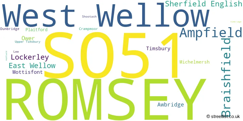
The largest settlement in the SO51 postal code is ROMSEY followed by West Wellow, and Ampfield.
The SO51 Postcode shares a border with SP5 (Downton, Winterslow, Alderbury), SO21 (Colden Common, Sutton Scotney, Twyford), SO52 (North Baddesley), SO53 (Chandler's Ford), SO20 (Kings Somborne, Middle Wallop, STOCKBRIDGE), SO43 (LYNDHURST, Minstead, Bramshaw), SO40 (Totton, Marchwood, Calmore) and SO16 (SOUTHAMPTON, Nursling, Rownhams).
The primary settlement in the SO51 postcode district is Romsey, located in Hampshire, England. Other significant settlements in the district include Ampfield, Awbridge, Braishfield, Dunbridge, Kimbridge, Lockerley, Michelmersh, Mottisfont, Shootash, Timsbury, and Upper Timsbury. The most significant post town in the district is Romsey.
For the district SO51, we have data on 7 postcode sectors. Here's a breakdown: The sector SO51 0, covers Romsey and Braishfield and Lockerley in Hampshire. The sector SO51 1 is non-geographic. It's often designated for PO Boxes, large organisations, or special services. The sector SO51 5, covers Romsey in Hampshire. The sector SO51 6, covers West Wellow and Sherfield English and East Wellow and Ower in Hampshire. The sector SO51 7, covers Romsey in Hampshire. The sector SO51 8, covers Romsey in Hampshire. The sector SO51 9, covers Ampfield and Romsey in Hampshire.

Map of the SO51 Postcode District
Explore the SO51 postcode district by using our free interactive map.

When it comes to local government, postal geography often disregards political borders. However, for a breakdown in the SO51 District: the district mostly encompasses the Test Valley District (862 postcodes), followed by the New Forest District area (13 postcodes), and finally, the Winchester District (B) area (4 postcodes).
Recent House Sales in SO51
| Date | Price | Address |
|---|---|---|
| 23/10/2023 | £630,000 | New Road, Romsey, SO51 7LL |
| 20/10/2023 | £878,000 | Canada Road, West Wellow, Romsey, SO51 6DE |
| 19/10/2023 | £460,000 | Knyght Close, Romsey, SO51 5UX |
| 11/10/2023 | £600,000 | Love Lane, Romsey, SO51 8DE |
| 10/10/2023 | £190,000 | Botley Road, Romsey, SO51 5PL |
| 10/10/2023 | £360,000 | Malmesbury Road, Romsey, SO51 8FS |
| 06/10/2023 | £740,000 | Manor Farm Lane, Michelmersh, Romsey, SO51 0NT |
| 03/10/2023 | £575,000 | Wheatears Drive, West Wellow, Romsey, SO51 6RA |
| 29/09/2023 | £265,000 | Botley Road, Romsey, SO51 5AB |
| 29/09/2023 | £450,000 | Petty Close, Romsey, SO51 5UY |
Weather Forecast for SO51
Press Button to Show Forecast for Mottisfont Abbey
| Time Period | Icon | Description | Temperature | Rain Probability | Wind |
|---|---|---|---|---|---|
| 15:00 to 18:00 | Light rain | 10.0°C (feels like 8.0°C) | 47.00% | W 9 mph | |
| 18:00 to 21:00 | Cloudy | 9.0°C (feels like 8.0°C) | 50.00% | SW 7 mph | |
| 21:00 to 00:00 | Cloudy | 7.0°C (feels like 6.0°C) | 8.00% | N 4 mph |
Press Button to Show Forecast for Mottisfont Abbey
| Time Period | Icon | Description | Temperature | Rain Probability | Wind |
|---|---|---|---|---|---|
| 00:00 to 03:00 | Cloudy | 6.0°C (feels like 5.0°C) | 5.00% | NE 4 mph | |
| 03:00 to 06:00 | Cloudy | 6.0°C (feels like 4.0°C) | 12.00% | NE 7 mph | |
| 06:00 to 09:00 | Cloudy | 6.0°C (feels like 3.0°C) | 11.00% | ENE 7 mph | |
| 09:00 to 12:00 | Cloudy | 8.0°C (feels like 5.0°C) | 9.00% | ENE 9 mph | |
| 12:00 to 15:00 | Overcast | 10.0°C (feels like 9.0°C) | 18.00% | E 7 mph | |
| 15:00 to 18:00 | Overcast | 11.0°C (feels like 9.0°C) | 19.00% | E 7 mph | |
| 18:00 to 21:00 | Overcast | 10.0°C (feels like 9.0°C) | 14.00% | ENE 7 mph | |
| 21:00 to 00:00 | Cloudy | 7.0°C (feels like 5.0°C) | 12.00% | E 7 mph |
Press Button to Show Forecast for Mottisfont Abbey
| Time Period | Icon | Description | Temperature | Rain Probability | Wind |
|---|---|---|---|---|---|
| 00:00 to 03:00 | Cloudy | 6.0°C (feels like 4.0°C) | 16.00% | ENE 7 mph | |
| 03:00 to 06:00 | Light rain | 6.0°C (feels like 3.0°C) | 51.00% | ENE 7 mph | |
| 06:00 to 09:00 | Overcast | 6.0°C (feels like 3.0°C) | 22.00% | NE 9 mph | |
| 09:00 to 12:00 | Overcast | 9.0°C (feels like 6.0°C) | 17.00% | ENE 9 mph | |
| 12:00 to 15:00 | Overcast | 12.0°C (feels like 10.0°C) | 18.00% | E 11 mph | |
| 15:00 to 18:00 | Light rain | 12.0°C (feels like 10.0°C) | 52.00% | ENE 11 mph | |
| 18:00 to 21:00 | Heavy rain | 11.0°C (feels like 8.0°C) | 75.00% | ENE 11 mph | |
| 21:00 to 00:00 | Heavy rain | 9.0°C (feels like 7.0°C) | 75.00% | NE 11 mph |
Press Button to Show Forecast for Mottisfont Abbey
| Time Period | Icon | Description | Temperature | Rain Probability | Wind |
|---|---|---|---|---|---|
| 00:00 to 03:00 | Light rain | 9.0°C (feels like 6.0°C) | 56.00% | NE 11 mph | |
| 03:00 to 06:00 | Heavy rain shower (night) | 8.0°C (feels like 6.0°C) | 62.00% | ENE 9 mph | |
| 06:00 to 09:00 | Cloudy | 9.0°C (feels like 7.0°C) | 22.00% | NE 7 mph | |
| 09:00 to 12:00 | Light rain shower (day) | 11.0°C (feels like 9.0°C) | 39.00% | NE 9 mph | |
| 12:00 to 15:00 | Light rain shower (day) | 12.0°C (feels like 10.0°C) | 41.00% | W 11 mph | |
| 15:00 to 18:00 | Light rain shower (day) | 12.0°C (feels like 9.0°C) | 38.00% | W 11 mph | |
| 18:00 to 21:00 | Light rain shower (day) | 11.0°C (feels like 9.0°C) | 32.00% | W 9 mph | |
| 21:00 to 00:00 | Clear night | 8.0°C (feels like 6.0°C) | 7.00% | WSW 7 mph |
Where is the SO51 Postcode District?
The postcode district SO51 is located in the town of Romsey. Romsey is surrounded by several nearby towns. To the east, there is Eastleigh which is approximately 7.92 miles away. To the southeast, there is Southampton which is approximately 7.99 miles away. To the north, there is Stockbridge which is approximately 8.25 miles away. To the south, there is Lyndhurst which is approximately 9.99 miles away. To the northeast, there is Winchester which is approximately 11.12 miles away. To the west, there is Salisbury which is approximately 12.10 miles away. Lastly, to the southwest, there is Fordingbridge which is approximately 13.18 miles away. Additionally, the postcode district SO51 is located around 69.75 miles away from the center of London.
The district is within the post town of ROMSEY.
The sector has postcodes within the nation of England.
The SO51 Postcode District is covers the following regions.
- Central Hampshire - Hampshire and Isle of Wight - South East (England)
- Wiltshire - Gloucestershire, Wiltshire and Bath/Bristol area - South West (England)
| Postcode Sector | Delivery Office |
|---|---|
| SO51 0 | Romsey Delivery Office |
| SO51 5 | Romsey Delivery Office |
| SO51 6 | Romsey Delivery Office |
| SO51 7 | Romsey Delivery Office |
| SO51 8 | Romsey Delivery Office |
| SO51 9 | Romsey Delivery Office |
| S | O | 5 | 1 | - | X | X | X |
| S | O | 5 | 1 | Space | Numeric | Letter | Letter |
Tourist Attractions within the Postcode Area
We found 2 visitor attractions within the SO51 postcode area
| Mottisfont Abbey Garden, House and Estate |
|---|
| Historic Properties |
| Historic House / House and Garden / Palace |
| View Mottisfont Abbey Garden, House and Estate on Google Maps |
| Romsey Signal Box |
| Visitor Centres |
| Heritage / Visitor Centre |
| View Romsey Signal Box on Google Maps |
Current Monthly Rental Prices
| # Bedrooms | Min Price | Max Price | Avg Price |
|---|---|---|---|
| £600 | £900 | £750 | |
| 1 | £875 | £950 | £913 |
| 2 | £1,200 | £1,200 | £1,200 |
| 3 | £1,400 | £2,500 | £1,699 |
| 4 | £2,250 | £4,000 | £3,000 |
| 5 | £2,200 | £2,250 | £2,225 |
| 6 | £3,600 | £6,000 | £4,800 |
Current House Prices
| # Bedrooms | Min Price | Max Price | Avg Price |
|---|---|---|---|
| £60,000 | £350,000 | £182,000 | |
| 1 | £80,000 | £350,000 | £207,599 |
| 2 | £102,500 | £750,000 | £350,993 |
| 3 | £200,000 | £1,200,000 | £504,131 |
| 4 | £425,000 | £1,650,000 | £756,457 |
| 5 | £650,000 | £1,950,000 | £1,029,375 |
| 6 | £1,000,000 | £2,400,000 | £1,799,000 |
| 7 | £1,795,000 | £2,400,000 | £2,148,317 |
Estate Agents who Operate in the SO51 District
| Logo | Name | Brand Name | Address | Contact Number | Total Properties |
|---|---|---|---|---|---|
 | Romsey | Michael Rhodes | 36 The Hundred, Romsey, SO51 8BX | 01794 514455 | 55 |
 | Romsey | Charters | 21A Market Place Romsey SO51 8NA | 01794 337541 | 36 |
 | Romsey | Henshaw Fox | 1 Middlebridge Street, Romsey, Hampshire, SO51 8HJ | 01794 337503 | 26 |
 | Romsey | Pearsons | 21 The Hundred, Romsey, SO51 8GB | 01794 514516 | 22 |
 | Romsey | Woolley & Wallis | 4-6 Bell Street, Romsey, SO51 8ZN | 01794 337473 | 19 |
- Abbotswood
- Ampfield
- Awbridge
- Belbins
- Braishfield
- Broadgate
- Canada Common
- Canada
- Carter's Clay
- Chandler's Ford
- Cowesfield Gate
- Crampmoor
- Dunbridge
- East Wellow
- Kimbridge
- Knapp
- Landfordwood
- Lee
- Lockerley
- Lower Slackstead
- Michelmersh
- Mottisfont
- Newtown
- Nursling
- Ower
- Plaitford Green
- Plaitford
- Romsey
- Rownhams
- Sherfield English
- Shootash
- Stonymarsh
- Timsbury
- West Wellow
- Wigley
| Type of Property | 2018 Average | 2018 Sales | 2017 Average | 2017 Sales | 2016 Average | 2016 Sales | 2015 Average | 2015 Sales |
|---|---|---|---|---|---|---|---|---|
| Detached | £571,510 | 215 | £596,819 | 190 | £582,017 | 165 | £563,703 | 211 |
| Semi-Detached | £332,657 | 127 | £348,054 | 110 | £315,832 | 109 | £300,000 | 112 |
| Terraced | £306,118 | 160 | £298,952 | 148 | £286,256 | 206 | £272,296 | 158 |
| Flats | £199,728 | 84 | £216,999 | 114 | £248,801 | 183 | £189,148 | 143 |