The SP1 postcode district is a postal district located in the SP Salisbury postcode area with a population of 22,723 residents according to the 2021 England and Wales Census.
The area of the SP1 postcode district is 4.62 square miles which is 11.95 square kilometres or 2,953.96 acres.
Currently, the SP1 district has about 669 postcode units spread across 13 geographic postcode sectors.
Given that each sector allows for 400 unique postcode combinations, the district has a capacity of 5,200 postcodes. With 669 postcodes already in use, this leaves 4531 units available.
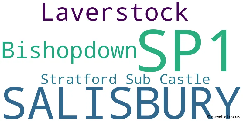
The largest settlement in the SP1 postal code is SALISBURY followed by Bishopdown, and Laverstock.
The SP1 Postcode shares a border with SP2 (SALISBURY, Wilton, South Newton), SP4 (Amesbury, Durrington, Larkhill) and SP5 (Downton, Winterslow, Alderbury).
The primary settlement in the SP1 postcode district is Salisbury, located in the county of Wiltshire, England. Other significant settlements in this district include Laverstock, Bishopdown, and Stratford Sub Castle. The most significant post town in this area is Salisbury.
For the district SP1, we have data on 3 postcode sectors. Here's a breakdown: The sector SP1 1, covers Salisbury and Laverstock in Wiltshire. The sector SP1 2, covers Salisbury in Wiltshire. The sector SP1 3, covers Salisbury and Bishopdown in Wiltshire.

Map of the SP1 Postcode District
Explore the SP1 postcode district by using our free interactive map.

When it comes to local government, postal geography often disregards political borders. However, for a breakdown in the SP1 District: the district mostly encompasses the Wiltshire area with a total of 673 postcodes.
Recent House Sales in SP10
| Date | Price | Address |
|---|---|---|
| 23/10/2023 | £330,000 | Wellington Road, Andover, SP10 3JW |
| 20/10/2023 | £325,000 | Albany Road, Andover, SP10 3EZ |
| 12/10/2023 | £325,000 | Durley Close, Andover, SP10 3UG |
| 12/10/2023 | £135,000 | Old Winton Road, Andover, SP10 2DU |
| 10/10/2023 | £120,000 | Weyhill Road, Andover, SP10 3AN |
| 02/10/2023 | £220,000 | Carters Meadow, Charlton, Andover, SP10 4AF |
| 29/09/2023 | £355,000 | Barnfield Rise, Andover, SP10 2UQ |
| 26/09/2023 | £143,000 | Kingsway Gardens, Andover, SP10 4BU |
| 22/09/2023 | £185,000 | Alfred Gardens, Andover, SP10 4NX |
| 19/09/2023 | £267,500 | Old Winton Road, Andover, SP10 2DS |
Weather Forecast for SP1
Press Button to Show Forecast for Laverstock
| Time Period | Icon | Description | Temperature | Rain Probability | Wind |
|---|---|---|---|---|---|
| 00:00 to 03:00 | Cloudy | 8.0°C (feels like 6.0°C) | 4.00% | W 9 mph | |
| 03:00 to 06:00 | Cloudy | 9.0°C (feels like 7.0°C) | 5.00% | W 9 mph | |
| 06:00 to 09:00 | Cloudy | 10.0°C (feels like 7.0°C) | 6.00% | WNW 11 mph | |
| 09:00 to 12:00 | Cloudy | 12.0°C (feels like 9.0°C) | 10.00% | NW 16 mph | |
| 12:00 to 15:00 | Overcast | 12.0°C (feels like 9.0°C) | 11.00% | NNW 16 mph | |
| 15:00 to 18:00 | Cloudy | 13.0°C (feels like 10.0°C) | 6.00% | NNW 16 mph | |
| 18:00 to 21:00 | Partly cloudy (day) | 12.0°C (feels like 9.0°C) | 1.00% | NNW 13 mph | |
| 21:00 to 00:00 | Cloudy | 8.0°C (feels like 6.0°C) | 5.00% | N 9 mph |
Press Button to Show Forecast for Laverstock
| Time Period | Icon | Description | Temperature | Rain Probability | Wind |
|---|---|---|---|---|---|
| 00:00 to 03:00 | Partly cloudy (night) | 7.0°C (feels like 5.0°C) | 1.00% | NNE 7 mph | |
| 03:00 to 06:00 | Partly cloudy (night) | 5.0°C (feels like 3.0°C) | 1.00% | N 4 mph | |
| 06:00 to 09:00 | Cloudy | 5.0°C (feels like 3.0°C) | 5.00% | N 4 mph | |
| 09:00 to 12:00 | Sunny day | 8.0°C (feels like 6.0°C) | 2.00% | NNE 9 mph | |
| 12:00 to 15:00 | Cloudy | 10.0°C (feels like 8.0°C) | 6.00% | N 9 mph | |
| 15:00 to 18:00 | Overcast | 11.0°C (feels like 9.0°C) | 8.00% | NNE 9 mph | |
| 18:00 to 21:00 | Overcast | 10.0°C (feels like 9.0°C) | 8.00% | NNE 7 mph | |
| 21:00 to 00:00 | Cloudy | 7.0°C (feels like 6.0°C) | 5.00% | NE 4 mph |
Press Button to Show Forecast for Laverstock
| Time Period | Icon | Description | Temperature | Rain Probability | Wind |
|---|---|---|---|---|---|
| 00:00 to 03:00 | Clear night | 5.0°C (feels like 4.0°C) | 2.00% | NNE 4 mph | |
| 03:00 to 06:00 | Partly cloudy (night) | 4.0°C (feels like 3.0°C) | 1.00% | N 4 mph | |
| 06:00 to 09:00 | Partly cloudy (day) | 5.0°C (feels like 4.0°C) | 1.00% | N 4 mph | |
| 09:00 to 12:00 | Cloudy | 9.0°C (feels like 7.0°C) | 5.00% | N 9 mph | |
| 12:00 to 15:00 | Cloudy | 11.0°C (feels like 9.0°C) | 6.00% | NNE 9 mph | |
| 15:00 to 18:00 | Overcast | 12.0°C (feels like 10.0°C) | 9.00% | NNE 9 mph | |
| 18:00 to 21:00 | Cloudy | 10.0°C (feels like 8.0°C) | 7.00% | NE 9 mph | |
| 21:00 to 00:00 | Partly cloudy (night) | 8.0°C (feels like 6.0°C) | 2.00% | NE 7 mph |
Press Button to Show Forecast for Laverstock
| Time Period | Icon | Description | Temperature | Rain Probability | Wind |
|---|---|---|---|---|---|
| 00:00 to 03:00 | Clear night | 6.0°C (feels like 3.0°C) | 2.00% | NE 7 mph | |
| 03:00 to 06:00 | Partly cloudy (night) | 5.0°C (feels like 2.0°C) | 3.00% | NNE 7 mph | |
| 06:00 to 09:00 | Partly cloudy (day) | 5.0°C (feels like 2.0°C) | 2.00% | NNE 7 mph | |
| 09:00 to 12:00 | Partly cloudy (day) | 9.0°C (feels like 6.0°C) | 1.00% | NE 11 mph | |
| 12:00 to 15:00 | Cloudy | 11.0°C (feels like 9.0°C) | 7.00% | NE 11 mph | |
| 15:00 to 18:00 | Cloudy | 11.0°C (feels like 9.0°C) | 8.00% | NNE 11 mph | |
| 18:00 to 21:00 | Cloudy | 10.0°C (feels like 8.0°C) | 7.00% | NNE 9 mph | |
| 21:00 to 00:00 | Clear night | 7.0°C (feels like 5.0°C) | 3.00% | NNE 7 mph |
Where is the SP1 Postcode District?
The postcode district SP1 is located in Salisbury, a district town. It is surrounded by several nearby towns, including Fordingbridge to the south (11.19 miles away), Tidworth to the northeast (11.49 miles away), Stockbridge to the east (13.43 miles away), Romsey to the southeast (14.73 miles away), and Pewsey to the north (17.46 miles away). Salisbury is also approximately 77.8 miles away from the city center of London.
The district is within the post town of SALISBURY.
The sector has postcodes within the nation of England.
The SP1 Postcode District is in the Wiltshire region of Gloucestershire, Wiltshire and Bath/Bristol area within the South West (England).
Postcode Sectors within the SP1 District
| Postcode Sector | Delivery Office |
|---|---|
| SP1 1 | Salisbury Delivery Office |
| SP1 2 | Salisbury Delivery Office |
| SP1 3 | Salisbury Delivery Office |
| S | P | 1 | - | X | X | X |
| S | P | 1 | Space | Numeric | Letter | Letter |
Tourist Attractions within the Postcode Area
We found 3 visitor attractions within the SP1 postcode area
| Old Sarum |
|---|
| Historic Properties |
| Historic Monument / Archaeological Site |
| View Old Sarum on Google Maps |
| Mompesson House |
| Historic Properties |
| Historic House / House and Garden / Palace |
| View Mompesson House on Google Maps |
| Salisbury Cathedral |
| Places of Worship |
| Place of Worship (still in use) |
| View Salisbury Cathedral on Google Maps |
Current Monthly Rental Prices
| # Bedrooms | Min Price | Max Price | Avg Price |
|---|---|---|---|
| £942 | £1,250 | £1,096 | |
| 1 | £500 | £3,170 | £1,418 |
| 2 | £850 | £3,670 | £1,252 |
| 3 | £950 | £1,500 | £1,331 |
| 4 | £3,250 | £3,250 | £3,250 |
Current House Prices
| # Bedrooms | Min Price | Max Price | Avg Price |
|---|---|---|---|
| 1 | £75,000 | £315,000 | £176,880 |
| 2 | £50,000 | £500,000 | £267,856 |
| 3 | £165,000 | £700,000 | £373,002 |
| 4 | £329,450 | £850,000 | £545,655 |
| 5 | £450,000 | £825,000 | £663,333 |
| 6 | £484,000 | £484,000 | £484,000 |
| 7 | £695,000 | £695,000 | £695,000 |
| 8 | £2,000,000 | £2,000,000 | £2,000,000 |
Estate Agents who Operate in the SP1 District
| Logo | Name | Brand Name | Address | Contact Number | Total Properties |
|---|---|---|---|---|---|
 | Salisbury | Whites | Castle Chambers, 47 Castle Street, Salisbury, SP1 3SP | 01722 548906 | 37 |
 | Salisbury | Oliver Chandler | 62 Castle Street, Salisbury, SP1 3TS | 01722 548931 | 19 |
 | Salisbury | Carter & May | 87 Castle Street, Salisbury, SP1 3SP | 01722 331993 | 13 |
 | Salisbury New Homes | Savills New Homes | Rolfes House 60 Milford Street, Salisbury, SP1 2BP | 01722 548531 | 12 |
 | Salisbury | Myddelton & Major | 49 High Street, Salisbury, SP1 2PD | 01722 449964 | 11 |
| Type of Property | 2018 Average | 2018 Sales | 2017 Average | 2017 Sales | 2016 Average | 2016 Sales | 2015 Average | 2015 Sales |
|---|---|---|---|---|---|---|---|---|
| Detached | £428,997 | 94 | £450,945 | 105 | £425,152 | 111 | £405,319 | 124 |
| Semi-Detached | £320,828 | 75 | £299,814 | 99 | £303,500 | 127 | £282,640 | 116 |
| Terraced | £289,090 | 113 | £292,827 | 146 | £283,727 | 166 | £259,871 | 138 |
| Flats | £228,488 | 99 | £203,670 | 113 | £203,384 | 96 | £181,186 | 86 |
Hotels within the Postcode Area
We found 21 hotels and guest houses within the SP1 postcode area
The Edwardian Lodge Guest House
59 Castle Road, Salisbury, Salisbury, salisbury, SP1 3RH.
View details