The SR2 postcode district is a postal district located in the SR Sunderland postcode area with a population of 32,068 residents according to the 2021 England and Wales Census.
The area of the SR2 postcode district is 4.48 square miles which is 11.60 square kilometres or 2,866.87 acres.
Currently, the SR2 district has about 834 postcode units spread across 4 geographic postcode sectors.
Given that each sector allows for 400 unique postcode combinations, the district has a capacity of 1,600 postcodes. With 834 postcodes already in use, this leaves 766 units available.
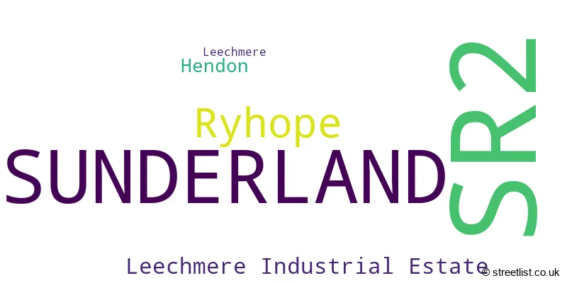
The largest settlements in the SR2 postal code are SUNDERLAND and Ryhope.
The postcode area has a boundary with The North Sea.
The SR2 Postcode shares a border with SR3 (SUNDERLAND, New Silksworth, East Herrington), SR4 (SUNDERLAND, South Hylton), SR7 (SEAHAM, Murton, Dalton-le-Dale) and SR1 (SUNDERLAND).
In the SR2 postcode district, the primary settlement is Sunderland, located in the county of Tyne & Wear. The most significant post town is also Sunderland. Other significant settlements in the district include Leechmere and Ryhope, both located within Sunderland. Additionally, Hendon and Leechmere Industrial Estate are smaller settlements within Sunderland.
For the district SR2, we have data on 4 postcode sectors. Here's a breakdown: The sector SR2 0, covers Sunderland and Ryhope in Tyne & Wear. The sector SR2 7, covers Sunderland in Tyne & Wear. The sector SR2 8, covers Sunderland in Tyne & Wear. The sector SR2 9, covers Sunderland in Tyne & Wear.

Map of the SR2 Postcode District
Explore the SR2 postcode district by using our free interactive map.

When it comes to local government, postal geography often disregards political borders. However, for a breakdown in the SR2 District: the district mostly encompasses the Sunderland District (B) area with a total of 848 postcodes.
Recent House Sales in SR2
| Date | Price | Address |
|---|---|---|
| 12/10/2023 | £34,000 | Mainsforth Terrace West, Sunderland, SR2 8JX |
| 06/10/2023 | £30,000 | Villette Brooke Street, Sunderland, SR2 8HF |
| 02/10/2023 | £31,750 | Edgmond Court, Sunderland, SR2 0DY |
| 29/09/2023 | £325,000 | Corby Hall Drive, Sunderland, SR2 7HZ |
| 29/09/2023 | £140,000 | Bevan Avenue, Sunderland, SR2 0JH |
| 28/09/2023 | £156,000 | Corby Gate, Sunderland, SR2 7JB |
| 26/09/2023 | £53,500 | Strawberry Court, Sunderland, SR2 7RQ |
| 15/09/2023 | £277,000 | Burleigh Close, Sunderland, SR2 0BZ |
| 15/09/2023 | £190,000 | Ryhope Road, Sunderland, SR2 7SZ |
| 12/09/2023 | £80,000 | Windsor Terrace, Sunderland, SR2 9QF |
Weather Forecast for SR2
Press Button to Show Forecast for Ryhope
| Time Period | Icon | Description | Temperature | Rain Probability | Wind |
|---|---|---|---|---|---|
| 09:00 to 12:00 | Cloudy | 6.0°C (feels like 2.0°C) | 6.00% | N 20 mph | |
| 12:00 to 15:00 | Cloudy | 7.0°C (feels like 3.0°C) | 4.00% | N 18 mph | |
| 15:00 to 18:00 | Partly cloudy (day) | 7.0°C (feels like 3.0°C) | 1.00% | NNE 13 mph | |
| 18:00 to 21:00 | Cloudy | 6.0°C (feels like 4.0°C) | 5.00% | ENE 9 mph | |
| 21:00 to 00:00 | Cloudy | 6.0°C (feels like 4.0°C) | 7.00% | SW 7 mph |
Press Button to Show Forecast for Ryhope
| Time Period | Icon | Description | Temperature | Rain Probability | Wind |
|---|---|---|---|---|---|
| 00:00 to 03:00 | Cloudy | 6.0°C (feels like 3.0°C) | 5.00% | SW 11 mph | |
| 03:00 to 06:00 | Cloudy | 5.0°C (feels like 2.0°C) | 13.00% | WNW 11 mph | |
| 06:00 to 09:00 | Cloudy | 5.0°C (feels like 2.0°C) | 8.00% | NW 13 mph | |
| 09:00 to 12:00 | Cloudy | 6.0°C (feels like 3.0°C) | 9.00% | NNW 13 mph | |
| 12:00 to 15:00 | Cloudy | 7.0°C (feels like 4.0°C) | 12.00% | N 13 mph | |
| 15:00 to 18:00 | Cloudy | 7.0°C (feels like 4.0°C) | 7.00% | NNE 13 mph | |
| 18:00 to 21:00 | Partly cloudy (day) | 7.0°C (feels like 4.0°C) | 2.00% | NNE 9 mph | |
| 21:00 to 00:00 | Partly cloudy (night) | 5.0°C (feels like 3.0°C) | 2.00% | NNE 7 mph |
Press Button to Show Forecast for Ryhope
| Time Period | Icon | Description | Temperature | Rain Probability | Wind |
|---|---|---|---|---|---|
| 00:00 to 03:00 | Partly cloudy (night) | 5.0°C (feels like 3.0°C) | 2.00% | ENE 7 mph | |
| 03:00 to 06:00 | Overcast | 4.0°C (feels like 2.0°C) | 7.00% | N 7 mph | |
| 06:00 to 09:00 | Cloudy | 5.0°C (feels like 3.0°C) | 6.00% | N 7 mph | |
| 09:00 to 12:00 | Cloudy | 7.0°C (feels like 5.0°C) | 7.00% | ENE 7 mph | |
| 12:00 to 15:00 | Overcast | 8.0°C (feels like 5.0°C) | 14.00% | ENE 9 mph | |
| 15:00 to 18:00 | Cloudy | 8.0°C (feels like 5.0°C) | 12.00% | E 9 mph | |
| 18:00 to 21:00 | Cloudy | 7.0°C (feels like 5.0°C) | 10.00% | E 11 mph | |
| 21:00 to 00:00 | Cloudy | 7.0°C (feels like 4.0°C) | 9.00% | ESE 9 mph |
Press Button to Show Forecast for Ryhope
| Time Period | Icon | Description | Temperature | Rain Probability | Wind |
|---|---|---|---|---|---|
| 00:00 to 03:00 | Cloudy | 6.0°C (feels like 4.0°C) | 15.00% | ESE 9 mph | |
| 03:00 to 06:00 | Cloudy | 6.0°C (feels like 3.0°C) | 11.00% | ESE 9 mph | |
| 06:00 to 09:00 | Cloudy | 7.0°C (feels like 4.0°C) | 13.00% | ESE 9 mph | |
| 09:00 to 12:00 | Overcast | 8.0°C (feels like 5.0°C) | 18.00% | E 11 mph | |
| 12:00 to 15:00 | Cloudy | 8.0°C (feels like 5.0°C) | 20.00% | E 13 mph | |
| 15:00 to 18:00 | Cloudy | 9.0°C (feels like 5.0°C) | 17.00% | E 16 mph | |
| 18:00 to 21:00 | Cloudy | 8.0°C (feels like 5.0°C) | 16.00% | E 13 mph | |
| 21:00 to 00:00 | Cloudy | 8.0°C (feels like 5.0°C) | 14.00% | E 11 mph |
Where is the SR2 Postcode District?
The postcode district SR2 is located in the town of Sunderland. It is situated in close proximity to several nearby towns, including Seaham to the south (3.54 miles away), Houghton Le Spring to the southwest (4.62 miles away), East Boldon to the northwest (5.16 miles away), Washington to the west (6.08 miles away), and South Shields to the north (7.13 miles away). Additionally, SR2 is approximately 238.85 miles away from the center of London.
The district is within the post town of SUNDERLAND.
The sector has postcodes within the nation of England.
The SR2 Postcode District is in the Sunderland region of Northumberland and Tyne and Wear within the North East (England).
| Postcode Sector | Delivery Office |
|---|---|
| SR2 0 | Sunderland Delivery Office |
| SR2 7 | Sunderland Delivery Office |
| SR2 8 | Sunderland Delivery Office |
| SR2 9 | Sunderland Delivery Office |
| S | R | 2 | - | X | X | X |
| S | R | 2 | Space | Numeric | Letter | Letter |
Current Monthly Rental Prices
| # Bedrooms | Min Price | Max Price | Avg Price |
|---|---|---|---|
| £395 | £455 | £425 | |
| 1 | £347 | £995 | £498 |
| 2 | £475 | £760 | £639 |
| 3 | £895 | £900 | £897 |
| 4 | £100 | £1,733 | £914 |
| 5 | £500 | £500 | £500 |
| 6 | £500 | £500 | £500 |
| 7 | £458 | £458 | £458 |
| 8 | £458 | £458 | £458 |
Current House Prices
| # Bedrooms | Min Price | Max Price | Avg Price |
|---|---|---|---|
| £4,000 | £140,000 | £71,333 | |
| 1 | £18,000 | £171,999 | £60,366 |
| 2 | £20,000 | £265,000 | £100,105 |
| 3 | £45,000 | £725,000 | £184,369 |
| 4 | £165,000 | £595,000 | £324,337 |
| 5 | £100,000 | £735,000 | £338,571 |
| 6 | £110,000 | £749,950 | £453,990 |
| 7 | £120,000 | £749,950 | £387,463 |
| 10 | £1,050,000 | £1,050,000 | £1,050,000 |
Estate Agents who Operate in the SR2 District
| Logo | Name | Brand Name | Address | Contact Number | Total Properties |
|---|---|---|---|---|---|
 | Sunderland | Good Life Homes Sales and Lettings | 46 Windsor Terrace, Ryhope Road, Grangetown, Sunderland, SR2 9QF | 0191 625 0272 | 32 |
 | Sunderland | Hackett Property | Lynas House, Athenaeum Street, Sunderland, SR1 1NA | 0191 625 0220 | 28 |
 | Sunderland | Michael Hodgson | 4 Athenaeum Street, Sunderland, SR1 1QX | 0191 625 0214 | 24 |
 | Sunderland | Dowen | 21, Athenaeum Street, Sunderland, SR1 1DH | 0191 625 0947 | 24 |
 | Sunderland | Pattinson Estate Agents | 51 Fawcett Street, Sunderland, SR1 1RS | 0191 625 0244 | 20 |
| Type of Property | 2018 Average | 2018 Sales | 2017 Average | 2017 Sales | 2016 Average | 2016 Sales | 2015 Average | 2015 Sales |
|---|---|---|---|---|---|---|---|---|
| Detached | £254,620 | 83 | £225,590 | 76 | £231,780 | 53 | £233,733 | 59 |
| Semi-Detached | £138,616 | 152 | £147,555 | 165 | £143,672 | 149 | £131,964 | 146 |
| Terraced | £113,240 | 164 | £104,349 | 173 | £122,457 | 171 | £90,340 | 164 |
| Flats | £93,847 | 77 | £98,574 | 61 | £86,339 | 69 | £95,761 | 68 |