The ST18 postcode district is a postal district located in the ST Stoke-on-Trent postcode area with a population of 18,144 residents according to the 2021 England and Wales Census.
The area of the ST18 postcode district is 78.10 square miles which is 202.28 square kilometres or 49,985.28 acres.
Currently, the ST18 district has about 602 postcode units spread across 2 geographic postcode sectors.
Given that each sector allows for 400 unique postcode combinations, the district has a capacity of 800 postcodes. With 602 postcodes already in use, this leaves 198 units available.
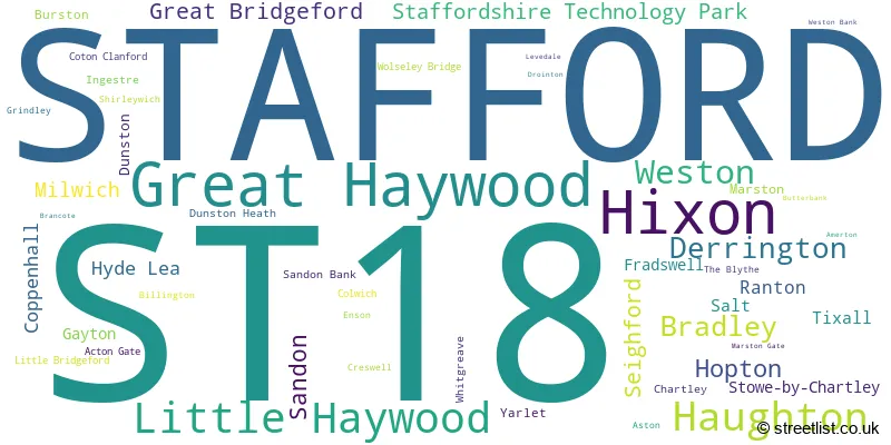
The largest settlement in the ST18 postal code is STAFFORD followed by Great Haywood, and Hixon.
The ST18 Postcode shares a border with ST16 (STAFFORD), ST17 (STAFFORD, Brocton, Acton Trussell), ST19 (Penkridge, Brewood, Wheaton Aston), ST15 (STONE, Yarnfield, Hilderstone), ST20 (Gnosall, Church Eaton, Woodseaves), WS15 (RUGELEY, Brereton, Abbots Bromley), ST14 (UTTOXETER, Rocester, Bramshall) and ST21 (Eccleshall, Cotes Heath, Standon).
The primary settlement in the ST18 postcode district is Stafford, located in the county of Staffordshire, England. Other significant settlements in the district include Amerton, Brancote, Burston, Chartley, Colwich, Drointon, Fradswell, Gayton, Great Haywood, Grindley, Hixon, Hopton, Ingestre, Little Haywood, Milwich, Salt, Sandon, Sandon Bank, Shirleywich, Staffordshire Technology Park, Stowe-by-Chartley, The Blythe, Tixall, Weston, Weston Bank, and Wolseley Bridge.
For the district ST18, we have data on 2 postcode sectors. Here's a breakdown: The sector ST18 0, covers Stafford and Great Haywood and Hixon and Little Haywood in Staffordshire. The sector ST18 9, covers Haughton and Derrington and Bradley in Staffordshire.

Map of the ST18 Postcode District
Explore the ST18 postcode district by using our free interactive map.

When it comes to local government, postal geography often disregards political borders. However, for a breakdown in the ST18 District: the district mostly encompasses the Stafford District (B) (574 postcodes), followed by the South Staffordshire District area (28 postcodes), and finally, the East Staffordshire District (B) area (4 postcodes).
Recent House Sales in ST18
| Date | Price | Address |
|---|---|---|
| 27/10/2023 | £180,000 | Hammonds Croft, Hixon, Stafford, ST18 0PQ |
| 29/09/2023 | £610,000 | Church Lane, Gayton, Stafford, ST18 0HL |
| 29/09/2023 | £310,000 | Avondale Circle, Stafford, ST18 0YZ |
| 29/09/2023 | £400,000 | Ferrers Road, Weston, Stafford, ST18 0JN |
| 27/09/2023 | £325,000 | Heather Close, Great Bridgeford, Stafford, ST18 9PU |
| 25/09/2023 | £480,000 | Hixon, Stafford, ST18 0NP |
| 25/09/2023 | £290,000 | Lilac Close, Great Bridgeford, Stafford, ST18 9PZ |
| 07/09/2023 | £262,000 | Green Lane, Whitgreave, Stafford, ST18 9SR |
| 06/09/2023 | £450,000 | Stowe Lane, Stowe By Chartley, Stafford, ST18 0NA |
| 04/09/2023 | £1,000,000 | Burston, Stafford, ST18 0DT |
Weather Forecast for ST18
Press Button to Show Forecast for Stafford
| Time Period | Icon | Description | Temperature | Rain Probability | Wind |
|---|---|---|---|---|---|
| 09:00 to 12:00 | Overcast | 8.0°C (feels like 6.0°C) | 8.00% | N 7 mph | |
| 12:00 to 15:00 | Overcast | 10.0°C (feels like 8.0°C) | 9.00% | NNW 11 mph | |
| 15:00 to 18:00 | Cloudy | 12.0°C (feels like 10.0°C) | 4.00% | N 9 mph | |
| 18:00 to 21:00 | Overcast | 10.0°C (feels like 8.0°C) | 9.00% | NNW 11 mph | |
| 21:00 to 00:00 | Overcast | 8.0°C (feels like 6.0°C) | 9.00% | N 7 mph |
Press Button to Show Forecast for Stafford
| Time Period | Icon | Description | Temperature | Rain Probability | Wind |
|---|---|---|---|---|---|
| 00:00 to 03:00 | Overcast | 7.0°C (feels like 6.0°C) | 9.00% | NW 4 mph | |
| 03:00 to 06:00 | Overcast | 6.0°C (feels like 4.0°C) | 11.00% | NNE 4 mph | |
| 06:00 to 09:00 | Cloudy | 5.0°C (feels like 3.0°C) | 6.00% | NNW 4 mph | |
| 09:00 to 12:00 | Cloudy | 7.0°C (feels like 5.0°C) | 6.00% | N 9 mph | |
| 12:00 to 15:00 | Overcast | 9.0°C (feels like 7.0°C) | 11.00% | N 9 mph | |
| 15:00 to 18:00 | Overcast | 10.0°C (feels like 8.0°C) | 9.00% | N 9 mph | |
| 18:00 to 21:00 | Cloudy | 8.0°C (feels like 6.0°C) | 5.00% | NNE 9 mph | |
| 21:00 to 00:00 | Partly cloudy (night) | 5.0°C (feels like 3.0°C) | 2.00% | NNE 7 mph |
Press Button to Show Forecast for Stafford
| Time Period | Icon | Description | Temperature | Rain Probability | Wind |
|---|---|---|---|---|---|
| 00:00 to 03:00 | Clear night | 3.0°C (feels like 1.0°C) | 3.00% | N 4 mph | |
| 03:00 to 06:00 | Cloudy | 3.0°C (feels like 0.0°C) | 5.00% | NNW 4 mph | |
| 06:00 to 09:00 | Overcast | 4.0°C (feels like 1.0°C) | 7.00% | NW 4 mph | |
| 09:00 to 12:00 | Cloudy | 7.0°C (feels like 5.0°C) | 5.00% | N 7 mph | |
| 12:00 to 15:00 | Overcast | 9.0°C (feels like 7.0°C) | 9.00% | NNW 7 mph | |
| 15:00 to 18:00 | Overcast | 10.0°C (feels like 9.0°C) | 10.00% | NNW 7 mph | |
| 18:00 to 21:00 | Cloudy | 9.0°C (feels like 7.0°C) | 8.00% | NNW 7 mph | |
| 21:00 to 00:00 | Partly cloudy (night) | 6.0°C (feels like 4.0°C) | 2.00% | NNW 4 mph |
Press Button to Show Forecast for Stafford
| Time Period | Icon | Description | Temperature | Rain Probability | Wind |
|---|---|---|---|---|---|
| 00:00 to 03:00 | Cloudy | 4.0°C (feels like 3.0°C) | 4.00% | N 4 mph | |
| 03:00 to 06:00 | Cloudy | 4.0°C (feels like 3.0°C) | 8.00% | N 4 mph | |
| 06:00 to 09:00 | Cloudy | 5.0°C (feels like 4.0°C) | 7.00% | NW 4 mph | |
| 09:00 to 12:00 | Cloudy | 9.0°C (feels like 7.0°C) | 8.00% | N 7 mph | |
| 12:00 to 15:00 | Overcast | 10.0°C (feels like 9.0°C) | 12.00% | N 7 mph | |
| 15:00 to 18:00 | Cloudy | 11.0°C (feels like 9.0°C) | 11.00% | WNW 7 mph | |
| 18:00 to 21:00 | Cloudy | 10.0°C (feels like 8.0°C) | 11.00% | N 7 mph | |
| 21:00 to 00:00 | Cloudy | 7.0°C (feels like 6.0°C) | 9.00% | NNE 4 mph |
Where is the ST18 Postcode District?
The postcode district ST18 is located in the town of Stafford. It is a district in the Staffordshire county. Stafford is surrounded by several nearby towns, with Stone to the north, Rugeley to the southeast, Cannock to the south, Uttoxeter to the northeast, Newport to the west, Newcastle to the northwest, and Shifnal to the southwest. The distance from ST18 to the center of London is approximately 123.45 miles.
The district is within the post town of STAFFORD.
The sector has postcodes within the nation of England.
The ST18 Postcode District is in the Staffordshire CC region of Shropshire and Staffordshire within the West Midlands (England).
| Postcode Sector | Delivery Office |
|---|---|
| ST18 0 | Stafford Delivery Office |
| ST18 9 | Stafford Delivery Office |
| S | T | 1 | 8 | - | X | X | X |
| S | T | 1 | 8 | Space | Numeric | Letter | Letter |
Current Monthly Rental Prices
| # Bedrooms | Min Price | Max Price | Avg Price |
|---|---|---|---|
| 2 | £850 | £850 | £850 |
| 4 | £1,400 | £3,500 | £2,450 |
| 5 | £1,750 | £1,750 | £1,750 |
Current House Prices
| # Bedrooms | Min Price | Max Price | Avg Price |
|---|---|---|---|
| £20,000 | £900,000 | £417,500 | |
| 1 | £75,000 | £75,000 | £75,000 |
| 2 | £50,000 | £900,000 | £264,952 |
| 3 | £89,250 | £750,000 | £342,727 |
| 4 | £240,000 | £1,250,000 | £505,309 |
| 5 | £425,000 | £1,400,000 | £669,286 |
| 6 | £685,000 | £1,200,000 | £893,333 |
| 7 | £1,000,000 | £1,000,000 | £1,000,000 |
Estate Agents who Operate in the ST18 District
| Logo | Name | Brand Name | Address | Contact Number | Total Properties |
|---|---|---|---|---|---|
 | Stafford | Dourish & Day | 14 Salter Street, Stafford, ST16 2JU | 01785 904848 | 40 |
 | Stafford | John German | 5 Pool Lane Brocton Stafford ST17 0TR | 01785 335590 | 13 |
 | Stafford | Bridgfords | Bank House 40 Greengate Street Stafford ST16 2JB | 01785 335732 | 11 |
 | Stafford | Connells | Unit 3C Salter Street, Stafford, ST16 2JU | 01785 335500 | 10 |
 | Stafford | D B Roberts & Partners | 18 Salter Street, Stafford, ST16 2JU | 01785 335520 | 8 |
- Acton Gate
- Amerton
- Aston
- Billington
- Bishton
- Bradley
- Burston
- Coppenhall
- Coton Clanford
- Coton Hayes
- Coton
- Dapple Heath
- Dayhills
- Derrington
- Dunston
- Ellenhall
- Fradswell
- Gayton
- Great Bridgeford
- Great Haywood
- Haughton
- Hixon
- Hopton
- Hyde Lea
- Ingestre
- Lea Heath
- Little Haywood
- Longridge
- Marston
- Middleton Green
- Milwich
- Ranton
- Salt
- Sandon
- Sandonbank
- Seighford
- Shirleywich
- Shut Heath
- Stafford
- Stone
- Stowe-by-Chartley
- The Blythe
- The Handfords
- Tixall
- Weston
- Whitecross
- Yarlet
| Type of Property | 2018 Average | 2018 Sales | 2017 Average | 2017 Sales | 2016 Average | 2016 Sales | 2015 Average | 2015 Sales |
|---|---|---|---|---|---|---|---|---|
| Detached | £341,960 | 241 | £317,145 | 262 | £311,430 | 216 | £285,991 | 159 |
| Semi-Detached | £218,273 | 106 | £209,504 | 116 | £202,371 | 109 | £193,453 | 71 |
| Terraced | £233,255 | 46 | £223,720 | 54 | £225,203 | 44 | £251,885 | 40 |
| Flats | £105,625 | 4 | £115,869 | 8 | £125,625 | 4 | £109,700 | 5 |