ST5 Postcode District
ST5 is one of 2 Postcode Districts for the Newcastle Post town in Staffordshire
The ST5 postcode district is located in the ST Stoke-on-Trent postal area, ST5 has a population of 82,287 residents according to the 2021 England and Wales Census..
The area of the district is 33.60 square miles (87.03 square kilometres or 21,506.17 acres).
A wide range of spatial data has been analysed to present this overview of ST5. If you would like anything added, please contact us.
Map of ST5
Explore the postcode district using the interactive map.
Larger circles indicate higher recorded crime totals.
On this page
District overview
The primary settlement in the ST5 postcode district is Newcastle in Staffordshire, the county of Staffordshire is mentioned here as it is unusual. The most significant post town is also Newcastle. Other significant settlements include Wolstanton, May Bank, Porthill, and Acton.
There are 10 postcode sectors within the district. Here's a breakdown:
The sector ST5 0, covers Newcastle and Wolstanton in Staffordshire.
The sector ST5 1, covers Newcastle in Staffordshire.
The sector ST5 2, covers Newcastle in Staffordshire.
The sector ST5 3, covers Newcastle in Staffordshire.
The sector ST5 4, covers Newcastle in Staffordshire.
The sector ST5 5, covers Keele and Baldwins Gate and Whitmore in Staffordshire.
The sector ST5 6, covers Newcastle and Silverdale in Staffordshire.
The sector ST5 7, covers Newcastle and Chesterton in Staffordshire.
The sector ST5 8, covers Newcastle in Staffordshire.
The sector ST5 9, covers Newcastle in Staffordshire.
The post town for this district is NEWCASTLE.
When it comes to local government, postal geography often disregards political borders. However, this district intersects the following councils: the district mostly encompasses the Newcastle-under-Lyme District (B) (2001 postal codes), followed by the Stafford District (B) area (15 postal codes), and finally, the City of Stoke-on-Trent (B) area (3 postal codes).
Postcode sectors and neighbouring districts
Nearest towns
To help place the district geographically, here are nearby towns and their approximate direction from the district centre.
| Town | Distance (miles) | Direction |
|---|---|---|
| Madeley | 2.87 | WNW |
| Stoke-on-Trent | 4.72 | ENE |
| Kidsgrove | 6.80 | NNE |
| Alsager | 7.41 | N |
| Stone | 8.17 | SE |
| Eccleshall | 9.10 | S |
| Biddulph | 9.51 | NNE |
| Crewe | 10.06 | NW |
| Market Drayton | 10.62 | SW |
| Sandbach | 11.28 | NNW |
| Nantwich | 11.63 | WNW |
| Cheadle | 12.03 | E |
| Congleton | 12.19 | NNE |
| Leek | 13.18 | NE |
| Stafford | 14.36 | SSE |
| Middlewich | 15.64 | NNW |
| Newport | 15.95 | SSW |
| Whitchurch | 17.20 | W |
| Winsford | 17.61 | NW |
Postcode information
Total geographical postcodes: 4,151
| Location | Post Town | Sector | Number of postcodes |
|---|---|---|---|
| NEWCASTLE | NEWCASTLE | ST5 3 | 464 |
| NEWCASTLE | NEWCASTLE | ST5 2 | 451 |
| NEWCASTLE | NEWCASTLE | ST5 8 | 415 |
| NEWCASTLE | NEWCASTLE | ST5 0 | 402 |
| NEWCASTLE | NEWCASTLE | ST5 9 | 364 |
| NEWCASTLE | NEWCASTLE | ST5 1 | 335 |
| NEWCASTLE | NEWCASTLE | ST5 7 | 333 |
| NEWCASTLE | NEWCASTLE | ST5 6 | 258 |
| NEWCASTLE | NEWCASTLE | ST5 4 | 224 |
| Chesterton | NEWCASTLE | ST5 7 | 90 |
| Silverdale | NEWCASTLE | ST5 6 | 89 |
| Silverdale | NEWCASTLE | ST5 6 | 56 |
| Wolstanton | NEWCASTLE | ST5 0 | 55 |
| Keele | NEWCASTLE | ST5 5 | 53 |
| Chesterton | NEWCASTLE | ST5 7 | 47 |
| NEWCASTLE | NEWCASTLE | ST5 7 | 45 |
| NEWCASTLE | NEWCASTLE | ST5 6 | 41 |
| NEWCASTLE | NEWCASTLE | ST5 0 | 39 |
| Baldwins Gate | NEWCASTLE | ST5 5 | 35 |
| Wolstanton | NEWCASTLE | ST5 0 | 29 |
| Knutton | NEWCASTLE | ST5 6 | 25 |
| NEWCASTLE | NEWCASTLE | ST5 6 | 19 |
| Whitmore | NEWCASTLE | ST5 5 | 16 |
| NEWCASTLE | NEWCASTLE | ST5 8 | 13 |
| Knutton | NEWCASTLE | ST5 6 | 13 |
| NEWCASTLE | NEWCASTLE | ST5 1 | 13 |
| Parkhouse Industrial Estate East | NEWCASTLE | ST5 7 | 11 |
| NEWCASTLE | NEWCASTLE | ST5 0 | 10 |
| Wolstanton | NEWCASTLE | ST5 8 | 10 |
| Leycett | NEWCASTLE | ST5 6 | 8 |
| Butterton | NEWCASTLE | ST5 4 | 8 |
| Parkhouse Industrial Estate East | NEWCASTLE | ST5 7 | 8 |
| Lymedale Business Park | NEWCASTLE | ST5 9 | 8 |
| NEWCASTLE | NEWCASTLE | ST5 7 | 7 |
| Maer | NEWCASTLE | ST5 5 | 7 |
| Parkhouse Industrial Estate West | NEWCASTLE | ST5 7 | 7 |
| Lymedale Business Park | NEWCASTLE | ST5 9 | 7 |
| NEWCASTLE | NEWCASTLE | ST5 9 | 7 |
| Parkhouse Industrial Estate West | NEWCASTLE | ST5 7 | 6 |
| May Bank | NEWCASTLE | ST5 0 | 6 |
| Chesterton | NEWCASTLE | ST5 7 | 5 |
| NEWCASTLE | NEWCASTLE | ST5 9 | 5 |
| Acton | NEWCASTLE | ST5 4 | 5 |
| Rowhurst Industrial Estate | NEWCASTLE | ST5 6 | 4 |
| Scot Hay | NEWCASTLE | ST5 6 | 4 |
| Porthill | NEWCASTLE | ST5 8 | 4 |
| NEWCASTLE | NEWCASTLE | ST5 7 | 4 |
| Wolstanton | NEWCASTLE | ST5 8 | 4 |
| High Carr Business Park | NEWCASTLE | ST5 7 | 4 |
| Hill Chorlton | NEWCASTLE | ST5 5 | 4 |
| Chapel Chorlton | NEWCASTLE | ST5 5 | 4 |
| Baldwins Gate | NEWCASTLE | ST5 5 | 3 |
| Red Street | NEWCASTLE | ST5 7 | 3 |
| Clayton | NEWCASTLE | ST5 4 | 3 |
| Chesterton | NEWCASTLE | ST5 7 | 3 |
| Stableford | NEWCASTLE | ST5 5 | 3 |
| Baldwins Gate | NEWCASTLE | ST5 5 | 3 |
| NEWCASTLE | NEWCASTLE | ST5 5 | 3 |
| Butterton | NEWCASTLE | ST5 4 | 2 |
| High Carr Business Park | NEWCASTLE | ST5 7 | 2 |
| Acton | NEWCASTLE | ST5 4 | 2 |
| NEWCASTLE | NEWCASTLE | ST5 6 | 2 |
| NEWCASTLE | NEWCASTLE | ST5 8 | 2 |
| Bradwell | NEWCASTLE | ST5 8 | 2 |
| Cross Heath | NEWCASTLE | ST5 9 | 2 |
| Porthill | NEWCASTLE | ST5 0 | 2 |
| May Bank | NEWCASTLE | ST5 9 | 2 |
| Blackbrook | NEWCASTLE | ST5 5 | 2 |
| Red Street | NEWCASTLE | ST5 7 | 2 |
| Blackbrook | NEWCASTLE | ST5 5 | 2 |
| Keele | NEWCASTLE | ST5 5 | 2 |
| Rowhurst Industrial Estate | NEWCASTLE | ST5 6 | 2 |
| NEWCASTLE | NEWCASTLE | ST5 6 | 2 |
| Knutton | NEWCASTLE | ST5 6 | 1 |
| Leycett | NEWCASTLE | ST5 6 | 1 |
| NEWCASTLE | NEWCASTLE | ST5 1 | 1 |
| NEWCASTLE | NEWCASTLE | ST5 3 | 1 |
| NEWCASTLE | NEWCASTLE | ST5 3 | 1 |
| Clayton | NEWCASTLE | ST5 4 | 1 |
| Bradwell | NEWCASTLE | ST5 8 | 1 |
| Leycett | NEWCASTLE | ST5 6 | 1 |
| Whitmore Heath | NEWCASTLE | ST5 5 | 1 |
| Whitmore Heath | NEWCASTLE | ST5 5 | 1 |
| Whitmore | NEWCASTLE | ST5 5 | 1 |
| Shelton Under Harley | NEWCASTLE | ST5 4 | 1 |
| Stableford | NEWCASTLE | ST5 4 | 1 |
| Whitmore | NEWCASTLE | ST5 5 | 1 |
| NEWCASTLE | NEWCASTLE | ST5 5 | 1 |
| NEWCASTLE | NEWCASTLE | ST5 7 | 1 |
| Whitmore | NEWCASTLE | ST5 5 | 1 |
| Parkhouse Industrial Estate West | NEWCASTLE | ST5 7 | 1 |
| Baldwins Gate | NEWCASTLE | ST5 5 | 1 |
Street list for ST5
ALBERT STREET
Minor roadTHE BRAMPTON, Newcastle Under Lyme, Staffordshire
Minor Road
USRN: 27000535
ANCHOR CLOSE
BALDWINS GATE, Newcastle Under Lyme, Staffordshire
Restricted Local Access Road
USRN: 27004333
BRAMPTON VALE GARDENS
Newcastle Under Lyme, Staffordshire
Restricted Local Access Road
USRN: 27004285
CHURCH PLANTATION
KEELE, Newcastle Under Lyme, Staffordshire
Restricted Local Access Road
USRN: 27002067
CROMWELL PLACE
CROSS HEATH, Newcastle Under Lyme, Staffordshire
Restricted Local Access Road
USRN: 27004273
HIGH STREET B5044
Minor roadSILVERDALE, Newcastle Under Lyme, Staffordshire
Minor Road
USRN: 27001033
HOME FARM DRIVE
KEELE, Newcastle Under Lyme, Staffordshire
Restricted Local Access Road
USRN: 27004304
QUEENS COURT
THE BRAMPTON, Newcastle Under Lyme, Staffordshire
Restricted Local Access Road
USRN: 27004259
ST MICHAELS ROAD
Minor roadCROSS HEATH, Newcastle Under Lyme, Staffordshire
Minor Road
USRN: 27000297
VALENTINE WAY
CROSS HEATH, Newcastle Under Lyme, Staffordshire
Restricted Local Access Road
USRN: 27004272
WILLOW CLOSE
CRACKLEY, Newcastle Under Lyme, Staffordshire
Restricted Local Access Road
USRN: 27000542
Crime overview
Top streets by recorded crime
| Street | Crime count |
|---|---|
| HIGH STREET | 412 |
| THE MIDWAY | 321 |
| THE MIDWAY | 321 |
| LIVERPOOL ROAD A34 | 245 |
| LIVERPOOL ROAD A34 | 245 |
| CHURCHILL CLOSE | 173 |
| SCHOOL STREET | 127 |
| HIGH STREET B5044 | 113 |
| HADRIANS WAY | 110 |
| THREE MILE LANE | 103 |
Most common crime types
| Crime type | Count |
|---|---|
| Violence and sexual offences | 7292 |
| Public order | 1522 |
| Shoplifting | 1469 |
| Criminal damage and arson | 1296 |
| Other theft | 1134 |
| Vehicle crime | 668 |
| Burglary | 632 |
| Drugs | 538 |
| Other crime | 368 |
| Possession of weapons | 187 |
| Robbery | 157 |
| Bicycle theft | 128 |
| Theft from the person | 66 |
Retail and shopping
| Street | Town | Locality | Number of shops | Central postcode | Map |
|---|---|---|---|---|---|
| HIGH STREET | NEWCASTLE | 97 | ST5 1SW | View map | |
| HIGH STREET | NEWCASTLE | WOLSTANTON | 42 | ST5 0EP | View map |
| LIVERPOOL ROAD | NEWCASTLE | 36 | ST5 9ER | View map | |
| LONDON ROAD | NEWCASTLE | CHESTERTON | 36 | ST5 7EL | View map |
| CASTLE WALK | NEWCASTLE | 34 | ST5 1AN | View map | |
| IRONMARKET | NEWCASTLE | 33 | ST5 1RF | View map | |
| GEORGE STREET | NEWCASTLE | 31 | ST5 1JU | View map | |
| MERRIAL STREET | NEWCASTLE | 29 | ST5 2AE | View map | |
| HIGH STREET | NEWCASTLE | MAY BANK | 21 | ST5 0JB | View map |
| BRUNSWICK STREET | NEWCASTLE | 20 | ST5 1HF | View map | |
| HIGH STREET | NEWCASTLE | SILVERDALE | 18 | ST5 6LY | View map |
| WATLANDS VIEW | NEWCASTLE | 18 | ST5 8AB | View map | |
| HASSELL STREET | NEWCASTLE | 17 | ST5 1AY | View map | |
| HANBRIDGE AVENUE | NEWCASTLE | 15 | ST5 8HX | View map | |
| STONE ROAD | NEWCASTLE | BALDWINS GATE | 14 | ST5 5ED | View map |
| THE PARADE | NEWCASTLE | 14 | ST5 6LQ | View map | |
| BRIDGE STREET | NEWCASTLE | 12 | ST5 2RY | View map | |
| LONDON ROAD | NEWCASTLE | 12 | ST5 1LL | View map | |
| LANCASTER BUILDINGS | NEWCASTLE | 9 | ST5 1PG | View map | |
| MORRIS SQUARE | NEWCASTLE | 9 | ST5 0EN | View map | |
| QUEENS PARADE | NEWCASTLE | 9 | ST5 1RW | View map | |
| KING STREET | NEWCASTLE | 8 | ST5 1HX | View map | |
| MILEHOUSE LANE | NEWCASTLE | 8 | ST5 9JZ | View map | |
| HIGH STREET | NEWCASTLE | KNUTTON | 7 | ST5 6DN | View map |
| PARIS AVENUE | NEWCASTLE | 7 | ST5 2QX | View map | |
| ANDREW PLACE | NEWCASTLE | 6 | ST5 1DL | View map | |
| BOROUGH ROAD | NEWCASTLE | 6 | ST5 1TT | View map | |
| CAMBRIDGE COURT | NEWCASTLE | 6 | ST5 3DA | View map | |
| CLAYTON ROAD | NEWCASTLE | 6 | ST5 3NE | View map | |
| DIMSDALE PARADE WEST | NEWCASTLE | 6 | ST5 8DZ | View map | |
| WESTBURY ROAD | NEWCASTLE | 6 | ST5 4JW | View map | |
| WOLSTANTON RETAIL PARK | NEWCASTLE | 6 | ST5 0AP | View map | |
| YORK PLACE | NEWCASTLE | 6 | ST5 2AH | View map |
Schools in the district
Ellison Primary School
Phase: Primary
Address:
Ellison Street , Wolstanton , Newcastle
Postcode: ST5 0BL
Headteacher: Mrs Nichola Gibson (Headteacher)
Ofsted rating: Good
Ellison Primary Academy
Phase: Primary
Address:
Ellison Street , Wolstanton , Newcastle
Postcode: ST5 0BL
Headteacher: Mrs Nichola Gibson (Headteacher)
Ofsted rating: Good
St Wulstan's Catholic Primary School
Phase: Primary
Address:
Church Lane , Wolstanton , Newcastle
Postcode: ST5 0EF
Headteacher: Joanne Kirkham (Headteacher)
Ofsted rating: Good
St Wulstan's Catholic Primary School
Phase: Primary
Address:
Church Lane , Wolstanton , Newcastle
Postcode: ST5 0EF
Headteacher: Mr Ben Grove (Headteacher)
Ofsted rating: Good
Oaklands Nursery School
Phase: Nursery
Address:
Oaklands Avenue , Porthill , Newcastle
Postcode: ST5 0EX
Headteacher: Mrs Sally Lynch (Headteacher)
Ofsted rating: Outstanding
Kaleidoscope School
Phase: Not applicable
Address:
Porthill Lodge , High Street , Wolstanton , Newcastle-Under-Lyme
Postcode: ST5 0EZ
Headteacher: Miss Sam Goodin
Ofsted rating: Good
St Margaret's CofE (VC) Junior School
Phase: Primary
Address:
Knutton Road , Wolstanton , Newcastle
Postcode: ST5 0HU
Headteacher: Mr D Hugill (Headteacher)
Ofsted rating: Good
May Bank Infants' School
Phase: Primary
Address:
Basford Park Road , May Bank , Newcastle
Postcode: ST5 0PT
Headteacher: Mrs Pauline Coxon (Headteacher)
Ofsted rating: Good
Lyme Brook Independent School
Phase: Not applicable
Address:
90 King Street , Newcastle Under Lyme , Staffordshire
Postcode: ST5 1JB
Headteacher: Headteacher David Cantillon
Ofsted rating: Good
Demetae Academy
Phase: Not applicable
Address:
17a King Street , Newcastle under Lyme
Postcode: ST5 1JF
Headteacher: Mr Matthew Davies
Ofsted rating: Good
Hassell Primary School
Phase: Primary
Address:
Barracks Road , Newcastle
Postcode: ST5 1LF
Headteacher: Mrs Kirsty Broome (Headteacher)
Ofsted rating: Good
Friarswood Primary School
Phase: Primary
Address:
Abbots Way , Newcastle
Postcode: ST5 2ES
Headteacher: Mrs L Wilmer (Headteacher)
Ofsted rating: Good
Co-op Academy Friarswood
Phase: Primary
Address:
Abbots Way , Newcastle
Postcode: ST5 2ES
Headteacher: Mrs L Wilmer (Headteacher)
Ofsted rating: Good
Coppice Academy
Phase: Not applicable
Address:
Abbots Way , Westlands , Newcastle
Postcode: ST5 2EY
Headteacher: Mrs Diane Ahearn (Principal)
Ofsted rating: Good
Newcastle and Stafford Colleges Group
Phase: 16 plus
Address:
Knutton Lane , Newcastle-under-Lyme
Postcode: ST5 2GB
Headteacher: Mr Craig Hodgson (Principal)
Ofsted rating: Outstanding
St Giles' and St George's Church of England Academy
Phase: Primary
Address:
St Paul's Road Off Orme Road , Newcastle
Postcode: ST5 2NB
Headteacher: Mrs Catherine Pointon (Headteacher)
Ofsted rating: Good
Newcastle Academy
Phase: Secondary
Address:
Gallowstree Lane , The Westlands , Newcastle Under Lyme
Postcode: ST5 2QS
Headteacher: Mrs Nicola Bromley-Smith (Principal)
Ofsted rating: Good
Westlands Primary School
Phase: Primary
Address:
Ostend Place , Westlands , Newcastle-under-Lyme
Postcode: ST5 2QY
Headteacher: Jonathan Taylor (Headteacher)
Ofsted rating: Good
St John Fisher Catholic College
Phase: Secondary
Address:
Ashfields New Road , Newcastle Under Lyme
Postcode: ST5 2SJ
Headteacher: Mr Garrett Murray (Headteacher)
Ofsted rating: Good
St Mary's Catholic Primary School
Phase: Primary
Address:
Silverdale Road , Newcastle Under Lyme
Postcode: ST5 2TA
Headteacher: Mrs Denise Mellor (Executive Headteacher)
Ofsted rating: Good
Blackfriars Academy
Phase: Not applicable
Address:
Priory Road , Newcastle-under-Lyme
Postcode: ST5 2TF
Headteacher: Mrs Alison Parr (Academy Principal)
Ofsted rating: Outstanding
Clayton Hall Academy
Phase: Secondary
Address:
Clayton Lane , Clayton , Newcastle-under-Lyme
Postcode: ST5 3DN
Headteacher: Mrs Catherine Reid (Principal)
Ofsted rating: Requires improvement
Seabridge Primary School
Phase: Primary
Address:
Roe Lane , Newcastle
Postcode: ST5 3PJ
Headteacher: Mrs Sandra Mitchell
Ofsted rating: Good
Seabridge Primary School
Phase: Primary
Address:
Roe Lane , Newcastle-Under-Lyme
Postcode: ST5 3PJ
Headteacher: Ms Sally Sanders
Ofsted rating: Good
Langdale Primary School
Phase: Primary
Address:
Langdale Road , Clayton , Newcastle
Postcode: ST5 3QE
Headteacher: Mrs Nicola Cartwright (Head Teacher)
Ofsted rating: Good
Our Lady and St Werburgh's Catholic Primary School
Phase: Primary
Address:
Seabridge Lane , Clayton , Newcastle
Postcode: ST5 4AG
Headteacher: Mr B Grove (Headteacher)
Ofsted rating: Good
Our Lady and St Werburgh's Catholic Primary School
Phase: Primary
Address:
Seabridge Lane , Clayton , Newcastle
Postcode: ST5 4AG
Headteacher: Mrs R Wilson (Headteacher)
Ofsted rating: Good
St John's CofE (C) Primary School
Phase: Primary
Address:
Quarry Bank Road , Keele , Newcastle
Postcode: ST5 5AF
Headteacher: Mrs Sarita Bailey (Headteacher)
Ofsted rating: Requires improvement
University of Keele
Phase: Not applicable
Address:
, Keele
Postcode: ST5 5BG
Headteacher: Professor Trevor McMillan (Vice-Chancellor)
Ofsted rating: Good
Baldwins Gate CofE(VC) Primary School
Phase: Primary
Address:
Tollgate Avenue , Baldwins Gate , Newcastle-Under-Lyme
Postcode: ST5 5DF
Headteacher: Mrs Leanne Lowndes (Headteacher)
Ofsted rating: Good
Cedars - Newcastle, Moorlands and Darwin Bases
Phase: Not applicable
Address:
High Street , Knutton , Newcastle-under-Lyme
Postcode: ST5 6BX
Headteacher: Mrs Pam Clulow (Headteacher)
Ofsted rating: Good
Knutton St Mary's Primary School
Phase: Primary
Address:
Church Lane , Knutton , Newcastle
Postcode: ST5 6EB
Headteacher: Mrs Anna Wheaver (Headteacher)
Ofsted rating: Requires improvement
Knutton St Marys CofE Academy
Phase: Primary
Address:
Church Lane , Knutton , Newcastle Under Lyme
Postcode: ST5 6EB
Headteacher: Miss Lynn Davis
Ofsted rating: Good
Silverdale Primary Academy
Phase: Primary
Address:
Racecourse , Silverdale , Newcastle
Postcode: ST5 6PB
Headteacher: Mrs Lindi Nejrup
Ofsted rating: Good
St Luke's CofE (C) Primary School
Phase: Primary
Address:
Pepper Street , Silverdale , Newcastle
Postcode: ST5 6QJ
Headteacher: Mrs Sam Ray (Headteacher)
Ofsted rating: Requires improvement
St Chad's CofE (C) Primary School
Phase: Primary
Address:
The Gateway , Redstreet Village , Newcastle
Postcode: ST5 7AB
Headteacher: Mrs Joanne Brennan (Headteacher)
Ofsted rating: Good
Crackley Bank Primary School
Phase: Primary
Address:
Blackthorn Place , Newcastle
Postcode: ST5 7BE
Headteacher: Mrs Sara Stevenson (Headteacher)
Ofsted rating: Good
Crackley Bank Primary School
Phase: Primary
Address:
Blackthorn Place , Newcastle
Postcode: ST5 7BE
Headteacher: Ms Sara Stevenson (Headteacher)
Ofsted rating: Good
Churchfields Primary School
Phase: Primary
Address:
School Street , Chesterton , Newcastle
Postcode: ST5 7HY
Headteacher: Mrs Diane Beardsmore
Ofsted rating: Outstanding
Chesterton Community Sports College
Phase: Secondary
Address:
Castle Street , Chesterton , Newcastle
Postcode: ST5 7LP
Headteacher: Mr Robert Swindells (Headteacher)
Ofsted rating: Good
Chesterton Primary School
Phase: Primary
Address:
Brittain Avenue , Chesterton , Newcastle-Under-Lyme
Postcode: ST5 7NT
Headteacher: Mr Jonathan Hankey (Headteacher)
Ofsted rating: Good
Chesterton Primary School
Phase: Primary
Address:
Brittain Avenue , Chesterton , Newcastle-Under-Lyme
Postcode: ST5 7NT
Headteacher: Ms Helen Swindells (Headteacher)
Ofsted rating: Good
Sun Academy Bradwell
Phase: Primary
Address:
Cauldon Avenue , Bradwell , Newcastle-Under-Lyme
Postcode: ST5 8JN
Headteacher: Mrs Laura Niemczyk (Principal)
Ofsted rating: Good
Bursley Academy
Phase: Primary
Address:
Bursley Way , Bradwell , Newcastle
Postcode: ST5 8JQ
Headteacher: Mr John Brian Wilkinson (Principal)
Ofsted rating: Outstanding
The Orme Academy
Phase: Secondary
Address:
Milehouse Lane , Newcastle
Postcode: ST5 9JU
Headteacher: Mr Mark Boughey
Ofsted rating: Requires improvement
Hempstalls Primary School
Phase: Primary
Address:
Collard Avenue , Cross Heath , Newcastle
Postcode: ST5 9LH
Headteacher: Mrs Lynne Bennett (Headteacher)
Ofsted rating: Outstanding
Merryfields School
Phase: Not applicable
Address:
Hoon Avenue , Newcastle
Postcode: ST5 9NY
Headteacher: Mrs Sarah Poyner (Headteacher)
Ofsted rating: Good
Merryfields School
Phase: Not applicable
Address:
Hoon Avenue , Newcastle
Postcode: ST5 9NY
Headteacher: Mr Neil Brannigan (Headteacher)
Ofsted rating: Good
Healthcare services
| # | Name | Address | Type | Contact |
|---|---|---|---|---|
| 1 | Westbury Park Dental Practice | 10 THE WESTBURY CENTRE, WESTBURY ROAD, NEWCASTLE, STAFFORDSHIRE, ST5 4LY | GENERAL DENTAL PRACTICE | No contact details listed |
| 2 | Elm Villa Dental Practice | 193 LONDON ROAD, CHESTERTON, NEWCASTLE, STAFFORDSHIRE, ST5 7HZ | GENERAL DENTAL PRACTICE | No contact details listed |
| 3 | Mr M E Neeld And Associates | CHERRY ORCHARD DENTAL SURGERY, 1 CHERRY ORCHARD, NEWCASTLE, STAFFORDSHIRE, ST5 2UB | GENERAL DENTAL PRACTICE | No contact details listed |
| 4 | Dental Surgery | 102 LIVERPOOL ROAD, NEWCASTLE, STAFFORDSHIRE, ST5 2AX | GENERAL DENTAL PRACTICE | No contact details listed |
| 5 | Dental Surgery | 12 KING STREET, NEWCASTLE, STAFFORDSHIRE, ST5 1EL | GENERAL DENTAL PRACTICE | No contact details listed |
| 6 | Wolstanton Dental Practice | VILLAGE DENTAL PRACTICE, 5 ELLISON STREET, WOLSTANTON, NEWCASTLE, STAFFORDSHIRE, ST5 0BJ | GENERAL DENTAL PRACTICE | No contact details listed |
| 7 | Dental Surgery | 121 NEWCASTLE STREET, NEWCASTLE, STAFFORDSHIRE, ST5 6PL | GENERAL DENTAL PRACTICE | No contact details listed |
| 8 | Milehouse Dental Practice | UNIT 8B, BROCK WAY, NEWCASTLE, STAFFORDSHIRE, ST5 6AZ | GENERAL DENTAL PRACTICE | No contact details listed |
| 9 | Newcastle Under Lyme Dental Practice | 1 MOUNT PLEASANT, NEWCASTLE, STAFFORDSHIRE, ST5 1DA | GENERAL DENTAL PRACTICE | No contact details listed |
| 10 | Whittaker Dental Practice | 86 KING STREET, NEWCASTLE, ST5 1JB | GENERAL DENTAL PRACTICE | |
| 11 | Newcastle Dental And Implant Clinic | 65 GEORGE STREET, NEWCASTLE, ST5 1JT | GENERAL DENTAL PRACTICE | No contact details listed |
| 12 | Tomkinson Domiciliary Care | 5 ABBOTS WAY, NEWCASTLE, ST5 2ES | GENERAL DENTAL PRACTICE | No contact details listed |
| 13 | King Street Dental Practice | 88 KING STREET, NEWCASTLE, ST5 1JB | GENERAL DENTAL PRACTICE | No contact details listed |
| 14 | Dental Surgery | 74 CRACKLEY BANK, NEWCASTLE, ST5 7AA | GENERAL DENTAL PRACTICE | No contact details listed |
| 15 | Ryecroft Primary Care Centre | BROAD STREET, NEWCASTLE, ST5 2BQ | GENERAL DENTAL PRACTICE | No contact details listed |
Data accessed from NHS Digital and updated monthly.
| # | Name | Address | Type | Contact |
|---|---|---|---|---|
| 1 | Dr Gp Morgans Branch | RYECROFT SURGERY, BROAD STREET, NEWCASTLE, STAFFORDSHIRE, ST5 2BQ | BRANCH SURGERY | Call 01782 619343 |
| 2 | Heathcote Street Surgery | 2 HEATHCOTE STREET, CHESTERTON, NEWCASTLE, STAFFORDSHIRE, ST5 7EB | GP PRACTICE | Call 01782 561057 |
| 3 | The Village Surgery | 49 HIGH STREET, WOLSTANTON, NEWCASTLE, STAFFORDSHIRE, ST5 0ET | GP PRACTICE | Call 01782 626172 |
| 4 | Miller Street Surgery | MILLER STREET, NEWCASTLE, STAFFORDSHIRE, ST5 1JD | GP PRACTICE | Call 01782 711618 |
| 5 | Silverdale Medical Centre | VALE PLEASANT, SILVERDALE, NEWCASTLE, STAFFORDSHIRE, ST5 6PS | GP PRACTICE | Call 01782 381680 |
| 6 | Wolstanton Medical Centre | PALMERSTON STREET, WOLSTANTON, NEWCASTLE-UNDER-LYME, NEWCASTLE, STAFFORDSHIRE, ST5 8BN | GP PRACTICE | Call 01782 627488 |
| 7 | Lyme Valley Medical Centre | LYME VALLEY ROAD, NEWCASTLE, STAFFORDSHIRE, ST5 3TF | GP PRACTICE | Call 01782 615367 |
| 8 | Higherland Surgery | 3 ORME ROAD, POOLFIELD, NEWCASTLE-UNDER-LYME, NEWCASTLE, STAFFORDSHIRE, ST5 2UE | GP PRACTICE | Call 01782 917840 |
| 9 | Kingsbridge Medical Centre | KINGSBRIDGE HOUSE, KINGSBRIDGE AVENUE, CLAYTON, NEWCASTLE UNDER LYME, STAFFORDSHIRE, ST5 3HP | GP PRACTICE | Call 0300 1231892 |
| 10 | Keele Practice | HEALTH CENTRE, UNIVERSITY OF KEELE, KEELE, NEWCASTLE, STAFFORDSHIRE, ST5 5BG | GP PRACTICE | Call 01782 753550 |
| 11 | Milehouse Medical Practice | MILEHOUSE PRIMARY CARE CENTRE, LYMEBROOK WAY, MILEHOUSE, NEWCASTLE, STAFFORDSHIRE, ST5 9GA | GP PRACTICE | Call 01782 663830 |
| 12 | Loomer Medical Partnership | LOOMER ROAD, CHESTERTON, NEWCASTLE UNDER LYME, NEWCASTLE, STAFFORDSHIRE, ST5 7JS | GP PRACTICE | Call 0300 3650002 |
| 13 | Dr Oleshko Cg Branch | THE POPLARS, TOLLGATE AVENUE, BALDWINS GATE, STOKE-ON-TRENT, STAFFORDSHIRE, ST5 5DA | BRANCH SURGERY | Call 0178268049 |
| 14 | Lymebrook Surgery | MILEHOUSE PCC, LYMEBROOK WAY, MILEHOUSE, NEWCASTLE, STAFFORDSHIRE, ST5 9GA | BRANCH SURGERY | No contact details listed |
| 15 | Dr A Malgwa Branch | 74 CRACKLEY BANK, NEWCASTLE, ST5 7AA | BRANCH SURGERY | No contact details listed |
| 16 | Ryecroft Surgery - Covid Local Vaccination Service | RYECROFT SURGERY, BROAD STREET, NEWCASTLE, ST5 2BQ | BRANCH SURGERY | No contact details listed |
| 17 | Ryecroft Surgery - Covid Local Vaccination Service 2 | BROAD STREET, NEWCASTLE, ST5 2BQ | BRANCH SURGERY | No contact details listed |
| 18 | Lyme Valley Medical Centre - Covid Local Vaccination Service 2 | LYME VALLEY ROAD, NEWCASTLE, ST5 3TF | BRANCH SURGERY | No contact details listed |
| 19 | Loomer Road Surgery - Covid Local Vaccination Service 2 | LOOMER ROAD, CHESTERTON, NEWCASTLE, STAFFORDSHIRE, ST5 7JS | BRANCH SURGERY | No contact details listed |
Data accessed from NHS Digital and updated monthly.
| # | Name | Address | Type | Contact |
|---|---|---|---|---|
| 1 | Cornwell's Chemists | 5 THE PARADE, SILVERDALE, NEWCASTLE, STAFFORDSHIRE, ST5 6LQ | PHARMACY | Call 01782 624203 |
| 2 | Asda Pharmacy | ASDA SUPERSTORE, WOLSTANTON RETAIL PARK, WOLSTANTON, NEWCASTLE, STAFFORDSHIRE, ST5 0AY | PHARMACY | Call 01782 712201 |
| 3 | Cornwell's Chemists | 11 HIGH STREET, NEWCASTLE-UNDER-LYME, NEWCASTLE, ST5 1RB | PHARMACY | Call 01782 663921 |
| 4 | Morrisons Pharmacy | GOOSE STREET, OFF BROOK LANE, NEWCASTLE, STAFFORDSHIRE, ST5 3HY | PHARMACY | Call 01782 719124 |
| 5 | Well | 21-23 LONDON ROAD, CHESTERTON, NEWCASTLE, STAFFORDSHIRE, ST5 7EA | PHARMACY | Call 01782 562239 |
| 6 | Morrell Pharmacy | MILEHOUSE PRIMARY CARE CENTRE, LYMEBROOK WAY, NEWCASTLE, STAFFORDSHIRE, ST5 9GA | PHARMACY | Call 01782 717545 |
| 7 | Inspire Pharmacy | UNIT 18, CROFT ROAD INDUSTRIAL ESTATE, NEWCASTLE, ST5 0TW | PHARMACY | Call 01782 638677 |
| 8 | Higherland Pharmacy | 3 ORME ROAD, POOLFIELDS, NEWCASTLE, STAFFORDSHIRE, ST5 2UE | PHARMACY | Call 01782 617929 |
| 9 | Bradwell Pharmacy | 111-113 HANBRIDGE AVENUE, BRADWELL, NEWCASTLE, STAFFORDSHIRE, ST5 8HX | PHARMACY | No contact details listed |
| 10 | Hollowood Chemists Ltd | KINGSBRIDGE HOUSE, KINGSBRIDGE AVENUE, NEWCASTLE, STAFFORDSHIRE, ST5 3HP | PHARMACY | Call 01782 616927 |
| 11 | Milwards (chemists) Ltd | 65 MILEHOUSE LANE, CROSS HEATH, NEWCASTLE, STAFFORDSHIRE, ST5 9JZ | PHARMACY | No contact details listed |
| 12 | Boots | 60-62 HIGH STREET, NEWCASTLE, STAFFORDSHIRE, ST5 1QL | PHARMACY | No contact details listed |
| 13 | Well | UNIT 4 STUDENT BUILDING, KEELE UNI SCIENCE PARK, KEELE, NEWCASTLE, ST5 5BG | PHARMACY | Call 01782 633785 |
| 14 | Westbury Pharmacy | 7 THE WESTBURY CENTRE, WESTBURY ROAD, NEWCASTLE, ST5 4LY | PHARMACY | Call 01782 712160 |
| 15 | Cornwell's Chemists | 117-119 HIGH STREET, WOLSTANTON, NEWCASTLE, ST5 0EP | PHARMACY | Call 01782 712165 |
| 16 | Cornwell's Chemists | UNITS 1 & 2, HIGH STREET, WOLSTANTON, NEWCASTLE, STAFFORDSHIRE, ST5 0ER | PHARMACY | Call 01782 626940 |
| 17 | King Street Pharmacy | 58-60 KING STREET, NEWCASTLE, ST5 1HX | PHARMACY | Call 01782 621900 |
Data accessed from NHS Digital and updated monthly.
| # | Name | Address | Type | Contact |
|---|---|---|---|---|
| 1 | Stevenson Jones Optician | 6 FRIARS STREET, NEWCASTLE, STAFFORDSHIRE, ST5 2DZ | OPTICAL SITE | No contact details listed |
| 2 | Three Counties Optical | PO BOX 282, NEWCASTLE, STAFFORDSHIRE, ST5 9HX | OPTICAL SITE | No contact details listed |
| 3 | Boots Opticians (newcastle-under-lyme) | 60-62 HIGH STREET, NEWCASTLE, STAFFORDSHIRE, ST5 1QL | OPTICAL SITE | No contact details listed |
| 4 | Asda Opticians - Wolstanton | ASDA STORES LTD, WOLSTANTON RETAIL PARK, NEWCASTLE, STAFFORDSHIRE, ST5 0AP | OPTICAL SITE | No contact details listed |
| 5 | Scrivens Opticians (wolstanton) | 107 HIGH STREET, WOLSTANTON, NEWCASTLE, ST5 0EP | OPTICAL SITE | No contact details listed |
| 6 | Specsavers (newcastle-under-lyme) | 9 CASTLE WALK, NEWCASTLE, STAFFORDSHIRE, ST5 1AN | OPTICAL SITE | No contact details listed |
| 7 | Bayfield's Opticians And Audiologists - Newcastle Under Lyme | 8 IRONMARKET, NEWCASTLE, ST5 1RF | OPTICAL SITE | No contact details listed |
| 8 | Vivid Opticians | 33 MERRIAL STREET, NEWCASTLE, ST5 2AE | OPTICAL SITE | No contact details listed |
| 9 | M&s Opticians - Wolstanton | M&S, WOLSTANTON RETAIL PARK, NEWCASTLE, STAFFORDSHIRE, ST5 0AP | OPTICAL SITE | No contact details listed |
Data accessed from NHS Digital and updated monthly.
Property and housing
Yearly house price averages for the district
| Type of property | 2025 average | 2025 sales | 2024 average | 2024 sales | 2023 average | 2023 sales | 2022 average | 2022 sales |
|---|---|---|---|---|---|---|---|---|
| Detached | £336,067 | 260 | £328,419 | 312 | £323,420 | 256 | £330,227 | 330 |
| Semi-detached | £205,550 | 477 | £193,673 | 555 | £192,292 | 488 | £186,524 | 526 |
| Terraced | £141,157 | 324 | £134,862 | 389 | £136,197 | 357 | £134,270 | 424 |
| Flats | £108,359 | 68 | £134,651 | 90 | £91,270 | 196 | £84,424 | 209 |
Transport and connectivity
Stations in the district
No stations found in this postcode district.
Accessible motorway junctions
M6 J16
Average Driving Time from within the district: 9.26
Average Driving Distance: 7.54
Number of Postcodes that can access the Motorway Junction: 2012
M6 J17
Average Driving Time from within the district: 15.22
Average Driving Distance: 13.73
Number of Postcodes that can access the Motorway Junction: 2012
M6 J14
Average Driving Time from within the district: 17.42
Average Driving Distance: 14.98
Number of Postcodes that can access the Motorway Junction: 2012
M6 J18
Average Driving Time from within the district: 18.21
Average Driving Distance: 16.78
Number of Postcodes that can access the Motorway Junction: 1849
M6 J15
Average Driving Time from within the district: 18.29
Average Driving Distance: 16.89
Number of Postcodes that can access the Motorway Junction: 2012
M6 J13
Average Driving Time from within the district: 19.89
Average Driving Distance: 18.89
Number of Postcodes that can access the Motorway Junction: 163
Royal Mail delivery and sorting offices
| Postal sector | Delivery office |
|---|---|
| ST5 0 | Newcastle Under Lyme Delivery Office |
| ST5 1 | Newcastle Under Lyme Delivery Office |
| ST5 2 | Newcastle Under Lyme Delivery Office |
| ST5 3 | Newcastle Under Lyme Delivery Office |
| ST5 4 | Newcastle Under Lyme Delivery Office |
| ST5 5 | Newcastle Under Lyme Delivery Office |
| ST5 6 | Newcastle Under Lyme Delivery Office |
| ST5 7 | Newcastle Under Lyme Delivery Office |
| ST5 8 | Newcastle Under Lyme Delivery Office |
| ST5 9 | Newcastle Under Lyme Delivery Office |
Postcode format
| S | T | 5 | - | X | X | X |
| S | T | 5 | Space | Numeric | Letter | Letter |
Tourist attractions
We found 2 visitor attractions in or around this district.
Administrative and boundary notes
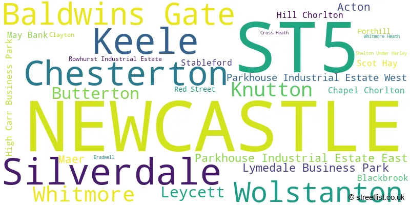
The largest settlement in the ST5 postal code is NEWCASTLE followed by Silverdale, and Chesterton.
The ST5 Postcode shares a border with CW3 (Madeley, Audlem, Woore), ST1 (STOKE-ON-TRENT), ST4 (STOKE-ON-TRENT), ST6 (STOKE-ON-TRENT, Brown Edge), ST7 (Alsager, Kidsgrove, Talke), TF9 (MARKET DRAYTON, Loggerheads, Hinstock) and ST21 (Eccleshall, Cotes Heath, Standon).
Maps and visuals
Weather
Weather Forecast for Keele
Powered by Met Office DataPoint under the Open Government Licence.