The ST7 postcode district is a postal district located in the ST Stoke-on-Trent postcode area with a population of 55,169 residents according to the 2021 England and Wales Census.
The area of the ST7 postcode district is 29.78 square miles which is 77.14 square kilometres or 19,061.51 acres.
Currently, the ST7 district has about 1343 postcode units spread across 5 geographic postcode sectors.
Given that each sector allows for 400 unique postcode combinations, the district has a capacity of 2,000 postcodes. With 1343 postcodes already in use, this leaves 657 units available.
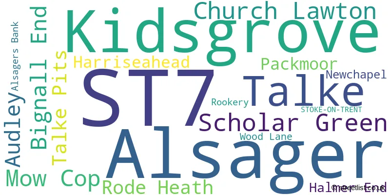
The largest settlement in the ST7 postal code is Alsager followed by Kidsgrove, and Talke.
The ST7 Postcode shares a border with CW1 (CREWE, Haslington, Leighton), CW11 (SANDBACH, Elworth, Winterley), CW2 (CREWE, Wistaston, Shavington), CW3 (Madeley, Audlem, Woore), CW12 (CONGLETON, Somerford, Eaton), ST5 (NEWCASTLE, Silverdale, Chesterton), ST6 (STOKE-ON-TRENT, Brown Edge) and ST8 (Biddulph, Knypersley, Biddulph Moor).
The primary settlement in the ST7 postcode district is Talke, located in Staffordshire. Other significant settlements in the district include Kidsgrove, Alsager, Church Lawton, Mow Cop, Rode Heath, Scholar Green, Harriseahead, Newchapel, Packmoor, Rookery, Alsagers Bank, Audley, Bignall End, Halmer End, and Wood Lane. The district is located in the county of Staffordshire, which is in England. The most significant post town in the district is Stoke-on-Trent.
For the district ST7, we have data on 6 postcode sectors. Here's a breakdown: The sector ST7 1, covers Talke and Kidsgrove and Talke Pits in Staffordshire. The sector ST7 2, covers Alsager in Cheshire. The sector ST7 3, covers Scholar Green and Church Lawton and Rode Heath in Cheshire. The sector ST7 4, covers Kidsgrove and Packmoor and Harriseahead in Staffordshire. The sector ST7 8, covers Bignall End and Audley and Halmer End in Staffordshire. The sector ST7 9 is non-geographic. It's often designated for PO Boxes, large organisations, or special services.

Map of the ST7 Postcode District
Explore the ST7 postcode district by using our free interactive map.

When it comes to local government, postal geography often disregards political borders. However, for a breakdown in the ST7 District: the district mostly encompasses the Newcastle-under-Lyme District (B) (698 postcodes), followed by the Cheshire East (B) area (608 postcodes), followed by the City of Stoke-on-Trent (B) area (37 postcodes), and finally, the Staffordshire Moorlands District area (8 postcodes).
Recent House Sales in ST7
| Date | Price | Address |
|---|---|---|
| 20/10/2023 | £190,000 | Primitive Street, Mow Cop, Stoke-on-trent, ST7 3NH |
| 13/10/2023 | £430,000 | Bedford Grove, Alsager, Stoke-on-trent, ST7 2SR |
| 13/10/2023 | £137,000 | West Grove, Alsager, Stoke-on-trent, ST7 2DW |
| 09/10/2023 | £108,000 | Queen Street, Kidsgrove, Stoke-on-trent, ST7 4AH |
| 06/10/2023 | £240,000 | Highfield Avenue, Kidsgrove, Stoke-on-trent, ST7 4AT |
| 29/09/2023 | £490,000 | Sunnyside, Alsager, Stoke-on-trent, ST7 2TN |
| 29/09/2023 | £235,000 | Bainbridge Street, Alsager, Stoke-on-trent, ST7 2FH |
| 26/09/2023 | £285,000 | Heathcote Road, Bignall End, Stoke-on-trent, ST7 8LH |
| 20/09/2023 | £260,000 | Stephens Way, Bignall End, Stoke-on-trent, ST7 8PL |
| 18/09/2023 | £133,849 | Harriseahead Lane, Harriseahead, Stoke-on-trent, ST7 4RB |
Weather Forecast for ST7
Press Button to Show Forecast for Alsager
| Time Period | Icon | Description | Temperature | Rain Probability | Wind |
|---|---|---|---|---|---|
| 21:00 to 00:00 | Cloudy | 5.0°C (feels like 4.0°C) | 14.00% | E 4 mph |
Press Button to Show Forecast for Alsager
| Time Period | Icon | Description | Temperature | Rain Probability | Wind |
|---|---|---|---|---|---|
| 00:00 to 03:00 | Cloudy | 4.0°C (feels like 2.0°C) | 5.00% | E 4 mph | |
| 03:00 to 06:00 | Partly cloudy (night) | 3.0°C (feels like 1.0°C) | 1.00% | E 4 mph | |
| 06:00 to 09:00 | Cloudy | 3.0°C (feels like 1.0°C) | 5.00% | E 4 mph | |
| 09:00 to 12:00 | Cloudy | 7.0°C (feels like 5.0°C) | 13.00% | ESE 4 mph | |
| 12:00 to 15:00 | Overcast | 8.0°C (feels like 8.0°C) | 17.00% | ENE 4 mph | |
| 15:00 to 18:00 | Cloudy | 9.0°C (feels like 8.0°C) | 10.00% | E 4 mph | |
| 18:00 to 21:00 | Cloudy | 9.0°C (feels like 8.0°C) | 8.00% | E 4 mph | |
| 21:00 to 00:00 | Partly cloudy (night) | 5.0°C (feels like 2.0°C) | 5.00% | E 7 mph |
Press Button to Show Forecast for Alsager
| Time Period | Icon | Description | Temperature | Rain Probability | Wind |
|---|---|---|---|---|---|
| 00:00 to 03:00 | Cloudy | 4.0°C (feels like 1.0°C) | 11.00% | E 7 mph | |
| 03:00 to 06:00 | Cloudy | 3.0°C (feels like 1.0°C) | 9.00% | E 4 mph | |
| 06:00 to 09:00 | Cloudy | 4.0°C (feels like 1.0°C) | 9.00% | ENE 7 mph | |
| 09:00 to 12:00 | Cloudy | 8.0°C (feels like 5.0°C) | 8.00% | E 9 mph | |
| 12:00 to 15:00 | Overcast | 9.0°C (feels like 7.0°C) | 17.00% | E 9 mph | |
| 15:00 to 18:00 | Overcast | 10.0°C (feels like 8.0°C) | 18.00% | E 9 mph | |
| 18:00 to 21:00 | Cloudy | 9.0°C (feels like 7.0°C) | 18.00% | ENE 9 mph | |
| 21:00 to 00:00 | Cloudy | 7.0°C (feels like 4.0°C) | 16.00% | ENE 9 mph |
Press Button to Show Forecast for Alsager
| Time Period | Icon | Description | Temperature | Rain Probability | Wind |
|---|---|---|---|---|---|
| 00:00 to 03:00 | Cloudy | 6.0°C (feels like 3.0°C) | 20.00% | NE 9 mph | |
| 03:00 to 06:00 | Cloudy | 6.0°C (feels like 3.0°C) | 18.00% | NNE 11 mph | |
| 06:00 to 09:00 | Heavy rain | 6.0°C (feels like 3.0°C) | 71.00% | NNE 11 mph | |
| 09:00 to 12:00 | Heavy rain | 7.0°C (feels like 4.0°C) | 74.00% | NNE 11 mph | |
| 12:00 to 15:00 | Heavy rain | 9.0°C (feels like 6.0°C) | 76.00% | N 11 mph | |
| 15:00 to 18:00 | Light rain | 9.0°C (feels like 6.0°C) | 54.00% | N 11 mph | |
| 18:00 to 21:00 | Cloudy | 9.0°C (feels like 7.0°C) | 17.00% | NNW 9 mph | |
| 21:00 to 00:00 | Clear night | 6.0°C (feels like 5.0°C) | 12.00% | NW 7 mph |
Where is the ST7 Postcode District?
The postcode district ST7 is located in the town of Stoke-on-Trent. This district is in close proximity to several nearby towns. To the South is Newcastle, which is approximately 4.95 miles away. To the North West is Sandbach, which is around 5.78 miles away. To the West is Crewe, located about 6.38 miles away. To the North East is Congleton, which is approximately 6.48 miles away. To the East is Leek, located around 9.26 miles away. Lastly, to the South East is Stone, which is approximately 13.53 miles away. It is worth noting that the distance between the postcode district ST7 and the center of London is 142.01 miles.
The district is within the post town of STOKE-ON-TRENT.
The sector has postcodes within the nation of England.
The ST7 Postcode District is covers the following regions.
- Staffordshire CC - Shropshire and Staffordshire - West Midlands (England)
- Cheshire East - Cheshire - North West (England)
- Stoke-on-Trent - Shropshire and Staffordshire - West Midlands (England)
| Postcode Sector | Delivery Office |
|---|---|
| ST7 1 | Kidsgrove Delivery Office |
| ST7 2 | Kidsgrove Delivery Office |
| ST7 3 | Kidsgrove Delivery Office |
| ST7 4 | Kidsgrove Delivery Office |
| ST7 8 | Kidsgrove Delivery Office |
| S | T | 7 | - | X | X | X |
| S | T | 7 | Space | Numeric | Letter | Letter |
Tourist Attractions within the Postcode Area
We found 1 visitor attractions within the ST7 postcode area
| Rode Hall & Gardens |
|---|
| Historic Properties |
| Historic House / House and Garden / Palace |
| View Rode Hall & Gardens on Google Maps |
Current Monthly Rental Prices
| # Bedrooms | Min Price | Max Price | Avg Price |
|---|---|---|---|
| 1 | £495 | £495 | £495 |
| 2 | £590 | £825 | £723 |
| 3 | £775 | £1,100 | £903 |
Current House Prices
| # Bedrooms | Min Price | Max Price | Avg Price |
|---|---|---|---|
| £10,000 | £150,000 | £64,900 | |
| 1 | £70,000 | £130,000 | £98,713 |
| 2 | £60,000 | £460,000 | £184,573 |
| 3 | £69,000 | £695,000 | £235,111 |
| 4 | £145,000 | £1,600,000 | £424,266 |
| 5 | £254,500 | £3,000,000 | £735,675 |
| 6 | £290,000 | £365,000 | £327,500 |
Estate Agents who Operate in the ST7 District
| Logo | Name | Brand Name | Address | Contact Number | Total Properties |
|---|---|---|---|---|---|
 | Alsager | Stephenson Browne Ltd | 13 Crewe Road, Alsager, ST7 2EW | 01270 433753 | 65 |
 | Kidsgrove | Shaw's and Company | 43 Liverpool Road, Kidsgrove, ST7 1EA | 01782 493508 | 32 |
 | Alsager | Bridgfords | 8 Crewe Road, Alsager, Stoke on Trent, Staffordshire , ST7 2ES | 01270 433208 | 32 |
 | Stoke-on-Trent | Samuel Makepeace Estate Agents | 4 Heathcote Street, Kidsgrove, Stoke-On-Trent, ST7 4AA | 01782 890765 | 31 |
 | covering Alsager | Butters John Bee | 1 Crewe Road, Alsager, ST7 2EW | 01270 433828 | 27 |
| Type of Property | 2018 Average | 2018 Sales | 2017 Average | 2017 Sales | 2016 Average | 2016 Sales | 2015 Average | 2015 Sales |
|---|---|---|---|---|---|---|---|---|
| Detached | £262,413 | 357 | £247,779 | 356 | £228,541 | 351 | £232,313 | 339 |
| Semi-Detached | £151,240 | 459 | £143,747 | 423 | £141,295 | 418 | £132,852 | 390 |
| Terraced | £123,137 | 205 | £123,274 | 219 | £109,226 | 203 | £109,719 | 167 |
| Flats | £122,688 | 16 | £108,534 | 17 | £96,102 | 22 | £71,130 | 25 |