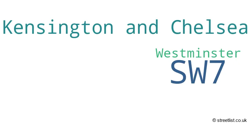
The SW7 postcode district is a postal district located in the SW London - SW postcode area with a population of 15,132 residents according to the 2021 England and Wales Census.
The area of the SW7 postcode district is 0.63 square miles which is 1.64 square kilometres or 404.45 acres.
Currently, the SW7 district has about 648 postcode units spread across 5 geographic postcode sectors.
Given that each sector allows for 400 unique postcode combinations, the district has a capacity of 2,000 postcodes. With 648 postcodes already in use, this leaves 1352 units available.
The SW7 postal code covers the settlement of LONDON.
The SW7 Postcode shares a border with SW3 (LONDON), W2 (LONDON), W8 (LONDON), SW10 (LONDON) and SW5 (LONDON).
In the SW7 postcode district, the primary settlement is Kensington and Chelsea, which is located in the Greater London region. The most significant postal town in this district is London.
For the district SW7, we have data on 6 postcode sectors. Here's a breakdown: The sector SW7 1, covers Westminster in Greater London. The sector SW7 2, covers Kensington And Chelsea and Westminster in Greater London. The sector SW7 3, covers Kensington And Chelsea in Greater London. The sector SW7 4, covers Kensington And Chelsea in Greater London. The sector SW7 5, covers Kensington And Chelsea in Greater London. The sector SW7 9 is non-geographic. It's often designated for PO Boxes, large organisations, or special services.

Map of the SW7 Postcode District
Explore the SW7 postcode district by using our free interactive map.

When it comes to local government, postal geography often disregards political borders. However, for a breakdown in the SW7 District: the district mostly encompasses the Kensington and Chelsea London Boro (483 postcodes), and finally, the City of Westminster London Boro area (169 postcodes).
Recent House Sales in SW7
| Date | Price | Address |
|---|---|---|
| 13/10/2023 | £785,000 | Rosary Gardens, London, SW7 4NQ |
| 14/09/2023 | £925,000 | Queen's Gate, London, SW7 5JW |
| 08/09/2023 | £330,000 | Queens Gate Gardens, London, SW7 5LZ |
| 08/09/2023 | £1,925,000 | Emperors Gate, London, SW7 4JA |
| 06/09/2023 | £1,400,000 | Rutland Mews South, London, SW7 1NZ |
| 06/09/2023 | £2,950,000 | Hereford Square, London, SW7 4TT |
| 31/08/2023 | £925,000 | Colbeck Mews, London, SW7 4LX |
| 31/08/2023 | £2,400,000 | Evelyn Gardens, London, SW7 3BG |
| 30/08/2023 | £980,000 | Mcleods Mews, London, SW7 4HP |
| 25/08/2023 | £800,000 | Thurloe Square, London, SW7 2SR |
Weather Forecast for SW7
Press Button to Show Forecast for Earl's Court Youth Hostel
| Time Period | Icon | Description | Temperature | Rain Probability | Wind |
|---|---|---|---|---|---|
| 21:00 to 00:00 | Cloudy | 8.0°C (feels like 7.0°C) | 4.00% | N 7 mph |
Press Button to Show Forecast for Earl's Court Youth Hostel
| Time Period | Icon | Description | Temperature | Rain Probability | Wind |
|---|---|---|---|---|---|
| 00:00 to 03:00 | Partly cloudy (night) | 7.0°C (feels like 5.0°C) | 1.00% | NNW 7 mph | |
| 03:00 to 06:00 | Cloudy | 6.0°C (feels like 3.0°C) | 4.00% | NNW 7 mph | |
| 06:00 to 09:00 | Cloudy | 6.0°C (feels like 3.0°C) | 4.00% | NNW 7 mph | |
| 09:00 to 12:00 | Cloudy | 8.0°C (feels like 5.0°C) | 4.00% | NNW 11 mph | |
| 12:00 to 15:00 | Cloudy | 10.0°C (feels like 8.0°C) | 4.00% | NNW 11 mph | |
| 15:00 to 18:00 | Cloudy | 11.0°C (feels like 9.0°C) | 4.00% | NNW 9 mph | |
| 18:00 to 21:00 | Cloudy | 11.0°C (feels like 9.0°C) | 4.00% | N 9 mph | |
| 21:00 to 00:00 | Partly cloudy (night) | 9.0°C (feels like 7.0°C) | 1.00% | NNE 4 mph |
Press Button to Show Forecast for Earl's Court Youth Hostel
| Time Period | Icon | Description | Temperature | Rain Probability | Wind |
|---|---|---|---|---|---|
| 00:00 to 03:00 | Cloudy | 7.0°C (feels like 6.0°C) | 3.00% | SW 4 mph | |
| 03:00 to 06:00 | Cloudy | 6.0°C (feels like 5.0°C) | 4.00% | WSW 4 mph | |
| 06:00 to 09:00 | Cloudy | 6.0°C (feels like 5.0°C) | 5.00% | WSW 4 mph | |
| 09:00 to 12:00 | Cloudy | 9.0°C (feels like 7.0°C) | 6.00% | W 7 mph | |
| 12:00 to 15:00 | Overcast | 11.0°C (feels like 9.0°C) | 12.00% | WNW 9 mph | |
| 15:00 to 18:00 | Overcast | 12.0°C (feels like 10.0°C) | 12.00% | WNW 9 mph | |
| 18:00 to 21:00 | Cloudy | 12.0°C (feels like 10.0°C) | 10.00% | NW 7 mph | |
| 21:00 to 00:00 | Cloudy | 9.0°C (feels like 8.0°C) | 8.00% | NNE 7 mph |
Press Button to Show Forecast for Earl's Court Youth Hostel
| Time Period | Icon | Description | Temperature | Rain Probability | Wind |
|---|---|---|---|---|---|
| 00:00 to 03:00 | Cloudy | 8.0°C (feels like 7.0°C) | 6.00% | E 4 mph | |
| 03:00 to 06:00 | Cloudy | 7.0°C (feels like 5.0°C) | 5.00% | NE 4 mph | |
| 06:00 to 09:00 | Cloudy | 6.0°C (feels like 5.0°C) | 7.00% | ENE 4 mph | |
| 09:00 to 12:00 | Cloudy | 9.0°C (feels like 7.0°C) | 9.00% | ESE 7 mph | |
| 12:00 to 15:00 | Overcast | 11.0°C (feels like 9.0°C) | 16.00% | SE 7 mph | |
| 15:00 to 18:00 | Light rain shower (day) | 11.0°C (feels like 10.0°C) | 38.00% | ESE 7 mph | |
| 18:00 to 21:00 | Cloudy | 11.0°C (feels like 9.0°C) | 13.00% | SE 9 mph | |
| 21:00 to 00:00 | Cloudy | 10.0°C (feels like 8.0°C) | 14.00% | SE 7 mph |
Press Button to Show Forecast for Earl's Court Youth Hostel
| Time Period | Icon | Description | Temperature | Rain Probability | Wind |
|---|---|---|---|---|---|
| 00:00 to 03:00 | Cloudy | 8.0°C (feels like 7.0°C) | 15.00% | ESE 7 mph | |
| 03:00 to 06:00 | Cloudy | 8.0°C (feels like 7.0°C) | 16.00% | ESE 7 mph | |
| 06:00 to 09:00 | Cloudy | 8.0°C (feels like 7.0°C) | 17.00% | ESE 7 mph | |
| 09:00 to 12:00 | Cloudy | 10.0°C (feels like 9.0°C) | 18.00% | SE 7 mph | |
| 12:00 to 15:00 | Cloudy | 13.0°C (feels like 11.0°C) | 14.00% | SE 9 mph | |
| 15:00 to 18:00 | Cloudy | 13.0°C (feels like 12.0°C) | 18.00% | SE 9 mph | |
| 18:00 to 21:00 | Cloudy | 13.0°C (feels like 11.0°C) | 18.00% | E 9 mph | |
| 21:00 to 00:00 | Cloudy | 11.0°C (feels like 10.0°C) | 16.00% | E 7 mph |
Where is the SW7 Postcode District?
The data indicates that the postcode district SW7 is located in LONDON. The nearby towns to SW7 are Knightsbridge and Belgravia in the North West, Bayswater in the North, Chelsea Harbour in the South, St George's in the East, Brook Green in the West, and Mayfair in the North East. Additionally, SW7 is approximately 2.25 miles away from the center of London.
The district is within the post town of LONDON.
The sector has postcodes within the nation of England.
The SW7 Postcode District is covers the following regions.
- Westminster - Inner London - West - London
- Kensington & Chelsea and Hammersmith & Fulham - Inner London - West - London
| Postcode Sector | Delivery Office |
|---|---|
| SW7 1 | South Kensington Sdelivery Office |
| SW7 2 | South Kensington Sdelivery Office |
| SW7 3 | South Kensington Sdelivery Office |
| SW7 4 | South Kensington Sdelivery Office |
| SW7 5 | South Kensington Sdelivery Office |
| S | W | 7 | - | X | X | X |
| S | W | 7 | Space | Numeric | Letter | Letter |
Tourist Attractions within the Postcode Area
We found 3 visitor attractions within the SW7 postcode area
| Natural History Museum |
|---|
| Museums & Art Galleries |
| Museum and / or Art Gallery |
| View Natural History Museum on Google Maps |
| Science Museum |
| Museums & Art Galleries |
| Museum and / or Art Gallery |
| View Science Museum on Google Maps |
| Victoria and Albert Museum |
| Museums & Art Galleries |
| Museum and / or Art Gallery |
| View Victoria and Albert Museum on Google Maps |
Current Monthly Rental Prices
| # Bedrooms | Min Price | Max Price | Avg Price |
|---|---|---|---|
| £375 | £7,280 | £2,436 | |
| 1 | £1,950 | £19,500 | £5,384 |
| 2 | £2,492 | £32,500 | £7,386 |
| 3 | £3,250 | £43,333 | £14,312 |
| 4 | £5,612 | £78,000 | £22,812 |
| 5 | £7,800 | £108,333 | £50,155 |
| 6 | £27,950 | £86,667 | £51,783 |
| 7 | £33,583 | £173,333 | £83,823 |
Current House Prices
| # Bedrooms | Min Price | Max Price | Avg Price |
|---|---|---|---|
| £35,000 | £650,000 | £341,563 | |
| 1 | £440,000 | £3,600,000 | £1,139,635 |
| 2 | £550,000 | £6,950,000 | £1,884,843 |
| 3 | £750,000 | £9,000,000 | £4,033,973 |
| 4 | £2,000,000 | £15,000,000 | £4,937,450 |
| 5 | £2,795,000 | £18,000,000 | £6,520,860 |
| 6 | £6,400,000 | £24,950,000 | £15,183,333 |
| 7 | £6,950,000 | £30,000,000 | £17,090,000 |
| 8 | £9,250,000 | £16,000,000 | £12,625,000 |
| 10 | £23,950,000 | £23,950,000 | £23,950,000 |
| 12 | £14,000,000 | £14,000,000 | £14,000,000 |
Estate Agents who Operate in the SW7 District
| Logo | Name | Brand Name | Address | Contact Number | Total Properties |
|---|---|---|---|---|---|
 | South Kensington | Foxtons | 94 Old Brompton Road, London, SW7 3RD | 020 3840 3425 | 138 |
 | South Kensington & Knightsbridge | Dexters | 144-146 Old Brompton Road, London, SW7 4NR | 020 7244 7711 | 83 |
 | South Kensington | Marsh & Parsons | 29 Harrington Road, London, SW7 3HD | 020 7590 0800 | 49 |
 | South Kensington Lettings | Chestertons Estate Agents | 44-48 Old Brompton Road, South Kensington, London, SW7 3DY | 020 3869 0916 | 47 |
 | South Kensington | John D Wood & Co. Sales | 125 Gloucester Road, London, SW7 4TE | 020 3835 3970 | 31 |
| Type of Property | 2018 Average | 2018 Sales | 2017 Average | 2017 Sales | 2016 Average | 2016 Sales | 2015 Average | 2015 Sales |
|---|---|---|---|---|---|---|---|---|
| Detached | £3,000,000 | 1 | £0 | 0 | £0 | 0 | £0 | 0 |
| Semi-Detached | £0 | 0 | £5,245,800 | 2 | £0 | 0 | £0 | 0 |
| Terraced | £4,676,108 | 45 | £4,369,810 | 36 | £5,325,913 | 47 | £4,368,219 | 64 |
| Flats | £1,849,674 | 181 | £2,320,942 | 231 | £2,377,167 | 243 | £1,814,209 | 277 |