The SY5 postcode district is a postal district located in the SY Shrewsbury postcode area with a population of 22,946 residents according to the 2021 England and Wales Census.
The area of the SY5 postcode district is 179.07 square miles which is 463.79 square kilometres or 114,605.75 acres.
Currently, the SY5 district has about 1054 postcode units spread across 5 geographic postcode sectors.
Given that each sector allows for 400 unique postcode combinations, the district has a capacity of 2,000 postcodes. With 1054 postcodes already in use, this leaves 946 units available.
The largest settlement in the SY5 postal code is Minsterley followed by Pontesbury, and Dorrington.
The SY5 Postcode shares a border with TF13 (MUCH WENLOCK, Homer, Brockton), TF6 (High Ercall, Allscott, Waters Upton), TF8 (Ironbridge, Coalbrookdale, Jackfield), SY3 (SHREWSBURY, Bicton Heath, Bayston Hill), SY6 (CHURCH STRETTON, All Stretton, Leebotwood), SY9 (BISHOPS CASTLE, Wentnor, Norbury), SY21 (WELSHPOOL, LLANFAIR CAEREINION, GUILSFIELD), SY22 (LLANFYLLIN, LLANSANTFFRAID-YM-MECHAIN, LLANYMYNECH), SY4 (Wem, Baschurch, Shawbury), SY2 (SHREWSBURY) and SY10 (Weston Rhyn, Morda, OSWESTRY).
The primary settlement in the SY5 postcode district is Minsterley, located in both Powys and Shropshire. The most significant Postal Town in the district is Shrewsbury, which is situated in Shropshire.
For the district SY5, we have data on 5 postcode sectors. Here's a breakdown: The sector SY5 0, covers Minsterley and Pontesbury in Shropshire. The sector SY5 6, covers Cross Houses and Cressage and Cound in Shropshire. The sector SY5 7, covers Dorrington and Condover and Acton Burnell in Shropshire. The sector SY5 8, covers Hanwood and Longden and Pulverbatch and Bowbrook in Shropshire. The sector SY5 9, covers Westbury and Ford and Halfway House and Worthen in Shropshire.

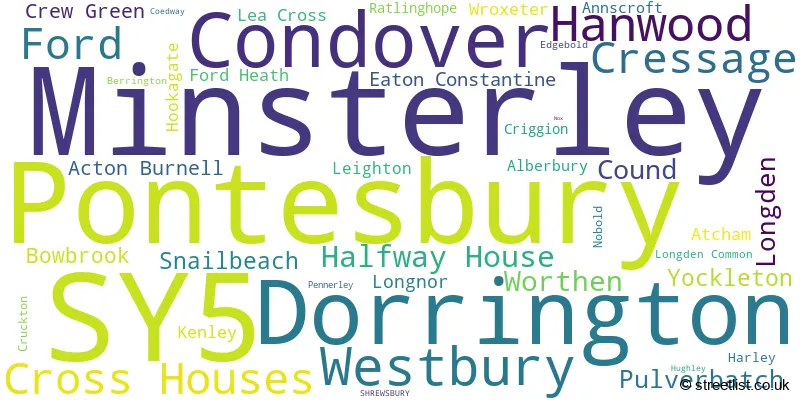
Map of the SY5 Postcode District
Explore the SY5 postcode district by using our free interactive map.

When it comes to local government, postal geography often disregards political borders. However, for a breakdown in the SY5 District: the district mostly encompasses the Shropshire (1028 postcodes), and finally, the Powys - Powys area (34 postcodes).
Recent House Sales in SY5
| Date | Price | Address |
|---|---|---|
| 23/10/2023 | £819,000 | Ratlinghope, Shrewsbury, SY5 0SX |
| 03/10/2023 | £240,000 | Oak Terrace, Annscroft, Shrewsbury, SY5 8AS |
| 22/09/2023 | £110,000 | Ash Grove, Pontesbury, Shrewsbury, SY5 0RQ |
| 14/09/2023 | £355,000 | Hinwood Road, Westbury, Shrewsbury, SY5 9QU |
| 14/09/2023 | £110,000 | West View, Ford, Shrewsbury, SY5 9LR |
| 08/09/2023 | £260,000 | Mount Way, Pontesbury, Shrewsbury, SY5 0RB |
| 06/09/2023 | £100,000 | Bebbington Cottages, Castle Pulverbatch, Shrewsbury, SY5 8DX |
| 04/09/2023 | £130,000 | Chapel Street, Pontesbury, Shrewsbury, SY5 0RJ |
| 30/08/2023 | £85,000 | Minsterley, Shrewsbury, SY5 0BA |
| 25/08/2023 | £115,000 | The Chestnuts, Cross Houses, Shrewsbury, SY5 6JG |
Weather Forecast for SY5
Press Button to Show Forecast for Westbury (Shropshire)
| Time Period | Icon | Description | Temperature | Rain Probability | Wind |
|---|---|---|---|---|---|
| 12:00 to 15:00 | Cloudy | 8.0°C (feels like 6.0°C) | 8.00% | NNE 9 mph | |
| 15:00 to 18:00 | Cloudy | 10.0°C (feels like 9.0°C) | 4.00% | NNE 7 mph | |
| 18:00 to 21:00 | Partly cloudy (day) | 9.0°C (feels like 8.0°C) | 3.00% | NNE 4 mph | |
| 21:00 to 00:00 | Clear night | 2.0°C (feels like 0.0°C) | 0.00% | NW 2 mph |
Press Button to Show Forecast for Westbury (Shropshire)
| Time Period | Icon | Description | Temperature | Rain Probability | Wind |
|---|---|---|---|---|---|
| 00:00 to 03:00 | Clear night | 1.0°C (feels like -1.0°C) | 1.00% | WSW 4 mph | |
| 03:00 to 06:00 | Cloudy | 4.0°C (feels like 1.0°C) | 5.00% | WSW 7 mph | |
| 06:00 to 09:00 | Cloudy | 5.0°C (feels like 3.0°C) | 7.00% | W 7 mph | |
| 09:00 to 12:00 | Cloudy | 9.0°C (feels like 6.0°C) | 8.00% | NW 9 mph | |
| 12:00 to 15:00 | Cloudy | 9.0°C (feels like 7.0°C) | 5.00% | NNW 9 mph | |
| 15:00 to 18:00 | Cloudy | 10.0°C (feels like 8.0°C) | 6.00% | N 9 mph | |
| 18:00 to 21:00 | Cloudy | 8.0°C (feels like 6.0°C) | 5.00% | N 7 mph | |
| 21:00 to 00:00 | Cloudy | 4.0°C (feels like 2.0°C) | 4.00% | NW 4 mph |
Press Button to Show Forecast for Westbury (Shropshire)
| Time Period | Icon | Description | Temperature | Rain Probability | Wind |
|---|---|---|---|---|---|
| 00:00 to 03:00 | Cloudy | 3.0°C (feels like 2.0°C) | 4.00% | NNE 4 mph | |
| 03:00 to 06:00 | Cloudy | 3.0°C (feels like 2.0°C) | 9.00% | ENE 4 mph | |
| 06:00 to 09:00 | Cloudy | 3.0°C (feels like 2.0°C) | 14.00% | NNE 4 mph | |
| 09:00 to 12:00 | Cloudy | 6.0°C (feels like 4.0°C) | 9.00% | E 4 mph | |
| 12:00 to 15:00 | Cloudy | 9.0°C (feels like 7.0°C) | 9.00% | E 7 mph | |
| 15:00 to 18:00 | Overcast | 10.0°C (feels like 8.0°C) | 13.00% | ENE 7 mph | |
| 18:00 to 21:00 | Cloudy | 9.0°C (feels like 7.0°C) | 11.00% | NE 4 mph | |
| 21:00 to 00:00 | Partly cloudy (night) | 4.0°C (feels like 2.0°C) | 9.00% | NE 4 mph |
Press Button to Show Forecast for Westbury (Shropshire)
| Time Period | Icon | Description | Temperature | Rain Probability | Wind |
|---|---|---|---|---|---|
| 00:00 to 03:00 | Cloudy | 3.0°C (feels like 1.0°C) | 11.00% | NE 4 mph | |
| 03:00 to 06:00 | Cloudy | 2.0°C (feels like 0.0°C) | 11.00% | NNE 4 mph | |
| 06:00 to 09:00 | Cloudy | 3.0°C (feels like 1.0°C) | 12.00% | NE 4 mph | |
| 09:00 to 12:00 | Overcast | 7.0°C (feels like 5.0°C) | 15.00% | ENE 7 mph | |
| 12:00 to 15:00 | Cloudy | 9.0°C (feels like 7.0°C) | 19.00% | E 9 mph | |
| 15:00 to 18:00 | Overcast | 10.0°C (feels like 8.0°C) | 21.00% | ENE 9 mph | |
| 18:00 to 21:00 | Overcast | 9.0°C (feels like 8.0°C) | 20.00% | ENE 7 mph | |
| 21:00 to 00:00 | Cloudy | 7.0°C (feels like 5.0°C) | 19.00% | NE 9 mph |
Press Button to Show Forecast for Westbury (Shropshire)
| Time Period | Icon | Description | Temperature | Rain Probability | Wind |
|---|---|---|---|---|---|
| 00:00 to 03:00 | Light rain | 5.0°C (feels like 3.0°C) | 50.00% | NNE 9 mph | |
| 03:00 to 06:00 | Light rain | 5.0°C (feels like 2.0°C) | 49.00% | N 11 mph | |
| 06:00 to 09:00 | Light rain | 6.0°C (feels like 3.0°C) | 51.00% | N 11 mph | |
| 09:00 to 12:00 | Heavy rain | 7.0°C (feels like 4.0°C) | 75.00% | N 11 mph | |
| 12:00 to 15:00 | Light rain | 9.0°C (feels like 6.0°C) | 54.00% | N 11 mph | |
| 15:00 to 18:00 | Light rain shower (day) | 10.0°C (feels like 8.0°C) | 42.00% | NW 11 mph | |
| 18:00 to 21:00 | Partly cloudy (day) | 10.0°C (feels like 8.0°C) | 14.00% | NNW 7 mph | |
| 21:00 to 00:00 | Partly cloudy (night) | 6.0°C (feels like 4.0°C) | 6.00% | WNW 7 mph |
Where is the SY5 Postcode District?
The postcode district SY5 is located in Shrewsbury, a town in the United Kingdom. Shrewsbury is situated near several nearby towns, including Church Stretton to the South (8.30 miles away), Bishops Castle to the South West (11.57 miles away), Much Wenlock to the East (12.39 miles away), Welshpool to the West (12.92 miles away), and Llanymynech to the North West (13.78 miles away). Additionally, Shrewsbury is located approximately 139.59 miles away from the center of London.
The district is within the post town of SHREWSBURY.
The sector has postcodes within the nations of England, Wales.
The SY5 Postcode District is covers the following regions.
- Shropshire CC - Shropshire and Staffordshire - West Midlands (England)
- Powys - East Wales - Wales
| Postcode Sector | Delivery Office |
|---|---|
| SY5 0 | Minsterley Scale Payment Delivery Office |
| SY5 0 | Pontesbury Scale Payment Delivery Office |
| SY5 6 | Cressage Scale Payment Delivery Office |
| SY5 6 | Shrewsbury Delivery Office |
| SY5 7 | Shrewsbury Delivery Office |
| SY5 7 | Condelivery Officever Scale Payment Delivery Office |
| SY5 8 | Shrewsbury Delivery Office |
| SY5 8 | Pontesbury Scale Payment Delivery Office |
| SY5 9 | Shrewsbury Delivery Office |
| SY5 9 | Westbury Scale Payment Delivery Office |
| S | Y | 5 | - | X | X | X |
| S | Y | 5 | Space | Numeric | Letter | Letter |
Tourist Attractions within the Postcode Area
We found 1 visitor attractions within the SY5 postcode area
| Wroxeter Roman City |
|---|
| Historic Properties |
| Historic Monument / Archaeological Site |
| View Wroxeter Roman City on Google Maps |
Current Monthly Rental Prices
| # Bedrooms | Min Price | Max Price | Avg Price |
|---|---|---|---|
| 1 | £450 | £590 | £520 |
| 3 | £995 | £1,575 | £1,257 |
| 4 | £1,175 | £1,800 | £1,593 |
| 5 | £2,900 | £3,250 | £3,075 |
Current House Prices
| # Bedrooms | Min Price | Max Price | Avg Price |
|---|---|---|---|
| £45,000 | £915,000 | £372,500 | |
| 1 | £125,000 | £125,000 | £125,000 |
| 2 | £60,995 | £395,000 | £226,944 |
| 3 | £117,500 | £975,000 | £378,470 |
| 4 | £320,000 | £1,800,000 | £596,041 |
| 5 | £350,000 | £3,100,000 | £958,846 |
| 6 | £460,000 | £1,600,000 | £870,000 |
| 7 | £850,000 | £850,000 | £850,000 |
| 21 | £1,150,000 | £1,150,000 | £1,150,000 |
Estate Agents who Operate in the SY5 District
| Logo | Name | Brand Name | Address | Contact Number | Total Properties |
|---|---|---|---|---|---|
 | Shrewsbury | Cooper Green Pooks | 3 Barker Street Shrewsbury Shropshire, SY1 1QF | 01743 652229 | 19 |
 | Shrewsbury | Holland Broadbridge | Agriculture House, 5 Barker Street, Shrewsbury, SY1 1QJ | 01743 652073 | 18 |
 | Shrewsbury | Roger Parry & Partners | 165, Welsh Bridge, Frankwell, Shrewsbury, SY3 8LG | 01743 664106 | 17 |
 | Shrewsbury | Halls Estate Agents | 2 Barker Street, Shrewsbury, SY1 1QJ | 01743 236444 | 13 |
 | Shrewsbury | Miller Evans | 4 Barker Street Shrewsbury SY1 1QJ | 01743 295861 | 12 |
- Acton Burnell
- Alberbury
- Annscroft
- Arscott
- Asterley
- Atcham
- Bentlawnt
- Brockton
- Cantlop
- Cardeston
- Cefn
- Churchstoke
- Coedway
- Condover
- Coundarbour
- Coundmoor
- Cressage
- Crewgreen
- Criggion
- Cross Houses
- Crowsnest
- Cruckton
- Dorrington
- Eaton Constantine
- Emstrey
- Exfords Green
- Ford Heath
- Ford
- Frodesley
- Great Ryton
- Habberley
- Halfway House
- Hanwood Bank
- Hanwood
- Harnage
- Hook-a-gate
- Hopesgate
- Horsebridge
- Leebotwood
- Leighton
- Linley
- Little Ryton
- Longden Common
- Longden
- Longnor
- Longville in the Dale
- Marton
- Middletown
- Minsterley
- Much Wenlock
- Plealey
- Ploxgreen
- Pontesbury
- Pontesford
- Redhill
- Rowton
- Shrawardine
- Shrewsbury
- Snailbeach
- Stapleton
- Stiperstones
- Telford
- Trewern
- Upper Cound
- Wattlesborough Heath
- Wentnor
- Westbury
- Worthen
- Wrentnall
- Wroxeter
- Yockleton
| Type of Property | 2018 Average | 2018 Sales | 2017 Average | 2017 Sales | 2016 Average | 2016 Sales | 2015 Average | 2015 Sales |
|---|---|---|---|---|---|---|---|---|
| Detached | £337,122 | 221 | £325,889 | 230 | £331,194 | 201 | £315,145 | 137 |
| Semi-Detached | £196,408 | 126 | £206,246 | 92 | £188,200 | 94 | £184,387 | 89 |
| Terraced | £193,562 | 40 | £177,721 | 44 | £187,706 | 33 | £211,295 | 28 |
| Flats | £142,291 | 7 | £118,273 | 11 | £146,000 | 5 | £102,395 | 10 |