The SY6 postcode district is a postal district located in the SY Shrewsbury postcode area with a population of 6,908 residents according to the 2021 England and Wales Census.
The area of the SY6 postcode district is 54.71 square miles which is 141.70 square kilometres or 35,014.10 acres.
Currently, the SY6 district has about 326 postcode units spread across 2 geographic postcode sectors.
Given that each sector allows for 400 unique postcode combinations, the district has a capacity of 800 postcodes. With 326 postcodes already in use, this leaves 474 units available.
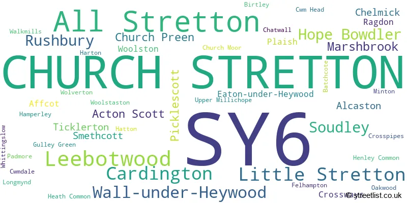
The largest settlement in the SY6 postal code is CHURCH STRETTON followed by All Stretton, and Leebotwood.
The SY6 Postcode shares a border with TF13 (MUCH WENLOCK, Homer, Brockton), SY5 (Minsterley, Pontesbury, Dorrington) and SY7 (CRAVEN ARMS, Leintwardine, Clun).
The primary settlement in the SY6 postcode district is Church Stretton, located in the county of Shropshire, England. Other significant settlements include Acton Scott, Affcot, Alcaston, All Stretton, Leebotwood, and Little Stretton. The most significant post town in this district is also Church Stretton.
For the district SY6, we have data on 3 postcode sectors. Here's a breakdown: The sector SY6 6, covers Church Stretton and All Stretton in Shropshire. The sector SY6 7, covers Church Stretton in Shropshire. The sector SY6 9 is non-geographic. It's often designated for PO Boxes, large organisations, or special services.

Map of the SY6 Postcode District
Explore the SY6 postcode district by using our free interactive map.

When it comes to local government, postal geography often disregards political borders. However, for a breakdown in the SY6 District: the district mostly encompasses the Shropshire area with a total of 324 postcodes.
Recent House Sales in SY6
| Date | Price | Address |
|---|---|---|
| 19/10/2023 | £775,000 | Clive Avenue, Church Stretton, SY6 7BL |
| 11/10/2023 | £475,000 | Longhills Road, Church Stretton, SY6 6DS |
| 10/10/2023 | £355,000 | Shrewsbury Road, Church Stretton, SY6 6EY |
| 03/10/2023 | £835,000 | The Meadows, Church Stretton, SY6 7EG |
| 29/09/2023 | £245,000 | Essex Road, Church Stretton, SY6 6AY |
| 29/09/2023 | £125,000 | Bromleys Court, Church Stretton, SY6 7BE |
| 22/09/2023 | £115,000 | Ashbrook Court, Church Stretton, SY6 6EW |
| 12/09/2023 | £480,000 | Poplar Drive, Church Stretton, SY6 7BW |
| 08/09/2023 | £550,000 | Ludlow Road, Church Stretton, SY6 6AD |
| 01/09/2023 | £650,000 | Yeld Bank, Church Stretton, SY6 6EZ |
Weather Forecast for SY6
Press Button to Show Forecast for Church Stretton
| Time Period | Icon | Description | Temperature | Rain Probability | Wind |
|---|---|---|---|---|---|
| 03:00 to 06:00 | Clear night | 3.0°C (feels like 2.0°C) | 0.00% | NNE 2 mph | |
| 06:00 to 09:00 | Partly cloudy (day) | 4.0°C (feels like 3.0°C) | 0.00% | NNW 2 mph | |
| 09:00 to 12:00 | Partly cloudy (day) | 7.0°C (feels like 6.0°C) | 0.00% | NNE 4 mph | |
| 12:00 to 15:00 | Partly cloudy (day) | 10.0°C (feels like 9.0°C) | 0.00% | N 7 mph | |
| 15:00 to 18:00 | Cloudy | 11.0°C (feels like 10.0°C) | 3.00% | NNE 7 mph | |
| 18:00 to 21:00 | Sunny day | 10.0°C (feels like 8.0°C) | 0.00% | NNE 7 mph | |
| 21:00 to 00:00 | Clear night | 6.0°C (feels like 4.0°C) | 0.00% | NNW 7 mph |
Press Button to Show Forecast for Church Stretton
| Time Period | Icon | Description | Temperature | Rain Probability | Wind |
|---|---|---|---|---|---|
| 00:00 to 03:00 | Clear night | 5.0°C (feels like 3.0°C) | 0.00% | NNW 4 mph | |
| 03:00 to 06:00 | Partly cloudy (night) | 4.0°C (feels like 2.0°C) | 2.00% | NNW 4 mph | |
| 06:00 to 09:00 | Cloudy | 5.0°C (feels like 4.0°C) | 5.00% | N 4 mph | |
| 09:00 to 12:00 | Cloudy | 7.0°C (feels like 6.0°C) | 5.00% | NNE 4 mph | |
| 12:00 to 15:00 | Cloudy | 9.0°C (feels like 7.0°C) | 7.00% | NNE 7 mph | |
| 15:00 to 18:00 | Cloudy | 10.0°C (feels like 8.0°C) | 8.00% | NE 9 mph | |
| 18:00 to 21:00 | Partly cloudy (day) | 9.0°C (feels like 7.0°C) | 4.00% | NE 7 mph | |
| 21:00 to 00:00 | Partly cloudy (night) | 5.0°C (feels like 3.0°C) | 5.00% | ENE 4 mph |
Press Button to Show Forecast for Church Stretton
| Time Period | Icon | Description | Temperature | Rain Probability | Wind |
|---|---|---|---|---|---|
| 00:00 to 03:00 | Overcast | 4.0°C (feels like 3.0°C) | 11.00% | NNE 4 mph | |
| 03:00 to 06:00 | Overcast | 4.0°C (feels like 3.0°C) | 9.00% | SE 2 mph | |
| 06:00 to 09:00 | Overcast | 5.0°C (feels like 3.0°C) | 15.00% | SW 4 mph | |
| 09:00 to 12:00 | Cloudy | 8.0°C (feels like 6.0°C) | 13.00% | SSW 4 mph | |
| 12:00 to 15:00 | Overcast | 10.0°C (feels like 9.0°C) | 17.00% | ENE 7 mph | |
| 15:00 to 18:00 | Light rain | 11.0°C (feels like 9.0°C) | 44.00% | NE 9 mph | |
| 18:00 to 21:00 | Light rain | 9.0°C (feels like 7.0°C) | 44.00% | NE 9 mph | |
| 21:00 to 00:00 | Cloudy | 8.0°C (feels like 6.0°C) | 10.00% | NNE 9 mph |
Press Button to Show Forecast for Church Stretton
| Time Period | Icon | Description | Temperature | Rain Probability | Wind |
|---|---|---|---|---|---|
| 00:00 to 03:00 | Cloudy | 7.0°C (feels like 5.0°C) | 13.00% | NNE 7 mph | |
| 03:00 to 06:00 | Overcast | 7.0°C (feels like 4.0°C) | 16.00% | NNE 7 mph | |
| 06:00 to 09:00 | Cloudy | 5.0°C (feels like 3.0°C) | 9.00% | NNE 7 mph | |
| 09:00 to 12:00 | Overcast | 8.0°C (feels like 5.0°C) | 10.00% | NNE 11 mph | |
| 12:00 to 15:00 | Overcast | 9.0°C (feels like 7.0°C) | 11.00% | NNE 11 mph | |
| 15:00 to 18:00 | Overcast | 10.0°C (feels like 8.0°C) | 13.00% | NNE 11 mph | |
| 18:00 to 21:00 | Cloudy | 9.0°C (feels like 7.0°C) | 7.00% | NNE 9 mph | |
| 21:00 to 00:00 | Partly cloudy (night) | 7.0°C (feels like 5.0°C) | 6.00% | N 7 mph |
Where is the SY6 Postcode District?
The data indicates that the postcode district SY6 is located in Church Stretton. This district is in close proximity to several nearby towns. To the south is Craven Arms, approximately 5.42 miles away. Lydbury North is situated to the southwest, about 8.48 miles away. Bishops Castle is located to the west, approximately 8.61 miles away. Much Wenlock is to the east, about 10.16 miles away. Finally, to the north is Shrewsbury, which is approximately 11.97 miles away. Additionally, the distance from Church Stretton to the center of London is approximately 133.80 miles.
The district is within the post town of CHURCH STRETTON.
The sector has postcodes within the nation of England.
The SY6 Postcode District is in the Shropshire CC region of Shropshire and Staffordshire within the West Midlands (England).
| Postcode Sector | Delivery Office |
|---|---|
| SY6 6 | Church Stretton Delivery Office |
| SY6 7 | Church Stretton Delivery Office |
| S | Y | 6 | - | X | X | X |
| S | Y | 6 | Space | Numeric | Letter | Letter |
Current Monthly Rental Prices
| # Bedrooms | Min Price | Max Price | Avg Price |
|---|---|---|---|
| 1 | £525 | £650 | £588 |
| 2 | £700 | £700 | £700 |
| 4 | £1,000 | £1,350 | £1,175 |
Current House Prices
| # Bedrooms | Min Price | Max Price | Avg Price |
|---|---|---|---|
| £500 | £675,000 | £312,625 | |
| 1 | £110,000 | £129,500 | £117,167 |
| 2 | £115,000 | £425,000 | £292,364 |
| 3 | £215,000 | £800,000 | £428,136 |
| 4 | £295,000 | £875,000 | £528,555 |
| 5 | £495,000 | £775,000 | £635,000 |
| 6 | £599,000 | £4,750,000 | £2,241,500 |
| 7 | £1,000,000 | £1,000,000 | £1,000,000 |
| 8 | £799,950 | £799,950 | £799,950 |
Estate Agents who Operate in the SY6 District
| Logo | Name | Brand Name | Address | Contact Number | Total Properties |
|---|---|---|---|---|---|
 | Church Stretton | Wrights | 32 Sandford Avenue, Church Stretton, SY6 6BW | 01694 247827 | 33 |
 | Shrewsbury | Miller Evans | 4 Barker Street Shrewsbury SY1 1QJ | 01743 295861 | 8 |
 | Craven Arms | Samuel Wood | 10 Corvedale Road, Craven Arms, SY7 9ND | 01588 508101 | 8 |
 | Craven Arms | McCartneys LLP | Corvedale Road, Craven Arms, SY7 9NE | 01588 672385 | 5 |
 | Shrewsbury | Samuel Wood | 2 Shoplatch, Shrewsbury, SY1 1HF | 01743 652234 | 3 |
| Type of Property | 2018 Average | 2018 Sales | 2017 Average | 2017 Sales | 2016 Average | 2016 Sales | 2015 Average | 2015 Sales |
|---|---|---|---|---|---|---|---|---|
| Detached | £390,301 | 65 | £381,874 | 72 | £353,400 | 58 | £354,072 | 69 |
| Semi-Detached | £243,738 | 21 | £237,071 | 21 | £209,641 | 35 | £208,203 | 20 |
| Terraced | £241,938 | 8 | £221,527 | 11 | £185,250 | 8 | £173,550 | 10 |
| Flats | £140,750 | 18 | £136,556 | 18 | £136,465 | 30 | £121,902 | 30 |
Hotels within the Postcode Area
We found 7 hotels and guest houses within the SY6 postcode area
Thursdays Corner Tudor Cottage
Thursdays Corner 84 High Street, Church Stretton, church-stretton, SY6 6BY.
View detailsMynd House
Ludlow Road, Little Stretton, Shropshire, Church Stretton, church-stretton, SY6 6RB.
View detailsAffcot Lodge
Upper Affcot, Near Church Stretton., Church Stretton, acton-scott, SY6 6RL.
View details