The TA17 postcode district is a postal district located in the TA Taunton postcode area with a population of 541 residents according to the 2021 England and Wales Census.
The area of the TA17 postcode district is 5.28 square miles which is 13.67 square kilometres or 3,378.64 acres.
Currently, the TA17 district has about 35 postcode units spread across 1 geographic postcode sectors.
Given that each sector allows for 400 unique postcode combinations, the district has a capacity of 400 postcodes. With 35 postcodes already in use, this leaves 365 units available.
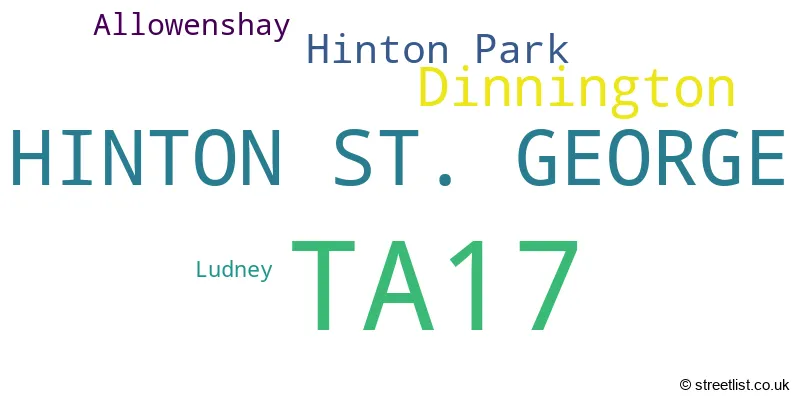
The largest settlement in the TA17 postal code is HINTON ST. GEORGE followed by Dinnington, and Allowenshay.
The TA17 Postcode shares a border with TA18 (CREWKERNE, Misterton, Haselbury Plucknett) and TA19 (ILMINSTER, Ilton, Horton).
The primary settlement in the TA17 postcode district is Hinton St. George, located in the county of Somerset in England. The most significant Postal Town in this district is also Hinton St. George in Somerset. Other significant settlements in this district include Allowenshay, Dinnington, Hinton Park, and Ludney, all within Somerset.
For the district TA17, we have data on 1 postcode sectors. Here's a breakdown: The sector TA17 8, covers Hinton St. George and Dinnington and Hinton Park in Somerset.
TA17 Postcode Sectors

Map of the TA17 Postcode District
Explore the TA17 postcode district by using our free interactive map.

When it comes to local government, postal geography often disregards political borders. However, for a breakdown in the TA17 District: the district mostly encompasses the Somerset area with a total of 35 postcodes.
Recent House Sales in TA17
| Date | Price | Address |
|---|---|---|
| 12/10/2023 | £380,000 | Merriott Road, Hinton St George, TA17 8SL |
| 25/08/2023 | £252,500 | Brettingham Court, Hinton St George, TA17 8RY |
| 18/08/2023 | £405,000 | Brettingham Court, Hinton St George, TA17 8RY |
| 31/07/2023 | £705,000 | Merriott Road, Hinton St George, TA17 8SL |
| 28/07/2023 | £675,000 | Brettingham Court, Hinton St George, TA17 8RY |
| 05/07/2023 | £440,000 | Brettingham Court, Hinton St George, TA17 8RY |
| 23/06/2023 | £310,000 | South Street, Hinton St George, TA17 8SW |
| 05/05/2023 | £970,000 | Dinnington, Hinton St George, TA17 8SX |
| 28/02/2023 | £750,000 | West Street, Hinton St George, TA17 8SA |
| 10/02/2023 | £547,500 | Hinton Close, Hinton St George, TA17 8SH |
Weather Forecast for TA17
Press Button to Show Forecast for Crewkerne
| Time Period | Icon | Description | Temperature | Rain Probability | Wind |
|---|---|---|---|---|---|
| 15:00 to 18:00 | Light rain | 12.0°C (feels like 10.0°C) | 47.00% | W 9 mph | |
| 18:00 to 21:00 | Cloudy | 11.0°C (feels like 9.0°C) | 6.00% | NW 7 mph | |
| 21:00 to 00:00 | Cloudy | 8.0°C (feels like 6.0°C) | 4.00% | NW 7 mph |
Press Button to Show Forecast for Crewkerne
| Time Period | Icon | Description | Temperature | Rain Probability | Wind |
|---|---|---|---|---|---|
| 00:00 to 03:00 | Cloudy | 6.0°C (feels like 5.0°C) | 4.00% | NNE 4 mph | |
| 03:00 to 06:00 | Cloudy | 5.0°C (feels like 4.0°C) | 5.00% | NNE 4 mph | |
| 06:00 to 09:00 | Cloudy | 6.0°C (feels like 4.0°C) | 7.00% | ENE 7 mph | |
| 09:00 to 12:00 | Cloudy | 8.0°C (feels like 6.0°C) | 9.00% | E 9 mph | |
| 12:00 to 15:00 | Overcast | 10.0°C (feels like 8.0°C) | 19.00% | E 9 mph | |
| 15:00 to 18:00 | Overcast | 10.0°C (feels like 9.0°C) | 19.00% | ENE 7 mph | |
| 18:00 to 21:00 | Cloudy | 10.0°C (feels like 8.0°C) | 17.00% | ENE 7 mph | |
| 21:00 to 00:00 | Cloudy | 8.0°C (feels like 6.0°C) | 14.00% | E 4 mph |
Press Button to Show Forecast for Crewkerne
| Time Period | Icon | Description | Temperature | Rain Probability | Wind |
|---|---|---|---|---|---|
| 00:00 to 03:00 | Overcast | 7.0°C (feels like 5.0°C) | 24.00% | ENE 7 mph | |
| 03:00 to 06:00 | Light rain | 6.0°C (feels like 4.0°C) | 52.00% | ENE 7 mph | |
| 06:00 to 09:00 | Light rain | 6.0°C (feels like 4.0°C) | 53.00% | ENE 7 mph | |
| 09:00 to 12:00 | Cloudy | 8.0°C (feels like 5.0°C) | 16.00% | ENE 9 mph | |
| 12:00 to 15:00 | Overcast | 11.0°C (feels like 8.0°C) | 18.00% | NE 11 mph | |
| 15:00 to 18:00 | Light rain | 11.0°C (feels like 9.0°C) | 51.00% | ENE 11 mph | |
| 18:00 to 21:00 | Light rain | 10.0°C (feels like 8.0°C) | 55.00% | NE 9 mph | |
| 21:00 to 00:00 | Light rain | 9.0°C (feels like 6.0°C) | 51.00% | NE 11 mph |
Press Button to Show Forecast for Crewkerne
| Time Period | Icon | Description | Temperature | Rain Probability | Wind |
|---|---|---|---|---|---|
| 00:00 to 03:00 | Light rain | 8.0°C (feels like 5.0°C) | 52.00% | NE 11 mph | |
| 03:00 to 06:00 | Light rain | 7.0°C (feels like 4.0°C) | 55.00% | NNE 11 mph | |
| 06:00 to 09:00 | Light rain | 7.0°C (feels like 4.0°C) | 53.00% | N 11 mph | |
| 09:00 to 12:00 | Light rain shower (day) | 8.0°C (feels like 5.0°C) | 39.00% | N 11 mph | |
| 12:00 to 15:00 | Light rain shower (day) | 10.0°C (feels like 7.0°C) | 42.00% | NNW 13 mph | |
| 15:00 to 18:00 | Light rain shower (day) | 11.0°C (feels like 8.0°C) | 38.00% | WNW 11 mph | |
| 18:00 to 21:00 | Cloudy | 11.0°C (feels like 9.0°C) | 12.00% | NW 7 mph | |
| 21:00 to 00:00 | Cloudy | 8.0°C (feels like 6.0°C) | 6.00% | WNW 7 mph |
Where is the TA17 Postcode District?
The TA17 postcode district is located in Hinton St. George. It is a district town surrounded by nearby towns. To the east is Merriott, which is about 2.21 miles away. To the southeast is Crewkerne, approximately 2.73 miles away. Towards the north is South Petherton, at a distance of around 3.55 miles. In the northwest direction is Ilminster, approximately 3.80 miles away. To the southwest is Chard, which is about 5.10 miles away. Finally, towards the northeast is Stoke-sub-Hamdon, approximately 5.51 miles away. The distance from the TA17 postcode district to London's center is about 125.09 miles.
The district is within the post town of HINTON ST. GEORGE.
The sector has postcodes within the nation of England.
The TA17 Postcode District is in the Somerset region of Dorset and Somerset within the South West (England).
Postcode Sectors within the TA17 District
| Postcode Sector | Delivery Office |
|---|---|
| TA17 8 | Crewkerne Delivery Office |
| T | A | 1 | 7 | - | X | X | X |
| T | A | 1 | 7 | Space | Numeric | Letter | Letter |
Current Monthly Rental Prices
| # Bedrooms | Min Price | Max Price | Avg Price |
|---|---|---|---|
| £650 | £650 | £650 |
Current House Prices
| # Bedrooms | Min Price | Max Price | Avg Price |
|---|---|---|---|
| 2 | £230,000 | £550,000 | £410,000 |
| 3 | £385,000 | £750,000 | £557,000 |
Estate Agents who Operate in the TA17 District
| Logo | Name | Brand Name | Address | Contact Number | Total Properties |
|---|---|---|---|---|---|
 | Ilminster | Symonds & Sampson | 21 East Street, Ilminster, TA19 0AN | 01460 202539 | 4 |
 | Chard | Derbyshire's Estate Agents | 7 High Street, Chard, Somerset, TA20 1QF | 01460 207118 | 3 |
 | Yeovil | Fox & Sons - Lettings | 14 Princes Street, Yeovil, BA20 1EW | 01935 313624 | 1 |
 | Wimborne | Savills | Wessex House, Priors Walk, East Borough, Wimborne, BH21 1PB | 01202 145469 | 1 |
| Type of Property | 2018 Average | 2018 Sales | 2017 Average | 2017 Sales | 2016 Average | 2016 Sales | 2015 Average | 2015 Sales |
|---|---|---|---|---|---|---|---|---|
| Detached | £525,000 | 4 | £498,650 | 5 | £463,421 | 7 | £456,364 | 11 |
| Semi-Detached | £180,000 | 1 | £257,000 | 2 | £311,750 | 2 | £335,000 | 2 |
| Terraced | £446,667 | 3 | £319,786 | 7 | £250,625 | 4 | £215,950 | 10 |
| Flats | £0 | 0 | £0 | 0 | £0 | 0 | £0 | 0 |