The TA3 postcode district is a postal district located in the TA Taunton postcode area with a population of 15,278 residents according to the 2021 England and Wales Census.
The area of the TA3 postcode district is 74.50 square miles which is 192.94 square kilometres or 47,677.10 acres.
Currently, the TA3 district has about 662 postcode units spread across 3 geographic postcode sectors.
Given that each sector allows for 400 unique postcode combinations, the district has a capacity of 1,200 postcodes. With 662 postcodes already in use, this leaves 538 units available.
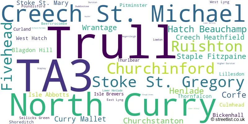
The largest settlement in the TA3 postal code is Creech St. Michael followed by Trull, and North Curry.
The TA3 Postcode shares a border with TA1 (TAUNTON, Bishops Hull), TA10 (LANGPORT, Curry Rivel, Long Sutton), TA19 (ILMINSTER, Ilton, Horton), TA20 (CHARD, South Chard, Combe St. Nicholas), TA7 (Woolavington, Puriton, Westonzoyland), EX14 (HONITON, Dunkeswell, Feniton), EX15 (CULLOMPTON, Willand, Uffculme), TA21 (WELLINGTON, Rockwell Green, Tonedale) and TA4 (Wiveliscombe, Williton, Bishops Lydeard).
In the TA3 postcode district of Somerset, the primary settlement is Creech St. Michael, which has the highest count. Other significant settlements in the district include Bickenhall, Durston, East Lyng, Haydon, Henlade, Ruishton, Staple Fitzpaine, Stoke St. Mary, Thornfalcon, Thurlbear, and West Hatch. The district is located in the county of Somerset in England. The most significant Postal Town in the district is Taunton.
For the district TA3, we have data on 3 postcode sectors. Here's a breakdown: The sector TA3 5, covers Creech St. Michael and Ruishton in Somerset. The sector TA3 6, covers North Curry and Stoke St. Gregory and Fivehead and Hatch Beauchamp in Somerset. The sector TA3 7, covers Trull and Churchinford in Somerset.

Map of the TA3 Postcode District
Explore the TA3 postcode district by using our free interactive map.

When it comes to local government, postal geography often disregards political borders. However, for a breakdown in the TA3 District: the district mostly encompasses the Somerset (655 postcodes), and finally, the East Devon District area (3 postcodes).
Recent House Sales in TA3
| Date | Price | Address |
|---|---|---|
| 25/10/2023 | £735,000 | Dipford Road, Trull, Taunton, TA3 7NN |
| 09/10/2023 | £465,000 | Honiton Road, Churchinford, Taunton, TA3 7QZ |
| 28/09/2023 | £320,000 | Heathfield Close, Creech Heathfield, Taunton, TA3 5EP |
| 22/09/2023 | £325,000 | Broomfield Park, Stoke St Gregory, Taunton, TA3 6FE |
| 21/09/2023 | £540,000 | Broomfield Park, Stoke St Gregory, Taunton, TA3 6FE |
| 08/09/2023 | £345,000 | Overlands, North Curry, Taunton, TA3 6JL |
| 06/09/2023 | £678,000 | Longs Field, North Curry, Taunton, TA3 6NN |
| 06/09/2023 | £610,000 | Loscombe Meadow, North Curry, Taunton, TA3 6AT |
| 01/09/2023 | £243,000 | Windmill Hill, North Curry, Taunton, TA3 6LY |
| 01/09/2023 | £299,000 | Church Street, Isle Abbotts, Taunton, TA3 6RJ |
Weather Forecast for TA3
Press Button to Show Forecast for Thurlbear
| Time Period | Icon | Description | Temperature | Rain Probability | Wind |
|---|---|---|---|---|---|
| 06:00 to 09:00 | Cloudy | 7.0°C (feels like 6.0°C) | 4.00% | WNW 4 mph | |
| 09:00 to 12:00 | Cloudy | 10.0°C (feels like 8.0°C) | 4.00% | NNW 9 mph | |
| 12:00 to 15:00 | Cloudy | 11.0°C (feels like 10.0°C) | 4.00% | N 9 mph | |
| 15:00 to 18:00 | Partly cloudy (day) | 12.0°C (feels like 11.0°C) | 2.00% | NNW 7 mph | |
| 18:00 to 21:00 | Partly cloudy (day) | 12.0°C (feels like 10.0°C) | 1.00% | NW 7 mph | |
| 21:00 to 00:00 | Clear night | 8.0°C (feels like 6.0°C) | 0.00% | W 7 mph |
Press Button to Show Forecast for Thurlbear
| Time Period | Icon | Description | Temperature | Rain Probability | Wind |
|---|---|---|---|---|---|
| 00:00 to 03:00 | Clear night | 6.0°C (feels like 4.0°C) | 0.00% | WSW 7 mph | |
| 03:00 to 06:00 | Clear night | 4.0°C (feels like 2.0°C) | 1.00% | W 7 mph | |
| 06:00 to 09:00 | Sunny day | 5.0°C (feels like 4.0°C) | 1.00% | W 4 mph | |
| 09:00 to 12:00 | Partly cloudy (day) | 10.0°C (feels like 8.0°C) | 2.00% | WNW 9 mph | |
| 12:00 to 15:00 | Cloudy | 12.0°C (feels like 10.0°C) | 6.00% | WNW 9 mph | |
| 15:00 to 18:00 | Cloudy | 12.0°C (feels like 10.0°C) | 6.00% | NW 11 mph | |
| 18:00 to 21:00 | Partly cloudy (day) | 10.0°C (feels like 8.0°C) | 1.00% | WNW 9 mph | |
| 21:00 to 00:00 | Partly cloudy (night) | 7.0°C (feels like 5.0°C) | 2.00% | W 7 mph |
Press Button to Show Forecast for Thurlbear
| Time Period | Icon | Description | Temperature | Rain Probability | Wind |
|---|---|---|---|---|---|
| 00:00 to 03:00 | Partly cloudy (night) | 6.0°C (feels like 4.0°C) | 3.00% | W 4 mph | |
| 03:00 to 06:00 | Cloudy | 5.0°C (feels like 4.0°C) | 11.00% | SSW 4 mph | |
| 06:00 to 09:00 | Cloudy | 6.0°C (feels like 5.0°C) | 12.00% | S 4 mph | |
| 09:00 to 12:00 | Cloudy | 10.0°C (feels like 8.0°C) | 13.00% | SSW 7 mph | |
| 12:00 to 15:00 | Overcast | 11.0°C (feels like 9.0°C) | 21.00% | SW 7 mph | |
| 15:00 to 18:00 | Light rain shower (day) | 11.0°C (feels like 9.0°C) | 35.00% | SE 9 mph | |
| 18:00 to 21:00 | Cloudy | 10.0°C (feels like 8.0°C) | 16.00% | S 7 mph | |
| 21:00 to 00:00 | Cloudy | 8.0°C (feels like 6.0°C) | 16.00% | ENE 7 mph |
Press Button to Show Forecast for Thurlbear
| Time Period | Icon | Description | Temperature | Rain Probability | Wind |
|---|---|---|---|---|---|
| 00:00 to 03:00 | Cloudy | 7.0°C (feels like 5.0°C) | 20.00% | ESE 7 mph | |
| 03:00 to 06:00 | Cloudy | 7.0°C (feels like 5.0°C) | 17.00% | W 7 mph | |
| 06:00 to 09:00 | Cloudy | 7.0°C (feels like 5.0°C) | 15.00% | ENE 7 mph | |
| 09:00 to 12:00 | Cloudy | 10.0°C (feels like 8.0°C) | 17.00% | E 9 mph | |
| 12:00 to 15:00 | Cloudy | 11.0°C (feels like 9.0°C) | 21.00% | ENE 11 mph | |
| 15:00 to 18:00 | Cloudy | 12.0°C (feels like 10.0°C) | 19.00% | ENE 11 mph | |
| 18:00 to 21:00 | Light rain | 11.0°C (feels like 9.0°C) | 50.00% | NE 9 mph | |
| 21:00 to 00:00 | Light rain | 9.0°C (feels like 7.0°C) | 51.00% | N 7 mph |
Where is the TA3 Postcode District?
The postcode district TA3 is located in the town of Taunton in Somerset. Taunton is surrounded by several nearby towns, including Ilminster to the South East, South Petherton to the East, Wellington to the West, and Bridgwater to the North. The distance from Taunton to London is approximately 131.05 miles.
The district is within the post town of TAUNTON.
The sector has postcodes within the nation of England.
The TA3 Postcode District is covers the following regions.
- Somerset - Dorset and Somerset - South West (England)
- Devon CC - Devon - South West (England)
| Postcode Sector | Delivery Office |
|---|---|
| TA3 5 | Taunton Delivery Office |
| TA3 6 | Taunton Delivery Office |
| TA3 7 | Taunton Delivery Office |
| T | A | 3 | - | X | X | X |
| T | A | 3 | Space | Numeric | Letter | Letter |
Current Monthly Rental Prices
| # Bedrooms | Min Price | Max Price | Avg Price |
|---|---|---|---|
| 2 | £850 | £850 | £850 |
| 3 | £1,100 | £1,450 | £1,275 |
| 4 | £2,800 | £2,800 | £2,800 |
Current House Prices
| # Bedrooms | Min Price | Max Price | Avg Price |
|---|---|---|---|
| £70,000 | £725,000 | £280,000 | |
| 1 | £80,000 | £80,000 | £80,000 |
| 2 | £125,000 | £475,000 | £245,663 |
| 3 | £242,500 | £795,000 | £404,165 |
| 4 | £295,000 | £1,275,000 | £640,431 |
| 5 | £400,000 | £1,395,000 | £744,286 |
| 6 | £525,000 | £1,275,000 | £942,143 |
| 7 | £835,000 | £1,000,000 | £917,500 |
Estate Agents who Operate in the TA3 District
| Logo | Name | Brand Name | Address | Contact Number | Total Properties |
|---|---|---|---|---|---|
 | Taunton | Greenslade Taylor Hunt | 13 Hammet Street, Taunton, TA1 1RN | 01823 211774 | 25 |
 | Taunton | Gibbins Richards | 50 High Street, Taunton, TA1 3PR | 01823 211768 | 9 |
 | Taunton | Robert Cooney | Corporation Street Taunton TA1 4AW | 01823 589485 | 9 |
 | Taunton | Jackson-Stops | 8 Hammet Street, Taunton, TA1 1RZ | 01823 211767 | 8 |
 | Taunton | Stags | 5 Hammet Street, Taunton, TA1 1RZ | 01823 217460 | 7 |
- Badbury
- Beercrocombe
- Blagdon Hill
- Burnworthy
- Capland
- Churchinford
- Corfe
- Creech Heathfield
- Creech St Michael
- Curland
- Curload
- Curry Mallet
- Dipford
- Durston
- East Lyng
- Fivehead
- Garlandhayes
- Ham
- Hatch Beauchamp
- Hatch Green
- Helland
- Huntham
- Isle Abbotts
- Isle Brewers
- Knapp
- Lillesdon
- Listock
- Lyng
- Meare Green
- Newport
- North Curry
- Pitminster
- Poundisford
- Ruishton
- Shoreditch
- Slough Green
- Smeatharpe
- Staple Fitzpaine
- Stoke St Gregory
- Stoke St Mary
- Sweethay
- Taunton
- Thornfalcon
- Trull
- Walford
- West Buckland
- West Hatch
- Westport
- Wrantage
| Type of Property | 2018 Average | 2018 Sales | 2017 Average | 2017 Sales | 2016 Average | 2016 Sales | 2015 Average | 2015 Sales |
|---|---|---|---|---|---|---|---|---|
| Detached | £448,755 | 144 | £402,155 | 168 | £393,813 | 185 | £352,840 | 187 |
| Semi-Detached | £260,155 | 55 | £253,319 | 73 | £249,633 | 60 | £258,828 | 52 |
| Terraced | £219,047 | 32 | £239,406 | 26 | £227,843 | 45 | £219,121 | 39 |
| Flats | £220,833 | 3 | £205,500 | 2 | £183,750 | 6 | £167,671 | 7 |