This section of the site is all about the TF Postcode area, also known as the Telford Postal Area. Explore links to the next level to learn more about specific postcode districts such as TF1.
The TF postcode area represents a group of postal districts in the Telford area of the United Kingdom. The area code TF stands for the letters t and f in TelFord. TF has a population of 212,061 and covers an area of 854,506 hectares. Fun fact: 0.33% of the population of Great Britain lives in this area.
The postcode area falls within the following counties: Shropshire (95.84%), Staffordshire (4.15%), Cheshire (0.01%).
Post Towns and Postcode Districts for the TF Postcode
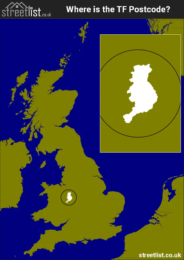
Where is the TF Postcode Area?
The TF Telford Postcode is in the West Midlands Region. The postal area borders the following neighbouring postal areas: CW - Crewe, WV - Wolverhampton, SY - Shrewsbury and ST - Stoke-on-Trent, and is located inland.
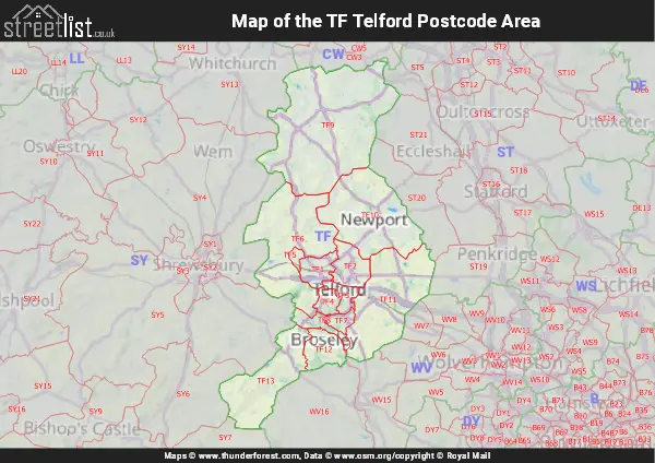
Map of the TF Telford Postcode Area
Explore the TF Telford postcode area by using our interactive map.
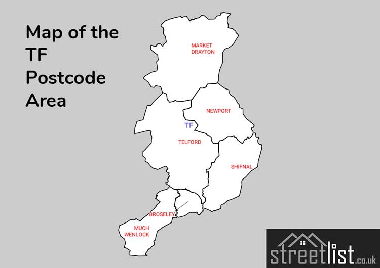
Postcode Districts within the TF Telford Postcode Area
There are 13 postcode districts within the Telford postcode area
A map showing the boundary of in relation to other areas
There are 5 towns within the Telford postcode area.
| Unit | Area² |
|---|---|
| Hectares | 854,506² |
| Miles | 3,299² |
| Feet | 91,978,171,334² |
| Kilometres | 8,545² |
Postal Delivery Offices serving the TF Telford Postcode Area
- Market Drayton Delivery Office
- Much Wenlock Delivery Office
- Newport (tf) Delivery Office
- Oakengates Delivery Office
- Tweedale Delivery Office
- Wellington (tf) Delivery Office
Councils with Postcodes in TF
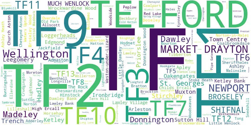
Towns and Villages within the TF Telford Postcode Area
- Adderley - village
- Allscott - village
- Ashley - village
- Ashley Dale - village
- Aston - village
- Beckbury - village
- Benthall - village
- Betton - otherSettlement
- Blymhill - village
- Blymhill Common - otherSettlement
- Blymhill Lawns - otherSettlement
- Bourton - village
- Bourton Westwood - otherSettlement
- Brockton - otherSettlement
- Broseley - town
- Buildwas - village
- Buntingsdale Estate - village
- Cherrington - village
- Cheswardine - village
- Chetwynd Aston - village
- Child's Ercall - village
- Chipnall - village
- Cold Hatton Heath - village
- Crackleybank - otherSettlement
- Crudgington - village
- Edgmond - village
- Ellerdine Heath - village
- Forton - village
- Goldstone - otherSettlement
- Hales - village
- Heath Lanes - village
- High Ercall - village
- Hinstock - village
- Hodnet - village
- Homer - village
- Kemberton - village
- Knighton - village
- Kynnersley - village
- Lilleshall - village
- Little Wenlock - village
- Loggerheads - village
- Long Lane - village
- Longdon on Tern - village
- Longville in the Dale - village
- Market Drayton - town
- Moreton - village
- Moretonwood - otherSettlement
- Much Wenlock - town
- Newport - town
- Norton - village
- Norton in Hales - village
- Outwoods - village
- Pave Lane - village
- Peplow - otherSettlement
- Pipe Gate - village
- Preston upon the Weald Moors - village
- Redhill - otherSettlement
- Roden - village
- Rosehill - village
- Ryton - village
- Sambrook - village
- Sheriffhales - village
- Shifnal - village
- Soudley - village
- Stoke Heath - village
- Stoke on Tern - village
- Sutton - village
- Sutton Maddock - village
- Telford - town
- Ternhill - village
- Tibberton - village
- Walcot - village
- Walton - village
- Waters Upton - village
- Weston Heath - otherSettlement
- Weston-under-Lizard - village
- Willoughbridge - village
- Wistanswick - village
- Wollerton - village
- Woodseaves - village