The TF12 postcode district is a postal district located in the TF Telford postcode area with a population of 5,760 residents according to the 2021 England and Wales Census.
The area of the TF12 postcode district is 10.78 square miles which is 27.91 square kilometres or 6,896.62 acres.
Currently, the TF12 district has about 235 postcode units spread across 1 geographic postcode sectors.
Given that each sector allows for 400 unique postcode combinations, the district has a capacity of 400 postcodes. With 235 postcodes already in use, this leaves 165 units available.
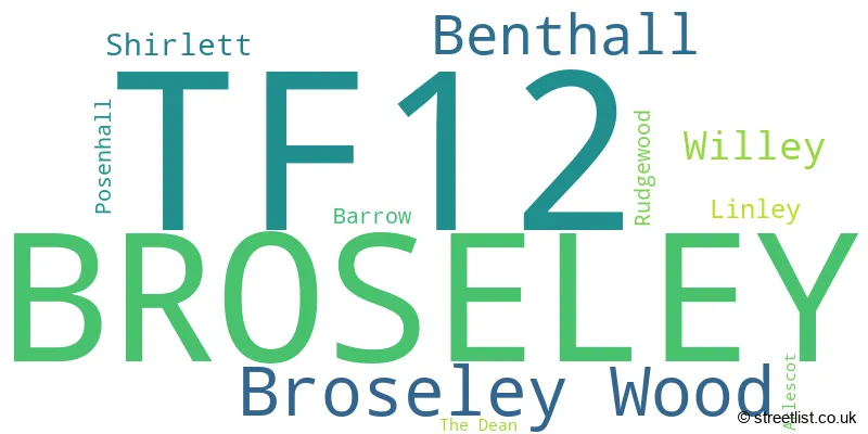
The largest settlement in the TF12 postal code is BROSELEY followed by Broseley Wood, and Benthall.
The TF12 Postcode shares a border with WV16 (BRIDGNORTH, Highley, Ditton Priors), TF13 (MUCH WENLOCK, Homer, Brockton) and TF8 (Ironbridge, Coalbrookdale, Jackfield).
The primary settlement in the TF12 postcode district is Broseley, located in the county of Shropshire in England.
For the district TF12, we have data on 1 postcode sectors. Here's a breakdown: The sector TF12 5, covers Broseley and Broseley Wood in Shropshire.
TF12 Postcode Sectors

Map of the TF12 Postcode District
Explore the TF12 postcode district by using our free interactive map.

When it comes to local government, postal geography often disregards political borders. However, for a breakdown in the TF12 District: the district mostly encompasses the Shropshire area with a total of 237 postcodes.
Recent House Sales in TF12
| Date | Price | Address |
|---|---|---|
| 04/10/2023 | £150,000 | High Street, Broseley, TF12 5EZ |
| 22/09/2023 | £300,000 | The Mines, Benthall, Broseley, TF12 5QY |
| 23/08/2023 | £99,000 | High Street, Broseley, TF12 5ET |
| 10/08/2023 | £290,000 | King Street, Broseley Wood, Broseley, TF12 5PR |
| 28/07/2023 | £191,000 | Cherrybrook Drive, Broseley, TF12 5SH |
| 28/07/2023 | £180,000 | Bridgnorth Road, Broseley, TF12 5DS |
| 27/07/2023 | £235,000 | The Bentlands, Benthall, Broseley, TF12 5RP |
| 14/07/2023 | £475,000 | Quarry Road, Broseley Wood, Broseley, TF12 5QF |
| 12/07/2023 | £200,000 | Barber Street, Broseley, TF12 5NR |
| 12/07/2023 | £247,500 | Amies Meadow, Broseley, TF12 5FE |
Weather Forecast for TF12
Press Button to Show Forecast for Benthall Hall
| Time Period | Icon | Description | Temperature | Rain Probability | Wind |
|---|---|---|---|---|---|
| 09:00 to 12:00 | Cloudy | 7.0°C (feels like 4.0°C) | 7.00% | WNW 11 mph | |
| 12:00 to 15:00 | Cloudy | 8.0°C (feels like 5.0°C) | 10.00% | NW 11 mph | |
| 15:00 to 18:00 | Cloudy | 9.0°C (feels like 6.0°C) | 42.00% | NNW 9 mph | |
| 18:00 to 21:00 | Cloudy | 7.0°C (feels like 5.0°C) | 10.00% | NE 7 mph | |
| 21:00 to 00:00 | Cloudy | 5.0°C (feels like 4.0°C) | 5.00% | NNE 4 mph |
Press Button to Show Forecast for Benthall Hall
| Time Period | Icon | Description | Temperature | Rain Probability | Wind |
|---|---|---|---|---|---|
| 00:00 to 03:00 | Cloudy | 4.0°C (feels like 2.0°C) | 5.00% | ENE 4 mph | |
| 03:00 to 06:00 | Cloudy | 4.0°C (feels like 2.0°C) | 6.00% | E 4 mph | |
| 06:00 to 09:00 | Cloudy | 3.0°C (feels like 1.0°C) | 6.00% | E 4 mph | |
| 09:00 to 12:00 | Cloudy | 6.0°C (feels like 3.0°C) | 6.00% | ENE 7 mph | |
| 12:00 to 15:00 | Overcast | 7.0°C (feels like 6.0°C) | 15.00% | ESE 4 mph | |
| 15:00 to 18:00 | Cloudy | 9.0°C (feels like 8.0°C) | 9.00% | ENE 4 mph | |
| 18:00 to 21:00 | Cloudy | 8.0°C (feels like 7.0°C) | 9.00% | ENE 7 mph | |
| 21:00 to 00:00 | Partly cloudy (night) | 5.0°C (feels like 2.0°C) | 7.00% | ENE 7 mph |
Press Button to Show Forecast for Benthall Hall
| Time Period | Icon | Description | Temperature | Rain Probability | Wind |
|---|---|---|---|---|---|
| 00:00 to 03:00 | Partly cloudy (night) | 2.0°C (feels like 0.0°C) | 7.00% | ENE 7 mph | |
| 03:00 to 06:00 | Overcast | 2.0°C (feels like -1.0°C) | 14.00% | NE 7 mph | |
| 06:00 to 09:00 | Cloudy | 2.0°C (feels like 0.0°C) | 12.00% | NE 7 mph | |
| 09:00 to 12:00 | Overcast | 7.0°C (feels like 4.0°C) | 17.00% | ENE 9 mph | |
| 12:00 to 15:00 | Overcast | 9.0°C (feels like 6.0°C) | 21.00% | ENE 9 mph | |
| 15:00 to 18:00 | Overcast | 9.0°C (feels like 7.0°C) | 22.00% | ENE 9 mph | |
| 18:00 to 21:00 | Cloudy | 9.0°C (feels like 6.0°C) | 16.00% | ENE 9 mph | |
| 21:00 to 00:00 | Cloudy | 7.0°C (feels like 3.0°C) | 18.00% | NE 11 mph |
Press Button to Show Forecast for Benthall Hall
| Time Period | Icon | Description | Temperature | Rain Probability | Wind |
|---|---|---|---|---|---|
| 00:00 to 03:00 | Light rain | 6.0°C (feels like 2.0°C) | 48.00% | NE 11 mph | |
| 03:00 to 06:00 | Light rain | 5.0°C (feels like 1.0°C) | 52.00% | NNE 11 mph | |
| 06:00 to 09:00 | Heavy rain | 5.0°C (feels like 1.0°C) | 74.00% | NNE 13 mph | |
| 09:00 to 12:00 | Heavy rain | 6.0°C (feels like 3.0°C) | 77.00% | N 13 mph | |
| 12:00 to 15:00 | Light rain | 8.0°C (feels like 4.0°C) | 54.00% | N 13 mph | |
| 15:00 to 18:00 | Light rain | 9.0°C (feels like 6.0°C) | 54.00% | N 13 mph | |
| 18:00 to 21:00 | Light rain shower (day) | 9.0°C (feels like 7.0°C) | 35.00% | NNW 9 mph | |
| 21:00 to 00:00 | Clear night | 5.0°C (feels like 3.0°C) | 8.00% | WNW 7 mph |
Where is the TF12 Postcode District?
The postcode district TF12 is located in the town of Broseley. It is situated in close proximity to several nearby towns. To the West is Much Wenlock, which is approximately 3.16 miles away. To the South East is Bridgnorth, located about 5.76 miles away. Telford is situated to the North, at a distance of approximately 5.92 miles. Shifnal is located in the North East, approximately 8.16 miles away. Shrewsbury is situated to the North West, approximately 13.12 miles away. Finally, Wolverhampton is located to the East, approximately 14.54 miles away. Broseley is also situated at a distance of 125.57 miles from the center of London.
The district is within the post town of BROSELEY.
The sector has postcodes within the nation of England.
The TF12 Postcode District is covers the following regions.
- Shropshire CC - Shropshire and Staffordshire - West Midlands (England)
- Telford and Wrekin - Shropshire and Staffordshire - West Midlands (England)
Postcode Sectors within the TF12 District
| Postcode Sector | Delivery Office |
|---|---|
| TF12 5 | Tweedale Delivery Office |
| T | F | 1 | 2 | - | X | X | X |
| T | F | 1 | 2 | Space | Numeric | Letter | Letter |
Tourist Attractions within the Postcode Area
We found 1 visitor attractions within the TF12 postcode area
| Benthall Hall |
|---|
| Historic Properties |
| Historic House / House and Garden / Palace |
| View Benthall Hall on Google Maps |
Current Monthly Rental Prices
| # Bedrooms | Min Price | Max Price | Avg Price |
|---|
Current House Prices
| # Bedrooms | Min Price | Max Price | Avg Price |
|---|---|---|---|
| £99,000 | £149,950 | £129,770 | |
| 1 | £99,950 | £99,950 | £99,950 |
| 2 | £140,250 | £340,000 | £251,450 |
| 3 | £179,950 | £485,000 | £309,600 |
| 4 | £339,950 | £895,000 | £524,995 |
| 5 | £620,000 | £620,000 | £620,000 |
Estate Agents who Operate in the TF12 District
| Logo | Name | Brand Name | Address | Contact Number | Total Properties |
|---|---|---|---|---|---|
 | Broseley | Harwood Shropshire Ltd | 1-3 The Square, Broseley, TF12 5EW | 01952 951253 | 25 |
 | Much Wenlock | Stentons Estate Agents | 58 High Street, Much Wenlock, TF13 6AE | 01952 728200 | 6 |
 | Ironbridge | Nock Deighton | 24 High Street, Ironbridge, Telford, TF8 7AD | 01952 458097 | 6 |
 | Worcestershire | Berriman Eaton | Churchill Suite, Churchill & Blakedown GC, Churchill Lane, Blakedown, DY10 3NB | 01562 543935 | 4 |
 | Telford | Nick Tart Estate Agents | 16 High Street, Ironbridge, Telford, TF8 7AD | 01952 984238 | 4 |
| Type of Property | 2018 Average | 2018 Sales | 2017 Average | 2017 Sales | 2016 Average | 2016 Sales | 2015 Average | 2015 Sales |
|---|---|---|---|---|---|---|---|---|
| Detached | £279,127 | 54 | £258,738 | 61 | £266,680 | 67 | £223,220 | 20 |
| Semi-Detached | £168,604 | 47 | £173,701 | 49 | £157,787 | 33 | £138,852 | 24 |
| Terraced | £162,454 | 20 | £151,662 | 27 | £142,795 | 22 | £153,766 | 24 |
| Flats | £120,000 | 1 | £0 | 0 | £270,000 | 1 | £0 | 0 |