The TN15 7 postcode sector is within the county of Kent.
Did you know? According to the 2021 Census, the TN15 7 postcode sector is home to a bustling 3,772 residents!
Given that each sector allows for 400 unique postcode combinations. Letters C, I, K, M, O and V are not allowed in the last two letters of a postcode. With 172 postcodes already in use, this leaves 228 units available.
The largest settlement in the TN15 7 postal code is Wrotham followed by Ash, and Wrotham Heath.
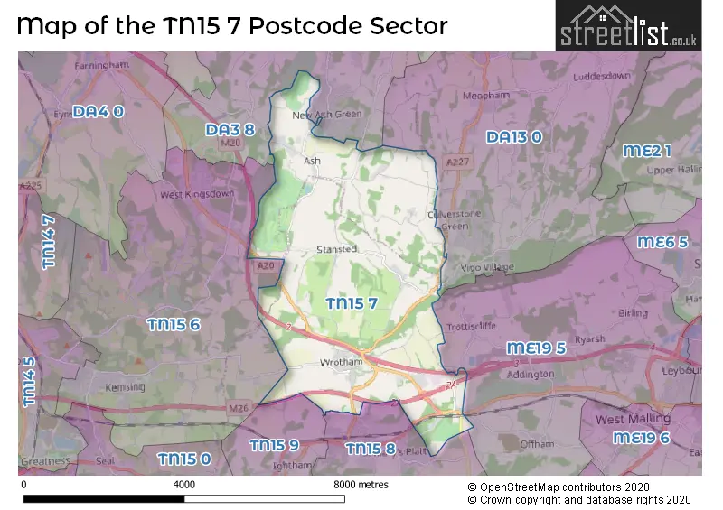
The TN15 7 Postcode shares a border with TN15 6 (West Kingsdown, KEMSING, Knatts Valley), TN15 8 (Borough Green, Platt), TN15 9 (Ightham), DA3 8 (New Ash Green, Hartley, Fawkham), DA13 0 (Meopham, Vigo, Luddesdown) and ME19 5 (Leybourne, Addington, Ryarsh).
The sector is within the post town of SEVENOAKS.
TN15 7 is a postcode sector within the TN15 postcode district which is within the TN Tonbridge postcode area.
The Royal Mail delivery office for the TN15 7 postal sector is the Sevenoaks Delivery Office.
The area of the TN15 7 postcode sector is 12.01 square miles which is 31.10 square kilometres or 7,684.79 square acres.
The TN15 7 postcode sector is crossed by the M20 motorway.
The TN15 7 postcode sector is crossed by the M26 motorway.

Map of the TN15 7 Postcode Sector
Explore the TN15 7 postcode sector by using our free interactive map.
| T | N | 1 | 5 | - | 7 | X | X |
| T | N | 1 | 5 | Space | 7 | Letter | Letter |
Official List of Streets
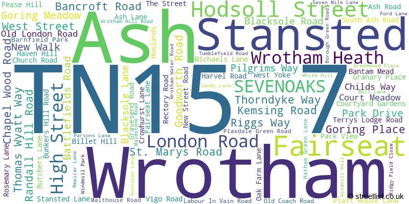
Ash (16 Streets)
Stansted (9 Streets)
Wrotham (37 Streets)
Fairseat (4 Streets)
Wrotham Heath (9 Streets)
Hodsoll Street (4 Streets)
Unofficial Streets or Alternative Spellings
Addington
LONDON ROAD SANDY LANETrottiscliffe
FORD LANE PILGRIMS WAY VIGO HILL WROTHAM WATER LANEPlatt
WINDMILL HILLHartley
HARTLEY BOTTOM ROADFawkham
MANOR LANEBorough Green
MAIDSTONE ROAD SEVEN MILE LANENew Ash Green
NORTH ASH ROAD PUNCH CROFT SEVEN ACRESKemsing
KEMSING ROADOffham
TESTON ROADIghtham
FEN POND ROADWeather Forecast for TN15 7
Press Button to Show Forecast for The London Golf Club
| Time Period | Icon | Description | Temperature | Rain Probability | Wind |
|---|---|---|---|---|---|
| 12:00 to 15:00 | Cloudy | 10.0°C (feels like 7.0°C) | 15.00% | WNW 11 mph | |
| 15:00 to 18:00 | Light rain shower (day) | 9.0°C (feels like 7.0°C) | 38.00% | WNW 11 mph | |
| 18:00 to 21:00 | Heavy rain | 8.0°C (feels like 6.0°C) | 79.00% | NNW 4 mph | |
| 21:00 to 00:00 | Cloudy | 6.0°C (feels like 4.0°C) | 49.00% | NE 7 mph |
Press Button to Show Forecast for The London Golf Club
| Time Period | Icon | Description | Temperature | Rain Probability | Wind |
|---|---|---|---|---|---|
| 00:00 to 03:00 | Cloudy | 5.0°C (feels like 3.0°C) | 8.00% | NE 7 mph | |
| 03:00 to 06:00 | Cloudy | 4.0°C (feels like 2.0°C) | 5.00% | NE 7 mph | |
| 06:00 to 09:00 | Cloudy | 4.0°C (feels like 2.0°C) | 5.00% | NE 7 mph | |
| 09:00 to 12:00 | Cloudy | 7.0°C (feels like 4.0°C) | 7.00% | NE 9 mph | |
| 12:00 to 15:00 | Cloudy | 9.0°C (feels like 7.0°C) | 13.00% | ENE 7 mph | |
| 15:00 to 18:00 | Cloudy | 9.0°C (feels like 8.0°C) | 12.00% | ENE 7 mph | |
| 18:00 to 21:00 | Cloudy | 8.0°C (feels like 7.0°C) | 12.00% | E 7 mph | |
| 21:00 to 00:00 | Cloudy | 6.0°C (feels like 3.0°C) | 12.00% | E 7 mph |
Press Button to Show Forecast for The London Golf Club
| Time Period | Icon | Description | Temperature | Rain Probability | Wind |
|---|---|---|---|---|---|
| 00:00 to 03:00 | Cloudy | 4.0°C (feels like 2.0°C) | 16.00% | ENE 7 mph | |
| 03:00 to 06:00 | Cloudy | 5.0°C (feels like 2.0°C) | 19.00% | NE 7 mph | |
| 06:00 to 09:00 | Cloudy | 6.0°C (feels like 3.0°C) | 21.00% | NE 9 mph | |
| 09:00 to 12:00 | Overcast | 9.0°C (feels like 7.0°C) | 19.00% | E 9 mph | |
| 12:00 to 15:00 | Cloudy | 11.0°C (feels like 9.0°C) | 19.00% | E 11 mph | |
| 15:00 to 18:00 | Light rain | 11.0°C (feels like 8.0°C) | 51.00% | E 11 mph | |
| 18:00 to 21:00 | Light rain | 10.0°C (feels like 7.0°C) | 53.00% | ENE 11 mph | |
| 21:00 to 00:00 | Light rain | 9.0°C (feels like 6.0°C) | 51.00% | ENE 11 mph |
Press Button to Show Forecast for The London Golf Club
| Time Period | Icon | Description | Temperature | Rain Probability | Wind |
|---|---|---|---|---|---|
| 00:00 to 03:00 | Heavy rain | 9.0°C (feels like 7.0°C) | 77.00% | ENE 9 mph | |
| 03:00 to 06:00 | Light rain | 9.0°C (feels like 7.0°C) | 49.00% | SSE 11 mph | |
| 06:00 to 09:00 | Light rain | 9.0°C (feels like 7.0°C) | 47.00% | SSE 11 mph | |
| 09:00 to 12:00 | Light rain shower (day) | 10.0°C (feels like 7.0°C) | 42.00% | SSE 13 mph | |
| 12:00 to 15:00 | Heavy rain shower (day) | 12.0°C (feels like 9.0°C) | 59.00% | S 16 mph | |
| 15:00 to 18:00 | Light rain shower (day) | 13.0°C (feels like 10.0°C) | 38.00% | SW 13 mph | |
| 18:00 to 21:00 | Light rain shower (day) | 11.0°C (feels like 9.0°C) | 33.00% | WSW 11 mph | |
| 21:00 to 00:00 | Cloudy | 9.0°C (feels like 6.0°C) | 9.00% | SW 9 mph |
Schools and Places of Education Within the TN15 7 Postcode Sector
Grange Park School
Community special school
Borough Green Road, Sevenoaks, Kent, TN15 7RD
Head: Miss Renukah Atwell
Ofsted Rating: Good
Inspection: 2016-10-11 (2753 days ago)
Website: Visit Grange Park School Website
Phone: 01732882111
Number of Pupils: 175
St George's Church of England Voluntary Controlled Primary School
Voluntary controlled school
Old London Road, Sevenoaks, Kent, TN15 7DL
Head: Mrs Elizabeth Rye
Ofsted Rating: Good
Inspection: 2022-12-14 (498 days ago)
Website: Visit St George's Church of England Voluntary Controlled Primary School Website
Phone: 01732882401
Number of Pupils: 203
Wrotham School
Academy converter
Borough Green Road, Sevenoaks, Kent, TN15 7RD
Head: Mr Michael Cater
Ofsted Rating: Good
Inspection: 2019-05-22 (1800 days ago)
Website: Visit Wrotham School Website
Phone: 01732905860
Number of Pupils: 1029
House Prices in the TN15 7 Postcode Sector
| Type of Property | 2018 Average | 2018 Sales | 2017 Average | 2017 Sales | 2016 Average | 2016 Sales | 2015 Average | 2015 Sales |
|---|---|---|---|---|---|---|---|---|
| Detached | £689,952 | 21 | £902,399 | 25 | £728,846 | 35 | £789,854 | 26 |
| Semi-Detached | £581,000 | 7 | £467,389 | 9 | £491,250 | 12 | £509,909 | 11 |
| Terraced | £325,542 | 18 | £298,800 | 10 | £266,864 | 11 | £263,138 | 20 |
| Flats | £872,500 | 2 | £0 | 0 | £219,975 | 2 | £239,000 | 1 |
Important Postcodes TN15 7 in the Postcode Sector
TN15 7DL is the postcode for St. Georges C of E County Primary School, Old London Road
TN15 7PH is the postcode for Stansted C of E Primary School, Malthouse Road
TN15 7RD is the postcode for ENGLISH BLOCK, Wrotham Secondary School, Borough Green Road, Wrotham Secondary School, Borough Green Road, Wrotham, Grange Park School, Borough Green Road, THE CURVE, Wrotham Secondary School, Borough Green Road, GRANGE PARK SCHOOL, BOROUGH GREEN ROAD, WROTHAM, TECHNOLOGY BLOCK, Wrotham Secondary School, Borough Green Road, and Wrotham Secondary School, Borough Green Road
| The TN15 7 Sector is within these Local Authorities |
|
|---|---|
| The TN15 7 Sector is within these Counties |
|
| The TN15 7 Sector is within these Water Company Areas |
|