The TN5 postcode district is a postal district located in the TN Tonbridge postcode area with a population of 8,740 residents according to the 2021 England and Wales Census.
The area of the TN5 postcode district is 29.53 square miles which is 76.49 square kilometres or 18,900.15 acres.
Currently, the TN5 district has about 404 postcode units spread across 2 geographic postcode sectors.
Given that each sector allows for 400 unique postcode combinations, the district has a capacity of 800 postcodes. With 404 postcodes already in use, this leaves 396 units available.
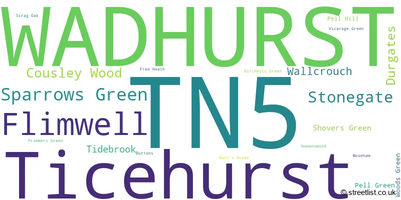
The largest settlement in the TN5 postal code is WADHURST followed by Ticehurst, and Flimwell.
The TN5 Postcode shares a border with TN19 (Burwash, Hurst Green, ETCHINGHAM), TN20 (MAYFIELD, Five Ashes, Wellbrook), TN3 (Langton Green, Lamberhurst, Groombridge) and TN18 (Hawkhurst, Sandhurst, Newenden).
The primary settlement in the TN5 postcode district is Wadhurst, located in the county of East Sussex. It is the most significant settlement in the district, with a count of 151. Other significant settlements in the district include Cousley Wood, Durgates, Sparrows Green, Tidebrook, Flimwell, Stonegate, and Ticehurst. Wadhurst is also the post town for the district.
For the district TN5, we have data on 2 postcode sectors. Here's a breakdown: The sector TN5 6, covers Wadhurst and Sparrows Green in East Sussex. The sector TN5 7, covers Ticehurst and Flimwell and Stonegate in East Sussex.

Map of the TN5 Postcode District
Explore the TN5 postcode district by using our free interactive map.

When it comes to local government, postal geography often disregards political borders. However, for a breakdown in the TN5 District: the district mostly encompasses the Wealden District (226 postcodes), followed by the Rother District area (171 postcodes), and finally, the Tunbridge Wells District (B) area (12 postcodes).
Recent House Sales in TN5
| Date | Price | Address |
|---|---|---|
| 14/09/2023 | £355,000 | Townlands Road, Wadhurst, TN5 6BY |
| 12/09/2023 | £615,000 | Great Durgates Close, Wadhurst, TN5 6RD |
| 30/08/2023 | £635,000 | Primmers Green Cottages, Primmers Green, Wadhurst, TN5 6DU |
| 30/08/2023 | £345,000 | Cross Lane Gardens, Ticehurst, Wadhurst, TN5 7HY |
| 29/08/2023 | £675,000 | Gloucester Villas, Sparrows Green, Wadhurst, TN5 6TJ |
| 23/08/2023 | £340,000 | Nursery Close, Flimwell, Wadhurst, TN5 7NF |
| 10/08/2023 | £420,000 | Townlands Road, Wadhurst, TN5 6BY |
| 07/08/2023 | £450,000 | High Street, Ticehurst, Wadhurst, TN5 7AL |
| 04/08/2023 | £575,000 | Old Wardsdown, Flimwell, Wadhurst, TN5 7NN |
| 01/08/2023 | £340,000 | Snape View, Wadhurst, TN5 6BZ |
Weather Forecast for TN5
Press Button to Show Forecast for Wadhurst
| Time Period | Icon | Description | Temperature | Rain Probability | Wind |
|---|---|---|---|---|---|
| 15:00 to 18:00 | Light rain | 9.0°C (feels like 7.0°C) | 52.00% | W 11 mph | |
| 18:00 to 21:00 | Light rain | 8.0°C (feels like 6.0°C) | 49.00% | W 7 mph | |
| 21:00 to 00:00 | Light rain | 6.0°C (feels like 4.0°C) | 51.00% | N 4 mph |
Press Button to Show Forecast for Wadhurst
| Time Period | Icon | Description | Temperature | Rain Probability | Wind |
|---|---|---|---|---|---|
| 00:00 to 03:00 | Cloudy | 5.0°C (feels like 3.0°C) | 50.00% | ENE 7 mph | |
| 03:00 to 06:00 | Cloudy | 5.0°C (feels like 2.0°C) | 6.00% | NE 7 mph | |
| 06:00 to 09:00 | Overcast | 5.0°C (feels like 2.0°C) | 10.00% | NE 9 mph | |
| 09:00 to 12:00 | Cloudy | 6.0°C (feels like 3.0°C) | 8.00% | ENE 9 mph | |
| 12:00 to 15:00 | Overcast | 9.0°C (feels like 6.0°C) | 14.00% | ENE 9 mph | |
| 15:00 to 18:00 | Cloudy | 9.0°C (feels like 7.0°C) | 14.00% | ENE 9 mph | |
| 18:00 to 21:00 | Cloudy | 8.0°C (feels like 6.0°C) | 11.00% | E 7 mph | |
| 21:00 to 00:00 | Cloudy | 5.0°C (feels like 2.0°C) | 12.00% | ENE 9 mph |
Press Button to Show Forecast for Wadhurst
| Time Period | Icon | Description | Temperature | Rain Probability | Wind |
|---|---|---|---|---|---|
| 00:00 to 03:00 | Cloudy | 4.0°C (feels like 1.0°C) | 17.00% | ENE 9 mph | |
| 03:00 to 06:00 | Overcast | 5.0°C (feels like 2.0°C) | 21.00% | ENE 9 mph | |
| 06:00 to 09:00 | Overcast | 6.0°C (feels like 3.0°C) | 21.00% | ENE 9 mph | |
| 09:00 to 12:00 | Overcast | 10.0°C (feels like 7.0°C) | 17.00% | E 11 mph | |
| 12:00 to 15:00 | Cloudy | 12.0°C (feels like 10.0°C) | 17.00% | ESE 11 mph | |
| 15:00 to 18:00 | Light rain shower (day) | 11.0°C (feels like 9.0°C) | 43.00% | E 11 mph | |
| 18:00 to 21:00 | Light rain | 10.0°C (feels like 7.0°C) | 53.00% | ENE 13 mph | |
| 21:00 to 00:00 | Light rain | 9.0°C (feels like 6.0°C) | 49.00% | ENE 11 mph |
Press Button to Show Forecast for Wadhurst
| Time Period | Icon | Description | Temperature | Rain Probability | Wind |
|---|---|---|---|---|---|
| 00:00 to 03:00 | Heavy rain | 9.0°C (feels like 7.0°C) | 76.00% | E 9 mph | |
| 03:00 to 06:00 | Light rain shower (night) | 9.0°C (feels like 6.0°C) | 43.00% | SSE 13 mph | |
| 06:00 to 09:00 | Light rain | 9.0°C (feels like 6.0°C) | 48.00% | SSE 11 mph | |
| 09:00 to 12:00 | Light rain | 10.0°C (feels like 7.0°C) | 54.00% | SSE 16 mph | |
| 12:00 to 15:00 | Light rain shower (day) | 12.0°C (feels like 9.0°C) | 41.00% | SSW 18 mph | |
| 15:00 to 18:00 | Light rain shower (day) | 12.0°C (feels like 9.0°C) | 36.00% | SSW 16 mph | |
| 18:00 to 21:00 | Cloudy | 11.0°C (feels like 9.0°C) | 15.00% | SW 11 mph | |
| 21:00 to 00:00 | Cloudy | 8.0°C (feels like 6.0°C) | 12.00% | SW 9 mph |
Where is the TN5 Postcode District?
The postcode district TN5 is located in the town of Wadhurst. Wadhurst is surrounded by several nearby towns. To the South East, there is Etchingham, which is approximately 4.11 miles away. To the South West, there is Mayfield, located around 4.71 miles from Wadhurst. The North West direction leads to Tunbridge Wells, which is about 6.95 miles away. In the North East, you will find Cranbrook, which is approximately 7.60 miles away. Finally, heading West will take you to Crowborough, located around 8.43 miles away. Additionally, Wadhurst is situated approximately 37.94 miles from the center of London.
The district is within the post town of WADHURST.
The sector has postcodes within the nation of England.
The TN5 Postcode District is covers the following regions.
- East Sussex CC - Surrey, East and West Sussex - South East (England)
- West Kent - Kent - South East (England)
| Postcode Sector | Delivery Office |
|---|---|
| TN5 6 | Tunbridge Wells Delivery Office |
| TN5 7 | Tunbridge Wells Delivery Office |
| T | N | 5 | - | X | X | X |
| T | N | 5 | Space | Numeric | Letter | Letter |
Tourist Attractions within the Postcode Area
We found 3 visitor attractions within the TN5 postcode area
| Pashley Manor Gardens |
|---|
| Gardens |
| Garden |
| View Pashley Manor Gardens on Google Maps |
| Bedgebury National Pinetum & Forest |
| Country Parks |
| Country Park |
| View Bedgebury National Pinetum & Forest on Google Maps |
| Go Ape! High Wire Forest Adventure - Bedgebury |
| Country Parks |
| Country Park |
| View Go Ape! High Wire Forest Adventure - Bedgebury on Google Maps |
Current Monthly Rental Prices
| # Bedrooms | Min Price | Max Price | Avg Price |
|---|---|---|---|
| 2 | £1,450 | £2,100 | £1,783 |
| 3 | £1,450 | £2,100 | £1,775 |
| 4 | £2,750 | £3,350 | £3,050 |
Current House Prices
| # Bedrooms | Min Price | Max Price | Avg Price |
|---|---|---|---|
| £25,000 | £200,000 | £84,167 | |
| 1 | £175,000 | £350,000 | £262,500 |
| 2 | £110,000 | £690,000 | £407,391 |
| 3 | £325,000 | £2,000,000 | £604,359 |
| 4 | £450,000 | £1,300,000 | £793,368 |
| 5 | £750,000 | £2,950,000 | £1,400,833 |
| 6 | £1,750,000 | £2,450,000 | £2,000,000 |
| 7 | £1,495,000 | £2,250,000 | £1,872,500 |
Estate Agents who Operate in the TN5 District
| Logo | Name | Brand Name | Address | Contact Number | Total Properties |
|---|---|---|---|---|---|
 | Wadhurst | Green Lizard | The Estate Office Durgates, Wadhurst, TN5 6DE | 01892 362402 | 19 |
 | Tunbridge Wells | Hamptons Sales | 18-20 London Road, Tunbridge Wells, Kent, TN1 1DA | 01892 362256 | 16 |
 | Ticehurst | Wyatt Hughes | 36 High Street, Ticehurst, TN5 7AS | 01580 236001 | 6 |
 | Tunbridge Wells | Savills | 53 High Street, Tunbridge Wells, TN1 1XU | 01892 362215 | 6 |
 | Hawkhurst | Freeman Forman | Field End, High Street Hawkhurst, Cranbrook Kent TN18 4AB | 01580 234747 | 6 |
| Type of Property | 2018 Average | 2018 Sales | 2017 Average | 2017 Sales | 2016 Average | 2016 Sales | 2015 Average | 2015 Sales |
|---|---|---|---|---|---|---|---|---|
| Detached | £781,226 | 61 | £767,686 | 43 | £834,154 | 46 | £611,682 | 48 |
| Semi-Detached | £383,522 | 36 | £395,359 | 33 | £386,599 | 39 | £362,296 | 42 |
| Terraced | £330,767 | 27 | £356,678 | 27 | £308,658 | 44 | £331,969 | 34 |
| Flats | £346,093 | 21 | £446,202 | 25 | £228,375 | 20 | £244,044 | 17 |