This section of the site is all about the TR Postcode area, also known as the Truro Postal Area. Explore links to the next level to learn more about specific postcode districts such as TR1.
With rugged coastlines, secluded beaches, mystic stone circles, scenic fishing ports and deserted mine workings the TR postcode is understandably a popular destination with tourists and visitors. The TR postcode consists of 27 postcode districts and contains the towns of Falmouth, Newquay, Penzance, Redruth and St Ives. Wholly within the county of Cornwall, the TR postcode measures 80 miles across at its widest point.
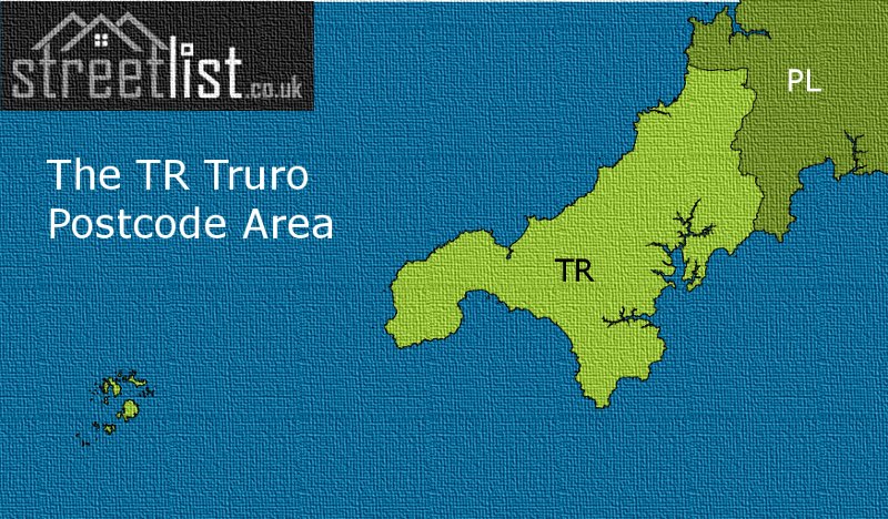
The TR postcode derives from the first two letters of Truro the historic cathedral city and Cornwall's only city and county town. Sharing only a border with the neighbouring PL Plymouth postcode the TR postcode extends far into the Celtic Sea to cover the Isles of Scilly.
The TR Postcode Area is represents a group of postal districts in the Truro area of the United Kingdom. The area code TR stands for the letters t and r in TRuro. TR has a population of 293,864 and covers an area of 1,418,013 hectares. Fun fact: 0.45% of the population of Great Britain lives in this area.
The postcode sector falls within the following counties: Cornwall (100.00%).
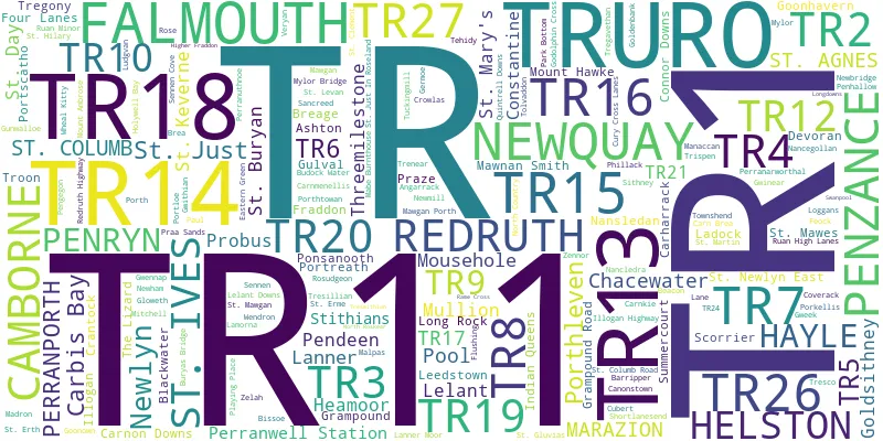
Post Towns and Postcode Districts for the TR Postcode
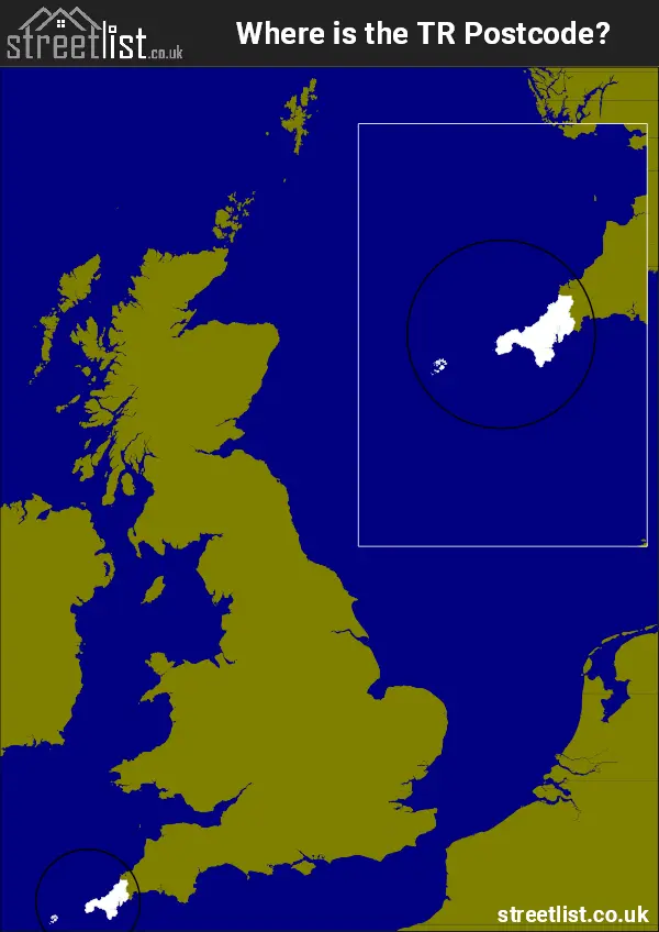
Where is the TR Postcode Area?
The TR Truro Postcode is in the South West of England. The postal area borders the following neighbouring postal areas: PL - Plymouth, It also borders The Irish Sea, Mount's Bay, Falmouth Harbour, Helford Estuary, The English Channel, St Ives Bay and The Celtic Sea.
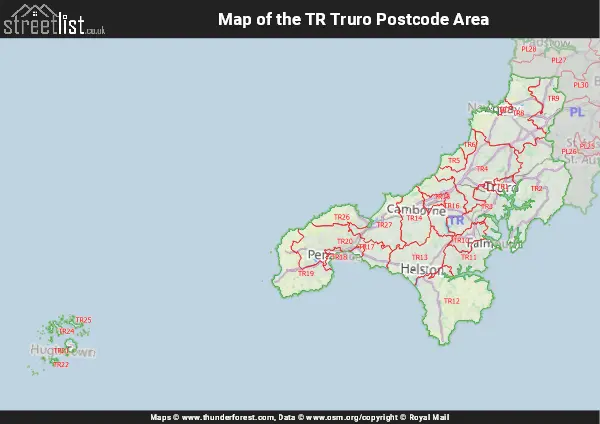
Map of the TR Truro Postcode Area
Explore the TR Truro postcode area by using our interactive map.
Postcode Districts within the TR Truro Postcode Area
There are 27 postcode districts within the Truro postcode area
A map showing the boundary of in relation to other areas
There are 14 towns within the Truro postcode area.

| Unit | Area² |
|---|---|
| Hectares | 1,418,013² |
| Miles | 5,475² |
| Feet | 152,633,501,307² |
| Kilometres | 14,180² |
Postal Delivery Offices serving the TR Truro Postcode Area
- Breage Scale Payment Delivery Office
- Bryher Scale Payment Delivery Office (isles Of Scilly)
- Camborne Delivery Office
- Carharrack Scale Payment Delivery Office
- Chacewater Scale Payment Delivery Office
- Coverack Scale Payment Delivery Office
- Falmouth Delivery Office
- Four Lanes Scale Payment Delivery Office
- Goonhavern Scale Payment Delivery Office
- Hayle Delivery Office
- Helford Scale Payment Delivery Office
- Helston Delivery Office
- Manaccan Scale Payment Delivery Office
- Mawgan Scale Payment Delivery Office
- Mousehole Scale Payment Delivery Office
- Mullion Scale Payment Delivery Office
- Newquay Delivery Office
- Pendeen Scale Payment Delivery Office
- Penzance Delivery Office
- Perranporth Scale Payment Delivery Office
- Perranwell Station Scale Payment Delivery Office
- Playing Place Scale Payment Delivery Office
- Ponsanooth Scale Payment Delivery Office
- Portloe Scale Payment Delivery Office
- Portscatho Scale Payment Delivery Office
- Probus Scale Payment Delivery Office
- Redruth Delivery Office
- St. Agnes (tr5) Scale Payment Delivery Office
- St. Agnes Scale Payment Delivery Office (isles Of Scilly)
- St. Buryan Scale Payment Delivery Office
- St. Columb Scale Payment Delivery Office
- St. Just Scale Payment Delivery Office
- St. Keverne Scale Payment Delivery Office
- St. Martin (helston) Scale Payment Delivery Office
- St. Martins Scale Payment Delivery Office (isles Of Scilly)
- St. Marys Scale Payment Delivery Office (isles Of Scilly)
- St. Mawes Scale Payment Delivery Office
- St Ives (tr) Delivery Office
- The Lizard Scale Payment Delivery Office
- Tregony Scale Payment Delivery Office
- Tresco Scale Payment Delivery Office (isles Of Scilly)
- Truro Delivery Office
Postcode Areas Closest to TR
Councils with Postcodes in TR
Towns and Villages within the TR Truro Postcode Area
- Angarrack - village
- Ashton - village
- Barripper - village
- Blackwater - village
- Bolingey - village
- Botallack - village
- Brea - village
- Breage - village
- Budock Water - village
- Cadgwith - village
- Camborne - town
- Canon's Town - village
- Carbis Bay - village
- Carharrack - village
- Carleen - village
- Carloggas - village
- Carn Brea Village - village
- Carn Towan - village
- Carnhell Green - village
- Carnkie - village
- Carnkie - village
- Carnon Downs - village
- Chacewater - village
- Connor Downs - village
- Constantine - village
- Coverack - village
- Crantock - village
- Crofthandy - village
- Crowlas - village
- Cubert - village
- Cury - village
- Devoran - village
- Drift - village
- Falmouth - town
- Feock - village
- Flushing - village
- Four Lanes - village
- Fraddon - village
- Frogpool - village
- Garras - village
- Germoe - village
- Gerrans - village
- Godolphin Cross - village
- Goldsithney - village
- Gollawater - otherSettlement
- Goonhavern - village
- Grampound - village
- Grampound Road - village
- Gweek - village
- Gwithian - village
- Halsetown - village
- Hayle - town
- Helford - village
- Helford Passage - village
- Helston - town
- Hendra - village
- Higher Downs - village
- Holywell - village
- Hugh Town - town
- Illogan - village
- Illogan Highway - village
- Indian Queens - village
- Kehelland - village
- Ladock - village
- Lamorna - village
- Lane - village
- Lanner - village
- Leedstown - village
- Lelant - village
- Little Beside - village
- Lizard - village
- Longdowns - village
- Longrock - village
- Ludgvan - village
- Mabe Burnthouse - village
- Madron - village
- Malpas - village
- Manaccan - village
- Market Jew / Marazion - town
- Mawgan - village
- Mawgan Porth - village
- Mawnan Smith - village
- Mitchell - village
- Mithian - village
- Mount Hawke - village
- Mousehole - village
- Mullion - village
- Mullion Cove - village
- Mylor Bridge - village
- Nancegollan - village
- Nancledra - village
- New Grimsby - village
- Newbridge - village
- Newbridge - village
- Newlyn - town
- Newquay - town
- North Country - village
- Old Town - village
- Paul - village
- Pendeen - village
- Penelewey - village
- Penhale - village
- Penmarth - village
- Penpol - village
- Penponds - village
- Penryn - town
- Penzance - town
- Perran Downs - village
- Perranarworthal - village
- Perrancoombe - village
- Perranporth - village
- Perranuthnoe - village
- Perranwell - village
- Perranzabuloe - village
- Playing Place - village
- Ponsanooth - village
- Pool - village
- Porkellis - village
- Porth Navas - village
- Porthallow - village
- Porthcurno - village
- Porthleven - village
- Porthtowan - village
- Portloe - village
- Portreath - village
- Portscatho - village
- Praa Sands - village
- Praze-an-Beeble - village
- Probus - village
- Quintrell Downs - village
- Rame - village
- Reawla - village
- Redruth - town
- Relubbus - village
- Rinsey Croft - village
- Rose - village
- Rose-an-Grouse - village
- Rosudgeon - village
- Ruan Lanihorne - village
- Ruan Minor - village
- Scorrier - village
- Sennen Cove - village
- Sheffield - village
- Shortlanesend - village
- South Tehidy - village
- St Agnes - village
- St Buryan - village
- St Columb Major - town
- St Columb Road - village
- St Day - village
- St Erme - village
- St Erth - village
- St Hilary - village
- St Ives - town
- St Just / St Just in Penwith - town
- St Just in Roseland - village
- St Keverne - village
- St Levan - village
- St Martin - village
- St Mawes - village
- St Mawgan - village
- St Newlyn East - village
- Stithians - village
- Summercourt - village
- The Towans - village
- Threemilestone - village
- Tolvaddon - village
- Treen - village
- Tregeseal - village
- Tregony - village
- Trenance - village
- Tresillian - village
- Trethewey - village
- Trevarrack - village
- Trevarrian - village
- Trevellas - village
- Trevenen Bal - village
- Treverva - village
- Trewennack - village
- Trispen - village
- Troon - village
- Truro - city
- Twelveheads - village
- Upton Towans - village
- Veryan - village
- Veryan Green - village
- Wall - village
- Wheal Rose - village
- Whitecross - village
- Zelah - village