The WF10 postcode district is a postal district located in the WF Wakefield postcode area with a population of 51,742 residents according to the 2021 England and Wales Census.
The area of the WF10 postcode district is 12.62 square miles which is 32.68 square kilometres or 8,075.08 acres.
Currently, the WF10 district has about 1246 postcode units spread across 5 geographic postcode sectors.
Given that each sector allows for 400 unique postcode combinations, the district has a capacity of 2,000 postcodes. With 1246 postcodes already in use, this leaves 754 units available.
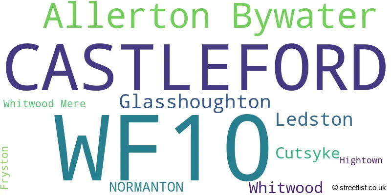
The largest settlement in the WF10 postal code is CASTLEFORD followed by Allerton Bywater, and Ledston.
The WF10 Postcode shares a border with LS25 (Garforth, Sherburn In Elmet, Kippax), LS26 (Rothwell, Woodlesford, Methley), WF11 (KNOTTINGLEY, Byram, Brotherton), WF6 (NORMANTON, Normanton Industrial Estate, Altofts) and WF8 (PONTEFRACT, Darrington, Kirk Smeaton).
The primary settlement in the WF10 postcode district is Castleford, located in the county of West Yorkshire. Other significant settlements within this district include Allerton Bywater, Fryston, Ledston, Whitwood, Glasshoughton, Cutsyke, and Hightown. The post town associated with this postcode district is Castleford. The county of West Yorkshire is in England.
For the district WF10, we have data on 6 postcode sectors. Here's a breakdown: The sector WF10 1, covers Castleford in West Yorkshire. The sector WF10 2, covers Allerton Bywater and Castleford in West Yorkshire. The sector WF10 3, covers Castleford in West Yorkshire. The sector WF10 4, covers Castleford in West Yorkshire. The sector WF10 5, covers Castleford in West Yorkshire. The sector WF10 9 is non-geographic. It's often designated for PO Boxes, large organisations, or special services.

Map of the WF10 Postcode District
Explore the WF10 postcode district by using our free interactive map.

When it comes to local government, postal geography often disregards political borders. However, for a breakdown in the WF10 District: the district mostly encompasses the Wakefield District (B) (1133 postcodes), and finally, the Leeds District (B) area (131 postcodes).
Recent House Sales in WF10
| Date | Price | Address |
|---|---|---|
| 13/10/2023 | £170,000 | Blands Terrace, Allerton Bywater, Castleford, WF10 2DU |
| 10/10/2023 | £100,000 | Heald Street, Castleford, WF10 4LS |
| 09/10/2023 | £190,000 | Old Mill Way, Castleford, WF10 1FB |
| 09/10/2023 | £225,000 | Mapplewell Road, Castleford, WF10 2PZ |
| 09/10/2023 | £310,000 | Gypsy Lane, Castleford, WF10 3PA |
| 03/10/2023 | £160,000 | Carlton Street, Castleford, WF10 1BA |
| 29/09/2023 | £140,000 | Whitwood Common Lane, Castleford, WF10 5PT |
| 29/09/2023 | £80,000 | Hugh Street, Castleford, WF10 4DS |
| 29/09/2023 | £108,000 | Churchfield Lane, Castleford, WF10 4DD |
| 25/09/2023 | £126,500 | Leeds Road, Glasshoughton, Castleford, WF10 4PB |
Weather Forecast for WF10
Press Button to Show Forecast for Castleford
| Time Period | Icon | Description | Temperature | Rain Probability | Wind |
|---|---|---|---|---|---|
| 21:00 to 00:00 | Partly cloudy (night) | 5.0°C (feels like 3.0°C) | 2.00% | NE 7 mph |
Press Button to Show Forecast for Castleford
| Time Period | Icon | Description | Temperature | Rain Probability | Wind |
|---|---|---|---|---|---|
| 00:00 to 03:00 | Clear night | 3.0°C (feels like 1.0°C) | 1.00% | N 4 mph | |
| 03:00 to 06:00 | Clear night | 2.0°C (feels like 0.0°C) | 1.00% | NNW 4 mph | |
| 06:00 to 09:00 | Partly cloudy (day) | 3.0°C (feels like 0.0°C) | 2.00% | N 7 mph | |
| 09:00 to 12:00 | Cloudy | 7.0°C (feels like 5.0°C) | 5.00% | NE 4 mph | |
| 12:00 to 15:00 | Cloudy | 8.0°C (feels like 7.0°C) | 11.00% | E 4 mph | |
| 15:00 to 18:00 | Cloudy | 9.0°C (feels like 8.0°C) | 9.00% | ENE 4 mph | |
| 18:00 to 21:00 | Partly cloudy (day) | 7.0°C (feels like 5.0°C) | 6.00% | E 7 mph | |
| 21:00 to 00:00 | Cloudy | 5.0°C (feels like 4.0°C) | 7.00% | E 4 mph |
Press Button to Show Forecast for Castleford
| Time Period | Icon | Description | Temperature | Rain Probability | Wind |
|---|---|---|---|---|---|
| 00:00 to 03:00 | Cloudy | 4.0°C (feels like 2.0°C) | 6.00% | NE 4 mph | |
| 03:00 to 06:00 | Cloudy | 2.0°C (feels like 1.0°C) | 7.00% | NNE 4 mph | |
| 06:00 to 09:00 | Cloudy | 3.0°C (feels like 1.0°C) | 10.00% | NNE 4 mph | |
| 09:00 to 12:00 | Cloudy | 8.0°C (feels like 6.0°C) | 10.00% | E 7 mph | |
| 12:00 to 15:00 | Overcast | 10.0°C (feels like 8.0°C) | 17.00% | E 9 mph | |
| 15:00 to 18:00 | Overcast | 10.0°C (feels like 8.0°C) | 21.00% | E 9 mph | |
| 18:00 to 21:00 | Cloudy | 9.0°C (feels like 6.0°C) | 17.00% | ENE 9 mph | |
| 21:00 to 00:00 | Cloudy | 6.0°C (feels like 4.0°C) | 15.00% | NE 7 mph |
Press Button to Show Forecast for Castleford
| Time Period | Icon | Description | Temperature | Rain Probability | Wind |
|---|---|---|---|---|---|
| 00:00 to 03:00 | Cloudy | 6.0°C (feels like 3.0°C) | 18.00% | NNE 9 mph | |
| 03:00 to 06:00 | Light rain | 6.0°C (feels like 3.0°C) | 50.00% | NNE 11 mph | |
| 06:00 to 09:00 | Light rain | 7.0°C (feels like 4.0°C) | 54.00% | NNE 11 mph | |
| 09:00 to 12:00 | Heavy rain | 8.0°C (feels like 5.0°C) | 79.00% | NNE 13 mph | |
| 12:00 to 15:00 | Light rain | 9.0°C (feels like 6.0°C) | 54.00% | NNE 13 mph | |
| 15:00 to 18:00 | Cloudy | 10.0°C (feels like 7.0°C) | 38.00% | N 11 mph | |
| 18:00 to 21:00 | Cloudy | 9.0°C (feels like 7.0°C) | 15.00% | NNE 9 mph | |
| 21:00 to 00:00 | Partly cloudy (night) | 7.0°C (feels like 5.0°C) | 8.00% | SE 7 mph |
Where is the WF10 Postcode District?
The data reveals that the postcode district WF10 is located in Castleford, a town in West Yorkshire. Castleford is positioned near several other towns, including Normanton to the southwest (approximately 3.72 miles away), Knottingley to the southeast (around 4.15 miles away), and Pontefract to the south (about 5.01 miles away). In addition, Castleford is situated about 9.28 miles northwest of Leeds and 9.98 miles north of Tadcaster. Furthermore, the distance from Castleford to London's center is approximately 161.99 miles.
The district covers the post towns of CASTLEFORD, NORMANTON.
The sector has postcodes within the nation of England.
The WF10 Postcode District is covers the following regions.
- Wakefield - West Yorkshire - Yorkshire and The Humber
- Leeds - West Yorkshire - Yorkshire and The Humber
| Postcode Sector | Delivery Office |
|---|---|
| WF10 1 | Whitwood Delivery Office |
| WF10 2 | Whitwood Delivery Office |
| WF10 3 | Whitwood Delivery Office |
| WF10 4 | Whitwood Delivery Office |
| WF10 5 | Whitwood Delivery Office |
| W | F | 1 | 0 | - | X | X | X |
| W | F | 1 | 0 | Space | Numeric | Letter | Letter |
Tourist Attractions within the Postcode Area
We found 1 visitor attractions within the WF10 postcode area
| Castleford Museum |
|---|
| Museums & Art Galleries |
| Museum and / or Art Gallery |
| View Castleford Museum on Google Maps |
Current Monthly Rental Prices
| # Bedrooms | Min Price | Max Price | Avg Price |
|---|---|---|---|
| 1 | £495 | £1,150 | £743 |
| 2 | £625 | £2,400 | £942 |
| 3 | £750 | £2,600 | £1,309 |
| 4 | £950 | £2,600 | £1,717 |
Current House Prices
| # Bedrooms | Min Price | Max Price | Avg Price |
|---|---|---|---|
| £250,000 | £290,000 | £266,667 | |
| 1 | £55,000 | £55,000 | £55,000 |
| 2 | £80,000 | £290,000 | £151,441 |
| 3 | £65,000 | £420,000 | £213,916 |
| 4 | £140,000 | £895,000 | £320,532 |
| 5 | £160,000 | £550,000 | £368,571 |
| 7 | £850,000 | £850,000 | £850,000 |
Estate Agents who Operate in the WF10 District
| Logo | Name | Brand Name | Address | Contact Number | Total Properties |
|---|---|---|---|---|---|
 | Castleford | William H. Brown | 10 Bank Street, Castleford, WF10 1HZ | 01977 803676 | 54 |
 | Castleford | Reeds Rains | 12 Wesley Street, Castleford, WF10 1AE | 01977 803692 | 34 |
 | Castleford | Castle Dwellings Ltd | 22 Bank Street Castleford WF10 1JD | 01977 802616 | 18 |
 | Castleford | Hunters | 6 Bank Street Castleford WF10 1HZ | 01977 805068 | 16 |
 | Pontefract | Richard Kendall | 15 Cornmarket, Pontefract, WF8 1AN | 01977 805524 | 15 |
| Type of Property | 2018 Average | 2018 Sales | 2017 Average | 2017 Sales | 2016 Average | 2016 Sales | 2015 Average | 2015 Sales |
|---|---|---|---|---|---|---|---|---|
| Detached | £222,110 | 241 | £218,824 | 235 | £204,358 | 170 | £201,010 | 150 |
| Semi-Detached | £142,705 | 398 | £135,781 | 378 | £134,594 | 355 | £122,914 | 347 |
| Terraced | £115,774 | 409 | £112,825 | 446 | £112,253 | 415 | £101,418 | 382 |
| Flats | £90,777 | 15 | £89,572 | 24 | £94,399 | 21 | £77,341 | 25 |