The WF11 postcode district is a postal district located in the WF Wakefield postcode area with a population of 17,666 residents according to the 2021 England and Wales Census.
The area of the WF11 postcode district is 17.22 square miles which is 44.60 square kilometres or 11,020.19 acres.
Currently, the WF11 district has about 521 postcode units spread across 3 geographic postcode sectors.
Given that each sector allows for 400 unique postcode combinations, the district has a capacity of 1,200 postcodes. With 521 postcodes already in use, this leaves 679 units available.
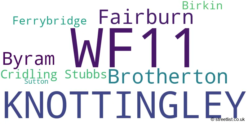
The largest settlement in the WF11 postal code is KNOTTINGLEY followed by Byram, and Brotherton.
The WF11 Postcode shares a border with YO8 (SELBY, Thorpe Willoughby, Brayton), DN14 (GOOLE, Howden, Eggborough), LS25 (Garforth, Sherburn In Elmet, Kippax), WF10 (CASTLEFORD, Allerton Bywater, Ledston) and WF8 (PONTEFRACT, Darrington, Kirk Smeaton).
The primary settlement in the WF11 postcode district is Knottingley, located in both North Yorkshire and West Yorkshire. Other significant settlements in the district include Cridling Stubbs, Ferrybridge, Birkin, Brotherton, Byram, Fairburn, and Sutton. The most significant Post Town in this district is Knottingley.
For the district WF11, we have data on 3 postcode sectors. Here's a breakdown: The sector WF11 0, covers Knottingley in West Yorkshire. The sector WF11 8, covers Knottingley in West Yorkshire. The sector WF11 9, covers Knottingley in West Yorkshire. The sector WF11 9, covers Brotherton and Fairburn and Byram in North Yorkshire.

Map of the WF11 Postcode District
Explore the WF11 postcode district by using our free interactive map.

When it comes to local government, postal geography often disregards political borders. However, for a breakdown in the WF11 District: the district mostly encompasses the Wakefield District (B) (410 postcodes), and finally, the North Yorkshire area (128 postcodes).
Recent House Sales in WF11
| Date | Price | Address |
|---|---|---|
| 25/10/2023 | £172,000 | Kingsley Avenue, Knottingley, WF11 8PY |
| 08/09/2023 | £160,000 | Queen Margarets Drive, Brotherton, Knottingley, WF11 9HR |
| 06/09/2023 | £220,000 | Kings Mount, Knottingley, WF11 8QZ |
| 30/08/2023 | £195,000 | Bywater Villas, Knottingley, WF11 9AE |
| 29/08/2023 | £121,800 | Hazel Road, Knottingley, WF11 0PF |
| 25/08/2023 | £118,500 | Forge Hill Lane, Knottingley, WF11 8HN |
| 24/08/2023 | £158,000 | Arnall Close, Knottingley, WF11 0EL |
| 18/08/2023 | £128,000 | Pollards Fields, Knottingley, WF11 8TD |
| 16/08/2023 | £150,000 | Pontefract Road, Ferrybridge, Knottingley, WF11 8PN |
| 11/08/2023 | £235,000 | Hall Court, Brotherton, Knottingley, WF11 9HF |
Weather Forecast for WF11
Press Button to Show Forecast for Knottingley
| Time Period | Icon | Description | Temperature | Rain Probability | Wind |
|---|---|---|---|---|---|
| 21:00 to 00:00 | Partly cloudy (night) | 5.0°C (feels like 3.0°C) | 1.00% | NE 4 mph |
Press Button to Show Forecast for Knottingley
| Time Period | Icon | Description | Temperature | Rain Probability | Wind |
|---|---|---|---|---|---|
| 00:00 to 03:00 | Clear night | 2.0°C (feels like 1.0°C) | 1.00% | N 4 mph | |
| 03:00 to 06:00 | Clear night | 2.0°C (feels like -1.0°C) | 1.00% | NNW 4 mph | |
| 06:00 to 09:00 | Partly cloudy (day) | 3.0°C (feels like 0.0°C) | 2.00% | NNW 7 mph | |
| 09:00 to 12:00 | Cloudy | 7.0°C (feels like 5.0°C) | 6.00% | NE 4 mph | |
| 12:00 to 15:00 | Cloudy | 8.0°C (feels like 7.0°C) | 16.00% | E 4 mph | |
| 15:00 to 18:00 | Light rain shower (day) | 9.0°C (feels like 8.0°C) | 27.00% | ENE 4 mph | |
| 18:00 to 21:00 | Partly cloudy (day) | 7.0°C (feels like 5.0°C) | 6.00% | E 7 mph | |
| 21:00 to 00:00 | Cloudy | 5.0°C (feels like 4.0°C) | 7.00% | E 4 mph |
Press Button to Show Forecast for Knottingley
| Time Period | Icon | Description | Temperature | Rain Probability | Wind |
|---|---|---|---|---|---|
| 00:00 to 03:00 | Partly cloudy (night) | 4.0°C (feels like 2.0°C) | 4.00% | NNE 4 mph | |
| 03:00 to 06:00 | Cloudy | 2.0°C (feels like 1.0°C) | 7.00% | NNE 4 mph | |
| 06:00 to 09:00 | Partly cloudy (day) | 3.0°C (feels like 1.0°C) | 7.00% | NNE 4 mph | |
| 09:00 to 12:00 | Cloudy | 8.0°C (feels like 6.0°C) | 11.00% | E 7 mph | |
| 12:00 to 15:00 | Overcast | 10.0°C (feels like 8.0°C) | 17.00% | E 9 mph | |
| 15:00 to 18:00 | Cloudy | 10.0°C (feels like 8.0°C) | 18.00% | E 9 mph | |
| 18:00 to 21:00 | Cloudy | 9.0°C (feels like 6.0°C) | 17.00% | ENE 9 mph | |
| 21:00 to 00:00 | Cloudy | 6.0°C (feels like 4.0°C) | 15.00% | NE 7 mph |
Press Button to Show Forecast for Knottingley
| Time Period | Icon | Description | Temperature | Rain Probability | Wind |
|---|---|---|---|---|---|
| 00:00 to 03:00 | Cloudy | 6.0°C (feels like 3.0°C) | 21.00% | NNE 9 mph | |
| 03:00 to 06:00 | Light rain | 6.0°C (feels like 3.0°C) | 49.00% | NNE 11 mph | |
| 06:00 to 09:00 | Light rain | 7.0°C (feels like 4.0°C) | 54.00% | NNE 11 mph | |
| 09:00 to 12:00 | Heavy rain | 8.0°C (feels like 5.0°C) | 79.00% | NNE 13 mph | |
| 12:00 to 15:00 | Light rain | 9.0°C (feels like 6.0°C) | 55.00% | NNE 13 mph | |
| 15:00 to 18:00 | Light rain shower (day) | 10.0°C (feels like 7.0°C) | 42.00% | N 11 mph | |
| 18:00 to 21:00 | Cloudy | 9.0°C (feels like 7.0°C) | 15.00% | NNE 9 mph | |
| 21:00 to 00:00 | Partly cloudy (night) | 7.0°C (feels like 5.0°C) | 9.00% | SE 7 mph |
Where is the WF11 Postcode District?
The postcode district WF11 is located in the town of Knottingley. Knottingley is situated near several nearby towns, including Castleford (4.65 miles to the west), Pontefract (5.02 miles to the southwest), Selby (9.28 miles to the northeast), Tadcaster (10.50 miles to the north), Leeds (13.35 miles to the northwest), and Goole (13.93 miles to the east). Furthermore, the distance from Knottingley to the center of London is approximately 159.75 miles.
The district is within the post town of KNOTTINGLEY.
The sector has postcodes within the nation of England.
The WF11 Postcode District is covers the following regions.
- Wakefield - West Yorkshire - Yorkshire and The Humber
- North Yorkshire CC - North Yorkshire - Yorkshire and The Humber
| Postcode Sector | Delivery Office |
|---|---|
| WF11 0 | Pontefract Delivery Office |
| WF11 8 | Pontefract Delivery Office |
| WF11 9 | Pontefract Delivery Office |
| W | F | 1 | 1 | - | X | X | X |
| W | F | 1 | 1 | Space | Numeric | Letter | Letter |
Current Monthly Rental Prices
| # Bedrooms | Min Price | Max Price | Avg Price |
|---|---|---|---|
| 1 | £500 | £500 | £500 |
| 2 | £595 | £795 | £695 |
| 3 | £1,100 | £1,100 | £1,100 |
Current House Prices
| # Bedrooms | Min Price | Max Price | Avg Price |
|---|---|---|---|
| £150,000 | £850,000 | £265,556 | |
| 1 | £90,000 | £130,000 | £110,000 |
| 2 | £65,000 | £425,000 | £158,115 |
| 3 | £35,000 | £599,999 | £197,445 |
| 4 | £110,000 | £650,000 | £327,476 |
| 15 | £740,000 | £740,000 | £740,000 |
Estate Agents who Operate in the WF11 District
| Logo | Name | Brand Name | Address | Contact Number | Total Properties |
|---|---|---|---|---|---|
 | Pontefract | William H. Brown | 26 Market Place Pontefract WF8 1AT | 01977 805508 | 19 |
 | Castleford | Hunters | 6 Bank Street Castleford WF10 1HZ | 01977 805068 | 8 |
 | Pontefract | Reeds Rains | 24 Beastfair, Pontefract, WF8 1AW | 01977 802621 | 7 |
 | Pontefract | Whitegates | 21 Beastfair Pontefract WF8 1AL | 01977 805512 | 6 |
 | Sheffield | MorfittSmith | The MorfittSmith Building, 67 Middlewood Road, Hillsborough, Sheffield S6 4GX | 0114 697 4116 | 6 |
| Type of Property | 2018 Average | 2018 Sales | 2017 Average | 2017 Sales | 2016 Average | 2016 Sales | 2015 Average | 2015 Sales |
|---|---|---|---|---|---|---|---|---|
| Detached | £216,924 | 56 | £208,099 | 63 | £183,673 | 81 | £224,404 | 46 |
| Semi-Detached | £117,949 | 158 | £115,708 | 158 | £113,542 | 148 | £112,141 | 122 |
| Terraced | £93,807 | 65 | £90,131 | 74 | £94,262 | 61 | £91,136 | 59 |
| Flats | £70,250 | 4 | £84,900 | 5 | £116,500 | 2 | £74,556 | 9 |