The WF12 postcode district is a postal district located in the WF Wakefield postcode area with a population of 36,018 residents according to the 2021 England and Wales Census.
The area of the WF12 postcode district is 9.46 square miles which is 24.50 square kilometres or 6,053.50 acres.
Currently, the WF12 district has about 805 postcode units spread across 4 geographic postcode sectors.
Given that each sector allows for 400 unique postcode combinations, the district has a capacity of 1,600 postcodes. With 805 postcodes already in use, this leaves 795 units available.
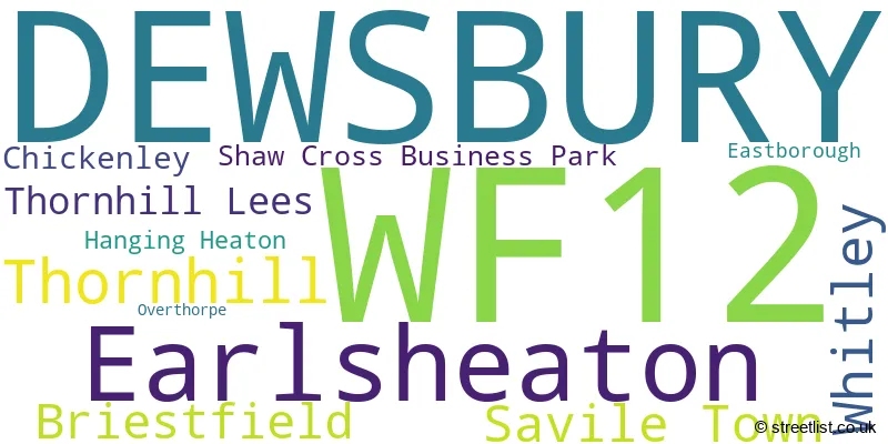
The largest settlement in the WF12 postal code is DEWSBURY followed by Earlsheaton, and Thornhill Lees.
The WF12 Postcode shares a border with WF13 (DEWSBURY, Ravensthorpe, Staincliffe), WF14 (MIRFIELD), WF17 (BATLEY, Birstall, Soothill), WF3 (Tingley, Stanley, East Ardsley), WF4 (Horbury, Crofton, Crigglestone) and WF5 (OSSETT).
Dewsbury, located in West Yorkshire, is the primary settlement in the WF12 postcode district, with the highest count. Other significant settlements in the district include Briestfield, Overthorpe, Thornhill, Thornhill Lees, Whitley, Earlsheaton, Eastborough, Hanging Heaton, and Shaw Cross Business Park. The most significant post town in the district is also Dewsbury, in West Yorkshire.
For the district WF12, we have data on 4 postcode sectors. Here's a breakdown: The sector WF12 0, covers Dewsbury in West Yorkshire. The sector WF12 7, covers Dewsbury in West Yorkshire. The sector WF12 8, covers Dewsbury and Earlsheaton in West Yorkshire. The sector WF12 9, covers Dewsbury in West Yorkshire.

Map of the WF12 Postcode District
Explore the WF12 postcode district by using our free interactive map.

When it comes to local government, postal geography often disregards political borders. However, for a breakdown in the WF12 District: the district mostly encompasses the Kirklees District (B) (800 postcodes), followed by the Leeds District (B) area (6 postcodes), and finally, the Wakefield District (B) area (5 postcodes).
Recent House Sales in WF12
| Date | Price | Address |
|---|---|---|
| 29/09/2023 | £110,000 | Frances Road, Earlsheaton, Dewsbury, WF12 8JG |
| 29/09/2023 | £230,000 | Pennine Road, Dewsbury, WF12 7AW |
| 15/09/2023 | £35,000 | Wakefield Road, Dewsbury, WF12 8AX |
| 08/09/2023 | £247,000 | Ullswater Avenue, Dewsbury, WF12 7PJ |
| 08/09/2023 | £247,000 | Ullswater Avenue, Dewsbury, WF12 7PJ |
| 06/09/2023 | £150,000 | Caulms Wood Road, Dewsbury, WF12 7BS |
| 01/09/2023 | £88,000 | Leeds Road, Dewsbury, WF12 7QL |
| 25/08/2023 | £110,000 | Owl Lane, Dewsbury, WF12 7RQ |
| 23/08/2023 | £250,000 | Glenlow Road, Dewsbury, WF12 7EW |
| 22/08/2023 | £195,000 | Edge Lane, Dewsbury, WF12 0HB |
Weather Forecast for WF12
Press Button to Show Forecast for Thornhill Lees
| Time Period | Icon | Description | Temperature | Rain Probability | Wind |
|---|---|---|---|---|---|
| 06:00 to 09:00 | Cloudy | 5.0°C (feels like 2.0°C) | 3.00% | NNW 7 mph | |
| 09:00 to 12:00 | Cloudy | 7.0°C (feels like 4.0°C) | 5.00% | N 9 mph | |
| 12:00 to 15:00 | Cloudy | 9.0°C (feels like 7.0°C) | 4.00% | N 9 mph | |
| 15:00 to 18:00 | Cloudy | 10.0°C (feels like 8.0°C) | 4.00% | N 9 mph | |
| 18:00 to 21:00 | Cloudy | 9.0°C (feels like 7.0°C) | 4.00% | NNE 7 mph | |
| 21:00 to 00:00 | Partly cloudy (night) | 7.0°C (feels like 5.0°C) | 1.00% | SE 4 mph |
Press Button to Show Forecast for Thornhill Lees
| Time Period | Icon | Description | Temperature | Rain Probability | Wind |
|---|---|---|---|---|---|
| 00:00 to 03:00 | Cloudy | 6.0°C (feels like 3.0°C) | 4.00% | WSW 7 mph | |
| 03:00 to 06:00 | Partly cloudy (night) | 5.0°C (feels like 3.0°C) | 2.00% | W 9 mph | |
| 06:00 to 09:00 | Cloudy | 6.0°C (feels like 3.0°C) | 6.00% | WNW 9 mph | |
| 09:00 to 12:00 | Partly cloudy (day) | 8.0°C (feels like 5.0°C) | 7.00% | NW 11 mph | |
| 12:00 to 15:00 | Cloudy | 9.0°C (feels like 7.0°C) | 9.00% | NNW 9 mph | |
| 15:00 to 18:00 | Overcast | 9.0°C (feels like 7.0°C) | 12.00% | N 7 mph | |
| 18:00 to 21:00 | Cloudy | 8.0°C (feels like 6.0°C) | 9.00% | NNE 7 mph | |
| 21:00 to 00:00 | Cloudy | 5.0°C (feels like 3.0°C) | 7.00% | NE 4 mph |
Press Button to Show Forecast for Thornhill Lees
| Time Period | Icon | Description | Temperature | Rain Probability | Wind |
|---|---|---|---|---|---|
| 00:00 to 03:00 | Cloudy | 4.0°C (feels like 2.0°C) | 5.00% | NE 4 mph | |
| 03:00 to 06:00 | Cloudy | 3.0°C (feels like 1.0°C) | 6.00% | NNE 4 mph | |
| 06:00 to 09:00 | Overcast | 4.0°C (feels like 2.0°C) | 8.00% | NNE 4 mph | |
| 09:00 to 12:00 | Cloudy | 7.0°C (feels like 5.0°C) | 6.00% | ENE 7 mph | |
| 12:00 to 15:00 | Overcast | 9.0°C (feels like 7.0°C) | 12.00% | E 7 mph | |
| 15:00 to 18:00 | Cloudy | 9.0°C (feels like 8.0°C) | 10.00% | ESE 7 mph | |
| 18:00 to 21:00 | Cloudy | 9.0°C (feels like 7.0°C) | 9.00% | E 9 mph | |
| 21:00 to 00:00 | Cloudy | 6.0°C (feels like 4.0°C) | 11.00% | E 7 mph |
Press Button to Show Forecast for Thornhill Lees
| Time Period | Icon | Description | Temperature | Rain Probability | Wind |
|---|---|---|---|---|---|
| 00:00 to 03:00 | Cloudy | 5.0°C (feels like 3.0°C) | 13.00% | E 7 mph | |
| 03:00 to 06:00 | Cloudy | 5.0°C (feels like 3.0°C) | 17.00% | ENE 7 mph | |
| 06:00 to 09:00 | Cloudy | 5.0°C (feels like 3.0°C) | 18.00% | ENE 7 mph | |
| 09:00 to 12:00 | Light rain | 8.0°C (feels like 5.0°C) | 46.00% | E 9 mph | |
| 12:00 to 15:00 | Cloudy | 10.0°C (feels like 8.0°C) | 20.00% | E 9 mph | |
| 15:00 to 18:00 | Light rain | 11.0°C (feels like 8.0°C) | 52.00% | E 9 mph | |
| 18:00 to 21:00 | Cloudy | 10.0°C (feels like 7.0°C) | 17.00% | NE 9 mph | |
| 21:00 to 00:00 | Cloudy | 8.0°C (feels like 5.0°C) | 16.00% | ENE 7 mph |
Where is the WF12 Postcode District?
The WF12 postcode district is located in DEWSBURY. It is in close proximity to several nearby towns. To the East is Ossett, which is approximately 2.16 miles away. To the North West is Heckmondwike, which is about 2.98 miles away. In the North is Batley, which is around 3.10 miles away. Lastly, to the West is Mirfield, which is approximately 4.11 miles away. Additionally, the WF12 postcode district is about 162.58 miles away from the center of London.
The district is within the post town of DEWSBURY.
The sector has postcodes within the nation of England.
The WF12 Postcode District is covers the following regions.
- Calderdale and Kirklees - West Yorkshire - Yorkshire and The Humber
- Wakefield - West Yorkshire - Yorkshire and The Humber
- Leeds - West Yorkshire - Yorkshire and The Humber
| Postcode Sector | Delivery Office |
|---|---|
| WF12 0 | Calderway Delivery Office |
| WF12 7 | Calderway Delivery Office |
| WF12 8 | Calderway Delivery Office |
| WF12 9 | Calderway Delivery Office |
| W | F | 1 | 2 | - | X | X | X |
| W | F | 1 | 2 | Space | Numeric | Letter | Letter |
Tourist Attractions within the Postcode Area
We found 1 visitor attractions within the WF12 postcode area
| Dewsbury Minster |
|---|
| Places of Worship |
| Place of Worship (still in use) |
| View Dewsbury Minster on Google Maps |
Current Monthly Rental Prices
| # Bedrooms | Min Price | Max Price | Avg Price |
|---|---|---|---|
| 1 | £625 | £800 | £692 |
| 2 | £750 | £750 | £750 |
| 3 | £785 | £1,075 | £906 |
| 4 | £1,200 | £1,200 | £1,200 |
Current House Prices
| # Bedrooms | Min Price | Max Price | Avg Price |
|---|---|---|---|
| £49,950 | £450,000 | £250,990 | |
| 1 | £55,000 | £200,000 | £100,000 |
| 2 | £85,000 | £489,999 | £203,300 |
| 3 | £130,000 | £600,000 | £237,255 |
| 4 | £180,000 | £1,295,000 | £394,710 |
| 5 | £325,000 | £750,000 | £502,500 |
| 6 | £375,000 | £4,800,000 | £1,385,000 |
| 10 | £595,000 | £595,000 | £595,000 |
Estate Agents who Operate in the WF12 District
| Logo | Name | Brand Name | Address | Contact Number | Total Properties |
|---|---|---|---|---|---|
 | Ossett | Richard Kendall | Unit 2 Wellgate, Ossett, WF5 8NS | 01924 908217 | 29 |
 | Dewsbury | William H. Brown | 1 Market Place, Dewsbury, WF13 1AE | 01924 907026 | 16 |
 | Dewsbury | Whitegates | 1-3 Northgate, Dewsbury, WF13 1DS | 01924 468323 | 16 |
 | Dewsbury | Hunters | 32-34 Market Place, Dewsbury, WF13 1DL | 01924 793052 | 10 |
 | Ossett | Reeds Rains | 9 Wesley Street, Ossett, WF5 8ER | 01924 908183 | 9 |
| Type of Property | 2018 Average | 2018 Sales | 2017 Average | 2017 Sales | 2016 Average | 2016 Sales | 2015 Average | 2015 Sales |
|---|---|---|---|---|---|---|---|---|
| Detached | £248,938 | 122 | £248,248 | 139 | £235,602 | 141 | £226,098 | 96 |
| Semi-Detached | £134,542 | 181 | £137,512 | 199 | £128,313 | 178 | £128,948 | 140 |
| Terraced | £100,611 | 129 | £101,933 | 133 | £97,559 | 153 | £88,554 | 117 |
| Flats | £59,738 | 6 | £82,167 | 12 | £65,800 | 10 | £60,643 | 7 |