The WN5 postcode district is a postal district located in the WN Wigan postcode area with a population of 44,740 residents according to the 2021 England and Wales Census.
The area of the WN5 postcode district is 10.14 square miles which is 26.27 square kilometres or 6,492.56 acres.
Currently, the WN5 district has about 933 postcode units spread across 4 geographic postcode sectors.
Given that each sector allows for 400 unique postcode combinations, the district has a capacity of 1,600 postcodes. With 933 postcodes already in use, this leaves 667 units available.
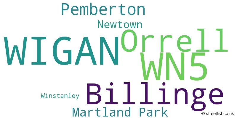
The largest settlement in the WN5 postal code is WIGAN followed by Orrell, and Billinge.
The WN5 Postcode shares a border with WN3 (WIGAN, Ince, Winstanley), WN4 (Ashton-in-Makerfield), WN8 (SKELMERSDALE, Upholland, Parbold), WA11 (Haydock, ST. HELENS, Rainford) and WN6 (Standish, WIGAN, Shevington).
The primary settlement in the WN5 postcode district is Wigan, which is located in the county of Greater Manchester. Other significant settlements include Orrell, Pemberton, Newtown, and Billinge. The most significant post town in this postcode district is Wigan.
For the district WN5, we have data on 4 postcode sectors. Here's a breakdown: The sector WN5 0, covers Wigan and Orrell in Greater Manchester. The sector WN5 7, covers Billinge in Merseyside. The sector WN5 7, covers Billinge in Greater Manchester. The sector WN5 8, covers Orrell and Wigan in Greater Manchester. The sector WN5 9, covers Wigan in Greater Manchester.

Map of the WN5 Postcode District
Explore the WN5 postcode district by using our free interactive map.

When it comes to local government, postal geography often disregards political borders. However, for a breakdown in the WN5 District: the district mostly encompasses the Wigan District (B) (797 postcodes), followed by the St. Helens District (B) area (122 postcodes), and finally, the West Lancashire District (B) area (15 postcodes).
Recent House Sales in WN5
| Date | Price | Address |
|---|---|---|
| 06/10/2023 | £69,000 | Oakley Avenue, Billinge, Wigan, WN5 7HQ |
| 29/09/2023 | £163,000 | Heysham Road, Orrell, Wigan, WN5 0EA |
| 29/09/2023 | £120,000 | Lancaster Road, Wigan, WN5 0QY |
| 29/09/2023 | £195,000 | Thomas More Gardens, Wigan, WN5 0AP |
| 29/09/2023 | £95,000 | Normanby Street, Wigan, WN5 8BS |
| 26/09/2023 | £65,500 | Orrell Road, Orrell, Wigan, WN5 8HD |
| 19/09/2023 | £260,000 | Braeside Crescent, Billinge, Wigan, WN5 7PQ |
| 19/09/2023 | £520,000 | Main Street, Billinge, Wigan, WN5 7HR |
| 15/09/2023 | £165,000 | Claremont Road, Billinge, Wigan, WN5 7LU |
| 11/09/2023 | £174,000 | Mitchell Street, Wigan, WN5 9BY |
Weather Forecast for WN5
Press Button to Show Forecast for Far Moor
| Time Period | Icon | Description | Temperature | Rain Probability | Wind |
|---|---|---|---|---|---|
| 09:00 to 12:00 | Partly cloudy (day) | 9.0°C (feels like 5.0°C) | 2.00% | NNW 16 mph | |
| 12:00 to 15:00 | Partly cloudy (day) | 10.0°C (feels like 7.0°C) | 32.00% | NNW 16 mph | |
| 15:00 to 18:00 | Partly cloudy (day) | 10.0°C (feels like 7.0°C) | 33.00% | NW 16 mph | |
| 18:00 to 21:00 | Sunny day | 8.0°C (feels like 5.0°C) | 0.00% | NW 13 mph | |
| 21:00 to 00:00 | Light rain shower (night) | 7.0°C (feels like 3.0°C) | 41.00% | NW 13 mph |
Press Button to Show Forecast for Far Moor
| Time Period | Icon | Description | Temperature | Rain Probability | Wind |
|---|---|---|---|---|---|
| 00:00 to 03:00 | Light rain shower (night) | 5.0°C (feels like 2.0°C) | 56.00% | NW 11 mph | |
| 03:00 to 06:00 | Partly cloudy (night) | 4.0°C (feels like 0.0°C) | 7.00% | NW 11 mph | |
| 06:00 to 09:00 | Sunny day | 4.0°C (feels like 0.0°C) | 4.00% | NW 11 mph | |
| 09:00 to 12:00 | Cloudy | 7.0°C (feels like 3.0°C) | 7.00% | NW 16 mph | |
| 12:00 to 15:00 | Cloudy | 8.0°C (feels like 5.0°C) | 8.00% | NW 18 mph | |
| 15:00 to 18:00 | Cloudy | 9.0°C (feels like 6.0°C) | 7.00% | NW 16 mph | |
| 18:00 to 21:00 | Cloudy | 8.0°C (feels like 5.0°C) | 6.00% | NW 11 mph | |
| 21:00 to 00:00 | Clear night | 5.0°C (feels like 3.0°C) | 3.00% | N 7 mph |
Press Button to Show Forecast for Far Moor
| Time Period | Icon | Description | Temperature | Rain Probability | Wind |
|---|---|---|---|---|---|
| 00:00 to 03:00 | Clear night | 3.0°C (feels like 1.0°C) | 4.00% | N 4 mph | |
| 03:00 to 06:00 | Clear night | 2.0°C (feels like 0.0°C) | 5.00% | NNW 4 mph | |
| 06:00 to 09:00 | Partly cloudy (day) | 3.0°C (feels like 1.0°C) | 3.00% | S 2 mph | |
| 09:00 to 12:00 | Partly cloudy (day) | 7.0°C (feels like 6.0°C) | 9.00% | WSW 4 mph | |
| 12:00 to 15:00 | Cloudy | 10.0°C (feels like 9.0°C) | 14.00% | W 7 mph | |
| 15:00 to 18:00 | Cloudy | 10.0°C (feels like 8.0°C) | 18.00% | W 11 mph | |
| 18:00 to 21:00 | Light rain | 9.0°C (feels like 7.0°C) | 50.00% | W 9 mph | |
| 21:00 to 00:00 | Light rain | 8.0°C (feels like 6.0°C) | 45.00% | WSW 11 mph |
Press Button to Show Forecast for Far Moor
| Time Period | Icon | Description | Temperature | Rain Probability | Wind |
|---|---|---|---|---|---|
| 00:00 to 03:00 | Overcast | 8.0°C (feels like 5.0°C) | 14.00% | W 11 mph | |
| 03:00 to 06:00 | Overcast | 9.0°C (feels like 5.0°C) | 11.00% | WNW 16 mph | |
| 06:00 to 09:00 | Overcast | 8.0°C (feels like 5.0°C) | 11.00% | WNW 13 mph | |
| 09:00 to 12:00 | Cloudy | 10.0°C (feels like 6.0°C) | 9.00% | NW 18 mph | |
| 12:00 to 15:00 | Cloudy | 11.0°C (feels like 7.0°C) | 11.00% | NW 18 mph | |
| 15:00 to 18:00 | Cloudy | 11.0°C (feels like 8.0°C) | 10.00% | NW 18 mph | |
| 18:00 to 21:00 | Partly cloudy (day) | 10.0°C (feels like 8.0°C) | 5.00% | NW 13 mph | |
| 21:00 to 00:00 | Clear night | 8.0°C (feels like 6.0°C) | 1.00% | NW 9 mph |
Where is the WN5 Postcode District?
The postcode district WN5 is located in Wigan. It is in close proximity to several nearby towns, including Skelmersdale to the North West (3.31 miles), St. Helens to the South (4.74 miles), Newton-le-Willows to the South East (4.90 miles), Leigh to the East (7.50 miles), Prescot to the South West (8.22 miles), and Chorley to the North (9.80 miles). The distance from WN5 to the center of London is 176.59 miles.
The district is within the post town of WIGAN.
The sector has postcodes within the nation of England.
The WN5 Postcode District is covers the following regions.
- Greater Manchester North West - Greater Manchester - North West (England)
- Chorley and West Lancashire - Lancashire - North West (England)
- East Merseyside - Merseyside - North West (England)
| Postcode Sector | Delivery Office |
|---|---|
| WN5 0 | Wigan Delivery Office |
| WN5 7 | Wigan Delivery Office |
| WN5 8 | Wigan Delivery Office |
| WN5 9 | Wigan Delivery Office |
| W | N | 5 | - | X | X | X |
| W | N | 5 | Space | Numeric | Letter | Letter |
Current Monthly Rental Prices
| # Bedrooms | Min Price | Max Price | Avg Price |
|---|---|---|---|
| 1 | £400 | £580 | £495 |
| 2 | £525 | £800 | £724 |
| 3 | £725 | £1,600 | £975 |
| 4 | £550 | £1,500 | £1,000 |
Current House Prices
| # Bedrooms | Min Price | Max Price | Avg Price |
|---|---|---|---|
| 1 | £62,500 | £65,000 | £63,750 |
| 2 | £65,000 | £299,950 | £156,954 |
| 3 | £115,000 | £900,000 | £234,008 |
| 4 | £110,000 | £860,000 | £354,863 |
| 5 | £450,000 | £650,000 | £520,714 |
| 6 | £1,100,000 | £1,100,000 | £1,100,000 |
Estate Agents who Operate in the WN5 District
| Logo | Name | Brand Name | Address | Contact Number | Total Properties |
|---|---|---|---|---|---|
 | Orrell | ABODE | Sefton Road, Orrell, WN5 8UP | 01685 707034 | 37 |
 | Wigan | Breakey & Co | Breakey & Co Estate Agents, 57-59 Ormskirk Road, Saddle Junction, Wigan, WN5 9EA | 01942 590036 | 20 |
 | Wigan | Regan & Hallworth | 10-12 Library Street, Wigan, WN1 1NN | 01942 925393 | 18 |
 | Pemberton | Reeds Rains | 798 Ormskirk Road Pemberton Wigan WN5 8AX | 01942 368429 | 14 |
 | Wigan | Alan Batt Estate Agents | 78 Market Street Wigan WN1 1HX | 01942 559666 | 13 |
| Type of Property | 2018 Average | 2018 Sales | 2017 Average | 2017 Sales | 2016 Average | 2016 Sales | 2015 Average | 2015 Sales |
|---|---|---|---|---|---|---|---|---|
| Detached | £260,192 | 123 | £241,093 | 129 | £238,715 | 128 | £239,038 | 128 |
| Semi-Detached | £143,861 | 300 | £143,997 | 274 | £131,635 | 279 | £124,559 | 243 |
| Terraced | £101,679 | 230 | £107,954 | 228 | £100,899 | 229 | £96,231 | 224 |
| Flats | £99,425 | 20 | £99,264 | 17 | £100,435 | 24 | £75,346 | 33 |