The WS10 8 postcode sector is within the county of West Midlands.
Did you know? According to the 2021 Census, the WS10 8 postcode sector is home to a bustling 14,033 residents!
Given that each sector allows for 400 unique postcode combinations. Letters C, I, K, M, O and V are not allowed in the last two letters of a postcode. With 270 postcodes already in use, this leaves 130 units available.
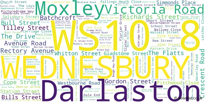
The largest settlement in the WS10 8 postal code is WEDNESBURY followed by Darlaston, and Moxley.
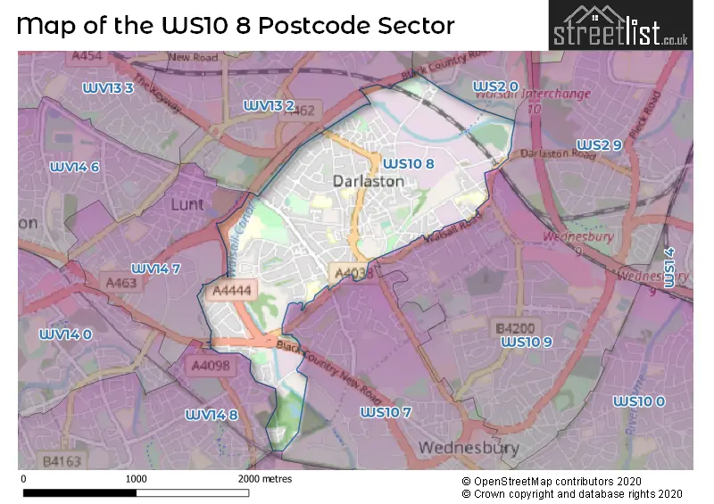
The WS10 8 Postcode shares a border with WS2 0 (WALSALL, Bentley), WS2 9 (WALSALL, Premier Business Park), WS10 7 (WEDNESBURY, Darlaston), WV14 7 (BILSTON), WV14 8 (BILSTON, Coseley, Bradley), WS10 9 (WEDNESBURY), WV13 2 (WILLENHALL) and DY4 0 (TIPTON, Ocker Hill).
The sector is within the post town of WEDNESBURY.
WS10 8 is a postcode sector within the WS10 postcode district which is within the WS Walsall postcode area.
The Royal Mail delivery office for the WS10 8 postal sector is the Wednesbury Delivery Office.
The area of the WS10 8 postcode sector is 1.42 square miles which is 3.67 square kilometres or 907.35 square acres.
Waterways within the WS10 8 postcode sector include the Walsall Canal, Bradley Locks Branch.

Map of the WS10 8 Postcode Sector
Explore the WS10 8 postcode sector by using our free interactive map.
| W | S | 1 | 0 | - | 8 | X | X |
| W | S | 1 | 0 | Space | 8 | Letter | Letter |
Official List of Streets
WEDNESBURY (143 Streets)
Darlaston (29 Streets)
Unofficial Streets or Alternative Spellings
WALSALL
BENTLEY MILL WAY BENTLEY ROAD NORTH DARLASTON ROADWEDNESBURY
WALSALL ROAD WESTERN WAYTIPTON,
BLACK COUNTRY NEW ROADMoxley
CASTLE VIEW ROADBILSTON,
BULL LANEDarlaston
MOXLEY ROAD ACCORD MEWS BOLSTON STREET BUGHOLE BRIDGE CROSS STREET DARLASTON ROAD BRIDGE GREAT CROFT STREET KING STREET PRECINCT LOWER GREEN LUNT JUNCTION MARSHLAND WAY MOXLEY JUNCTION NEW ROAD PARK TERRACE PINFOLD STREET EXTENSION PORKETS BRIDGE SAINT GEORGES CLOSE SAINT GEORGES STREET ST JOHNS ROAD ST. LAWRENCE WAY SUSSEX COURT TRAMWAY CLOSE WESLEYS FOLD WOODS BANK TERRACEBILSTON
ARDEN PLACE BLACK COUNTRY ROUTE DARLASTON LANEWILLENHALL
THE CRESCENTWeather Forecast for WS10 8
Press Button to Show Forecast for Darlaston
| Time Period | Icon | Description | Temperature | Rain Probability | Wind |
|---|---|---|---|---|---|
| 06:00 to 09:00 | Cloudy | 6.0°C (feels like 4.0°C) | 5.00% | NNE 7 mph | |
| 09:00 to 12:00 | Cloudy | 7.0°C (feels like 5.0°C) | 4.00% | N 7 mph | |
| 12:00 to 15:00 | Cloudy | 9.0°C (feels like 7.0°C) | 3.00% | N 7 mph | |
| 15:00 to 18:00 | Cloudy | 11.0°C (feels like 9.0°C) | 3.00% | NNW 9 mph | |
| 18:00 to 21:00 | Partly cloudy (day) | 10.0°C (feels like 8.0°C) | 1.00% | NNW 7 mph | |
| 21:00 to 00:00 | Partly cloudy (night) | 7.0°C (feels like 5.0°C) | 1.00% | NNW 7 mph |
Press Button to Show Forecast for Darlaston
| Time Period | Icon | Description | Temperature | Rain Probability | Wind |
|---|---|---|---|---|---|
| 00:00 to 03:00 | Partly cloudy (night) | 5.0°C (feels like 4.0°C) | 1.00% | WNW 4 mph | |
| 03:00 to 06:00 | Partly cloudy (night) | 4.0°C (feels like 2.0°C) | 2.00% | W 7 mph | |
| 06:00 to 09:00 | Cloudy | 5.0°C (feels like 2.0°C) | 4.00% | W 7 mph | |
| 09:00 to 12:00 | Cloudy | 7.0°C (feels like 5.0°C) | 7.00% | WNW 9 mph | |
| 12:00 to 15:00 | Overcast | 10.0°C (feels like 8.0°C) | 12.00% | NW 9 mph | |
| 15:00 to 18:00 | Cloudy | 11.0°C (feels like 9.0°C) | 8.00% | NNW 9 mph | |
| 18:00 to 21:00 | Cloudy | 10.0°C (feels like 8.0°C) | 6.00% | NNW 7 mph | |
| 21:00 to 00:00 | Cloudy | 7.0°C (feels like 6.0°C) | 6.00% | NNE 4 mph |
Press Button to Show Forecast for Darlaston
| Time Period | Icon | Description | Temperature | Rain Probability | Wind |
|---|---|---|---|---|---|
| 00:00 to 03:00 | Cloudy | 6.0°C (feels like 4.0°C) | 6.00% | ENE 4 mph | |
| 03:00 to 06:00 | Cloudy | 5.0°C (feels like 3.0°C) | 8.00% | ESE 4 mph | |
| 06:00 to 09:00 | Cloudy | 4.0°C (feels like 2.0°C) | 10.00% | ENE 7 mph | |
| 09:00 to 12:00 | Cloudy | 6.0°C (feels like 4.0°C) | 12.00% | ESE 7 mph | |
| 12:00 to 15:00 | Overcast | 9.0°C (feels like 7.0°C) | 16.00% | ESE 7 mph | |
| 15:00 to 18:00 | Overcast | 10.0°C (feels like 8.0°C) | 17.00% | ESE 7 mph | |
| 18:00 to 21:00 | Overcast | 9.0°C (feels like 7.0°C) | 23.00% | E 9 mph | |
| 21:00 to 00:00 | Light rain | 7.0°C (feels like 5.0°C) | 48.00% | E 7 mph |
Press Button to Show Forecast for Darlaston
| Time Period | Icon | Description | Temperature | Rain Probability | Wind |
|---|---|---|---|---|---|
| 00:00 to 03:00 | Cloudy | 6.0°C (feels like 4.0°C) | 20.00% | E 7 mph | |
| 03:00 to 06:00 | Overcast | 6.0°C (feels like 3.0°C) | 22.00% | E 7 mph | |
| 06:00 to 09:00 | Cloudy | 6.0°C (feels like 3.0°C) | 19.00% | ENE 7 mph | |
| 09:00 to 12:00 | Cloudy | 8.0°C (feels like 5.0°C) | 16.00% | ENE 9 mph | |
| 12:00 to 15:00 | Cloudy | 10.0°C (feels like 8.0°C) | 20.00% | E 9 mph | |
| 15:00 to 18:00 | Overcast | 11.0°C (feels like 9.0°C) | 21.00% | E 9 mph | |
| 18:00 to 21:00 | Cloudy | 10.0°C (feels like 8.0°C) | 16.00% | ENE 9 mph | |
| 21:00 to 00:00 | Cloudy | 9.0°C (feels like 7.0°C) | 16.00% | ENE 9 mph |
Schools and Places of Education Within the WS10 8 Postcode Sector
Grace Academy Darlaston
Academy sponsor led
Herberts Park Road, Wednesbury, West Midlands, WS10 8QJ
Head: Headteacher Julie Anstey
Ofsted Rating: Good
Inspection: 2022-04-27 (728 days ago)
Website: Visit Grace Academy Darlaston Website
Phone: 01215683300
Number of Pupils: 984
Old Church Church of England C Primary School
Voluntary controlled school
School Street, Wednesbury, West Midlands, WS10 8DL
Head: Ms Davina Clacy
Ofsted Rating: Good
Inspection: 2018-10-23 (2010 days ago)
Website: Visit Old Church Church of England C Primary School Website
Phone: 01215686329
Number of Pupils: 437
Pinfold Street Primary School
Community school
Pinfold Street Extension, Wednesbury, West Midlands, WS10 8PU
Head: Mrs Toni Beech
Ofsted Rating: Good
Inspection: 2022-10-19 (553 days ago)
Website: Visit Pinfold Street Primary School Website
Phone: 01215686366
Number of Pupils: 416
Salisbury Primary School
Community school
Salisbury Street, Wednesbury, West Midlands, WS10 8BQ
Head: Mrs Nin Matharu
Ofsted Rating: Good
Inspection: 2019-03-19 (1863 days ago)
Website: Visit Salisbury Primary School Website
Phone: 01216674066
Number of Pupils: 325
St Joseph's Catholic Primary School, Darlaston
Voluntary aided school
Rough Hay Road, Wednesbury, , WS10 8HN
Head: Mrs Kathleen Hinton
Ofsted Rating: Outstanding
Inspection: 2023-04-26 (364 days ago)
Website: Visit St Joseph's Catholic Primary School, Darlaston Website
Phone: 01215686496
Number of Pupils: 225
Woods Bank Academy
Academy converter
Rough Hay Road, Wednesbury, West Midlands, WS10 8NQ
Head: Miss Nicola Berkeley
Ofsted Rating: Requires improvement
Inspection: 2022-02-02 (812 days ago)
Website: Visit Woods Bank Academy Website
Phone: 01215686421
Number of Pupils: 390
House Prices in the WS10 8 Postcode Sector
| Type of Property | 2018 Average | 2018 Sales | 2017 Average | 2017 Sales | 2016 Average | 2016 Sales | 2015 Average | 2015 Sales |
|---|---|---|---|---|---|---|---|---|
| Detached | £198,450 | 10 | £176,500 | 10 | £151,406 | 16 | £144,917 | 12 |
| Semi-Detached | £125,014 | 37 | £119,220 | 37 | £121,687 | 41 | £105,409 | 47 |
| Terraced | £109,208 | 62 | £103,587 | 65 | £89,554 | 51 | £86,639 | 62 |
| Flats | £80,611 | 9 | £77,318 | 11 | £76,125 | 4 | £75,100 | 5 |
Important Postcodes WS10 8 in the Postcode Sector
WS10 8AA is the postcode for Town Hall, Victoria Road, and Darlaston Town Hall, Victoria Road
WS10 8AE is the postcode for Surestart, Ilmington House, Crescent Road
WS10 8AP is the postcode for Darlaston Swimming Baths, Victoria Road, and Darlaston Swimming Pool, Victoria Road
WS10 8BQ is the postcode for Salisbury Primary School, Salisbury Street
WS10 8DE is the postcode for Darlaston Library, 1 King Street
WS10 8DL is the postcode for Annexe, Old Church C Of E Primary School, School Street, Old Church C Of E Primary School, School Street, Darlaston, Old Church C of E J M I School, School Street, and Old Church C of E J M I School, School Street, Darlaston
WS10 8EY is the postcode for Darlaston Health Centre, Bilston Street
WS10 8HN is the postcode for St. Josephs Catholic Primary School, Rough Hay Road, and St. Josephs RC School, Rough Hay Road
WS10 8JB is the postcode for Rubery Owen, Booth Street
WS10 8NQ is the postcode for Woods Bank Academy, Rough Hay Road
WS10 8PU is the postcode for Pinfold Street Primary School, Pinfold St. Extension, Pinfold Street Primary School, Pinfold Street Extension, and PINFOLD STREET PRIMARY SCHOOL, PINFOLD STREET EXTENSION, DARLASTON
WS10 8QJ is the postcode for MAIN BUILDING, Darlaston Community School, Herberts Park Road, GRACE ACADEMY DARLASTON, HERBERTS PARK ROAD, DARLASTON, Grace Academy Darlaston, Herberts Park Road, MAIN BLOCK, Grace Academy Darlaston, Herberts Park Road, SPORTS BLOCK, Darlaston Community School, Herberts Park Road, and SPORTS BLOCK, Grace Academy Darlaston, Herberts Park Road
WS10 8SU is the postcode for Moxley Court, Sutton Road
WS10 8SY is the postcode for Darlaston Health Centre, Pinfold Street
| The WS10 8 Sector is within these Local Authorities |
|
|---|---|
| The WS10 8 Sector is within these Counties |
|
| The WS10 8 Sector is within these Water Company Areas |
|