The WS15 postcode district is a postal district located in the WS Walsall postcode area with a population of 38,685 residents according to the 2021 England and Wales Census.
The area of the WS15 postcode district is 56.26 square miles which is 145.70 square kilometres or 36,003.32 acres.
Currently, the WS15 district has about 1061 postcode units spread across 4 geographic postcode sectors.
Given that each sector allows for 400 unique postcode combinations, the district has a capacity of 1,600 postcodes. With 1061 postcodes already in use, this leaves 539 units available.
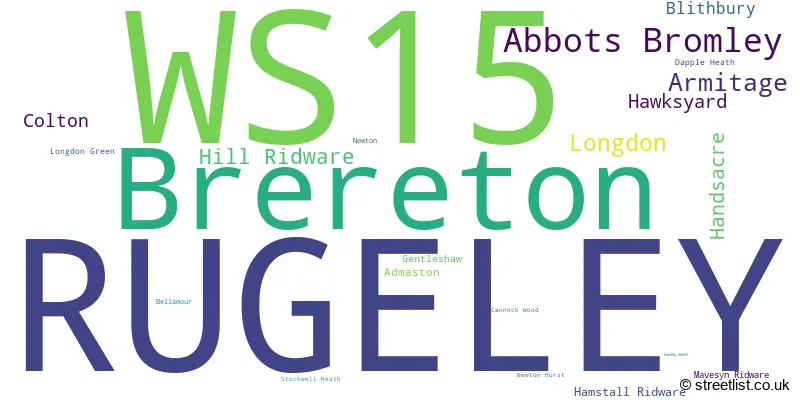
The largest settlement in the WS15 postal code is RUGELEY followed by Brereton, and Abbots Bromley.
The WS15 Postcode shares a border with WS12 (Hednesford, CANNOCK, Huntington), ST17 (STAFFORD, Brocton, Acton Trussell), ST18 (STAFFORD, Great Haywood, Hixon), WS13 (LICHFIELD, Fradley, Streethay), DE13 (BURTON-ON-TRENT, Stretton, Barton Under Needwood), ST14 (UTTOXETER, Rocester, Bramshall) and WS7 (BURNTWOOD, Chase Terrace, Chasetown).
The primary settlement in the WS15 postcode district is Rugeley, which is located in the county of Staffordshire in England. Other significant settlements in this district include Brereton, Hawksyard, Abbots Bromley, Admaston, Bellamour, Blithbury, Colton, Dapple Heath, Hamley Heath, Hamstall Ridware, Hill Ridware, Mavesyn Ridware, Newton, Newton Hurst, Stockwell Heath, Armitage, Cannock Wood, Gentleshaw, Handsacre, Longdon, and Longdon Green. The most significant post town in this district is Rugeley.
For the district WS15, we have data on 5 postcode sectors. Here's a breakdown: The sector WS15 1, covers Brereton and Rugeley in Staffordshire. The sector WS15 2, covers Rugeley in Staffordshire. The sector WS15 3, covers Abbots Bromley and Rugeley and Hill Ridware in Staffordshire. The sector WS15 4, covers Rugeley and Armitage and Longdon and Handsacre in Staffordshire. The sector WS15 9 is non-geographic. It's often designated for PO Boxes, large organisations, or special services.

Map of the WS15 Postcode District
Explore the WS15 postcode district by using our free interactive map.

When it comes to local government, postal geography often disregards political borders. However, for a breakdown in the WS15 District: the district mostly encompasses the Cannock Chase District (601 postcodes), followed by the Lichfield District area (357 postcodes), followed by the East Staffordshire District (B) area (102 postcodes), and finally, the Stafford District (B) area (9 postcodes).
Recent House Sales in WS15
| Date | Price | Address |
|---|---|---|
| 29/09/2023 | £170,000 | Beech Close, Handsacre, Rugeley, WS15 4EQ |
| 21/09/2023 | £320,000 | Needwood Grange, Abbots Bromley, Rugeley, WS15 3AU |
| 15/09/2023 | £180,000 | Daywell Rise, Rugeley, WS15 2RE |
| 13/09/2023 | £185,000 | John Till Close, Rugeley, WS15 2AF |
| 06/09/2023 | £400,000 | Hayfield Hill, Rugeley, WS15 4RR |
| 04/09/2023 | £875,000 | Borough Lane, Longdon, Rugeley, WS15 4QN |
| 01/09/2023 | £270,000 | Portobello, Rugeley, WS15 2QS |
| 01/09/2023 | £630,000 | Bower Lane, Rugeley, WS15 2TP |
| 31/08/2023 | £99,500 | Chester Road, Rugeley, WS15 1GD |
| 25/08/2023 | £280,000 | Sheringham Drive, Rugeley, WS15 2YG |
Weather Forecast for WS15
Press Button to Show Forecast for Rugeley
| Time Period | Icon | Description | Temperature | Rain Probability | Wind |
|---|---|---|---|---|---|
| 21:00 to 00:00 | Clear night | 6.0°C (feels like 4.0°C) | 0.00% | NW 4 mph |
Press Button to Show Forecast for Rugeley
| Time Period | Icon | Description | Temperature | Rain Probability | Wind |
|---|---|---|---|---|---|
| 00:00 to 03:00 | Partly cloudy (night) | 4.0°C (feels like 2.0°C) | 0.00% | W 4 mph | |
| 03:00 to 06:00 | Cloudy | 3.0°C (feels like 1.0°C) | 5.00% | WSW 7 mph | |
| 06:00 to 09:00 | Light rain | 5.0°C (feels like 2.0°C) | 51.00% | WSW 7 mph | |
| 09:00 to 12:00 | Light rain | 8.0°C (feels like 5.0°C) | 46.00% | WNW 9 mph | |
| 12:00 to 15:00 | Cloudy | 8.0°C (feels like 6.0°C) | 52.00% | NW 11 mph | |
| 15:00 to 18:00 | Cloudy | 9.0°C (feels like 6.0°C) | 34.00% | NNE 7 mph | |
| 18:00 to 21:00 | Cloudy | 8.0°C (feels like 6.0°C) | 11.00% | ENE 4 mph | |
| 21:00 to 00:00 | Cloudy | 6.0°C (feels like 5.0°C) | 9.00% | NE 4 mph |
Press Button to Show Forecast for Rugeley
| Time Period | Icon | Description | Temperature | Rain Probability | Wind |
|---|---|---|---|---|---|
| 00:00 to 03:00 | Cloudy | 4.0°C (feels like 2.0°C) | 6.00% | ENE 4 mph | |
| 03:00 to 06:00 | Cloudy | 3.0°C (feels like 1.0°C) | 4.00% | ENE 4 mph | |
| 06:00 to 09:00 | Partly cloudy (day) | 3.0°C (feels like 1.0°C) | 1.00% | ENE 4 mph | |
| 09:00 to 12:00 | Cloudy | 7.0°C (feels like 5.0°C) | 8.00% | ENE 7 mph | |
| 12:00 to 15:00 | Overcast | 9.0°C (feels like 8.0°C) | 10.00% | E 4 mph | |
| 15:00 to 18:00 | Cloudy | 10.0°C (feels like 9.0°C) | 7.00% | ENE 4 mph | |
| 18:00 to 21:00 | Cloudy | 9.0°C (feels like 8.0°C) | 9.00% | ENE 4 mph | |
| 21:00 to 00:00 | Partly cloudy (night) | 5.0°C (feels like 3.0°C) | 7.00% | E 7 mph |
Press Button to Show Forecast for Rugeley
| Time Period | Icon | Description | Temperature | Rain Probability | Wind |
|---|---|---|---|---|---|
| 00:00 to 03:00 | Partly cloudy (night) | 3.0°C (feels like 1.0°C) | 7.00% | ENE 4 mph | |
| 03:00 to 06:00 | Cloudy | 3.0°C (feels like 0.0°C) | 11.00% | ENE 7 mph | |
| 06:00 to 09:00 | Cloudy | 4.0°C (feels like 1.0°C) | 12.00% | ENE 7 mph | |
| 09:00 to 12:00 | Cloudy | 8.0°C (feels like 5.0°C) | 14.00% | E 9 mph | |
| 12:00 to 15:00 | Overcast | 10.0°C (feels like 7.0°C) | 22.00% | E 9 mph | |
| 15:00 to 18:00 | Overcast | 10.0°C (feels like 8.0°C) | 22.00% | ENE 11 mph | |
| 18:00 to 21:00 | Cloudy | 10.0°C (feels like 7.0°C) | 18.00% | ENE 9 mph | |
| 21:00 to 00:00 | Cloudy | 7.0°C (feels like 4.0°C) | 20.00% | ENE 11 mph |
Press Button to Show Forecast for Rugeley
| Time Period | Icon | Description | Temperature | Rain Probability | Wind |
|---|---|---|---|---|---|
| 00:00 to 03:00 | Cloudy | 6.0°C (feels like 3.0°C) | 17.00% | NE 11 mph | |
| 03:00 to 06:00 | Light rain | 6.0°C (feels like 3.0°C) | 50.00% | NNE 11 mph | |
| 06:00 to 09:00 | Heavy rain | 7.0°C (feels like 3.0°C) | 72.00% | NNE 11 mph | |
| 09:00 to 12:00 | Heavy rain | 8.0°C (feels like 5.0°C) | 76.00% | NNE 9 mph | |
| 12:00 to 15:00 | Heavy rain | 9.0°C (feels like 6.0°C) | 75.00% | N 11 mph | |
| 15:00 to 18:00 | Heavy rain shower (day) | 10.0°C (feels like 7.0°C) | 61.00% | N 11 mph | |
| 18:00 to 21:00 | Cloudy | 9.0°C (feels like 7.0°C) | 19.00% | WSW 9 mph | |
| 21:00 to 00:00 | Partly cloudy (night) | 7.0°C (feels like 5.0°C) | 9.00% | SW 7 mph |
Where is the WS15 Postcode District?
The data postcode district WS15 is located in the town of Rugeley. It is nearby several towns, including Burntwood to the south (6.72 miles), Cannock to the southwest (7.13 miles), Uttoxeter to the north (7.96 miles), Lichfield to the southeast (7.99 miles), Burton-on-Trent to the east (10.86 miles), Stafford to the west (12.28 miles), and Stone to the northwest (13.36 miles). Additionally, the distance from WS15 to the center of London is approximately 115.72 miles.
The district is within the post town of RUGELEY.
The sector has postcodes within the nation of England.
The WS15 Postcode District is in the Staffordshire CC region of Shropshire and Staffordshire within the West Midlands (England).
| Postcode Sector | Delivery Office |
|---|---|
| WS15 1 | Rugeley Delivery Office |
| WS15 2 | Rugeley Delivery Office |
| WS15 3 | Rugeley Delivery Office |
| WS15 4 | Rugeley Delivery Office |
| WS15 3 | Abbots Bromley Scale Payment Delivery Office |
| W | S | 1 | 5 | - | X | X | X |
| W | S | 1 | 5 | Space | Numeric | Letter | Letter |
Tourist Attractions within the Postcode Area
We found 1 visitor attractions within the WS15 postcode area
| Go Ape! Tree Top Adventure - Cannock Forest |
|---|
| Country Parks |
| Country Park |
| View Go Ape! Tree Top Adventure - Cannock Forest on Google Maps |
Current Monthly Rental Prices
| # Bedrooms | Min Price | Max Price | Avg Price |
|---|---|---|---|
| 1 | £450 | £595 | £540 |
| 2 | £675 | £1,250 | £837 |
| 3 | £835 | £1,250 | £1,043 |
| 4 | £4,200 | £4,200 | £4,200 |
Current House Prices
| # Bedrooms | Min Price | Max Price | Avg Price |
|---|---|---|---|
| £88,000 | £950,000 | £519,000 | |
| 1 | £70,000 | £225,000 | £117,222 |
| 2 | £100,000 | £450,000 | £227,994 |
| 3 | £83,750 | £985,000 | £303,158 |
| 4 | £189,950 | £1,195,000 | £455,568 |
| 5 | £265,500 | £2,500,000 | £931,930 |
| 6 | £975,000 | £975,000 | £975,000 |
| 7 | £800,000 | £800,000 | £800,000 |
| 9 | £1,750,000 | £1,750,000 | £1,750,000 |
Estate Agents who Operate in the WS15 District
| Logo | Name | Brand Name | Address | Contact Number | Total Properties |
|---|---|---|---|---|---|
 | Rugeley | C residential Ltd | Globe House Upper Brook Street Rugeley WS15 2DN | 01889 227299 | 42 |
 | Rugeley | Chase Owl Estates | 10 Anson Street, Rugeley, Staffordshire, WS15 2BB | 01889 227308 | 29 |
 | Rugeley | JR Properties Ltd | 25B Horsefair, Rugeley, Staffordshire, WS15 2EJ | 01889 227307 | 22 |
 | Lichfield | Andrew Downing-Booth Estate Agents | 6-8 City Arcade, Lichfield, WS13 6LY | 01543 395668 | 15 |
 | Lichfield | Webbs Estate Agents | Unit 2, City Point, Friars Alley, Lichfield, WS13 6QB | 01543 229223 | 14 |
- Abbots Bromley
- Admaston
- Armitage
- Blithbury
- Breretonhill
- Bromley Wood
- Burntwood
- Cannock Wood
- Cold Well
- Colton
- Dapple Heath
- Farewell
- Gentleshaw
- Hamstall Ridware
- Handsacre
- Heatley
- Hill Ridware
- Hoar Cross
- King's Bromley
- Lea Heath
- Longdon Green
- Longdon
- Marchington Woodlands
- Mavesyn Ridware
- Newborough
- Newton
- Olive Green
- Rugeley
- Slitting Mill
- Stockwell Heath
- Upper Longdon
- Windmill Bank
| Type of Property | 2018 Average | 2018 Sales | 2017 Average | 2017 Sales | 2016 Average | 2016 Sales | 2015 Average | 2015 Sales |
|---|---|---|---|---|---|---|---|---|
| Detached | £321,261 | 234 | £301,820 | 262 | £296,085 | 241 | £264,694 | 215 |
| Semi-Detached | £172,751 | 246 | £168,289 | 233 | £154,003 | 203 | £148,834 | 225 |
| Terraced | £158,365 | 164 | £146,597 | 180 | £144,962 | 192 | £137,127 | 170 |
| Flats | £106,280 | 25 | £91,188 | 34 | £97,529 | 35 | £95,254 | 35 |