The WS7 1 postcode sector is within the county of Staffordshire.
Did you know? According to the 2021 Census, the WS7 1 postcode sector is home to a bustling 5,458 residents!
Given that each sector allows for 400 unique postcode combinations. Letters C, I, K, M, O and V are not allowed in the last two letters of a postcode. With 108 postcodes already in use, this leaves 292 units available.
The largest settlements in the WS7 1 postal code are BURNTWOOD and Chase Terrace.
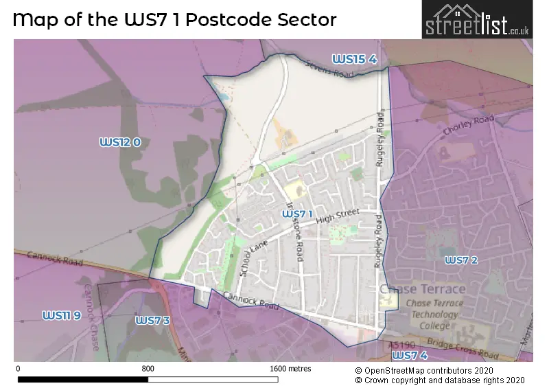
The WS7 1 Postcode shares a border with WS7 2 (BURNTWOOD, Chase Terrace), WS15 4 (RUGELEY, Armitage, Handsacre), WS7 3 (BURNTWOOD, Chasetown, Burntwood Business Park), WS11 9 (Norton Canes, CANNOCK) and WS12 0 (CANNOCK, Hednesford, Hazel Slade).
The sector is within the post town of BURNTWOOD.
WS7 1 is a postcode sector within the WS7 postcode district which is within the WS Walsall postcode area.
The Royal Mail delivery office for the WS7 1 postal sector is the Lichfield Delivery Office.
The area of the WS7 1 postcode sector is 0.70 square miles which is 1.81 square kilometres or 447.44 square acres.

Map of the WS7 1 Postcode Sector
Explore the WS7 1 postcode sector by using our free interactive map.
| W | S | 7 | - | 1 | X | X |
| W | S | 7 | Space | 1 | Letter | Letter |
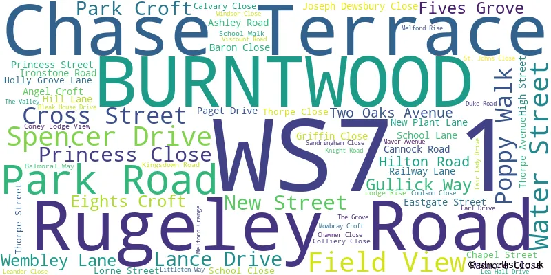
Official List of Streets
BURNTWOOD (56 Streets)
Chase Terrace (11 Streets)
Unofficial Streets or Alternative Spellings
BURNTWOOD
BRIDGE CROSS ROAD CHASELANDS CHORLEY ROAD LYMINGTON ROAD PLANT LANE REDWOOD DRIVE SILVERDALE DRIVE SPINNEY LANE VICTORY AVENUE CHASE TERRACE ROAD PARK VIEW SAINT JOHNS CLOSE STABLES WAYBurntwood Business Park
COBBETT ROAD RING ROADChasetown
HIGH STREETCANNOCK,
SEVENS ROADWeather Forecast for WS7 1
Press Button to Show Forecast for Hednesford
| Time Period | Icon | Description | Temperature | Rain Probability | Wind |
|---|---|---|---|---|---|
| 00:00 to 03:00 | Partly cloudy (night) | 3.0°C (feels like 1.0°C) | 0.00% | WNW 4 mph | |
| 03:00 to 06:00 | Cloudy | 2.0°C (feels like 1.0°C) | 4.00% | WSW 4 mph | |
| 06:00 to 09:00 | Light rain | 4.0°C (feels like 2.0°C) | 49.00% | WSW 4 mph | |
| 09:00 to 12:00 | Cloudy | 7.0°C (feels like 4.0°C) | 15.00% | WNW 9 mph | |
| 12:00 to 15:00 | Cloudy | 8.0°C (feels like 5.0°C) | 50.00% | NW 11 mph | |
| 15:00 to 18:00 | Cloudy | 8.0°C (feels like 6.0°C) | 49.00% | NNE 7 mph | |
| 18:00 to 21:00 | Cloudy | 7.0°C (feels like 6.0°C) | 7.00% | ENE 4 mph | |
| 21:00 to 00:00 | Cloudy | 5.0°C (feels like 4.0°C) | 6.00% | NE 4 mph |
Press Button to Show Forecast for Hednesford
| Time Period | Icon | Description | Temperature | Rain Probability | Wind |
|---|---|---|---|---|---|
| 00:00 to 03:00 | Cloudy | 4.0°C (feels like 2.0°C) | 7.00% | ENE 7 mph | |
| 03:00 to 06:00 | Cloudy | 2.0°C (feels like 0.0°C) | 4.00% | ENE 4 mph | |
| 06:00 to 09:00 | Cloudy | 2.0°C (feels like 0.0°C) | 5.00% | ENE 7 mph | |
| 09:00 to 12:00 | Cloudy | 6.0°C (feels like 4.0°C) | 5.00% | ENE 7 mph | |
| 12:00 to 15:00 | Overcast | 8.0°C (feels like 7.0°C) | 10.00% | ENE 4 mph | |
| 15:00 to 18:00 | Cloudy | 9.0°C (feels like 8.0°C) | 9.00% | ENE 4 mph | |
| 18:00 to 21:00 | Cloudy | 8.0°C (feels like 7.0°C) | 9.00% | ENE 4 mph | |
| 21:00 to 00:00 | Partly cloudy (night) | 5.0°C (feels like 2.0°C) | 7.00% | E 7 mph |
Press Button to Show Forecast for Hednesford
| Time Period | Icon | Description | Temperature | Rain Probability | Wind |
|---|---|---|---|---|---|
| 00:00 to 03:00 | Partly cloudy (night) | 3.0°C (feels like 0.0°C) | 7.00% | ENE 7 mph | |
| 03:00 to 06:00 | Cloudy | 2.0°C (feels like 0.0°C) | 11.00% | ENE 7 mph | |
| 06:00 to 09:00 | Cloudy | 3.0°C (feels like 0.0°C) | 9.00% | ENE 7 mph | |
| 09:00 to 12:00 | Cloudy | 7.0°C (feels like 4.0°C) | 12.00% | E 9 mph | |
| 12:00 to 15:00 | Overcast | 9.0°C (feels like 6.0°C) | 20.00% | E 9 mph | |
| 15:00 to 18:00 | Overcast | 9.0°C (feels like 7.0°C) | 22.00% | ENE 11 mph | |
| 18:00 to 21:00 | Cloudy | 9.0°C (feels like 6.0°C) | 18.00% | ENE 9 mph | |
| 21:00 to 00:00 | Cloudy | 7.0°C (feels like 3.0°C) | 20.00% | NE 11 mph |
Press Button to Show Forecast for Hednesford
| Time Period | Icon | Description | Temperature | Rain Probability | Wind |
|---|---|---|---|---|---|
| 00:00 to 03:00 | Cloudy | 6.0°C (feels like 2.0°C) | 20.00% | NE 11 mph | |
| 03:00 to 06:00 | Light rain | 6.0°C (feels like 2.0°C) | 49.00% | NE 11 mph | |
| 06:00 to 09:00 | Heavy rain | 6.0°C (feels like 3.0°C) | 77.00% | NNE 11 mph | |
| 09:00 to 12:00 | Light rain | 7.0°C (feels like 4.0°C) | 57.00% | NNE 9 mph | |
| 12:00 to 15:00 | Heavy rain | 8.0°C (feels like 6.0°C) | 76.00% | N 11 mph | |
| 15:00 to 18:00 | Light rain | 9.0°C (feels like 6.0°C) | 54.00% | N 11 mph | |
| 18:00 to 21:00 | Overcast | 9.0°C (feels like 7.0°C) | 20.00% | NW 9 mph | |
| 21:00 to 00:00 | Partly cloudy (night) | 6.0°C (feels like 4.0°C) | 10.00% | WNW 7 mph |
Schools and Places of Education Within the WS7 1 Postcode Sector
Chase Terrace Primary School
Foundation school
Rugeley Road, Burntwood, Staffordshire, WS7 1AH
Head: Mrs Tania Harrison
Ofsted Rating: Good
Inspection: 2019-05-21 (1801 days ago)
Website: Visit Chase Terrace Primary School Website
Phone: 01543227150
Number of Pupils: 280
House Prices in the WS7 1 Postcode Sector
| Type of Property | 2018 Average | 2018 Sales | 2017 Average | 2017 Sales | 2016 Average | 2016 Sales | 2015 Average | 2015 Sales |
|---|---|---|---|---|---|---|---|---|
| Detached | £240,378 | 34 | £232,281 | 32 | £229,875 | 34 | £218,944 | 27 |
| Semi-Detached | £175,485 | 37 | £188,327 | 35 | £148,698 | 45 | £134,577 | 41 |
| Terraced | £145,474 | 19 | £135,731 | 13 | £125,464 | 14 | £127,631 | 19 |
| Flats | £106,292 | 6 | £145,000 | 2 | £125,000 | 2 | £105,000 | 1 |
Important Postcodes WS7 1 in the Postcode Sector
WS7 1AH is the postcode for Chase Terrace Cp School, Rugeley Road, Chase Terrace Primary School, Rugeley Road, Chase Terrace, and Chase Terrace Cp School, Rugeley Road, Chase Terrace
WS7 1AQ is the postcode for Salters Meadow Health Centre, Rugeley Road, and Staffordshire Fire & Rescue Service, Fire Station, Rugeley Road
WS7 1LU is the postcode for Holly Grove Primary School, Holly Grove Lane, and HOLLY GROVE PRIMARY SCHOOL, HOLLY GROVE LANE, BURNTWOOD
| The WS7 1 Sector is within these Local Authorities |
|
|---|---|
| The WS7 1 Sector is within these Counties |
|
| The WS7 1 Sector is within these Water Company Areas |
|