The WV3 postcode district is a postal district located in the WV Wolverhampton postcode area with a population of 30,487 residents according to the 2021 England and Wales Census.
The area of the WV3 postcode district is 3.04 square miles which is 7.88 square kilometres or 1,946.18 acres.
Currently, the WV3 district has about 616 postcode units spread across 4 geographic postcode sectors.
Given that each sector allows for 400 unique postcode combinations, the district has a capacity of 1,600 postcodes. With 616 postcodes already in use, this leaves 984 units available.
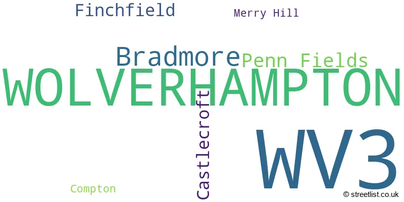
The largest settlements in the WV3 postal code are WOLVERHAMPTON and Bradmore.
The WV3 Postcode shares a border with WV1 (WOLVERHAMPTON), WV4 (WOLVERHAMPTON, Penn, Lanesfield), WV6 (WOLVERHAMPTON, Perton, Pattingham) and WV2 (WOLVERHAMPTON, Ettingshall).
The primary settlement in the WV3 postcode district is Wolverhampton, located in the West Midlands county of England. Other significant settlements in this district include Bradmore, Merry Hill, and Penn Fields. The most significant post town in the WV3 postcode district is Wolverhampton.
For the district WV3, we have data on 4 postcode sectors. Here's a breakdown: The sector WV3 0, covers Wolverhampton in West Midlands. The sector WV3 7, covers Wolverhampton in West Midlands. The sector WV3 8, covers Wolverhampton in West Midlands. The sector WV3 9, covers Wolverhampton in West Midlands.

Map of the WV3 Postcode District
Explore the WV3 postcode district by using our free interactive map.

When it comes to local government, postal geography often disregards political borders. However, for a breakdown in the WV3 District: the district mostly encompasses the City of Wolverhampton District (B) area with a total of 613 postcodes.
Recent House Sales in WV3
| Date | Price | Address |
|---|---|---|
| 20/10/2023 | £180,000 | Chelmarsh Avenue, Wolverhampton, WV3 8JA |
| 27/09/2023 | £178,000 | Worfield Gardens, Penn Fields, Wolverhampton, WV3 7EL |
| 22/09/2023 | £135,000 | Larches Lane, Chapel Ash, Wolverhampton, WV3 9PX |
| 06/09/2023 | £158,500 | Norfolk Road, Wolverhampton, WV3 0JA |
| 05/09/2023 | £180,000 | New Street, Merry Hill, Wolverhampton, WV3 7NW |
| 25/08/2023 | £265,000 | The Avenue, Castlecroft, Wolverhampton, WV3 8LR |
| 22/08/2023 | £275,000 | Marchant Road, Wolverhampton, WV3 9QG |
| 21/08/2023 | £300,000 | Westhill, Wolverhampton, WV3 9HL |
| 17/08/2023 | £375,000 | Wychbury Road, Wolverhampton, WV3 8DN |
| 16/08/2023 | £85,000 | Minsterley Close, Wolverhampton, WV3 7JB |
Weather Forecast for WV3
Press Button to Show Forecast for Bradmore
| Time Period | Icon | Description | Temperature | Rain Probability | Wind |
|---|---|---|---|---|---|
| 21:00 to 00:00 | Cloudy | 6.0°C (feels like 5.0°C) | 4.00% | NE 4 mph |
Press Button to Show Forecast for Bradmore
| Time Period | Icon | Description | Temperature | Rain Probability | Wind |
|---|---|---|---|---|---|
| 00:00 to 03:00 | Cloudy | 5.0°C (feels like 3.0°C) | 7.00% | ENE 4 mph | |
| 03:00 to 06:00 | Cloudy | 4.0°C (feels like 2.0°C) | 4.00% | ENE 4 mph | |
| 06:00 to 09:00 | Cloudy | 3.0°C (feels like 1.0°C) | 4.00% | E 4 mph | |
| 09:00 to 12:00 | Cloudy | 6.0°C (feels like 4.0°C) | 6.00% | ENE 7 mph | |
| 12:00 to 15:00 | Overcast | 9.0°C (feels like 7.0°C) | 9.00% | ENE 4 mph | |
| 15:00 to 18:00 | Cloudy | 9.0°C (feels like 9.0°C) | 9.00% | ENE 4 mph | |
| 18:00 to 21:00 | Cloudy | 9.0°C (feels like 8.0°C) | 9.00% | ENE 4 mph | |
| 21:00 to 00:00 | Partly cloudy (night) | 6.0°C (feels like 3.0°C) | 8.00% | ENE 7 mph |
Press Button to Show Forecast for Bradmore
| Time Period | Icon | Description | Temperature | Rain Probability | Wind |
|---|---|---|---|---|---|
| 00:00 to 03:00 | Partly cloudy (night) | 4.0°C (feels like 1.0°C) | 8.00% | ENE 7 mph | |
| 03:00 to 06:00 | Cloudy | 3.0°C (feels like 1.0°C) | 12.00% | NE 4 mph | |
| 06:00 to 09:00 | Cloudy | 3.0°C (feels like 1.0°C) | 10.00% | NE 7 mph | |
| 09:00 to 12:00 | Cloudy | 7.0°C (feels like 5.0°C) | 15.00% | ENE 9 mph | |
| 12:00 to 15:00 | Overcast | 9.0°C (feels like 7.0°C) | 21.00% | ENE 9 mph | |
| 15:00 to 18:00 | Overcast | 10.0°C (feels like 8.0°C) | 23.00% | ENE 9 mph | |
| 18:00 to 21:00 | Overcast | 10.0°C (feels like 7.0°C) | 20.00% | ENE 9 mph | |
| 21:00 to 00:00 | Cloudy | 7.0°C (feels like 5.0°C) | 20.00% | NE 11 mph |
Press Button to Show Forecast for Bradmore
| Time Period | Icon | Description | Temperature | Rain Probability | Wind |
|---|---|---|---|---|---|
| 00:00 to 03:00 | Cloudy | 6.0°C (feels like 3.0°C) | 19.00% | NE 9 mph | |
| 03:00 to 06:00 | Cloudy | 6.0°C (feels like 3.0°C) | 25.00% | NNE 11 mph | |
| 06:00 to 09:00 | Heavy rain | 6.0°C (feels like 3.0°C) | 75.00% | NNE 11 mph | |
| 09:00 to 12:00 | Heavy rain | 7.0°C (feels like 4.0°C) | 77.00% | NNE 11 mph | |
| 12:00 to 15:00 | Light rain | 9.0°C (feels like 6.0°C) | 55.00% | N 13 mph | |
| 15:00 to 18:00 | Light rain | 10.0°C (feels like 7.0°C) | 54.00% | NNE 11 mph | |
| 18:00 to 21:00 | Light rain shower (day) | 9.0°C (feels like 7.0°C) | 39.00% | N 9 mph | |
| 21:00 to 00:00 | Clear night | 7.0°C (feels like 5.0°C) | 11.00% | N 7 mph |
Where is the WV3 Postcode District?
The postcode district WV3 is located in Wolverhampton, a town in the West Midlands region of England. It is situated near several nearby towns, including Bilston to the South East (3.84 miles away), Willenhall to the East (4.76 miles away), and Kingswinford to the South (5.57 miles away). Additionally, WV3 is approximately 114.06 miles away from the center of London.
The district is within the post town of WOLVERHAMPTON.
The sector has postcodes within the nation of England.
The WV3 Postcode District is in the Wolverhampton region of West Midlands within the West Midlands (England).
| Postcode Sector | Delivery Office |
|---|---|
| WV3 0 | Wolverhampton Delivery Office |
| WV3 7 | Wolverhampton Delivery Office |
| WV3 8 | Wolverhampton Delivery Office |
| WV3 9 | Wolverhampton Delivery Office |
| W | V | 3 | - | X | X | X |
| W | V | 3 | Space | Numeric | Letter | Letter |
Current Monthly Rental Prices
| # Bedrooms | Min Price | Max Price | Avg Price |
|---|---|---|---|
| £475 | £675 | £558 | |
| 1 | £425 | £695 | £616 |
| 2 | £750 | £1,200 | £883 |
| 3 | £775 | £1,395 | £1,113 |
| 4 | £1,150 | £1,500 | £1,320 |
Current House Prices
| # Bedrooms | Min Price | Max Price | Avg Price |
|---|---|---|---|
| £549,999 | £549,999 | £549,999 | |
| 1 | £40,000 | £200,000 | £104,286 |
| 2 | £75,000 | £325,000 | £215,231 |
| 3 | £135,000 | £485,000 | £288,292 |
| 4 | £229,950 | £675,000 | £384,579 |
| 5 | £275,000 | £875,000 | £495,761 |
| 6 | £510,000 | £1,150,000 | £742,500 |
| 7 | £515,000 | £515,000 | £515,000 |
| 9 | £47,250 | £47,250 | £47,250 |
| 12 | £1,500,000 | £1,500,000 | £1,500,000 |
| 13 | £825,000 | £825,000 | £825,000 |
| 20 | £895,000 | £895,000 | £895,000 |
Estate Agents who Operate in the WV3 District
| Logo | Name | Brand Name | Address | Contact Number | Total Properties |
|---|---|---|---|---|---|
 | Tettenhall | Berriman Eaton | 15 High Street, Tettenhall, Wolverhampton, WV6 8QS | 01902 953057 | 33 |
 | Wolverhampton | Connells | 81-83 Darlington Street, Wolverhampton, WV1 4EX | 01902 943827 | 21 |
 | Tettenhall | Thomas Harvey | 1 The Arcade, High Street, Tettenhall, Wolverhampton, WV6 8QS | 01902 943555 | 16 |
 | covering Wolverhampton | Purplebricks | Suite 7 First Floor Cranmore Drive Shirley Solihull B90 4RZ | 020 3840 3372 | 12 |
 | Tettenhall | Peter James Property Ltd | 2 High Street, Tettenhall, Wolverhampton, WV6 8QT | 01902 953402 | 12 |
| Type of Property | 2018 Average | 2018 Sales | 2017 Average | 2017 Sales | 2016 Average | 2016 Sales | 2015 Average | 2015 Sales |
|---|---|---|---|---|---|---|---|---|
| Detached | £279,479 | 99 | £297,580 | 125 | £285,497 | 123 | £278,576 | 126 |
| Semi-Detached | £180,617 | 151 | £179,191 | 132 | £175,767 | 149 | £164,428 | 138 |
| Terraced | £136,391 | 137 | £132,886 | 123 | £123,761 | 116 | £109,296 | 95 |
| Flats | £111,105 | 52 | £95,833 | 36 | £87,312 | 39 | £92,950 | 36 |