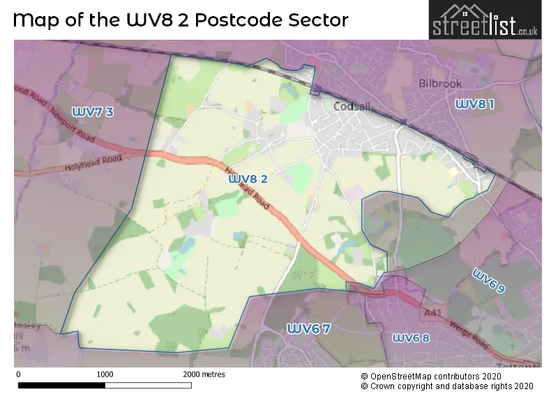
The WV8 2 postcode sector stands on the Staffordshire and West Midlands border.
Did you know? According to the 2021 Census, the WV8 2 postcode sector is home to a bustling 4,207 residents!
Given that each sector allows for 400 unique postcode combinations. Letters C, I, K, M, O and V are not allowed in the last two letters of a postcode. With 106 postcodes already in use, this leaves 294 units available.
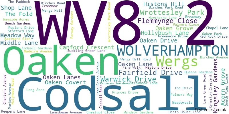
The largest settlement in the WV8 2 postal code is Codsall followed by Oaken, and WOLVERHAMPTON.
The WV8 2 Postcode shares a border with WV6 9 (WOLVERHAMPTON, Tettenhall), WV7 3 (Albrighton), WV6 7 (Perton, WOLVERHAMPTON, Pattingham) and WV8 1 (Codsall, WOLVERHAMPTON, Pendeford).
The sector is within the post town of WOLVERHAMPTON.
WV8 2 is a postcode sector within the WV8 postcode district which is within the WV Wolverhampton postcode area.
The Royal Mail delivery office for the WV8 2 postal sector is the Wolverhampton Nw Delivery Office.
The area of the WV8 2 postcode sector is 3.58 square miles which is 9.27 square kilometres or 2,291.17 square acres.
Waterways within the WV8 2 postcode sector include the River Penk, Nurton Brook, Penk.

Map of the WV8 2 Postcode Sector
Explore the WV8 2 postcode sector by using our free interactive map.
| W | V | 8 | - | 2 | X | X |
| W | V | 8 | Space | 2 | Letter | Letter |
Official List of Streets
Codsall (58 Streets)
Wrottesley Park (2 Streets)
Oaken (5 Streets)
WOLVERHAMPTON (3 Streets)
Wergs (1 Streets)
Unofficial Streets or Alternative Spellings
Codsall
DAM MILL CLOSEWOLVERHAMPTON
WERGS ROADPattingham
HOLLIES LANEAlbrighton
HOLYHEAD ROADWeather Forecast for WV8 2
Press Button to Show Forecast for Codsall
| Time Period | Icon | Description | Temperature | Rain Probability | Wind |
|---|---|---|---|---|---|
| 18:00 to 21:00 | Cloudy | 9.0°C (feels like 7.0°C) | 33.00% | NNW 9 mph | |
| 21:00 to 00:00 | Cloudy | 7.0°C (feels like 6.0°C) | 4.00% | NE 4 mph |
Press Button to Show Forecast for Codsall
| Time Period | Icon | Description | Temperature | Rain Probability | Wind |
|---|---|---|---|---|---|
| 00:00 to 03:00 | Cloudy | 5.0°C (feels like 4.0°C) | 4.00% | NE 4 mph | |
| 03:00 to 06:00 | Clear night | 4.0°C (feels like 2.0°C) | 0.00% | NNW 2 mph | |
| 06:00 to 09:00 | Sunny day | 4.0°C (feels like 2.0°C) | 0.00% | NNW 4 mph | |
| 09:00 to 12:00 | Partly cloudy (day) | 7.0°C (feels like 6.0°C) | 0.00% | N 7 mph | |
| 12:00 to 15:00 | Cloudy | 10.0°C (feels like 8.0°C) | 4.00% | N 9 mph | |
| 15:00 to 18:00 | Cloudy | 11.0°C (feels like 9.0°C) | 5.00% | N 7 mph | |
| 18:00 to 21:00 | Cloudy | 10.0°C (feels like 9.0°C) | 5.00% | N 7 mph | |
| 21:00 to 00:00 | Cloudy | 8.0°C (feels like 6.0°C) | 4.00% | N 4 mph |
Press Button to Show Forecast for Codsall
| Time Period | Icon | Description | Temperature | Rain Probability | Wind |
|---|---|---|---|---|---|
| 00:00 to 03:00 | Partly cloudy (night) | 5.0°C (feels like 4.0°C) | 0.00% | NE 4 mph | |
| 03:00 to 06:00 | Cloudy | 5.0°C (feels like 4.0°C) | 8.00% | ENE 2 mph | |
| 06:00 to 09:00 | Overcast | 6.0°C (feels like 5.0°C) | 9.00% | NNE 2 mph | |
| 09:00 to 12:00 | Cloudy | 7.0°C (feels like 5.0°C) | 14.00% | NE 7 mph | |
| 12:00 to 15:00 | Cloudy | 9.0°C (feels like 7.0°C) | 7.00% | NE 7 mph | |
| 15:00 to 18:00 | Overcast | 10.0°C (feels like 8.0°C) | 11.00% | NE 9 mph | |
| 18:00 to 21:00 | Cloudy | 10.0°C (feels like 8.0°C) | 7.00% | NE 7 mph | |
| 21:00 to 00:00 | Cloudy | 6.0°C (feels like 4.0°C) | 6.00% | ENE 4 mph |
Press Button to Show Forecast for Codsall
| Time Period | Icon | Description | Temperature | Rain Probability | Wind |
|---|---|---|---|---|---|
| 00:00 to 03:00 | Overcast | 5.0°C (feels like 3.0°C) | 9.00% | E 4 mph | |
| 03:00 to 06:00 | Overcast | 5.0°C (feels like 4.0°C) | 10.00% | E 2 mph | |
| 06:00 to 09:00 | Overcast | 5.0°C (feels like 4.0°C) | 15.00% | SSE 2 mph | |
| 09:00 to 12:00 | Cloudy | 7.0°C (feels like 6.0°C) | 15.00% | SW 4 mph | |
| 12:00 to 15:00 | Overcast | 10.0°C (feels like 8.0°C) | 20.00% | SW 9 mph | |
| 15:00 to 18:00 | Overcast | 10.0°C (feels like 8.0°C) | 19.00% | ENE 9 mph | |
| 18:00 to 21:00 | Overcast | 10.0°C (feels like 8.0°C) | 20.00% | NE 7 mph | |
| 21:00 to 00:00 | Cloudy | 9.0°C (feels like 7.0°C) | 13.00% | NE 7 mph |
Press Button to Show Forecast for Codsall
| Time Period | Icon | Description | Temperature | Rain Probability | Wind |
|---|---|---|---|---|---|
| 00:00 to 03:00 | Cloudy | 8.0°C (feels like 6.0°C) | 9.00% | NE 7 mph | |
| 03:00 to 06:00 | Overcast | 7.0°C (feels like 5.0°C) | 10.00% | NE 7 mph | |
| 06:00 to 09:00 | Cloudy | 6.0°C (feels like 3.0°C) | 6.00% | NNE 7 mph | |
| 09:00 to 12:00 | Cloudy | 8.0°C (feels like 6.0°C) | 7.00% | NE 9 mph | |
| 12:00 to 15:00 | Overcast | 10.0°C (feels like 8.0°C) | 13.00% | NNE 9 mph | |
| 15:00 to 18:00 | Cloudy | 11.0°C (feels like 9.0°C) | 9.00% | NNE 9 mph | |
| 18:00 to 21:00 | Cloudy | 10.0°C (feels like 9.0°C) | 9.00% | NNE 7 mph | |
| 21:00 to 00:00 | Partly cloudy (night) | 8.0°C (feels like 7.0°C) | 3.00% | NE 4 mph |
Schools and Places of Education Within the WV8 2 Postcode Sector
Birches First School
Academy converter
Birches Avenue, WOLVERHAMPTON, West Midlands, WV8 2JG
Head: Miss Sabrina Varricchione
Ofsted Rating: Good
Inspection: 2023-11-29 (142 days ago)
Website: Visit Birches First School Website
Phone: 01902297910
Number of Pupils: 148
House Prices in the WV8 2 Postcode Sector
| Type of Property | 2018 Average | 2018 Sales | 2017 Average | 2017 Sales | 2016 Average | 2016 Sales | 2015 Average | 2015 Sales |
|---|---|---|---|---|---|---|---|---|
| Detached | £349,282 | 28 | £372,674 | 31 | £334,368 | 31 | £279,432 | 31 |
| Semi-Detached | £239,717 | 24 | £204,648 | 23 | £252,381 | 21 | £198,015 | 36 |
| Terraced | £233,125 | 4 | £218,540 | 10 | £302,883 | 9 | £208,564 | 7 |
| Flats | £211,250 | 2 | £207,250 | 2 | £325,000 | 1 | £215,975 | 2 |
Important Postcodes WV8 2 in the Postcode Sector
WV8 2JG is the postcode for Staffordshire County Council, Birches First School, Birches Avenue
| The WV8 2 Sector is within these Local Authorities |
|
|---|---|
| The WV8 2 Sector is within these Counties |
|
| The WV8 2 Sector is within these Water Company Areas |
|