The YO10 postcode district is a postal district located in the YO York postcode area with a population of 32,478 residents according to the 2021 England and Wales Census.
The area of the YO10 postcode district is 7.37 square miles which is 19.08 square kilometres or 4,714.60 acres.
Currently, the YO10 district has about 637 postcode units spread across 3 geographic postcode sectors.
Given that each sector allows for 400 unique postcode combinations, the district has a capacity of 1,200 postcodes. With 637 postcodes already in use, this leaves 563 units available.
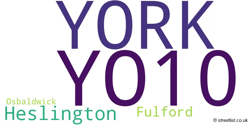
The largest settlement in the YO10 postal code is YORK followed by Heslington, and Fulford.
The YO10 Postcode shares a border with YO1 (YORK), YO19 (Dunnington, Riccall, Fulford) and YO31 (YORK, Huntington).
The primary settlement in the YO10 postcode district is York, located in the county of North Yorkshire in England. Other significant settlements within the district include Osbaldwick and Fulford. The main post town is York.
For the district YO10, we have data on 3 postcode sectors. Here's a breakdown: The sector YO10 3, covers York in North Yorkshire. The sector YO10 4, covers York and Fulford in North Yorkshire. The sector YO10 5, covers York and Heslington in North Yorkshire.

Map of the YO10 Postcode District
Explore the YO10 postcode district by using our free interactive map.

When it comes to local government, postal geography often disregards political borders. However, for a breakdown in the YO10 District: the district mostly encompasses the York (B) area with a total of 643 postcodes.
Recent House Sales in YO10
| Date | Price | Address |
|---|---|---|
| 20/10/2023 | £216,800 | Margaret Street, York, YO10 4UT |
| 16/10/2023 | £270,000 | Kexby Avenue, York, YO10 3HF |
| 13/10/2023 | £320,000 | Sussex Road, York, YO10 5HX |
| 06/10/2023 | £215,000 | Brinkworth Terrace, York, YO10 3DE |
| 29/09/2023 | £260,000 | Grasmere Drive, York, YO10 3RY |
| 26/09/2023 | £400,000 | Brentwood Crescent, York, YO10 5HU |
| 25/09/2023 | £250,000 | Lawrence Square, York, YO10 3FH |
| 22/09/2023 | £210,000 | Elvington Terrace, York, YO10 3DG |
| 15/09/2023 | £446,500 | Stirling Grove, York, YO10 4HT |
| 07/09/2023 | £950,000 | Marlborough Villas, York, YO10 4AZ |
Weather Forecast for YO10
Press Button to Show Forecast for York Racecourse
| Time Period | Icon | Description | Temperature | Rain Probability | Wind |
|---|---|---|---|---|---|
| 15:00 to 18:00 | Cloudy | 10.0°C (feels like 7.0°C) | 4.00% | N 13 mph | |
| 18:00 to 21:00 | Partly cloudy (day) | 9.0°C (feels like 6.0°C) | 1.00% | N 11 mph | |
| 21:00 to 00:00 | Cloudy | 6.0°C (feels like 3.0°C) | 3.00% | NNW 9 mph |
Press Button to Show Forecast for York Racecourse
| Time Period | Icon | Description | Temperature | Rain Probability | Wind |
|---|---|---|---|---|---|
| 00:00 to 03:00 | Cloudy | 5.0°C (feels like 2.0°C) | 4.00% | NW 9 mph | |
| 03:00 to 06:00 | Cloudy | 5.0°C (feels like 2.0°C) | 5.00% | NNW 9 mph | |
| 06:00 to 09:00 | Cloudy | 4.0°C (feels like 1.0°C) | 5.00% | NNW 9 mph | |
| 09:00 to 12:00 | Cloudy | 7.0°C (feels like 4.0°C) | 6.00% | N 11 mph | |
| 12:00 to 15:00 | Cloudy | 9.0°C (feels like 6.0°C) | 5.00% | N 13 mph | |
| 15:00 to 18:00 | Cloudy | 9.0°C (feels like 7.0°C) | 5.00% | N 11 mph | |
| 18:00 to 21:00 | Cloudy | 8.0°C (feels like 6.0°C) | 4.00% | NE 9 mph | |
| 21:00 to 00:00 | Cloudy | 6.0°C (feels like 4.0°C) | 3.00% | SE 4 mph |
Press Button to Show Forecast for York Racecourse
| Time Period | Icon | Description | Temperature | Rain Probability | Wind |
|---|---|---|---|---|---|
| 00:00 to 03:00 | Cloudy | 5.0°C (feels like 3.0°C) | 4.00% | WSW 7 mph | |
| 03:00 to 06:00 | Partly cloudy (night) | 5.0°C (feels like 2.0°C) | 3.00% | W 7 mph | |
| 06:00 to 09:00 | Cloudy | 5.0°C (feels like 3.0°C) | 7.00% | WNW 7 mph | |
| 09:00 to 12:00 | Cloudy | 8.0°C (feels like 5.0°C) | 11.00% | NNW 11 mph | |
| 12:00 to 15:00 | Cloudy | 8.0°C (feels like 6.0°C) | 11.00% | NNW 9 mph | |
| 15:00 to 18:00 | Cloudy | 9.0°C (feels like 6.0°C) | 7.00% | N 9 mph | |
| 18:00 to 21:00 | Sunny day | 8.0°C (feels like 5.0°C) | 4.00% | N 9 mph | |
| 21:00 to 00:00 | Clear night | 4.0°C (feels like 3.0°C) | 1.00% | NE 4 mph |
Press Button to Show Forecast for York Racecourse
| Time Period | Icon | Description | Temperature | Rain Probability | Wind |
|---|---|---|---|---|---|
| 00:00 to 03:00 | Partly cloudy (night) | 3.0°C (feels like 1.0°C) | 3.00% | NNE 4 mph | |
| 03:00 to 06:00 | Partly cloudy (night) | 2.0°C (feels like 0.0°C) | 4.00% | N 4 mph | |
| 06:00 to 09:00 | Cloudy | 3.0°C (feels like 2.0°C) | 6.00% | NNE 4 mph | |
| 09:00 to 12:00 | Cloudy | 7.0°C (feels like 6.0°C) | 8.00% | ENE 4 mph | |
| 12:00 to 15:00 | Overcast | 9.0°C (feels like 8.0°C) | 12.00% | E 7 mph | |
| 15:00 to 18:00 | Overcast | 9.0°C (feels like 8.0°C) | 12.00% | ESE 7 mph | |
| 18:00 to 21:00 | Cloudy | 8.0°C (feels like 6.0°C) | 9.00% | E 9 mph | |
| 21:00 to 00:00 | Cloudy | 6.0°C (feels like 4.0°C) | 10.00% | E 7 mph |
Press Button to Show Forecast for York Racecourse
| Time Period | Icon | Description | Temperature | Rain Probability | Wind |
|---|---|---|---|---|---|
| 00:00 to 03:00 | Cloudy | 5.0°C (feels like 3.0°C) | 13.00% | E 7 mph | |
| 03:00 to 06:00 | Cloudy | 5.0°C (feels like 3.0°C) | 17.00% | E 7 mph | |
| 06:00 to 09:00 | Cloudy | 6.0°C (feels like 3.0°C) | 17.00% | ENE 7 mph | |
| 09:00 to 12:00 | Overcast | 8.0°C (feels like 6.0°C) | 22.00% | E 9 mph | |
| 12:00 to 15:00 | Cloudy | 10.0°C (feels like 8.0°C) | 19.00% | E 11 mph | |
| 15:00 to 18:00 | Cloudy | 11.0°C (feels like 8.0°C) | 18.00% | E 11 mph | |
| 18:00 to 21:00 | Cloudy | 9.0°C (feels like 7.0°C) | 18.00% | ENE 9 mph | |
| 21:00 to 00:00 | Cloudy | 8.0°C (feels like 5.0°C) | 13.00% | ENE 9 mph |
Where is the YO10 Postcode District?
The YO10 postcode district is located in YORK. It is surrounded by nearby towns, including Selby to the South, Tadcaster to the South West, Wetherby to the West, and Malton to the North East. In addition, the distance from YO10 to the centre of London is approximately 172.32 miles.
The district is within the post town of YORK.
The sector has postcodes within the nation of England.
The YO10 Postcode District is in the York region of North Yorkshire within the Yorkshire and The Humber.
| Postcode Sector | Delivery Office |
|---|---|
| YO10 3 | York Central Delivery Office |
| YO10 4 | York Central Delivery Office |
| YO10 5 | York Central Delivery Office |
| Y | O | 1 | 0 | - | X | X | X |
| Y | O | 1 | 0 | Space | Numeric | Letter | Letter |
Current Monthly Rental Prices
| # Bedrooms | Min Price | Max Price | Avg Price |
|---|---|---|---|
| £800 | £1,700 | £1,025 | |
| 1 | £585 | £995 | £842 |
| 2 | £1,100 | £2,500 | £1,821 |
| 3 | £950 | £2,100 | £1,508 |
| 4 | £1,500 | £2,400 | £1,825 |
| 5 | £475 | £2,750 | £1,613 |
Current House Prices
| # Bedrooms | Min Price | Max Price | Avg Price |
|---|---|---|---|
| 1 | £75,000 | £200,000 | £149,417 |
| 2 | £135,000 | £350,000 | £246,638 |
| 3 | £200,000 | £625,000 | £342,969 |
| 4 | £325,000 | £895,000 | £546,576 |
| 5 | £850,000 | £1,550,000 | £1,058,333 |
| 6 | £1,000,000 | £1,000,000 | £1,000,000 |
| 7 | £1,000,000 | £1,000,000 | £1,000,000 |
| 8 | £850,000 | £850,000 | £850,000 |
| 10 | £1,500,000 | £1,500,000 | £1,500,000 |
| 12 | £1,450,000 | £1,450,000 | £1,450,000 |
| 18 | £3,000,000 | £3,000,000 | £3,000,000 |
Estate Agents who Operate in the YO10 District
| Logo | Name | Brand Name | Address | Contact Number | Total Properties |
|---|---|---|---|---|---|
 | York | Ashtons Estate Agents | 1 Bootham, York, YO30 7BN | 01904 935504 | 26 |
 | York | Churchills Estate Agents | 3a Bishopthorpe Road, York, YO23 1NA | 01904 935538 | 11 |
 | York | Hunters | Apollo House, Eboracum Way, Heworth Green, York YO31 7RE | 01904 935969 | 9 |
 | Micklegate | Hudson Moody | 58 Micklegate, York, YO1 6LF | 01904 935955 | 9 |
 | York | Quantum Estate Agents | 6 Walmgate, York, Yorkshire, YO1 9TY | 01904 935500 | 6 |
| Type of Property | 2018 Average | 2018 Sales | 2017 Average | 2017 Sales | 2016 Average | 2016 Sales | 2015 Average | 2015 Sales |
|---|---|---|---|---|---|---|---|---|
| Detached | £375,978 | 45 | £419,233 | 39 | £362,978 | 61 | £360,104 | 48 |
| Semi-Detached | £249,046 | 127 | £243,231 | 136 | £232,560 | 116 | £228,940 | 115 |
| Terraced | £242,386 | 113 | £250,233 | 115 | £249,903 | 120 | £219,175 | 142 |
| Flats | £166,963 | 109 | £139,517 | 238 | £162,541 | 100 | £156,067 | 92 |