The YO19 postcode district is a postal district located in the YO York postcode area with a population of 13,180 residents according to the 2021 England and Wales Census.
The area of the YO19 postcode district is 48.92 square miles which is 126.70 square kilometres or 31,307.56 acres.
Currently, the YO19 district has about 477 postcode units spread across 3 geographic postcode sectors.
Given that each sector allows for 400 unique postcode combinations, the district has a capacity of 1,200 postcodes. With 477 postcodes already in use, this leaves 723 units available.
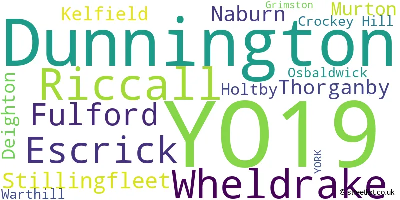
The largest settlement in the YO19 postal code is Dunnington followed by Riccall, and Fulford.
The YO19 Postcode shares a border with YO42 (Pocklington, Melbourne, Barmby Moor), YO8 (SELBY, Thorpe Willoughby, Brayton), YO10 (YORK, Heslington, Fulford), YO23 (YORK, Copmanthorpe, Bishopthorpe), YO32 (Haxby, Huntington, Strensall) and YO41 (Stamford Bridge, Wilberfoss, Elvington).
The primary settlement in the YO19 postcode district is Fulford, located in the county of North Yorkshire, England. Other significant settlements in this district include Riccall, Escrick, Dunnington, Wheldrake, and Stillingfleet. The post town for this district is York.
For the district YO19, we have data on 3 postcode sectors. Here's a breakdown: The sector YO19 4, covers Fulford and Naburn and Crockey Hill in North Yorkshire. The sector YO19 5, covers Dunnington in North Yorkshire. The sector YO19 6, covers Riccall and Wheldrake and Escrick in North Yorkshire.

Map of the YO19 Postcode District
Explore the YO19 postcode district by using our free interactive map.

When it comes to local government, postal geography often disregards political borders. However, for a breakdown in the YO19 District: the district mostly encompasses the York (B) (301 postcodes), and finally, the North Yorkshire area (182 postcodes).
Recent House Sales in YO19
| Date | Price | Address |
|---|---|---|
| 29/09/2023 | £202,000 | Hull Road, Dunnington, York, YO19 5LR |
| 27/09/2023 | £407,000 | King Rudding Close, Riccall, York, YO19 6RY |
| 27/09/2023 | £290,000 | Station Rise, Riccall, York, YO19 6JR |
| 26/09/2023 | £497,500 | Back Lane, Riccall, York, YO19 6PT |
| 20/09/2023 | £850,000 | Dower Park, Escrick, York, YO19 6JN |
| 06/09/2023 | £380,000 | Spring Bank Avenue, Dunnington, York, YO19 5PZ |
| 06/09/2023 | £680,000 | Garden Flats Lane, Dunnington, York, YO19 5NB |
| 01/09/2023 | £690,000 | Beckwith Hall Drive, Riccall, York, YO19 6SY |
| 01/09/2023 | £380,000 | Woodlands, Warthill, York, YO19 5XN |
| 01/09/2023 | £365,000 | Common Road, Dunnington, York, YO19 5NG |
Weather Forecast for YO19
Press Button to Show Forecast for York Racecourse
| Time Period | Icon | Description | Temperature | Rain Probability | Wind |
|---|---|---|---|---|---|
| 12:00 to 15:00 | Cloudy | 8.0°C (feels like 7.0°C) | 6.00% | N 7 mph | |
| 15:00 to 18:00 | Cloudy | 9.0°C (feels like 6.0°C) | 9.00% | NNW 9 mph | |
| 18:00 to 21:00 | Sunny day | 8.0°C (feels like 5.0°C) | 3.00% | NNE 9 mph | |
| 21:00 to 00:00 | Clear night | 4.0°C (feels like 2.0°C) | 1.00% | NNE 4 mph |
Press Button to Show Forecast for York Racecourse
| Time Period | Icon | Description | Temperature | Rain Probability | Wind |
|---|---|---|---|---|---|
| 00:00 to 03:00 | Clear night | 2.0°C (feels like 0.0°C) | 1.00% | NNW 4 mph | |
| 03:00 to 06:00 | Partly cloudy (night) | 1.0°C (feels like -1.0°C) | 1.00% | NNW 4 mph | |
| 06:00 to 09:00 | Cloudy | 2.0°C (feels like 0.0°C) | 4.00% | NNW 4 mph | |
| 09:00 to 12:00 | Cloudy | 7.0°C (feels like 5.0°C) | 14.00% | NNE 4 mph | |
| 12:00 to 15:00 | Cloudy | 8.0°C (feels like 7.0°C) | 8.00% | NE 4 mph | |
| 15:00 to 18:00 | Light rain shower (day) | 8.0°C (feels like 6.0°C) | 33.00% | ENE 7 mph | |
| 18:00 to 21:00 | Partly cloudy (day) | 7.0°C (feels like 6.0°C) | 8.00% | E 7 mph | |
| 21:00 to 00:00 | Clear night | 4.0°C (feels like 2.0°C) | 2.00% | ENE 4 mph |
Press Button to Show Forecast for York Racecourse
| Time Period | Icon | Description | Temperature | Rain Probability | Wind |
|---|---|---|---|---|---|
| 00:00 to 03:00 | Partly cloudy (night) | 2.0°C (feels like 1.0°C) | 2.00% | ENE 4 mph | |
| 03:00 to 06:00 | Partly cloudy (night) | 2.0°C (feels like 0.0°C) | 5.00% | NE 4 mph | |
| 06:00 to 09:00 | Partly cloudy (day) | 3.0°C (feels like 1.0°C) | 6.00% | NE 4 mph | |
| 09:00 to 12:00 | Cloudy | 8.0°C (feels like 6.0°C) | 8.00% | E 7 mph | |
| 12:00 to 15:00 | Cloudy | 10.0°C (feels like 8.0°C) | 11.00% | E 9 mph | |
| 15:00 to 18:00 | Cloudy | 10.0°C (feels like 8.0°C) | 14.00% | E 11 mph | |
| 18:00 to 21:00 | Cloudy | 9.0°C (feels like 6.0°C) | 15.00% | ENE 9 mph | |
| 21:00 to 00:00 | Cloudy | 6.0°C (feels like 4.0°C) | 13.00% | NE 7 mph |
Press Button to Show Forecast for York Racecourse
| Time Period | Icon | Description | Temperature | Rain Probability | Wind |
|---|---|---|---|---|---|
| 00:00 to 03:00 | Cloudy | 6.0°C (feels like 3.0°C) | 15.00% | NE 9 mph | |
| 03:00 to 06:00 | Cloudy | 7.0°C (feels like 4.0°C) | 19.00% | NNE 11 mph | |
| 06:00 to 09:00 | Light rain | 7.0°C (feels like 4.0°C) | 53.00% | NNE 11 mph | |
| 09:00 to 12:00 | Heavy rain | 9.0°C (feels like 6.0°C) | 75.00% | NNE 13 mph | |
| 12:00 to 15:00 | Light rain | 10.0°C (feels like 7.0°C) | 55.00% | NE 13 mph | |
| 15:00 to 18:00 | Light rain shower (day) | 10.0°C (feels like 7.0°C) | 43.00% | NNE 11 mph | |
| 18:00 to 21:00 | Cloudy | 9.0°C (feels like 7.0°C) | 15.00% | NE 9 mph | |
| 21:00 to 00:00 | Partly cloudy (night) | 7.0°C (feels like 5.0°C) | 10.00% | SSW 7 mph |
Where is the YO19 Postcode District?
The YO19 postcode district is located in YORK. It is situated approximately 7.3 miles south of SELBY, 10.1 miles west of TADCASTER, 16 miles southwest of KNOTTINGLEY, 18.8 miles northeast of MALTON, and 19.9 miles southeast of BROUGH. Additionally, the YO19 postcode district is about 169.3 miles away from the center of London.
The district is within the post town of YORK.
The sector has postcodes within the nation of England.
The YO19 Postcode District is covers the following regions.
- York - North Yorkshire - Yorkshire and The Humber
- North Yorkshire CC - North Yorkshire - Yorkshire and The Humber
| Postcode Sector | Delivery Office |
|---|---|
| YO19 4 | York Central Delivery Office |
| YO19 5 | York Central Delivery Office |
| YO19 6 | York Central Delivery Office |
| Y | O | 1 | 9 | - | X | X | X |
| Y | O | 1 | 9 | Space | Numeric | Letter | Letter |
Current Monthly Rental Prices
| # Bedrooms | Min Price | Max Price | Avg Price |
|---|---|---|---|
| 2 | £1,100 | £1,300 | £1,200 |
| 3 | £950 | £1,450 | £1,200 |
| 4 | £1,800 | £4,000 | £2,767 |
Current House Prices
| # Bedrooms | Min Price | Max Price | Avg Price |
|---|---|---|---|
| £60,000 | £500,000 | £265,000 | |
| 2 | £155,000 | £625,000 | £342,368 |
| 3 | £220,000 | £1,375,000 | £429,798 |
| 4 | £325,000 | £1,395,000 | £603,194 |
| 5 | £400,000 | £1,395,000 | £745,000 |
| 6 | £899,500 | £1,100,000 | £999,750 |
| 8 | £695,000 | £695,000 | £695,000 |
| 9 | £995,000 | £995,000 | £995,000 |
Estate Agents who Operate in the YO19 District
| Logo | Name | Brand Name | Address | Contact Number | Total Properties |
|---|---|---|---|---|---|
 | York | Ashtons Estate Agents | 1 Bootham, York, YO30 7BN | 01904 935504 | 14 |
 | York | Stephensons | 17 Colliergate York YO1 8BP | 01904 935659 | 12 |
 | Harrogate | FSS | 8 Raglan Street, Harrogate, HG1 1LE | 01423 228038 | 8 |
 | York | Churchills Estate Agents | 3a Bishopthorpe Road, York, YO23 1NA | 01904 935538 | 7 |
 | Dunnington | Hudson Moody | 16 York Street Dunnington YO19 5PN | 01904 935626 | 7 |
| Type of Property | 2018 Average | 2018 Sales | 2017 Average | 2017 Sales | 2016 Average | 2016 Sales | 2015 Average | 2015 Sales |
|---|---|---|---|---|---|---|---|---|
| Detached | £376,022 | 136 | £359,476 | 120 | £349,744 | 123 | £355,901 | 124 |
| Semi-Detached | £241,122 | 55 | £224,767 | 55 | £232,231 | 48 | £224,384 | 52 |
| Terraced | £247,158 | 37 | £200,722 | 29 | £202,944 | 24 | £179,331 | 24 |
| Flats | £150,833 | 6 | £157,750 | 2 | £149,354 | 8 | £117,000 | 4 |