Given that each sector allows for 400 unique postcode combinations. Letters C, I, K, M, O and V are not allowed in the last two letters of a postcode. With 230 postcodes already in use, this leaves 170 units available.
The largest settlement in the AB54 4 postal code is Rhynie followed by HUNTLY, and Cairnie.
The AB54 4 Postcode shares a border with AB55 6 (Newmill, Grange, Mulben), AB54 8 (HUNTLY), AB33 8 (ALFORD, Glenkindie, Keig), AB36 8 (STRATHDON, Corgarff, Glenbuchat), AB37 9 (Tomintoul, Glenlivet, BALLINDALLOCH), AB52 6 (INSCH, Oyne, Old Rayne), AB54 6 (Forgue, Drumblade, HUNTLY), AB54 7 (Aberchirder, Rothiemay, Bridge Of Marnoch), AB55 4 (Dufftown, Glenrinnes, Auchindoun) and AB55 5 (KEITH, Drummuir, Botriphnie).
The sector is within the post town of HUNTLY.
AB54 4 is a postcode sector within the AB54 postcode district which is within the AB Aberdeen postcode area.
The Royal Mail delivery office for the AB54 4 postal sector is the Huntly Delivery Office.
The area of the AB54 4 postcode sector is 201.12 square miles which is 520.90 square kilometres or 128,716.47 square acres.


Map of the AB54 4 Postcode Sector
Explore the AB54 4 postcode sector by using our free interactive map.
| A | B | 5 | 4 | - | 4 | X | X |
| A | B | 5 | 4 | Space | 4 | Letter | Letter |
Official List of Streets
Lumsden (7 Streets)
Cairnie (2 Streets)
Rhynie (14 Streets)
Glass (1 Streets)
HUNTLY (4 Streets)
Ruthven (1 Streets)
Unofficial Streets or Alternative Spellings
HUNTLY
BLEACHFIELD STREET BURNSIDE ROAD DEVERON ROAD ROWAN AVENUE SETON TERRACE STEVEN ROAD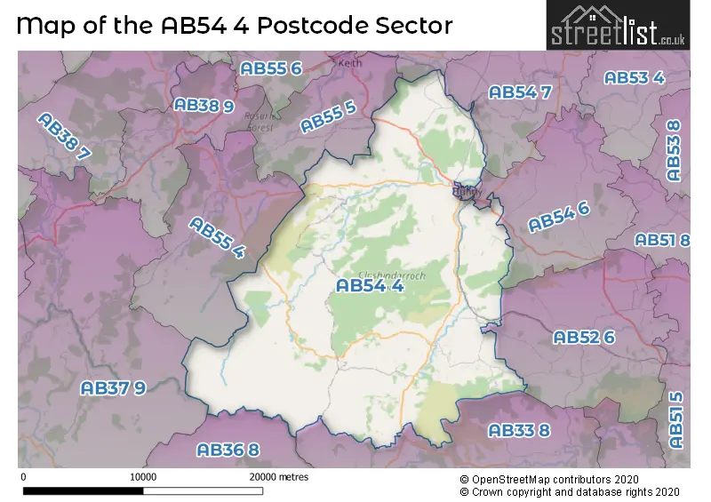
| The AB54 4 Sector is within these Local Authorities | |
|---|---|
| The AB54 4 Sector is within these Counties | |
| The AB54 4 Sector is within these Water Company Areas |