Map of Griffin Way South
| Street Crime (updated 04/05/2024) | ||
|---|---|---|
| Location Note | Central Point of Street - Not Actual Location | |
| MSOA Info | For MSOA E02004756 (Statistical Neighbourhood) | |
| Click Hint | Click on a Circle for a detailed breakdown below map. | |
| Crime Levels |
Green = Very Low Yellow = Low Orange = High Red = Very High |
|
| Postcodes | ||
| Icon | Postcodes for Griffin Way South | |
| Walking Distances | ||
| Distance Info | Green Circle = 10 Minutes Walk (800 metres) | |
About Griffin Way South
Griffin Way South is a street located in the village of Hook. It uses the postcode RG27 9RW. The street has a length of approximately 2,288 metres.
The street is publicly maintained which means that the road is adopted and Hampshire is responsible for the repair and upkeep of the highway.
Griffin Way South is located within the Hart District Council's jurisdiction. They provide various services, like refuse collection, and manage council tax collection. It's situated in the South East region of the UK.
Griffin Way South has been assigned the Unique Street Reference Number of 16709475 and 16700140 in the National Street Gazetteer.
Griffin Way South is located within the county of Hampshire, situated in the South East region of the UK. It's 39.61 miles South West from central London., 5.55 miles East from Basingstoke, 12.1 miles South from Reading and 16.87 miles West from Guildford.
Griffin Way South is within the Post Town of HOOK
David Caldwell Griffin Way South

Do you know why this road is called Griffin Way South?
What's it like to live here?
Ask the community a question about Griffin Way South.
Do you have any questions, memories to share or know any facts about Griffin Way South? We'd love to know more.
Reader Comments for Griffin Way South
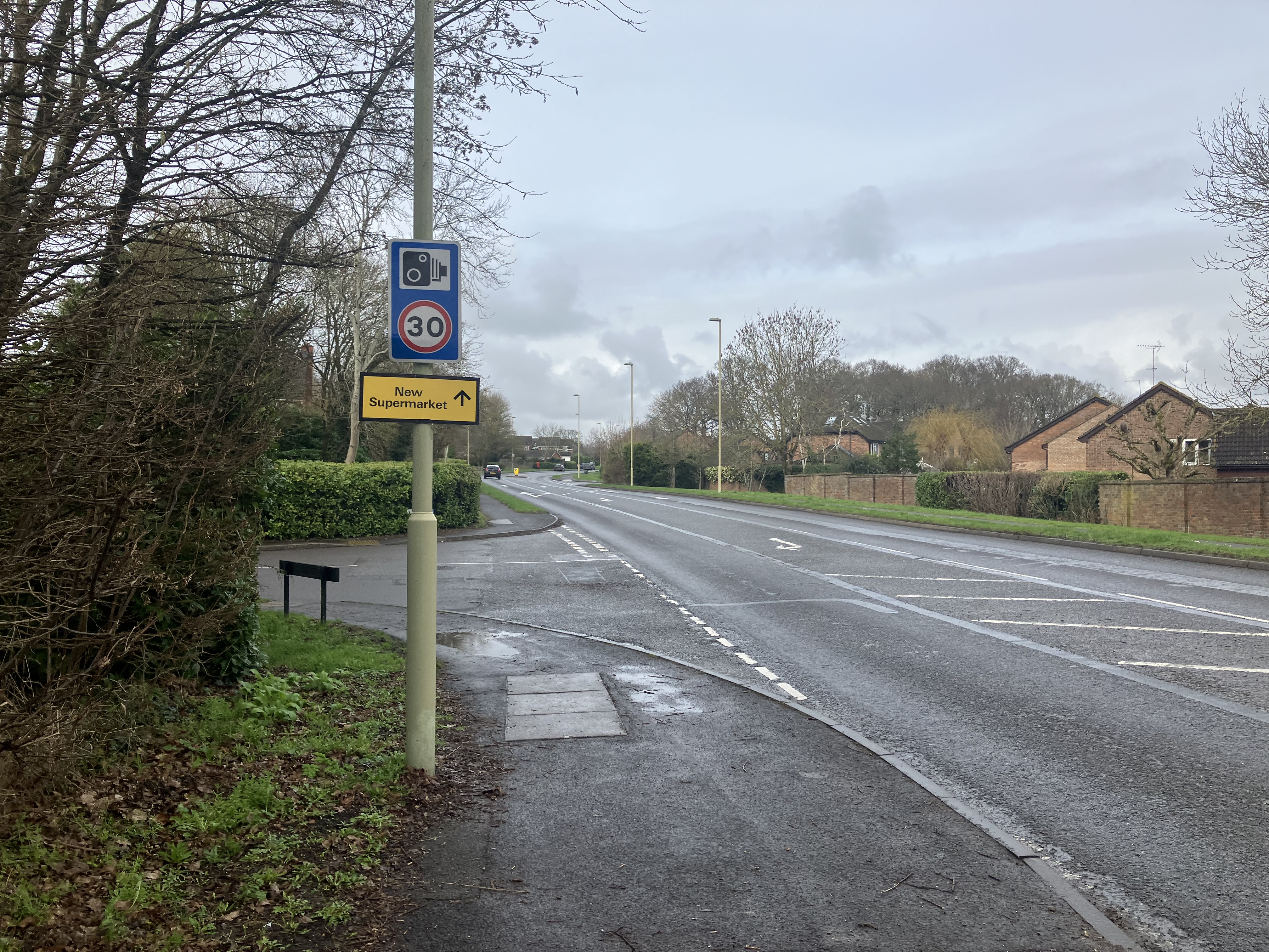
The cars that do obey the speed limit get aggressively tailgated by other cars.
As a pedestrian it can be difficult to cross due to the volume and speed of traffic. It can only be a matter of time before a serious accident.
Also on streetlist.co.uk, can you help?
Swing Swang Lane
28th April 2024
I am trying to find out why the lane is named Swing Swang?
It has been known known this since at least 1905 when hedge making contents used to be held here.
Swing Swang is often used to describe a fairground ride. I remember Swing Boats. Were they a bit like this or is Swing Swang another name for swings?
Swing Swangs are also mentioned in connection to orchards. Or were orchards just good places to have swings?
Estate Agents near Griffin Way South
| Name | Address | Website |
|---|---|---|
| Bridges Estate Agents | 3 Fairholme Parade Station Road Hook RG27 9HE | Visit Website |
| Hook Homes.com | Phillips House, Station Road, Hook, RG27 9HD | Visit Website |
| Mackenzie Smith | 1 Aldridge House, Elms Road, Hook RG27 9DG | Visit Website |
We have found 1 postcode for Griffin Way South
Location Details
| Griffin Way South | |
|---|---|

| |
| Latitude | 51.280486 |
| Longitude | -0.953920 |
| OS Easting (X): | 472951 |
| OS Northing (Y): | 154058 |
| OS Grid Reference: | SU730541 |
Neighbourhood Policing |
| Police Force: Hampshire |
 View Neighbourhood Crime and Policing View Neighbourhood Crime and Policing |
| Find a Local Neighbourhood Watch Scheme |
Frequently asked Questions for Griffin Way South
What Council (Local Authority) is Griffin Way South in?
Griffin Way South is located within the local authority area of Hart Council which is a District Council.
What Parish Council is Griffin Way South in?
Griffin Way South is located within the area of Hook Parish Council.
What Electoral Ward is Griffin Way South in?
Griffin Way South is located within the ward of Hook.
What County is Griffin Way South in?
Griffin Way South is located within the ceremonial county of Hampshire.
What Constituency is Griffin Way South in?
Griffin Way South is located within the constituency of North East Hampshire.
What Part of the UK is Griffin Way South in?
Griffin Way South is located within the South East (England) region of the United Kingdom.
What County Council area is Griffin Way South in?
Griffin Way South is located within the Hampshire Council area.
What Police Force area is Griffin Way South in?
Griffin Way South is located within the Hampshire Police area.
Roads that have a Junction with Griffin Way South
| Street | Junction Type |
|---|---|
| Station Road | roundabout |
| Bartley Way | junction |
| Wild Herons | junction |
| Quince Tree Way | junction |
| Bow Field | junction |
| Ravenscroft | junction |
| Four Acre Coppice | junction |
| London Road (A30) | roundabout |
| Bartley Way | roundabout |
| Bartley Way | roundabout |
Sunset and Sunrise times for Griffin Way South , RG27 9RW
| Sunrise | 05:15 |
|---|---|
| Sunset | 20:44 |
Latest Weather Conditions for Griffin Way South, RG27 9RW
| Observed at Weather Station: | Odiham 11 May 2024 at 12:00 (2.97 miles away) |
|---|---|
| Current Weather: | Sunny day |
| Temperature and Humidity: | 21.2°C (55.8%) |
| Wind Direction and Speed: | ENE (10 mph) |
Population Statistics
| ONS Area Code | E00116282 |
|---|---|
| ONS Area Name | Established Farming Communities |
| Average Age | 38.39 |
| Area Population | 2365.00 |
| Male Population | 1180.00 (50%) |
| Female Population | 1185.00 (50%) |
| Benefit Claimants | 8 (0%) |
| LSOA Code: | E01022881 |
|---|---|
| LSOA Name: | Hart 006A |
| SOA Code: | 3a |
| SOA Name: | |
| MSOA Code: | E02004756 |
| MSOA Name: | Hart 006 |
Nearest Supermarkets
| Tesco Hook Superstore |
|---|
| Station Rd, Hook, RG27 9JE |
| 0345 677 9352 |
| Distance: 0.29 Miles |
| Directions from Griffin Way South to Tesco Hook Superstore |
| Morrisons Fleet |
|---|
| Elvetham Heath, Fleet GU51 1GY |
| 01252 786050 |
| Distance: 4.24 Miles |
| Directions from Griffin Way South to Morrisons Fleet |
| Waitrose At Fleet South Services |
|---|
| M3 Motorway, Junction 4a/5, Fleet, Hampshire, GU51 1AA |
| 01252 621656 |
| Distance: 4.32 Miles |
| Directions from Griffin Way South to Waitrose At Fleet South Services |
| Waitrose At Fleet North Services |
|---|
| M3 Motorway, Junction 4a/5, Fleet, Hampshire, GU51 1AA |
| 0800 188 884 |
| Distance: 4.38 Miles |
| Directions from Griffin Way South to Waitrose At Fleet North Services |
Telephone Information
| Area Code |
|---|
| Area Code: 01256 - Basingstoke |
| Area Code: 01420 - Alton |
| Area Code: 01252 - Aldershot |
Local Government
| Local Council Details |
|---|
| Within the area of Hart |
| Visit the Council's Website |
| Civic Offices, Harlington Way, Fleet, Hants &GU51 4AE |
| Send email |
| Telephone Number: 01252 622122 |
| Local Member of Parliament |
|---|
| Within the Westminster Parliamentary Constituency of North East Hampshire |
| The Member of Parliament is Ranil Jayawardena |
| Details for the MP Ranil Jayawardena on parliament.uk |
| Details for the MP Ranil Jayawardena on theyworkforyou.com |
| In the 2019 General Election Ranil Jayawardena won with a majority of 20,211 the result was Con hold. The total electorate was 78,954 |
| Wards, Parish Councils and County Councils |
|---|
| Ward: Hook Ward |
| Parish: Hook Parish Council |
| Ceremonial County: Hampshire |
Nearest Schools
England Primary Schools
Mayhill Junior School
Address: Mayhill Junior School, The Bury, Odiham, Hook, Hampshire, RG29 1NB
Distance: 2.00 miles
Contact: 01256702973
Hook Junior School
Address: Hook Junior School, Ravenscroft, Hook, Hampshire, RG27 9NN
Distance: 0.24 miles
Contact: 01256762468
Hook Infant School
Address: Hook Infant School, Church View, Hook, Hampshire, RG27 9NR
Distance: 0.28 miles
Contact: 01256764487
Whitewater Church of England Primary School
Address: Whitewater Church of England Primary School, The Street, Rotherwick, Hook, Hampshire, RG27 9BG
Distance: 1.82 miles
Contact: 01256762637
England Secondary Schools
Robert May's School
Address: Robert May's School, West Street, Odiham, Hook, Hampshire, RG29 1NA
Distance: 1.89 miles
Contact: 01256702700
Nearest Hospitals
| Odiham Cottage Hospital |
|---|
| Address: Buryfields, Odiham, Hook, RG29 1NE, |
| Independent Sector |
| Southern Health NHS Foundation Trust |
| Telephone: 01256 393600 |
| Distance: 3.34 (miles) |
| Directions from to Odiham Cottage Hospital |
| Fleet Community Hospital |
|---|
| Address: Church Road, Fleet, GU51 4LZ, |
| Independent Sector |
| Southern Health NHS Foundation Trust |
| Telephone: 01252 813800 |
| Distance: 7.36 (miles) |
| Directions from to Fleet Community Hospital |
| Spire Clare Park Hospital |
|---|
| Address: Crondall Lane, Farnham, GU10 5XX, |
| Independent Sector |
| Spire Healthcare |
| Telephone: 01252 850216 |
| Visit Hospital Website |
| Distance: 9.62 (miles) |
| Directions from to Spire Clare Park Hospital |
Nearest Dentists
Dentists near Griffin Way South
HOOK DENTAL
Address: STANLEY HOUSE, LONDON ROAD, HOOK, HAMPSHIRE, RG27 9GA
Distance: 0.38 miles
Contact: :
2 LONDON ROAD (DENTAL PRACTICE)
Address: 2 LONDON ROAD, HOOK, HAMPSHIRE, RG27 9DJ
Distance: 0.43 miles
Contact: :
ODIHAM DENTAL CARE
Address: 45B HIGH STREET, ODIHAM, HOOK, HAMPSHIRE, RG29 1LF
Distance: 1.95 miles
Contact: :
KING STREET DENTAL PRACTICE
Address: KING STREET, ODIHAM, HOOK, HAMPSHIRE, RG29 1NJ
Distance: 2.02 miles
Contact: :
ODIHAM DENTAL CENTRE
Address: THE DENTAL CENTRE, ODIHAM, HOOK, HAMPSHIRE, RG29 1QT
Distance: 2.79 miles
Contact: :
DENTAL SURGERY
Address: HIGH STREET, HARTLEY WINTNEY, HOOK, HAMPSHIRE, RG27 8NS
Distance: 2.94 miles
Contact: :
Nearest GP Surgeries
Doctors near Griffin Way South
HOOK SURGERY
Address: READING ROAD, HOOK, HAMPSHIRE, RG27 9ED
Distance: 0.56 miles
Contact: :
ODIHAM HEALTH CENTRE
Address: DEER PARK VIEW, ODIHAM, HOOK, HAMPSHIRE, RG29 1JY
Distance: 1.88 miles
Contact: tel: 01256 702371
WHITEWATER HEALTH
Address: THE SURGERY, 1 CHAPTER TERRACE, HARTLEY WINTNEY, HOOK, HAMPSHIRE, RG27 8QJ
Distance: 2.88 miles
Contact: tel: 01252 842087
OLD BASING SURGERY
Address: 2 LINDEN COURT, LINDEN AVENUE, OLD BASING, BASINGSTOKE, HAMPSHIRE, RG24 7HS
Distance: 3.91 miles
Contact: :
ODIHAM AND OLD BASING HEALTH CENTRES - COVID LOCAL VACCINATION SERVICE 2
Address: MANOR DRIVE, CHINEHAM, BASINGSTOKE, RG24 7AE
Distance: 3.95 miles
Contact: :
OLD BASING SURGERY (MANOR LANE)
Address: MANOR LANE, OLD BASING, BASINGSTOKE, HAMPSHIRE, RG24 7DG
Distance: 3.99 miles
Contact: :
Nearest Dispensing Chemists
Pharmacies near Griffin Way South
BOOTS
Address: FLAT 2, HOOK PARADE, STATION ROAD, HOOK, HAMPSHIRE, RG27 9HB
Distance: 0.38 miles
Contact: tel: 01256 762497
WHITEWATER PHARMACY
Address: READING ROAD, HOOK, HAMPSHIRE, RG27 9ED
Distance: 0.56 miles
Contact: tel: 07811 261922
TOUCHWOOD PHARMACY
Address: 138 HIGH STREET, ODIHAM, HOOK, RG29 1LT
Distance: 1.91 miles
Contact: tel: 01256 702218
WELLBEING PHARMACY
Address: 74 HIGH STREET, HARTLEY WINTNEY, HOOK, RG27 8NY
Distance: 2.98 miles
Contact: tel: 01252 842449
DAY LEWIS PHARMACY
Address: THE OLD BASING HEALTH CENTRE, MANOR LANE, OLD BASING, BASINGSTOKE, HAMPSHIRE, RG24 7AE
Distance: 3.95 miles
Contact: tel: 01256 477267
MORRISONS PHARMACY
Address: THE KEY, ELVETHAM HEATH WAY, FLEET, GU51 1HA
Distance: 4.23 miles
Contact: tel: 01252 625821
Nearest Opticians
Opticians near Griffin Way South
BROWN AND WHITE OPTICIANS LTD (HOOK)
Address: BOURNE HOUSE, LONDON ROAD, HOOK, HAMPSHIRE, RG27 9DJ
Distance: 0.43 miles
Contact: :
RICHARD WARD EYECARE (HARTLEY MEWS)
Address: THE OLD BAKEHOUSE, HARTLEY MEWS, HARTLEY WINTNEY, HOOK, HAMPSHIRE, RG27 8NX
Distance: 3.03 miles
Contact: :
BASINGSTOKE
Address: DISTRICT SHOPPING CENTRE, CHINEHAM, BASINGSTOKE, HAMPSHIRE, RG24 8BE
Distance: 4.54 miles
Contact: :
CHINEHAM CENTRE OPTICIANS
Address: 17 CHINEHAM SHOPPING CENTRE, CHINEHAM, BASINGSTOKE, HAMPSHIRE, RG24 8BQ
Distance: 4.58 miles
Contact: :
BROWN AND WHITE OPTICIANS LTD (FLEET)
Address: 341 FLEET ROAD, FLEET, HAMPSHIRE, GU51 3NT
Distance: 4.71 miles
Contact: :
CHEC BASINGSTOKE
Address: INOVA HOUSE, LIME TREE WAY, HAMPSHIRE INT BUSINESS PARK, BASINGSTOKE, RG24 8GG
Distance: 4.73 miles
Contact: :
Transport
Nearest Rail Stations
Hook Station is 0.34 miles away.
Address: Hook station, Station Approach / Road, Hook, Hampshire, RG27 9HS
Hook is situated on the South Western Main Line and is managed by South Western Railway.
Hook Station is staffed on a part time basis.
Winchfield Station is 2.05 miles away.
Address: Winchfield station, Station Road, Winchfield, Hampshire, RG27 8BX
Winchfield is situated on the South Western Main Line and is managed by South Western Railway.
Winchfield Station is staffed on a part time basis.
Directions from Griffin Way South to Winchfield Rail Station
Please be polite and respectful.