Map of Harbour Street
| Postcodes | ||
|---|---|---|
| Icon | Postcodes for Harbour Street | |
| Walking Distances | ||
| Distance Info | Green Circle = 10 Minutes Walk (800 metres) | |
About Harbour Street
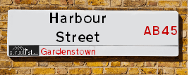
Harbour Street is a street located in Gardenstown. It uses the postcode AB45 3YT. The street has a length of approximately 106 metres.
Harbour Street is located within the Aberdeenshire Council's jurisdiction. They provide various services, like refuse collection, and manage council tax collection. It's situated in the (pseudo) Scotland region of the UK.
Harbour Street is located within the county of Banffshire, situated in the (pseudo) Scotland region of the UK. It's 436.02 miles North from central London., 37.7 miles North from Aberdeen, 71.32 miles East from Inverness and 87.32 miles North from Dundee.
Harbour Street is within the Post Town of BANFF

Do you know why this road is called Harbour Street?
What's it like to live here?
Ask the community a question about Harbour Street.
Do you have any questions, memories to share or know any facts about Harbour Street? We'd love to know more.
Also on streetlist.co.uk, can you help?
Swing Swang Lane
28th April 2024
I am trying to find out why the lane is named Swing Swang?
It has been known known this since at least 1905 when hedge making contents used to be held here.
Swing Swang is often used to describe a fairground ride. I remember Swing Boats. Were they a bit like this or is Swing Swang another name for swings?
Swing Swangs are also mentioned in connection to orchards. Or were orchards just good places to have swings?
Estate Agents near Harbour Street
| Name | Address | Website |
|---|---|---|
| Stewart & Watson | 65 High Street, Banff,AB45 1AN | Visit Website |
| Grant Smith Law Practice | The Old Bank Buildings, Balmellie Street, Turriff,AB53 4DW | Visit Website |
We have found 1 postcode for Harbour Street
Location Details
| Harbour Street | |
|---|---|

| |
| Latitude | 57.673093 |
| Longitude | -2.336397 |
| OS Easting (X): | 379936 |
| OS Northing (Y): | 864824 |
| OS Grid Reference: | NJ799648 |
Neighbourhood Policing |
| Police Force: Scotland |
| Find a Local Neighbourhood Watch Scheme |
Frequently asked Questions for Harbour Street
What Council (Local Authority) is Harbour Street in?
Harbour Street is located within the local authority area of Aberdeenshire Council which is a Scottish unitary authority.
What Parish Council is Harbour Street in?
Harbour Street is in an unparished area.
What Electoral Ward is Harbour Street in?
Harbour Street is located within the ward of Troup.
What County is Harbour Street in?
Harbour Street is located within the ceremonial county of Banffshire.
What Constituency is Harbour Street in?
Harbour Street is located within the constituency of Banff and Buchan.
What Part of the UK is Harbour Street in?
Harbour Street is located within the historic nation of Scotland.
What County Council area is Harbour Street in?
Harbour Street is not in a County Council area.
What Police Force area is Harbour Street in?
Harbour Street is located within the Scotland Police area.
Roads that have a Junction with Harbour Street
| Street | Junction Type |
|---|---|
| New Ground | junction |
Sunset and Sunrise times for Harbour Street , AB45 3YT
| Sunrise | 04:53 |
|---|---|
| Sunset | 21:18 |
Latest Weather Conditions for Harbour Street, AB45 3YT
| Observed at Weather Station: | Aberdeen Airport 10 May 2024 at 20:00 (32.66 miles away) |
|---|---|
| Current Weather: | Overcast |
| Temperature and Humidity: | 17.7°C (62.0%) |
| Wind Direction and Speed: | SSW (13 mph) |
Population Statistics
| ONS Area Code | S00092114 |
|---|---|
| ONS Area Name | White Professionals |
| LSOA Code: | S01007044 |
|---|---|
| LSOA Name: | Gardenstown and King Edward - 03 |
| SOA Code: | 2d |
| SOA Name: | |
| MSOA Code: | S02001328 |
| MSOA Name: | Gardenstown and King Edward |
Nearest Supermarkets
| Tesco Banff Metro |
|---|
| Carmelite St, Banff, AB45 1AF |
| 0345 677 9028 |
| Distance: 6.8 Miles |
| Directions from Harbour Street to Tesco Banff Metro |
| Tesco Turriff Superstore |
|---|
| 32 High Steet, Turriff, AB53 4EN |
| 0345 675 7122 |
| Distance: 10.5 Miles |
| Directions from Harbour Street to Tesco Turriff Superstore |
| Asda Fraserburgh |
|---|
| Watermill Road, Fraserburgh, AB43 7ED |
| 01346 589117 |
| Distance: 11.27 Miles |
| Directions from Harbour Street to Asda Fraserburgh |
| Tesco Fraserburgh Superstore |
|---|
| South Harbour Rd, Fraserburgh, AB43 9TE |
| 0345 677 9281 |
| Distance: 12.29 Miles |
| Directions from Harbour Street to Tesco Fraserburgh Superstore |
Telephone Information
| Area Code |
|---|
| Area Code: 01261 - Banff |
Broadband Information
| Speed | Average Speed | Median Speed | Maximum Speed | Next-generation access (NGA) | Number of Connections |
|---|---|---|---|---|---|
| Less than 2 Mbps | 6.1 | 7.4 | 7.4 | N | 7 |
Local Government
| Local Council Details |
|---|
| Within the area of Aberdeenshire |
| Visit the Council's Website |
| Woodhill House, Westburn Road, Aberdeen, Aberdeenshire &AB16 5GB |
| Telephone Number: 0845 608 1207 |
| Local Member of Parliament |
|---|
| Within the Westminster Parliamentary Constituency of Banff and Buchan |
| The Member of Parliament is David Duguid |
| Details for the MP David Duguid on parliament.uk |
| Details for the MP David Duguid on theyworkforyou.com |
| In the 2019 General Election David Duguid won with a majority of 4,118 the result was Con hold. The total electorate was 66,655 |
| Wards, Parish Councils and County Councils |
|---|
| Ward: Troup Ward |
| Ceremonial County: Banffshire |
Nearest Schools
Scotland Primary Schools
Bracoden School
Address: Bracoden School, Gamrie, Banff, BANFFSHIRE, AB45 3HA
Distance: 0.71 miles
Contact: 01261 455790
Nearest Hospitals
| Name | Address | Postcode | Distance | Map |
|---|---|---|---|---|
| Turriff Cottage Hospital | Balmellie Road, Turriff | AB53 4DQ | 16.65 Km | View Directions |
Nearest Dentists
Dentists near Harbour Street
| Name | Address | Postcode | Distance | Map |
|---|
Nearest GP Surgeries
Doctors near Harbour Street
MACDUFF MEDICAL PRACTICE
Address: MACDUFF HEALTH CLINIC, FIFE STREET, BANFF, BANFFSHIRE, AB45 1JD
Distance: 7.01 miles
Contact: tel: 03453 379933
TURRIFF MEDICAL PRACTICE
Address: TURRIFF HEALTH CENTRE, BALMELLIE ROAD, TURRIFF, ABERDEENSHIRE, AB53 4DQ
Distance: 10.35 miles
Contact: tel: 03453 376320
SALTOUN SURGERY
Address: LOCHPOTS ROAD, FRASERBURGH, AB43 9NH
Distance: 11.73 miles
Contact: tel: 01346 514154
FINLAYSON STREET PRACTICE
Address: FINLAYSON STREET SURGERY, 33 FINLAYSON STREET, FRASERBURGH, ABERDEENSHIRE, AB43 9JW
Distance: 11.98 miles
Contact: tel: 01346 518088
AN CAORANN MEDICAL PRACTICE
Address: PORTSOY SURGERY, 16 SEAFIELD TERRACE, PORTSOY, BANFF, BANFFSHIRE, AB45 2GB
Distance: 13.32 miles
Contact: tel: 03453 379966
ADEN HEALTH CENTRE
Address: NEWLANDS ROAD, MINTLAW, PETERHEAD, AB42 5GP
Distance: 15.89 miles
Contact: tel: 01771 624070
Nearest Dispensing Chemists
Pharmacies near Harbour Street
| Name | Address | Postcode | Telephone | Map | Distance in Km |
|---|
Nearest Opticians
Opticians near Harbour Street
BOOTS OPTICIANS (ELGIN)
Address: 169 HIGH STREET, ELGIN, IV30 1DW
Distance: 36.31 miles
Contact: :
COSTCO WHOLESALE UK LTD - MANDELA WAY
Address: COSTCO, ENDEAVOUR DRIVE, ARNHALL BUSINESS PARK, WESTHILL, ABERDEENSHIRE, AB32 6UF
Distance: 36.32 miles
Contact: :
VISION EXPRESS (ABERDEEN)
Address: UNIT 32, BON ACCORD CENTRE, GEORGE STREET, ABERDEEN, ABERDEENSHIRE, AB25 1HZ
Distance: 37.27 miles
Contact: :
BOOTS OPTICIANS (ABERDEEN - BON ACCORD CENTRE)
Address: BON ACCORD CENTRE, GEORGE STREET, ABERDEEN, ABERDEENSHIRE, AB25 1HZ
Distance: 37.27 miles
Contact: :
ABERDEEN DOMICILIARY SPECSAVERS LIMITED
Address: 56-58 UNION STREET, ABERDEEN, ABERDEENSHIRE, AB10 1BB
Distance: 37.41 miles
Contact: :
OPTIMAX LASER EYE CLINIC
Address: 2 GOLDEN SQUARE, ABERDEEN, ABERDEENSHIRE, AB10 1RD
Distance: 37.44 miles
Contact: :
Transport
Nearest Rail Stations
Huntly Station is 22.71 miles away.
Address: Huntly station, off Bogie St, Huntly, Aberdeenshire, AB54 5HS
Huntly is situated on the Aberdeen to Inverness line and is managed by ScotRail.
Huntly Station is staffed on a part time basis.
Keith Station is 24.37 miles away.
Address: Keith station, Station Road, Keith, Moray, AB55 3DR
Keith is situated on the Aberdeen to Inverness line and is managed by ScotRail.
Keith Station is staffed on a part time basis.