Map of Main Street
| Postcodes | ||
|---|---|---|
| Icon | Postcodes for Main Street | |
| Walking Distances | ||
| Distance Info | Green Circle = 10 Minutes Walk (800 metres) | |
About Main Street
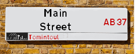
Main Street is a street located in the village of Tomintoul. The street has a length of approximately 1,244 metres.
Main Street is located within the West Moray &North East Moray Council's jurisdiction. They provide various services, like refuse collection, and manage council tax collection. It's situated in the (pseudo) Scotland region of the UK.
Main Street has the postcodes of AB37 9HA and AB37 9EX.
Main Street is located within the county of Banffshire, situated in the (pseudo) Scotland region of the UK. It's 414.25 miles North from central London., 35.9 miles South East from Inverness, 51.3 miles West from Aberdeen and 52.16 miles North from Dundee.
Main Street is within the Post Town of BALLINDALLOCH.

Do you know why this road is called Main Street?
What's it like to live here?
Ask the community a question about Main Street.
Do you have any questions, memories to share or know any facts about Main Street? We'd love to know more.
Also on streetlist.co.uk, can you help?
Eldroth Road
15th April 2024
I wondered if anyone has any old pictures of Wenning Bank House in the 1940’s and also Lane Side before of the same era .. we visited today with my Mum in law as she used to live at both these properties. Also any photos of the schools around that time .. thank you.
Can You Help?Napps Way
15th April 2024
Why is the road called Napps Way (belonging to Napp, but minus an
apostrophe as is usual with such nomenclature)? Moreover, who or
what is, or was, “Napp” in the respective, possessive case?
Several years ago, I met an elderly man (probably in his late-eighties)
who lives on Bentham Drive, Liverpool 16, and during a conversation
with him whilst in a Northwest Passenger Transport Ambulance on the
way to the former RLUH (Royal Liverpool University Hospital), he told
me that he could remember (when he was a boy, living in Childwall,
Liverpool 16) that, “Where Napps Way is now, during WW2, there was
a two-man gun emplacement on the, then, open land to protect the
railway line passing over Childwall Valley Road - next to the railway
bridge - when suddenly, as they were loading a live “shell” into the gun’s
breach, the aforementioned “shell” accidentally exploded in the gun’s
breach killing both of the two soldiers, that had been manning the gun,
instantly! (Very sad, of course, but could - perhaps - two ghosts relating
to those two, very unfortunately and prematurely-killed soldiers have
haunted that place of their deaths ever since - and have any residents
of Napps Way - formerly and in its latest incarnation - seen two, WW2
(uniformed) soldiers unexpectedly appear in or near their homes?)
Mauritius Road
15th April 2024
Why is Mauritius Road so called, since when and by whom? Does Greenwich have any particular links with Mauritius? Very interested to know. 🤞🏼
Can You Help?Estate Agents near Main Street
| Name | Address | Website |
|---|---|---|
| Masson Cairns | Strathspey House, High Street, Grantown-On-Spey, PH26 3EQ | Visit Website |
| Cockburns | 21 High Street, Grantown-On-Spey,PH26 3EG | Visit Website |
Location Details
| Main Street | |
|---|---|

| |
| Latitude | 57.164624 |
| Longitude | -3.458939 |
| OS Easting (X): | 311776 |
| OS Northing (Y): | 809119 |
| OS Grid Reference: | NJ118091 |
Ordnance Survey Maps for Main Street
If you purchase a map through the links below, we may earn an affiliate commission.
| Map Series | link | Ordnance Survey |
| Explorer 1:25,000 ol58 Braemar, Tomintoul & Glen Avon | Check Price on Amazon | Buy Direct from the Ordnance Survey |
| Explorer 1:25,000 ol61 Grantown-on-Spey & Hills of Cromdale | Check Price on Amazon | Buy Direct from the Ordnance Survey |
| Landranger 1:50,000 36 Grantown, Aviemore & Cairngorm |
Neighbourhood Policing |
| Police Force: Scotland |
| Find a Local Neighbourhood Watch Scheme |
Frequently asked Questions for Main Street
What Council (Local Authority) is Main Street in?
Main Street is located within the local authority area of West Moray &North East Moray Council which is a Scottish unitary authority.
What Parish Council is Main Street in?
Main Street is in an unparished area.
What Electoral Ward is Main Street in?
Main Street is located within the ward of Speyside Glenlivet.
What County is Main Street in?
Main Street is located within the ceremonial county of Banffshire.
What Constituency is Main Street in?
Main Street is located within the constituency of Moray.
What Part of the UK is Main Street in?
Main Street is located within the historic nation of Scotland.
What County Council area is Main Street in?
Main Street is not in a County Council area.
What Police Force area is Main Street in?
Main Street is located within the Scotland Police area.
Roads that have a Junction with Main Street
| Street | Junction Type |
|---|---|
| Smiddy Lane | junction |
| Firemans Lane | junction |
| Tailors Lane | junction |
| The Square | junction |
| Rattrays Lane | junction |
| Gordon Lane | junction |
| Mackies Lane | junction |
Sunset and Sunrise times for Main Street
| Sunrise | 05:30 |
|---|---|
| Sunset | 20:52 |
Latest Weather Conditions for Main Street
| Observed at Weather Station: | Cairn Gorm Summit 27 April 2024 at 05:00 (7.64 miles away) |
|---|---|
| Current Weather: | Clear night |
| Temperature and Humidity: | -3.9°C (95.6%) |
| Wind Direction and Speed: | SSW (10 mph) |
Population Statistics
| ONS Area Code | S00121201 & S00121754 |
|---|---|
| ONS Area Name | Ageing Rural Industry Workers & Rural Life |
| LSOA Code: | S01011045 |
|---|---|
| LSOA Name: | South Speyside and the Cabrach - 01 |
| SOA Code: | 2c |
| SOA Name: | |
| MSOA Code: | S02002073 |
| MSOA Name: | South Speyside and the Cabrach |
Nearest Supermarkets
| Tesco Aviemore Metro |
|---|
| Grampian Rd, Aviemore, PH22 1RH |
| 0345 677 9017 |
| Distance: 14 Miles |
| Directions from Main Street to Tesco Aviemore Metro |
Telephone Information
| Area Code |
|---|
Broadband Information
| Speed | Average Speed | Median Speed | Maximum Speed | Next-generation access (NGA) | Number of Connections |
|---|---|---|---|---|---|
| Greater than 2 Mbps | 7 | 8.1 | 8.1 | N | 31 |
Local Government
| Local Council Details |
|---|
| Within the area of West Moray &North East Moray |
| Visit the Council's Website |
| Council Office, High Street, Elgin, Moray &IV30 1BX |
| Telephone Number: 01343 543 451 |
| Local Member of Parliament |
|---|
| Within the Westminster Parliamentary Constituency of Moray |
| The Member of Parliament is Douglas Ross |
| Details for the MP Douglas Ross on parliament.uk |
| Details for the MP Douglas Ross on theyworkforyou.com |
| In the 2019 General Election Douglas Ross won with a majority of 513 the result was Con hold. The total electorate was 71,035 |
| Wards, Parish Councils and County Councils |
|---|
| Ward: Speyside Glenlivet Ward |
| Ceremonial County: Banffshire |
Nearest Schools
Nearest Hospitals
| Name | Address | Postcode | Distance | Map |
|---|
Nearest Dentists
Dentists near Main Street
| Name | Address | Postcode | Distance | Map |
|---|
Nearest GP Surgeries
Doctors near Main Street
BRAEMAR HEALTH CLINIC
Address: ST ANDREW'S TERRACE, BRAEMAR, BALLATER, AB35 5WR
Distance: 11.05 miles
Contact: tel: 01339 741202
GRANTOWN-ON-SPEY MEDICAL PRACTICE
Address: THE HEALTH CENTRE, CASTLE ROAD EAST, GRANTOWN-ON-SPEY, PH26 3HR
Distance: 12.98 miles
Contact: tel: 01479 872484
GLENLIVET MEDICAL PRACTICE
Address: GLENLIVET COMMUNITY SURGERY, DRUMIN, BALLINDALLOCH, AB37 9AN
Distance: 13.65 miles
Contact: tel: 01807 590273
AVIEMORE MEDICAL PRACTICE
Address: AVIEMORE HEALTH CENTRE, AVIEMORE, HIGHLAND, PH22 1SY
Distance: 14.00 miles
Contact: tel: 01479 810258
STRATHDON MEDICAL CENTRE
Address: NEWE, STRATHDON, AB36 8XB
Distance: 15.97 miles
Contact: tel: 01975 651209
BALLATER CLINIC
Address: 13 PROVOST CRAIG ROAD, BALLATER, AB35 5NN
Distance: 17.57 miles
Contact: tel: 01339 755686
Nearest Dispensing Chemists
Pharmacies near Main Street
| Name | Address | Postcode | Telephone | Map | Distance in Km |
|---|---|---|---|---|---|
| Braemar Pharmacy | 23 Mar Road, Braemar, Aberdeenshire, | AB35 5YP | 01339 741423 | View Directions |
Nearest Opticians
Opticians near Main Street
BOOTS OPTICIANS (ELGIN)
Address: 169 HIGH STREET, ELGIN, IV30 1DW
Distance: 33.85 miles
Contact: :
BOOTS OPTICIANS (EASTGATE)
Address: 16-28 EASTGATE, INVERNESS, INVERNESS-SHIRE, IV2 3NA
Distance: 35.77 miles
Contact: :
BOOTS OPTICIANS (INVERNESS - HIGH ST)
Address: 17-19 HIGH STREET, INVERNESS, INVERNESS-SHIRE, IV1 1HY
Distance: 35.85 miles
Contact: :
COSTCO WHOLESALE UK LTD - MANDELA WAY
Address: COSTCO, ENDEAVOUR DRIVE, ARNHALL BUSINESS PARK, WESTHILL, ABERDEENSHIRE, AB32 6UF
Distance: 44.24 miles
Contact: :
Transport
Nearest Rail Stations
Aviemore Station is 13.94 miles away.
Address: Aviemore station, Grampian Road, Aviemore, Highland, PH22 1PD
Aviemore is situated on the Highland Main Line and is managed by ScotRail.
Aviemore Station is staffed on a part time basis.
Carrbridge Station is 15.93 miles away.
Address: Carrbridge station, off Station Road, Carrbridge, Perthshire, PH23 3AJ
Carrbridge is situated on the Highland Main Line and is managed by ScotRail.
Carrbridge Station is an unstaffed station.