Map of St Helena Brae
| Postcodes | ||
|---|---|---|
| Icon | Postcodes for St Helena Brae | |
| Walking Distances | ||
| Distance Info | Green Circle = 10 Minutes Walk (800 metres) | |
About St Helena Brae
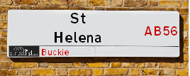
St Helena Brae is a street located in Buckie. It uses the postcode AB56 1XP. The street has a length of approximately 90 metres.
St Helena Brae is located within the West Moray &North East Moray Council's jurisdiction. They provide various services, like refuse collection, and manage council tax collection. It's situated in the (pseudo) Scotland region of the UK.
St Helena Brae is located within the county of Banffshire, situated in the (pseudo) Scotland region of the UK. It's 442.14 miles North from central London., 48.27 miles East from Inverness, 49.34 miles North West from Aberdeen and 84.16 miles North from Dundee.
St Helena Brae is within the Post Town of BUCKIE

Do you know why this road is called St Helena Brae?
What's it like to live here?
Ask the community a question about St Helena Brae.
Do you have any questions, memories to share or know any facts about St Helena Brae? We'd love to know more.
Also on streetlist.co.uk, can you help?
Swing Swang Lane
28th April 2024
I am trying to find out why the lane is named Swing Swang?
It has been known known this since at least 1905 when hedge making contents used to be held here.
Swing Swang is often used to describe a fairground ride. I remember Swing Boats. Were they a bit like this or is Swing Swang another name for swings?
Swing Swangs are also mentioned in connection to orchards. Or were orchards just good places to have swings?
Estate Agents near St Helena Brae
| Name | Address | Website |
|---|---|---|
| Grant Smith Law Practice Ltd | 16 East Church Street, Buckie,AB56 1AE | Visit Website |
| Stewart & Watson | 42-44 East Church Street, Buckie,AB56 1AB | Visit Website |
| Springfield - North Scotland, Inchgower | Seafield Circle, off Barhill Road, Buckie, AB56 5AD | Visit Website |
We have found 1 postcode for St Helena Brae
Location Details
| St Helena Brae | |
|---|---|

| |
| Latitude | 57.675928 |
| Longitude | -2.975053 |
| OS Easting (X): | 341852 |
| OS Northing (Y): | 865508 |
| OS Grid Reference: | NJ419655 |
Neighbourhood Policing |
| Police Force: Scotland |
| Find a Local Neighbourhood Watch Scheme |
Frequently asked Questions for St Helena Brae
What Council (Local Authority) is St Helena Brae in?
St Helena Brae is located within the local authority area of West Moray &North East Moray Council which is a Scottish unitary authority.
What Parish Council is St Helena Brae in?
St Helena Brae is in an unparished area.
What Electoral Ward is St Helena Brae in?
St Helena Brae is located within the ward of Buckie.
What County is St Helena Brae in?
St Helena Brae is located within the ceremonial county of Banffshire.
What Constituency is St Helena Brae in?
St Helena Brae is located within the constituency of Moray.
What Part of the UK is St Helena Brae in?
St Helena Brae is located within the historic nation of Scotland.
What County Council area is St Helena Brae in?
St Helena Brae is not in a County Council area.
What Police Force area is St Helena Brae in?
St Helena Brae is located within the Scotland Police area.
Roads that have a Junction with St Helena Brae
| Street | Junction Type |
|---|---|
| Union Terrace | junction |
Sunset and Sunrise times for St Helena Brae , AB56 1XP
| Sunrise | 04:49 |
|---|---|
| Sunset | 21:26 |
Latest Weather Conditions for St Helena Brae, AB56 1XP
| Observed at Weather Station: | Lossiemouth 13 May 2024 at 10:00 (13.05 miles away) |
|---|---|
| Current Weather: | Sunny day |
| Temperature and Humidity: | 14.5°C (80.0%) |
| Wind Direction and Speed: | E (13 mph) |
Population Statistics
| ONS Area Code | S00121516 |
|---|---|
| ONS Area Name | Industrious Transitions |
| LSOA Code: | S01011080 |
|---|---|
| LSOA Name: | Buckie West and Mains of Buckie - 03 |
| SOA Code: | 5e |
| SOA Name: | |
| MSOA Code: | S02002079 |
| MSOA Name: | Buckie West and Mains of Buckie |
Nearest Supermarkets
| Tesco Buckie Superstore |
|---|
| Highstreet, Buckie, AB56 4AB |
| 0345 026 9628 |
| Distance: 0.87 Miles |
| Directions from St Helena Brae to Tesco Buckie Superstore |
| Tesco Keith Moss St Superstore |
|---|
| Moss St, Keith, AB55 5HB |
| 0345 671 9357 |
| Distance: 9.35 Miles |
| Directions from St Helena Brae to Tesco Keith Moss St Superstore |
| Asda Elgin |
|---|
| Edgar Road, Elgin, IV30 6YQ |
| 01343 564000 |
| Distance: 12.62 Miles |
| Directions from St Helena Brae to Asda Elgin |
| Tesco Elgin Extra |
|---|
| Blackfriars Rd, Elgin, IV30 1TY |
| 0345 677 9792 |
| Distance: 12.92 Miles |
| Directions from St Helena Brae to Tesco Elgin Extra |
Telephone Information
| Area Code |
|---|
| Area Code: 01542 - Keith |
Local Government
| Local Council Details |
|---|
| Within the area of West Moray &North East Moray |
| Visit the Council's Website |
| Council Office, High Street, Elgin, Moray &IV30 1BX |
| Telephone Number: 01343 543 451 |
| Local Member of Parliament |
|---|
| Within the Westminster Parliamentary Constituency of Moray |
| The Member of Parliament is Douglas Ross |
| Details for the MP Douglas Ross on parliament.uk |
| Details for the MP Douglas Ross on theyworkforyou.com |
| In the 2019 General Election Douglas Ross won with a majority of 513 the result was Con hold. The total electorate was 71,035 |
| Wards, Parish Councils and County Councils |
|---|
| Ward: Buckie Ward |
| Ceremonial County: Banffshire |
Nearest Schools
Scotland Primary Schools
Portessie Primary School
Address: Portessie Primary School, School Road, Portessie, BUCKIE, AB56 1TN
Distance: 1.40 miles
Contact: 01542 832288
Cluny Primary School
Address: Cluny Primary School, South Pringle Street, Buckie, MORAY, AB56 1PX
Distance: 0.26 miles
Contact: 01542 831417
Millbank Primary School
Address: Millbank Primary School, McWilliam Crescent, Buckie, MORAY, AB56 1LU
Distance: 0.73 miles
Contact: 01542 831113
St Peter's RC Primary School
Address: St Peter's RC Primary School, 37 St Peter's Terrace, Buckie, MORAY, AB56 1QN
Distance: 0.11 miles
Contact: 01542 831339
Portgordon Primary School
Address: Portgordon Primary School, Richmond Terrace, Portgordon, MORAY, AB56 5RA
Distance: 1.76 miles
Contact: 01542 831198
Scotland Secondary Schools
Buckie High School
Address: Buckie High School, West Cathcart Street, Buckie, MORAY, AB56 1QB
Distance: 0.23 miles
Contact: 01542 832605
Nearest Hospitals
| Name | Address | Postcode | Distance | Map |
|---|---|---|---|---|
| Buckie Day Hospital | The Bungalow, Seafield Hospital, Buckie | AB56 1SF | 0.98 Km | View Directions |
| Seafield Hospital | Barrhill Road, Buckie | AB56 1SF | 0.98 Km | View Directions |
| Turner Memorial Hospital | Turner Street, Keith | AB55 5DJ | 14.95 Km | View Directions |
Nearest Dentists
Dentists near St Helena Brae
| Name | Address | Postcode | Distance | Map |
|---|---|---|---|---|
| BUCKIE DENTAL PRACTICE | 93 West Church Street, Buckie | AB561BS | 0.26 Km | View Directions |
| 8 TO 8 DENTAL | 32 West Church Street, Buckie | AB561HL | 0.35 Km | View Directions |
| 8TO8 DENTAL | 1 Westerton Rd North, Keith | AB555FL | 15.04 Km | View Directions |
Nearest GP Surgeries
Doctors near St Helena Brae
ARDACH HEALTH CENTRE
Address: HIGHFIELD ROAD, BUCKIE, BANFFSHIRE, AB56 1JE
Distance: 0.44 miles
Contact: tel: 03450 997200
SEAFIELD & CULLEN MEDICAL GROUP
Address: BARHILL ROAD, BUCKIE, AB56 1FP
Distance: 0.62 miles
Contact: tel: 01542 835577
FOCHABERS MEDICAL PRACTICE
Address: 12 HIGH STREET, FOCHABERS, IV32 7EP
Distance: 6.17 miles
Contact: tel: 01343 820247
KEITH MEDICAL GROUP
Address: TURNER STREET, KEITH, BANFFSHIRE, AB55 5DJ
Distance: 9.30 miles
Contact: tel: 03453 379944
AN CAORANN MEDICAL PRACTICE
Address: PORTSOY SURGERY, 16 SEAFIELD TERRACE, PORTSOY, BANFF, BANFFSHIRE, AB45 2GB
Distance: 10.29 miles
Contact: tel: 03453 379966
LINKWOOD MEDICAL
Address: THE GLASSGREEN CENTRE, 2 THORNHILL DRIVE, ELGIN, MORAYSHIRE, IV30 6GQ
Distance: 12.08 miles
Contact: tel: 03453 376350
Nearest Dispensing Chemists
Pharmacies near St Helena Brae
| Name | Address | Postcode | Telephone | Map | Distance in Km |
|---|---|---|---|---|---|
| Norvick Pharmacies Ltd | 12 St Andrews Square, Buckie, Moray, | AB56 1BU | 01542 833321 | View Directions | |
| Norvik Pharmacies Ltd | 3 Seaview Road, Findochty | AB56 1QX | 01542 832162 | View Directions | |
| Norvik Pharmacies Ltd | 1 High Street, Buckie | AB56 1AL | 01542 831116 | View Directions |
Nearest Opticians
Opticians near St Helena Brae
BOOTS OPTICIANS (ELGIN)
Address: 169 HIGH STREET, ELGIN, IV30 1DW
Distance: 12.80 miles
Contact: :
COSTCO WHOLESALE UK LTD - MANDELA WAY
Address: COSTCO, ENDEAVOUR DRIVE, ARNHALL BUSINESS PARK, WESTHILL, ABERDEENSHIRE, AB32 6UF
Distance: 44.73 miles
Contact: :
BOOTS OPTICIANS (EASTGATE)
Address: 16-28 EASTGATE, INVERNESS, INVERNESS-SHIRE, IV2 3NA
Distance: 48.17 miles
Contact: :
BOOTS OPTICIANS (INVERNESS - HIGH ST)
Address: 17-19 HIGH STREET, INVERNESS, INVERNESS-SHIRE, IV1 1HY
Distance: 48.29 miles
Contact: :
VISION EXPRESS (ABERDEEN)
Address: UNIT 32, BON ACCORD CENTRE, GEORGE STREET, ABERDEEN, ABERDEENSHIRE, AB25 1HZ
Distance: 48.85 miles
Contact: :
BOOTS OPTICIANS (ABERDEEN - BON ACCORD CENTRE)
Address: BON ACCORD CENTRE, GEORGE STREET, ABERDEEN, ABERDEENSHIRE, AB25 1HZ
Distance: 48.85 miles
Contact: :
Transport
Nearest Rail Stations
Keith Station is 8.67 miles away.
Address: Keith station, Station Road, Keith, Moray, AB55 3DR
Keith is situated on the Aberdeen to Inverness line and is managed by ScotRail.
Keith Station is staffed on a part time basis.
Elgin Station is 12.63 miles away.
Address: Elgin station, Station Road, Elgin, Moray, IV30 1QP
Elgin is situated on the Aberdeen to Inverness line and is managed by ScotRail.
Elgin Station is staffed on a part time basis.