Map of The Square
| Postcodes | ||
|---|---|---|
| Icon | Postcodes for The Square | |
| Walking Distances | ||
| Distance Info | Green Circle = 10 Minutes Walk (800 metres) | |
About The Square
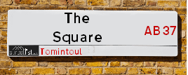
The Square is a street located in the village of Tomintoul. It uses the postcode AB37 9ET. The street has a length of approximately 150 metres.
The Square is located within the West Moray &North East Moray Council's jurisdiction. They provide various services, like refuse collection, and manage council tax collection. It's situated in the (pseudo) Scotland region of the UK.
The Square is located within the county of Banffshire, situated in the (pseudo) Scotland region of the UK. It's 418.88 miles North from central London., 35.19 miles South East from Inverness, 48.81 miles West from Aberdeen and 56.94 miles North from Dundee.
The Square is within the Post Town of BALLINDALLOCH

Do you know why this road is called The Square?
What's it like to live here?
Ask the community a question about The Square.
Do you have any questions, memories to share or know any facts about The Square? We'd love to know more.
Also on streetlist.co.uk, can you help?
Swing Swang Lane
28th April 2024
I am trying to find out why the lane is named Swing Swang?
It has been known known this since at least 1905 when hedge making contents used to be held here.
Swing Swang is often used to describe a fairground ride. I remember Swing Boats. Were they a bit like this or is Swing Swang another name for swings?
Swing Swangs are also mentioned in connection to orchards. Or were orchards just good places to have swings?
Estate Agents near The Square
| Name | Address | Website |
|---|---|---|
| Masson Cairns | Strathspey House, High Street, Grantown-On-Spey, PH26 3EQ | Visit Website |
| Cockburns | 21 High Street, Grantown-On-Spey,PH26 3EG | Visit Website |
We have found 1 postcode for The Square
Location Details
| The Square | |
|---|---|

| |
| Latitude | 57.251730 |
| Longitude | -3.379499 |
| OS Easting (X): | 316776 |
| OS Northing (Y): | 818714 |
| OS Grid Reference: | NJ168187 |
Neighbourhood Policing |
| Police Force: Scotland |
| Find a Local Neighbourhood Watch Scheme |
Frequently asked Questions for The Square
What Council (Local Authority) is The Square in?
The Square is located within the local authority area of West Moray &North East Moray Council which is a Scottish unitary authority.
What Parish Council is The Square in?
The Square is in an unparished area.
What Electoral Ward is The Square in?
The Square is located within the ward of Speyside Glenlivet.
What County is The Square in?
The Square is located within the ceremonial county of Banffshire.
What Constituency is The Square in?
The Square is located within the constituency of Moray.
What Part of the UK is The Square in?
The Square is located within the historic nation of Scotland.
What County Council area is The Square in?
The Square is not in a County Council area.
What Police Force area is The Square in?
The Square is located within the Scotland Police area.
Roads that have a Junction with The Square
| Street | Junction Type |
|---|---|
| Cults Drive | junction |
| Main Street (A939) | junction |
| Conglass Lane | junction |
Sunset and Sunrise times for The Square , AB37 9ET
| Sunrise | 04:57 |
|---|---|
| Sunset | 21:21 |
Latest Weather Conditions for The Square, AB37 9ET
| Observed at Weather Station: | Cairn Gorm Summit 11 May 2024 at 17:00 (13.59 miles away) |
|---|---|
| Current Weather: | Clear night |
| Temperature and Humidity: | 11.7°C (79.1%) |
| Wind Direction and Speed: | SSE (25 mph) |
Population Statistics
| ONS Area Code | S00121202 |
|---|---|
| ONS Area Name | Ageing Rural Industry Workers |
| LSOA Code: | S01011045 |
|---|---|
| LSOA Name: | South Speyside and the Cabrach - 01 |
| SOA Code: | 2c |
| SOA Name: | |
| MSOA Code: | S02002073 |
| MSOA Name: | South Speyside and the Cabrach |
Nearest Supermarkets
| Tesco Aviemore Metro |
|---|
| Grampian Rd, Aviemore, PH22 1RH |
| 0345 677 9017 |
| Distance: 17.39 Miles |
| Directions from The Square to Tesco Aviemore Metro |
| Tesco Huntly Superstore |
|---|
| Deveron Rd, Huntly, AB54 8TS |
| 0345 026 9499 |
| Distance: 25.41 Miles |
| Directions from The Square to Tesco Huntly Superstore |
| Asda Huntly |
|---|
| Steven Road, Huntly, AB54 8SX |
| 01466 795500 |
| Distance: 25.46 Miles |
| Directions from The Square to Asda Huntly |
| Tesco Keith Moss St Superstore |
|---|
| Moss St, Keith, AB55 5HB |
| 0345 671 9357 |
| Distance: 25.77 Miles |
| Directions from The Square to Tesco Keith Moss St Superstore |
Telephone Information
| Area Code |
|---|
Broadband Information
| Speed | Average Speed | Median Speed | Maximum Speed | Next-generation access (NGA) | Number of Connections |
|---|---|---|---|---|---|
| Less than 2 Mbps | 5.1 | 6.2 | 8.1 | N | 9 |
Local Government
| Local Council Details |
|---|
| Within the area of West Moray &North East Moray |
| Visit the Council's Website |
| Council Office, High Street, Elgin, Moray &IV30 1BX |
| Telephone Number: 01343 543 451 |
| Local Member of Parliament |
|---|
| Within the Westminster Parliamentary Constituency of Moray |
| The Member of Parliament is Douglas Ross |
| Details for the MP Douglas Ross on parliament.uk |
| Details for the MP Douglas Ross on theyworkforyou.com |
| In the 2019 General Election Douglas Ross won with a majority of 513 the result was Con hold. The total electorate was 71,035 |
| Wards, Parish Councils and County Councils |
|---|
| Ward: Speyside Glenlivet Ward |
| Ceremonial County: Banffshire |
Nearest Schools
Scotland Primary Schools
Tomintoul Primary School
Address: Tomintoul Primary School, Cults Drive, Tomintoul, BALLINDALLOCH, AB37 9HA
Distance: 0.20 miles
Contact: 01807 580271
Nearest Hospitals
| Name | Address | Postcode | Distance | Map |
|---|
Nearest Dentists
Dentists near The Square
| Name | Address | Postcode | Distance | Map |
|---|
Nearest GP Surgeries
Doctors near The Square
GLENLIVET MEDICAL PRACTICE
Address: GLENLIVET COMMUNITY SURGERY, DRUMIN, BALLINDALLOCH, AB37 9AN
Distance: 7.12 miles
Contact: tel: 01807 590273
GRANTOWN-ON-SPEY MEDICAL PRACTICE
Address: THE HEALTH CENTRE, CASTLE ROAD EAST, GRANTOWN-ON-SPEY, PH26 3HR
Distance: 10.20 miles
Contact: tel: 01479 872484
STRATHDON MEDICAL CENTRE
Address: NEWE, STRATHDON, AB36 8XB
Distance: 13.46 miles
Contact: tel: 01975 651209
ABERLOUR HEALTH CENTRE
Address: QUEENS ROAD, ABERLOUR, AB38 9PR
Distance: 16.11 miles
Contact: tel: 01340 871210
RINNES MEDICAL GROUP
Address: HEALTH CENTRE, MOUNT STREET, DUFFTOWN, KEITH, AB55 4FJ
Distance: 16.43 miles
Contact: tel: 01340 820888
BRAEMAR HEALTH CLINIC
Address: ST ANDREW'S TERRACE, BRAEMAR, BALLATER, AB35 5WR
Distance: 16.88 miles
Contact: tel: 01339 741202
Nearest Dispensing Chemists
Pharmacies near The Square
| Name | Address | Postcode | Telephone | Map | Distance in Km |
|---|
Nearest Opticians
Opticians near The Square
BOOTS OPTICIANS (ELGIN)
Address: 169 HIGH STREET, ELGIN, IV30 1DW
Distance: 27.51 miles
Contact: :
BOOTS OPTICIANS (EASTGATE)
Address: 16-28 EASTGATE, INVERNESS, INVERNESS-SHIRE, IV2 3NA
Distance: 35.07 miles
Contact: :
BOOTS OPTICIANS (INVERNESS - HIGH ST)
Address: 17-19 HIGH STREET, INVERNESS, INVERNESS-SHIRE, IV1 1HY
Distance: 35.17 miles
Contact: :
COSTCO WHOLESALE UK LTD - MANDELA WAY
Address: COSTCO, ENDEAVOUR DRIVE, ARNHALL BUSINESS PARK, WESTHILL, ABERDEENSHIRE, AB32 6UF
Distance: 41.82 miles
Contact: :
ASDA OPTICIANS (BRIDGE OF DEE)
Address: ASDA STORES LTD, GARTHDEE ROAD, BRIDGE OF DEE, ABERDEEN, ABERDEENSHIRE, AB10 7QA
Distance: 47.84 miles
Contact: :
4637 PORTLETHEN
Address: ASDA STORES LTD, MUIREND ROAD, PORTLETHEN, ABERDEEN, ABERDEENSHIRE, AB12 4XP
Distance: 48.28 miles
Contact: :
Transport
Nearest Rail Stations
Carrbridge Station is 16.87 miles away.
Address: Carrbridge station, off Station Road, Carrbridge, Perthshire, PH23 3AJ
Carrbridge is situated on the Highland Main Line and is managed by ScotRail.
Carrbridge Station is an unstaffed station.
Aviemore Station is 17.34 miles away.
Address: Aviemore station, Grampian Road, Aviemore, Highland, PH22 1PD
Aviemore is situated on the Highland Main Line and is managed by ScotRail.
Aviemore Station is staffed on a part time basis.