Map of Sock Lane
| Postcodes | ||
|---|---|---|
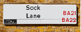
| Icon | Postcodes for Sock Lane | |
| Walking Distances | ||
| Distance Info | Green Circle = 10 Minutes Walk (800 metres) | |
About Sock Lane
Sock Lane is a street located in Mudford Sock and near Mudford Sock. The street has a length of approximately 977 metres.
Sock Lane is located within the South Somerset District Council's jurisdiction. They provide various services, like refuse collection, and manage council tax collection. It's situated in the South West region of the UK.
Sock Lane has been assigned the Unique Street Reference Number of 36610189 and 36618592 in the National Street Gazetteer.
Sock Lane is located within the county of Somerset, situated in the South West region of the UK. It's 115.25 miles West from central London., 2.03 miles North from Yeovil, 19.64 miles North West from Dorchester and 20.92 miles East from Taunton.

Do you know why this road is called Sock Lane?
What's it like to live here?
Ask the community a question about Sock Lane.
Do you have any questions, memories to share or know any facts about Sock Lane? We'd love to know more.
Also on streetlist.co.uk, can you help?
Swing Swang Lane
28th April 2024
I am trying to find out why the lane is named Swing Swang?
It has been known known this since at least 1905 when hedge making contents used to be held here.
Swing Swang is often used to describe a fairground ride. I remember Swing Boats. Were they a bit like this or is Swing Swang another name for swings?
Swing Swangs are also mentioned in connection to orchards. Or were orchards just good places to have swings?
Eldroth Road
15th April 2024
I wondered if anyone has any old pictures of Wenning Bank House in the 1940’s and also Lane Side before of the same era .. we visited today with my Mum in law as she used to live at both these properties. Also any photos of the schools around that time .. thank you.
Can You Help?Napps Way
15th April 2024
Why is the road called Napps Way (belonging to Napp, but minus an
apostrophe as is usual with such nomenclature)? Moreover, who or
what is, or was, “Napp” in the respective, possessive case?
Several years ago, I met an elderly man (probably in his late-eighties)
who lives on Bentham Drive, Liverpool 16, and during a conversation
with him whilst in a Northwest Passenger Transport Ambulance on the
way to the former RLUH (Royal Liverpool University Hospital), he told
me that he could remember (when he was a boy, living in Childwall,
Liverpool 16) that, “Where Napps Way is now, during WW2, there was
a two-man gun emplacement on the, then, open land to protect the
railway line passing over Childwall Valley Road - next to the railway
bridge - when suddenly, as they were loading a live “shell” into the gun’s
breach, the aforementioned “shell” accidentally exploded in the gun’s
breach killing both of the two soldiers, that had been manning the gun,
instantly! (Very sad, of course, but could - perhaps - two ghosts relating
to those two, very unfortunately and prematurely-killed soldiers have
haunted that place of their deaths ever since - and have any residents
of Napps Way - formerly and in its latest incarnation - seen two, WW2
(uniformed) soldiers unexpectedly appear in or near their homes?)
Estate Agents near Sock Lane
| Name | Address | Website |
|---|---|---|
| Symonds & Sampson | 2 Court Ash, Yeovil, BA20 1HG | Visit Website |
| Stags | 4-6 Park Road, Yeovil, BA20 1DZ | Visit Website |
| Greenslade Taylor Hunt | 22 Princes Street, Yeovil, BA20 1EQ |
Location Details
| Sock Lane | |
|---|---|

| |
| Latitude | 50.970188 |
| Longitude | -2.627128 |
| OS Easting (X): | 355970 |
| OS Northing (Y): | 119222 |
| OS Grid Reference: | ST560192 |
Ordnance Survey Maps for Sock Lane
If you purchase a map through the links below, we may earn an affiliate commission.
| Map Series | link | Ordnance Survey |
| Explorer 1:25,000 129 Yeovil and Sherbourne | Check Price on Amazon | Buy Direct from the Ordnance Survey |
| Landranger 1:50,000 183 Yeovil & Frome | Check Price on Amazon | Buy Direct from the Ordnance Survey |
Neighbourhood Policing |
| Police Force: Avon And Somerset |
 View Neighbourhood Crime and Policing View Neighbourhood Crime and Policing |
| Find a Local Neighbourhood Watch Scheme |
Frequently asked Questions for Sock Lane
What Council (Local Authority) is Sock Lane in?
Sock Lane is located within the local authority area of South Somerset Council which is a District Council.
What Parish Council is Sock Lane in?
Sock Lane is located within the area of Mudford Parish Council.
What Electoral Ward is Sock Lane in?
Sock Lane is located within the ward of Northstone &Ivelchester & St Michael's.
What County is Sock Lane in?
Sock Lane is located within the ceremonial county of Somerset.
What Constituency is Sock Lane in?
Sock Lane is located within the constituency of Yeovil.
What Part of the UK is Sock Lane in?
Sock Lane is located within the South West (England) region of the United Kingdom.
What County Council area is Sock Lane in?
Sock Lane is located within the Somerset Council area.
What Police Force area is Sock Lane in?
Sock Lane is located within the Avon and Somerset Police area.
Roads that have a Junction with Sock Lane
| Street | Junction Type |
|---|---|
| Stone Lane | junction |
| Sock Hill | junction |
Sunset and Sunrise times for Sock Lane
| Sunrise | 05:35 |
|---|---|
| Sunset | 20:39 |
Latest Weather Conditions for Sock Lane
| Observed at Weather Station: | Yeovilton 4 May 2024 at 08:00 (2.54 miles away) |
|---|---|
| Current Weather: | Sunny day |
| Temperature and Humidity: | 11.5°C (90.5%) |
| Wind Direction and Speed: | ESE (3 mph) |
Population Statistics
| ONS Area Code | E00148747 |
|---|---|
| ONS Area Name | Established Farming Communities |
| Average Age | 38.53 |
| Area Population | 3013.00 |
| Male Population | 1898.00 (63%) |
| Female Population | 1115.00 (37%) |
| Benefit Claimants | 9 (0%) |
| LSOA Code: | E01029199 |
|---|---|
| LSOA Name: | South Somerset 006D |
| SOA Code: | 2a |
| SOA Name: | |
| MSOA Code: | E02006080 |
| MSOA Name: | South Somerset 006 |
Nearest Supermarkets
| Tesco Cavalier Way Express |
|---|
| 2 Cavalier Way, Yeovil, BA21 5UB |
| 0345 610 6716 |
| Distance: 1.16 Miles |
| Directions from Sock Lane to Tesco Cavalier Way Express |
| Tesco Ilchester Rd Express |
|---|
| 147 Ilchester Rd, Yeovil, BA21 3BL |
| 0345 610 2883 |
| Distance: 1.44 Miles |
| Directions from Sock Lane to Tesco Ilchester Rd Express |
| Iceland Yeovil |
|---|
| Unit 20 Ivel Square, Quedam Shopping Centre, Yeovil, BA20 1EY |
| 01935479862 |
| Distance: 1.94 Miles |
| Directions from Sock Lane to Iceland Yeovil |
| Tesco Yeovil Extra |
|---|
| Queensway, Huish, Yeovil, BA20 1DL |
| 0345 677 9758 |
| Distance: 1.99 Miles |
| Directions from Sock Lane to Tesco Yeovil Extra |
Telephone Information
| Dialling Code | Telephone Exchange | Telephone Cabinet | Fibre to the Cabinet or Fibre to the Premises |
|---|---|---|---|
| 01935 | YEOVIL - WWYEOV | P18 | FTTC |
Broadband Information
| Speed | Average Speed | Median Speed | Maximum Speed | Next-generation access (NGA) | Number of Connections |
|---|---|---|---|---|---|
| Less than 2 Mbps | 2.3 | 2.3 | 3.6 | Y | 8 |
Local Government
| Local Council Details |
|---|
| Within the area of South Somerset |
| Visit the Council's Website |
| Council Offices, Brympton Way, Yeovil, Somerset &BA20 2HT |
| Telephone Number: 01935 462 462 |
| Local Member of Parliament |
|---|
| Within the Westminster Parliamentary Constituency of Yeovil |
| The Member of Parliament is Marcus Fysh |
| Details for the MP Marcus Fysh on parliament.uk |
| Details for the MP Marcus Fysh on theyworkforyou.com |
| In the 2019 General Election Marcus Fysh won with a majority of 16,181 the result was Con hold. The total electorate was 82,468 |
| Wards, Parish Councils and County Councils |
|---|
| Ward: Northstone &Ivelchester & St Michael's Ward |
| Ceremonial County: Somerset |
Nearest Schools
England Secondary Schools
Buckler's Mead Academy
Address: Buckler's Mead Academy, St John's Road, Yeovil, Somerset, BA21 4NH
Distance: 0.94 miles
Contact:
England Primary Schools
Milford Infants' School
Address: Milford Infants' School, Glenthorne Avenue, Yeovil, Somerset, BA21 4PG
Distance: 1.15 miles
Contact: 01935475426
Milford Junior School
Address: Milford Junior School, Glenthorne Avenue, Yeovil, Somerset, BA21 4PG
Distance: 1.15 miles
Contact:
Nearest Hospitals
| Name | Address | Postcode | Distance | Map |
|---|
Nearest Dentists
Dentists near Sock Lane
| Name | Address | Postcode | Distance | Map |
|---|
Nearest GP Surgeries
Doctors near Sock Lane
OAKLANDS SURGERY
Address: BIRCHFIELD ROAD, YEOVIL, SOMERSET, BA21 5RL
Distance: 1.18 miles
Contact: tel: 01935 473068
RYALLS PARK MEDICAL CENTRE, YEOVIL
Address: MARSH LANE, YEOVIL, SOMERSET, BA21 3BA
Distance: 1.40 miles
Contact: tel: 01935 434000
THE HEALTH CENTRE
Address: ABOVE BOOTS, 37 MIDDLE STREET, YEOVIL, SOMERSET, BA20 1LS
Distance: 1.98 miles
Contact: :
PRESTON GROVE MEDICAL CENTRE, YEOVIL
Address: PRESTON GROVE, YEOVIL, SOMERSET, BA20 2BQ
Distance: 2.10 miles
Contact: tel: 01935 474353
PENN HILL SURGERY, YEOVIL
Address: ST. NICHOLAS CLOSE, YEOVIL, SOMERSET, BA20 1SB
Distance: 2.14 miles
Contact: tel: 01935 470800
ABBEY MANOR SURGERY - COVID LOCAL VACCINATION SERVICE 2
Address: THE FORUM, YEOVIL, SOMERSET, BA21 3TL
Distance: 2.15 miles
Contact: :
Nearest Dispensing Chemists
Pharmacies near Sock Lane
| Name | Address | Postcode | Telephone | Map | Distance in Km |
|---|
Nearest Opticians
Opticians near Sock Lane
ROBERT FRITH OPTOMETRISTS LTD (YEOVIL)
Address: 26-28 PRINCES STREET, YEOVIL, BA20 1EQ
Distance: 1.93 miles
Contact: :
YOEVIL EXTRA
Address: QUEENSWAY PLACE, HUISH, YEOVIL, SOMERSET, BA20 1DL
Distance: 1.99 miles
Contact: :
VISION EXPRESS (QUEENSWAY)
Address: QUEENSWAY PLACE, YEOVIL, SOMERSET, BA20 1DL
Distance: 1.99 miles
Contact: :
BOOTS OPTICIANS (YEOVIL)
Address: 39-41 MIDDLE STREET, YEOVIL, SOMERSET, BA20 1LG
Distance: 2.00 miles
Contact: :
VISION EXPRESS (YEOVIL)
Address: 44-46 MIDDLE STREET, YEOVIL, SOMERSET, BA20 1LX
Distance: 2.02 miles
Contact: :
SPECSAVERS (YEOVIL)
Address: 50-52 MIDDLE STREET, YEOVIL, SOMERSET, BA20 1LX
Distance: 2.02 miles
Contact: :
Transport
Nearest Rail Stations
Yeovil Pen Mill Station is 1.87 miles away.
Address: Yeovil Pen Mill station, Sherborne Road, Yeovil, Somerset, BA21 5DD
Yeovil Pen Mill is situated on the Heart of Wessex Line and is managed by Great Western Railway.
Yeovil Pen Mill Station is staffed on a part time basis.
Yeovil Junction Station is 3.20 miles away.
Address: Yeovil Junction station, off Newton Road, Stoford, Somerset, BA22 9UU
Yeovil Junction is situated on the South Western Main Line and is managed by South Western Railway.
Yeovil Junction Station is staffed on a part time basis.