Map of Hughes Road
| Postcodes | ||
|---|---|---|
| Icon | Postcodes for Hughes Road | |
| Walking Distances | ||
| Distance Info | Green Circle = 10 Minutes Walk (800 metres) | |
About Hughes Road
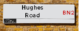
Hughes Road is a street located in the City of Brighton. It uses the postcode BN2 4AW. The street has a length of approximately 261 metres.
Hughes Road is located within the The City of Brighton and Hove (B) Council's jurisdiction. They provide various services, like refuse collection, and manage council tax collection. It's situated in the South East region of the UK.
Hughes Road has been assigned the Unique Street Reference Number of 4400814 in the National Street Gazetteer.
Hughes Road is located within the county of East Sussex, situated in the South East region of the UK. It's 45.78 miles South from central London., 1.27 miles North East from Brighton, 6.81 miles South West from Lewes and 28.4 miles East from Chichester.

Do you know why this road is called Hughes Road?
What's it like to live here?
Ask the community a question about Hughes Road.
Do you have any questions, memories to share or know any facts about Hughes Road? We'd love to know more.
Also on streetlist.co.uk, can you help?
Swing Swang Lane
28th April 2024
I am trying to find out why the lane is named Swing Swang?
It has been known known this since at least 1905 when hedge making contents used to be held here.
Swing Swang is often used to describe a fairground ride. I remember Swing Boats. Were they a bit like this or is Swing Swang another name for swings?
Swing Swangs are also mentioned in connection to orchards. Or were orchards just good places to have swings?
Estate Agents near Hughes Road
| Name | Address | Website |
|---|---|---|
| John Hilton & Co | 127 Lewes Road, BN2 3LG | Visit Website |
| Pavilion Properties | 129 Lewes Road, BN2 3LG | Visit Website |
| Avard Estate Agents | 143 Ditchling Road, Brighton, East Sussex, BN1 6JA | Visit Website |
We have found 1 postcode for Hughes Road
Location Details
| Hughes Road | |
|---|---|

| |
| Latitude | 50.837729 |
| Longitude | -0.128506 |
| OS Easting (X): | 531762 |
| OS Northing (Y): | 105975 |
| OS Grid Reference: | TQ318060 |
Neighbourhood Policing |
| Police Force: Sussex |
 View Neighbourhood Crime and Policing View Neighbourhood Crime and Policing |
| Find a Local Neighbourhood Watch Scheme |
Frequently asked Questions for Hughes Road
What Council (Local Authority) is Hughes Road in?
Hughes Road is located within the local authority area of Brighton and Hove Council which is a Unitary Authority.
What Parish Council is Hughes Road in?
Hughes Road is in an unparished area.
What Electoral Ward is Hughes Road in?
Hughes Road is located within the ward of St. Peter's and North Laine.
What County is Hughes Road in?
Hughes Road is located within the ceremonial county of East Sussex.
What Constituency is Hughes Road in?
Hughes Road is located within the constituency of Brighton &Pavilion.
What Part of the UK is Hughes Road in?
Hughes Road is located within the South East (England) region of the United Kingdom.
What County Council area is Hughes Road in?
Hughes Road is located within the Brighton and Hove Council area.
What Police Force area is Hughes Road in?
Hughes Road is located within the Sussex Police area.
Roads that have a Junction with Hughes Road
| Street | Junction Type |
|---|---|
| Hollingdean Road | junction |
Sunset and Sunrise times for Hughes Road , BN2 4AW
| Sunrise | 05:15 |
|---|---|
| Sunset | 20:37 |
Latest Weather Conditions for Hughes Road, BN2 4AW
| Observed at Weather Station: | Shoreham 10 May 2024 at 18:00 (7.14 miles away) |
|---|---|
| Current Weather: | Clear night |
| Temperature and Humidity: | 16.2°C (67.3%) |
| Wind Direction and Speed: | ESE (10 mph) |
Population Statistics
| ONS Area Code | E00085699 |
|---|---|
| ONS Area Name | Students and Professionals |
| Average Age | 34.86 |
| Area Population | 1636.00 |
| Male Population | 777.00 (47%) |
| Female Population | 859.00 (53%) |
| Benefit Claimants | 20 (1%) |
| LSOA Code: | E01016970 |
|---|---|
| LSOA Name: | Brighton and Hove 015C |
| SOA Code: | 1a |
| SOA Name: | |
| MSOA Code: | E02003505 |
| MSOA Name: | Brighton and Hove 015 |
Nearest Supermarkets
| Sainsburys Lewes Road |
|---|
| 93 Lewes Road, Brighton, England, BN2 3QA |
| 01273 674201 |
| Distance: 0.12 Miles |
| Directions from Hughes Road to Sainsburys Lewes Road |
| Iceland Brighton |
|---|
| Unit 2 5/8 London Road, Brighton, Sussex, BN1 4JA |
| 01273680060 |
| Distance: 0.62 Miles |
| Directions from Hughes Road to Iceland Brighton |
| Sainsburys Brighton |
|---|
| 27 New England Street, Brighton, England, BN1 4GQ |
| 01273 696539 |
| Distance: 0.63 Miles |
| Directions from Hughes Road to Sainsburys Brighton |
| Tesco Brighton Queens Rd Express |
|---|
| 104 Queens Rd, Brighton, BN1 3XF |
| 0345 671 9410 |
| Distance: 0.96 Miles |
| Directions from Hughes Road to Tesco Brighton Queens Rd Express |
Telephone Information
| Area Code |
|---|
| Area Code: 01273 - Brighton |
Broadband Information
| Speed | Average Speed | Median Speed | Maximum Speed | Next-generation access (NGA) | Number of Connections |
|---|---|---|---|---|---|
| Greater than 2 Mbps | 6.8 | 6.8 | 9.1 | Y | 3 |
Local Government
| Local Council Details |
|---|
| Within the area of Brighton and Hove |
| Visit the Council's Website |
| Kings House, Grand Avenue, Hove, East Sussex &BN3 2LS |
| Send email |
| Telephone Number: 01273 290000 |
| Local Member of Parliament |
|---|
| Within the Westminster Parliamentary Constituency of Brighton &Pavilion |
| The Member of Parliament is Caroline Lucas |
| Details for the MP Caroline Lucas on parliament.uk |
| Details for the MP Caroline Lucas on theyworkforyou.com |
| In the 2019 General Election Caroline Lucas won with a majority of 19,940 the result was Green hold. The total electorate was 79,057 |
| Wards, Parish Councils and County Councils |
|---|
| Ward: St. Peter's and North Laine Ward |
| Ceremonial County: East Sussex |
Nearest Schools
England Primary Schools
Moulsecoomb Primary School
Address: Moulsecoomb Primary School, The Highway, Moulsecoomb, Brighton, East Sussex, BN2 4PA
Distance: 1.12 miles
Contact:
Coombe Road Primary School
Address: Coombe Road Primary School, Milner Road, Brighton, East Sussex, BN2 4BP
Distance: 0.50 miles
Contact: 01273077130
Hertford Junior School
Address: Hertford Junior School, Lynchet Close, Brighton, East Sussex, BN1 7FP
Distance: 0.65 miles
Contact: 01273557341
St Joseph's Catholic Primary School
Address: St Joseph's Catholic Primary School, Davey Drive, Hollingdean, Brighton, East Sussex, BN1 7BF
Distance: 0.31 miles
Contact: 01273556607
St Martin's CofE Primary School
Address: St Martin's CofE Primary School, Hartington Road, Brighton, East Sussex, BN2 3LJ
Distance: 0.28 miles
Contact: 01273707114
Hertford Infant School
Address: Hertford Infant School, Hertford Road, Brighton, East Sussex, BN1 7GF
Distance: 0.56 miles
Contact: 01273552931
Elm Grove Primary School
Address: Elm Grove Primary School, Elm Grove, Elm Grove Primary School, Brighton, East Sussex, BN2 3ES
Distance: 0.52 miles
Contact: 01273708004
St Luke's Primary School
Address: St Luke's Primary School, Queens Park Rise, Brighton, East Sussex, BN2 9ZF
Distance: 0.81 miles
Contact: 01273675080
Fairlight Primary School
Address: Fairlight Primary School, St Leonard's Road, Brighton, East Sussex, BN2 3AJ
Distance: 0.25 miles
Contact: 01273601270
Downs Junior School
Address: Downs Junior School, Rugby Road, Brighton, East Sussex, BN1 6ED
Distance: 0.29 miles
Contact: 01273558422
Downs Infant School
Address: Downs Infant School, Ditchling Road, Brighton, East Sussex, BN1 6JA
Distance: 0.21 miles
Contact: 01273099854
Balfour Primary School
Address: Balfour Primary School, Balfour Road, Brighton, East Sussex, BN1 6NE
Distance: 0.81 miles
Contact: 01273507722
Carlton Hill Primary School
Address: Carlton Hill Primary School, Sussex Street, BRIGHTON, East Sussex, BN2 9HS
Distance: 0.92 miles
Contact: 01273604966
St Bartholomew's CofE Primary School
Address: St Bartholomew's CofE Primary School, Ann Street, Brighton, East Sussex, BN1 4GP
Distance: 0.64 miles
Contact: 01273692463
St Bernadette's Catholic Primary School
Address: St Bernadette's Catholic Primary School, Preston Road, Withdean, Brighton, East Sussex, BN1 6UT
Distance: 1.14 miles
Contact: 01273553813
Stanford Junior School
Address: Stanford Junior School, Stanford Road, Brighton, East Sussex, BN1 5PR
Distance: 0.86 miles
Contact: 01273565570
Stanford Infant School
Address: Stanford Infant School, Highcroft Villas, Brighton, East Sussex, BN1 5PS
Distance: 1.03 miles
Contact: 01273555240
England Secondary Schools
Varndean School
Address: Varndean School, Balfour Road, Brighton, East Sussex, BN1 6NP
Distance: 0.95 miles
Contact: 01273561281
Dorothy Stringer School
Address: Dorothy Stringer School, Loder Road, Brighton, East Sussex, BN1 6PZ
Distance: 1.01 miles
Contact: 01273852222
England Higher Schools
Brighton Hove and Sussex Sixth Form College
Address: Brighton Hove and Sussex Sixth Form College, 205 Dyke Road, Hove, East Sussex, BN3 6EG
Distance: 1.16 miles
Contact: 01273552200
Nearest Hospitals
| Name | Address | Postcode | Distance | Map |
|---|
Nearest Dentists
Dentists near Hughes Road
| Name | Address | Postcode | Distance | Map |
|---|
Nearest GP Surgeries
Doctors near Hughes Road
PARISH
Address: CHURCH SURGERY, SAUNDERS PARK RISE, LEWES ROAD, BRIGHTON, EAST SUSSEX, BN2 4ES
Distance: 0.26 miles
Contact: tel: 01273 684500
PARK CRESCENT HEALTH CENTRE
Address: 1 LEWES ROAD, BRIGHTON, EAST SUSSEX, BN2 3HP
Distance: 0.36 miles
Contact: tel: 01273 523623
PRESTON PARK SURGERY
Address: 2A FLORENCE ROAD, BRIGHTON, EAST SUSSEX, BN1 6DP
Distance: 0.52 miles
Contact: tel: 01273 559601
ST. PETER'S MEDICAL CENTRE
Address: 30-36 OXFORD STREET, BRIGHTON, EAST SUSSEX, BN1 4LA
Distance: 0.55 miles
Contact: tel: 01273 606006
SCHOOL HOUSE SURGERY
Address: SCHOOL HOUSE, HERTFORD ROAD, BRIGHTON, EAST SUSSEX, BN1 7GF
Distance: 0.56 miles
Contact: tel: 01273 551031
EADIE
Address: COCKCROFT SURGERY, UNIVERSITY OF BRIGHTON LEWES ROAD, BRIGHTON, EAST SUSSEX, BN2 4GN
Distance: 0.65 miles
Contact: tel: 01273 642864
Nearest Dispensing Chemists
Pharmacies near Hughes Road
| Name | Address | Postcode | Telephone | Map | Distance in Km |
|---|
Nearest Opticians
Opticians near Hughes Road
THOMAS H COLLISON LTD (BRIGHTON)
Address: 57B LONDON ROAD, BRIGHTON, EAST SUSSEX, BN1 4JE
Distance: 0.55 miles
Contact: :
OM OPTICAL LTD
Address: 39 LONDON ROAD, BRIGHTON, EAST SUSSEX, BN1 4JB
Distance: 0.57 miles
Contact: :
BRIGHTON LONDON ROAD SPECSAVERS LIMITED
Address: 142-143 LONDON ROAD, BRIGHTON, BN1 4JH
Distance: 0.62 miles
Contact: :
SPECS OF BRIGHTON OPTICIANS - KENSINGTON GARDENS
Address: 22 KENSINGTON GARDENS, BRIGHTON, EAST SUSSEX, BN1 4AL
Distance: 0.91 miles
Contact: :
OPTICAL EXPRESS [BRIGHTON]
Address: QUEENSBURY HOUSE, 103- 109 QUEENS ROAD, BRIGHTON, EAST SUSSEX, BN1 3XF
Distance: 0.97 miles
Contact: :
EYE VISIT (BRIGHTON)
Address: 31 CUTHBERT ROAD, BRIGHTON, EAST SUSSEX, BN2 0EN
Distance: 0.97 miles
Contact: :
Transport
Nearest Rail Stations
London Road (Brighton) Station is 0.36 miles away.
Address: London Road (Brighton) station, Shaftesbury Place, Brighton, East Sussex, BN1 4QS
London Road (Brighton) is situated on the East Coastway Line and is managed by Southern.
London Road (Brighton) Station is staffed on a part time basis.
Directions from Hughes Road to London Road (Brighton) Rail Station
Moulsecoomb Station is 0.75 miles away.
Address: Moulsecoomb station, Queendown School Road, Moulsecoomb, Brighton, BN2 4GP
Moulsecoomb is situated on the East Coastway Line and is managed by Southern.
Moulsecoomb Station is staffed on a part time basis.