The BN22 0 postcode sector is within the county of East Sussex.
Did you know? According to the 2021 Census, the BN22 0 postcode sector is home to a bustling 9,450 residents!
Given that each sector allows for 400 unique postcode combinations. Letters C, I, K, M, O and V are not allowed in the last two letters of a postcode. With 224 postcodes already in use, this leaves 176 units available.
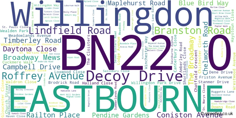
The largest settlements in the BN22 0 postal code are EASTBOURNE and Willingdon.
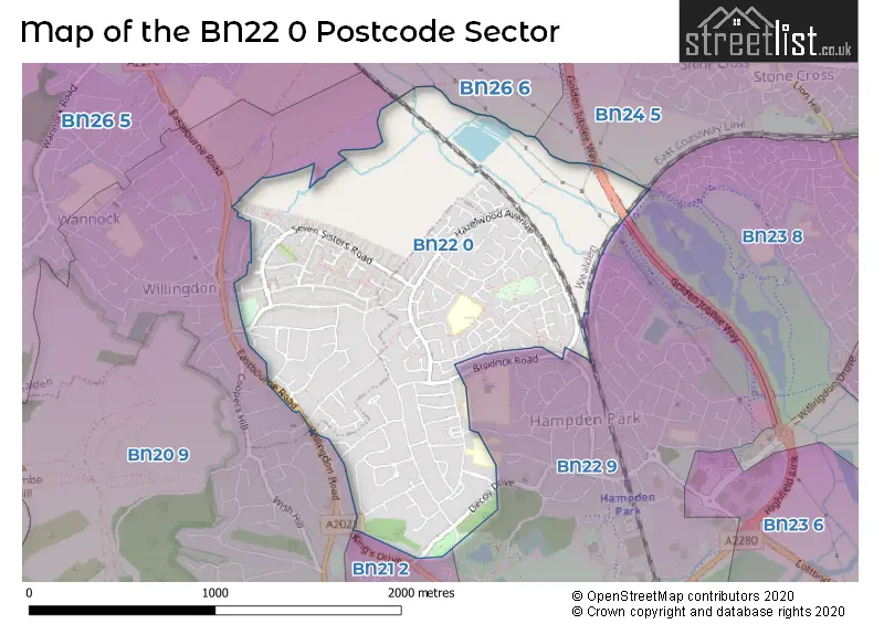
The BN22 0 Postcode shares a border with BN24 5 (Stone Cross, Westham, Hankham), BN26 6 (POLEGATE, Berwick, Arlington), BN20 9 (EASTBOURNE, Willingdon), BN21 2 (EASTBOURNE), BN22 9 (EASTBOURNE) and BN23 8 (EASTBOURNE).
The sector is within the post town of EASTBOURNE.
BN22 0 is a postcode sector within the BN22 postcode district which is within the BN Brighton postcode area.
The Royal Mail delivery office for the BN22 0 postal sector is the Eastbourne Delivery Office.
The area of the BN22 0 postcode sector is 1.20 square miles which is 3.11 square kilometres or 768.52 square acres.

Map of the BN22 0 Postcode Sector
Explore the BN22 0 postcode sector by using our free interactive map.
| B | N | 2 | 2 | - | 0 | X | X |
| B | N | 2 | 2 | Space | 0 | Letter | Letter |
Official List of Streets
EASTBOURNE (109 Streets)
Unofficial Streets or Alternative Spellings
Schools and Places of Education Within the BN22 0 Postcode Sector
Oakwood Primary Academy
Academy sponsor led
Magnolia Drive, Eastbourne, East Sussex, BN22 0SS
Head: Mr Ryan Laker
Ofsted Rating: Good
Inspection: 2022-10-12 (601 days ago)
Website: Visit Oakwood Primary Academy Website
Phone: 01323501251
Number of Pupils: 322
The Lindfield School
Academy special converter
Lindfield Road, Eastbourne, East Sussex, BN22 0BQ
Head: Mrs Kirsty Eydmann
Ofsted Rating: Outstanding
Inspection: 2019-03-12 (1911 days ago)
Website: Visit The Lindfield School Website
Phone: 01323502988
Number of Pupils: 111
House Prices in the BN22 0 Postcode Sector
| Type of Property | 2018 Average | 2018 Sales | 2017 Average | 2017 Sales | 2016 Average | 2016 Sales | 2015 Average | 2015 Sales |
|---|---|---|---|---|---|---|---|---|
| Detached | £382,305 | 60 | £348,566 | 59 | £345,493 | 56 | £318,502 | 64 |
| Semi-Detached | £271,159 | 37 | £281,847 | 38 | £238,284 | 44 | £226,633 | 36 |
| Terraced | £219,055 | 44 | £208,005 | 39 | £191,006 | 47 | £176,747 | 47 |
| Flats | £131,705 | 19 | £136,734 | 28 | £129,154 | 13 | £118,122 | 16 |
Important Postcodes BN22 0 in the Postcode Sector
BN22 0BQ is the postcode for Lindfield School, Lindfield Road
BN22 0SS is the postcode for Oakwood School, Magnolia Walk, and Eastbourne Childrens Centre, Magnolia Walk
BN22 0UT is the postcode for Maywood Family Centre, Holly Place
| The BN22 0 Sector is within these Local Authorities |
|
|---|---|
| The BN22 0 Sector is within these Counties |
|
| The BN22 0 Sector is within these Water Company Areas |
|