The CR0 8 postcode sector is within the county of Greater London.
Did you know? According to the 2021 Census, the CR0 8 postcode sector is home to a bustling 12,871 residents!
Given that each sector allows for 400 unique postcode combinations. Letters C, I, K, M, O and V are not allowed in the last two letters of a postcode. With 267 postcodes already in use, this leaves 133 units available.
The CR0 8 postal code covers the settlement of CROYDON .
The CR0 8 Postcode shares a border with BR3 3 (BECKENHAM ), BR4 0 (WEST WICKHAM ), BR4 9 (WEST WICKHAM ), CR0 5 (CROYDON ) and CR0 7 (CROYDON ).
The sector is within the post town of CROYDON.
CR0 8 is a postcode sector within the CR0 postcode district which is within the CR Croydon postcode area.
The Royal Mail delivery office for the CR0 8 postal sector is the unknown.
The area of the CR0 8 postcode sector is 1.09 square miles which is 2.83 square kilometres or 700.27 square acres.
Waterways within the CR0 8 postcode sector include the The Beck.

Map of the CR0 8 Postcode Sector
Explore the CR0 8 postcode sector by using our free interactive map.
| C | R | 0 | - | 8 | X | X |
| C | R | 0 | Space | 8 | Letter | Letter |
Official List of Streets
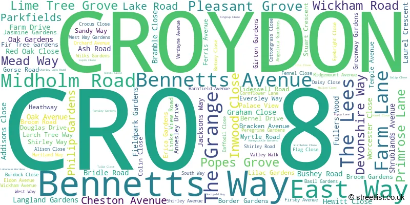
CROYDON (108 Streets)
Unofficial Streets or Alternative Spellings
CROYDON
BARMOUTH ROAD BRIDLE WAY NURSERY AVENUE SHIRLEY CHURCH ROAD SPOUT HILL SPRING PARK AVENUE SPRING PARK ROAD THE VALEWEST WICKHAM
POND COTTAGE LANEBECKENHAM
MONKS ORCHARD ROAD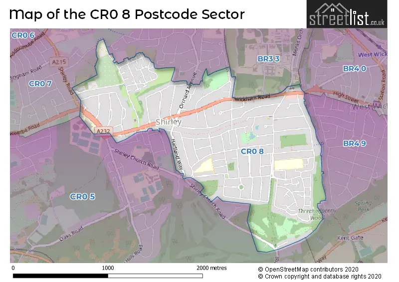
House Prices in the CR0 8 Postcode Sector
| Type of Property | 2018 Average | 2018 Sales | 2017 Average | 2017 Sales | 2016 Average | 2016 Sales | 2015 Average | 2015 Sales |
|---|---|---|---|---|---|---|---|---|
| Detached | £566,179 | 14 | £626,625 | 20 | £584,071 | 21 | £508,110 | 21 |
| Semi-Detached | £537,040 | 57 | £530,000 | 66 | £506,956 | 59 | £464,094 | 86 |
| Terraced | £427,642 | 30 | £385,909 | 17 | £352,696 | 37 | £332,029 | 17 |
| Flats | £296,143 | 49 | £247,433 | 30 | £248,545 | 41 | £217,472 | 53 |
Important Postcodes CR0 8 in the Postcode Sector
CR0 8HQ is the postcode for FOREST ACADEMY, BRIDLE ROAD, and The Forest Academy, Bridle Road
CR0 8RQ is the postcode for JUNIORS, Benson Primary School, West Way, INFANTS, Benson Primary School, West Way, Infants, Harris Primary Academy Benson, West Way, Juniors, Harris Primary Academy Benson, West Way, and KITCHEN/DINING, Benson Primary School, West Way
| The CR0 8 Sector is within these Local Authorities |
|
|---|---|
| The CR0 8 Sector is within these Counties |
|
| The CR0 8 Sector is within these Water Company Areas |
|