Given that each sector allows for 400 unique postcode combinations. Letters C, I, K, M, O and V are not allowed in the last two letters of a postcode. With 221 postcodes already in use, this leaves 179 units available.
The largest settlements in the DD7 7 postal code are CARNOUSTIE and Barry.
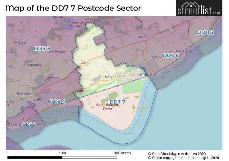
The DD7 7 Postcode shares a border with DD5 3 (Broughty Ferry), DD5 4 (Monifieth) and DD7 6 (CARNOUSTIE, Panbride, Panmure).
The sector is within the post town of CARNOUSTIE.
DD7 7 is a postcode sector within the DD7 postcode district which is within the DD Dundee postcode area.
The Royal Mail delivery office for the DD7 7 postal sector is the Carnoustie Delivery Office.
The area of the DD7 7 postcode sector is 9.33 square miles which is 24.18 square kilometres or 5,973.94 square acres.

Map of the DD7 7 Postcode Sector
Explore the DD7 7 postcode sector by using our free interactive map.
| D | D | 7 | - | 7 | X | X |
| D | D | 7 | Space | 7 | Letter | Letter |
Official List of Streets
CARNOUSTIE (96 Streets)
Barry (9 Streets)
Unofficial Streets or Alternative Spellings
| The DD7 7 Sector is within these Local Authorities | |
|---|---|
| The DD7 7 Sector is within these Counties | |
| The DD7 7 Sector is within these Water Company Areas |