Given that each sector allows for 400 unique postcode combinations. Letters C, I, K, M, O and V are not allowed in the last two letters of a postcode. With 223 postcodes already in use, this leaves 177 units available.
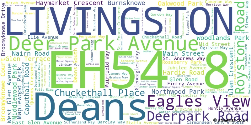
The largest settlements in the EH54 8 postal code are LIVINGSTON and Deans.
The EH54 8 Postcode shares a border with EH48 1 (BATHGATE), EH47 7 (Blackburn, Seafield, BATHGATE), EH54 7 (LIVINGSTON, Livingston Village, Kirkton Campus), EH52 6 (Winchburgh, BROXBURN, Uphall), EH54 5 (LIVINGSTON, Uphall Station, Houstoun Industrial Estate) and EH54 6 (LIVINGSTON).
The sector is within the post town of LIVINGSTON.
EH54 8 is a postcode sector within the EH5 postcode district which is within the EH Edinburgh postcode area.
The Royal Mail delivery office for the EH54 8 postal sector is the unknown.
The area of the EH54 8 postcode sector is 3.48 square miles which is 9.01 square kilometres or 2,227.51 square acres.

Map of the EH54 8 Postcode Sector
Explore the EH54 8 postcode sector by using our free interactive map.
| E | H | 5 | 4 | - | 8 | X | X |
| E | H | 5 | 4 | Space | 8 | Letter | Letter |
Official List of Streets
LIVINGSTON (72 Streets)
Deans (50 Streets)
Unofficial Streets or Alternative Spellings
Houstoun Industrial Estate
HOUSTOUN ROAD NETTLEHILL ROADLIVINGSTON
SCHOOL HOUSE ROAD ALDERSTONE PATH ARRAN BARRACKS ROUNDABOUT BUTE CARMONDEAN CENTRE ROAD CARMONDEAN PATH CLARKE SQUARE DEANS EAST ROAD DEANS NORTH ROAD DEANS ROUNDABOUT DECHMONT LAW LINK DEER PARK DRIVE DEER PARK ROAD ELIBURN NORTH ROUNDABOUT FOLLY BURN PATH GREENWOOD PARK HOUSTOUN INTERCHANGE HOUSTOUN PARK JURA KNIGHTSRIDGE EAST ROAD KNIGHTSRIDGE ROUNDABOUT KNIGHTSRIDGE WEST ROAD LADYWELL EAST ROAD LIVINGSTON EAST ROUNDABOUT LIVINGSTON ROAD LOAN PATH MOSS INTERCHANGE MOSSBANK ROUNDABOUT NELL BURN PATH NELLBURN ROAD RAILWAY PATH NORTH RAILWAY PATH SOUTH STARLAW PARK STARLAW WEST ROUNDABOUT TAILEND ROUNDABOUT WESTER DECHMONTBATHGATE
STARLAW ROAD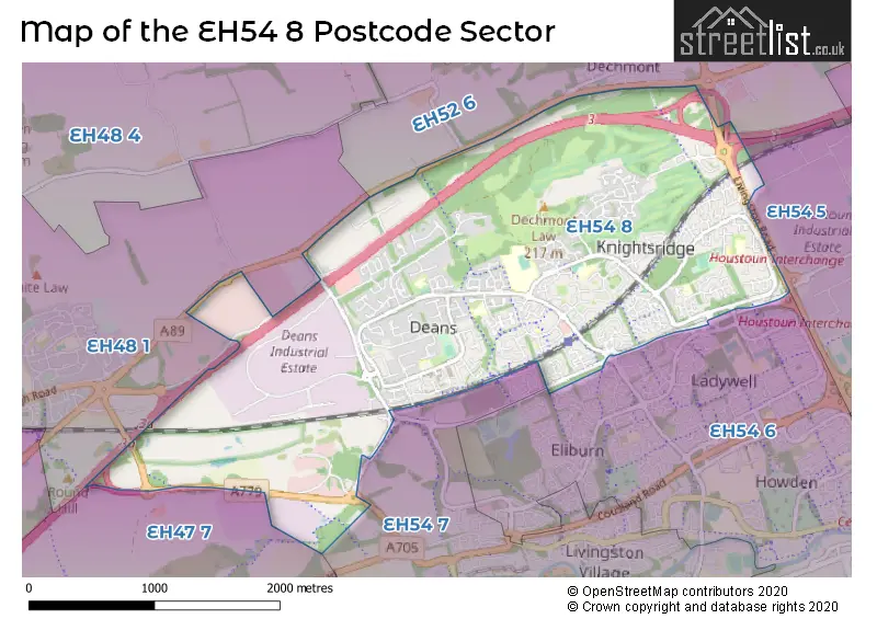
| The EH54 8 Sector is within these Local Authorities | |
|---|---|
| The EH54 8 Sector is within these Counties | |
| The EH54 8 Sector is within these Water Company Areas |