Given that each sector allows for 400 unique postcode combinations. Letters C, I, K, M, O and V are not allowed in the last two letters of a postcode. With 271 postcodes already in use, this leaves 129 units available.
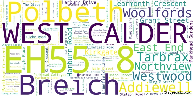
The largest settlement in the EH55 8 postal code is WEST CALDER followed by Polbeth, and Addiewell.
The EH55 8 Postcode shares a border with ML11 8 (Forth, Carnwath, Carstairs Junction), EH27 8 (KIRKNEWTON, Wilkieston), EH47 7 (Blackburn, Seafield, BATHGATE), EH54 7 (LIVINGSTON, Livingston Village, Kirkton Campus), EH47 8 (Whitburn, Stoneyburn, Longridge), EH47 9 (Fauldhouse, BATHGATE), EH53 0 (East Calder, Mid Calder, Pumpherston) and EH54 9 (LIVINGSTON, Murieston, Bellsquarry).
The sector is within the post town of WEST CALDER.
EH55 8 is a postcode sector within the EH5 postcode district which is within the EH Edinburgh postcode area.
The Royal Mail delivery office for the EH55 8 postal sector is the unknown.
The area of the EH55 8 postcode sector is 35.71 square miles which is 92.49 square kilometres or 22,855.35 square acres.

Map of the EH55 8 Postcode Sector
Explore the EH55 8 postcode sector by using our free interactive map.
| E | H | 5 | 5 | - | 8 | X | X |
| E | H | 5 | 5 | Space | 8 | Letter | Letter |
Official List of Streets
WEST CALDER (65 Streets)
Addiewell (23 Streets)
Polbeth (34 Streets)
Breich (6 Streets)
Unofficial Streets or Alternative Spellings
Murieston
MURIESTON VALLEYLIVINGSTON
MURIESTON ROAD ADDIEBROWNHILL ANNETSCROSS BRIDGE BANKTON ROAD BLACKHILL BRIDGE BREICH BRIDGE BREICH PIT STUDIO BROTHERTON AVENUE BROTHERTON FOREST BROTHERTON GLADE BROTHERTON WOOD BURN PATH CROSSWOOD BRIDGE CUTHILL BRIDGE EASTER BREICH WOODAND EASTER BREICH WOODLAND PATH FAIRY TRAIL HARTWOOD BRIDGE MIDGY LANE MURIESTON SOUTH DISTRICT ROAD NORTH VIEW SHEAR BRIDGE STEPEND BRIDGE TORPHIN BRIDGE WEST CALDER TO HARBURN RIGHT OF WAY WEST MUIR ROAD WILDERNESS ROUNDABOUT WOODLAND WALK WOOLFORDS TO TARBRAX TRAILStoneyburn
GLENVIEW ROAD MAIN STREET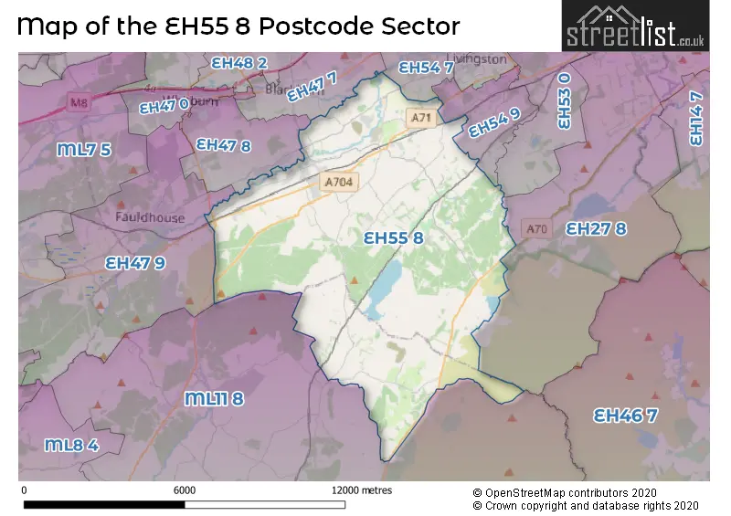
| The EH55 8 Sector is within these Local Authorities | |
|---|---|
| The EH55 8 Sector is within these Counties | |
| The EH55 8 Sector is within these Water Company Areas |