The IG8 7 postcode sector stands on the Essex and Greater London border.
Did you know? According to the 2021 Census, the IG8 7 postcode sector is home to a bustling 9,770 residents!
Given that each sector allows for 400 unique postcode combinations. Letters C, I, K, M, O and V are not allowed in the last two letters of a postcode. With 161 postcodes already in use, this leaves 239 units available.
The IG8 7 postal code covers the settlement of WOODFORD GREEN .
The IG8 7 Postcode shares a border with E18 1 (SOUTH WOODFORD , LONDON ), IG8 8 (WOODFORD GREEN , CHIGWELL ), IG8 9 (WOODFORD GREEN ), IG9 5 (BUCKHURST HILL ), IG9 6 (BUCKHURST HILL ) and IG8 0 (WOODFORD GREEN ).
The sector is within the post town of WOODFORD GREEN.
IG8 7 is a postcode sector within the IG8 postcode district which is within the IG Ilford postcode area.
The Royal Mail delivery office for the IG8 7 postal sector is the Woodford Green Delivery Office.
The area of the IG8 7 postcode sector is 0.58 square miles which is 1.49 square kilometres or 369.37 square acres.
The IG8 7 postcode sector is crossed by the M11 motorway.
Waterways within the IG8 7 postcode sector include the River Roding, Roding.

Map of the IG8 7 Postcode Sector
Explore the IG8 7 postcode sector by using our free interactive map.
| I | G | 8 | - | 7 | X | X |
| I | G | 8 | Space | 7 | Letter | Letter |
Official List of Streets
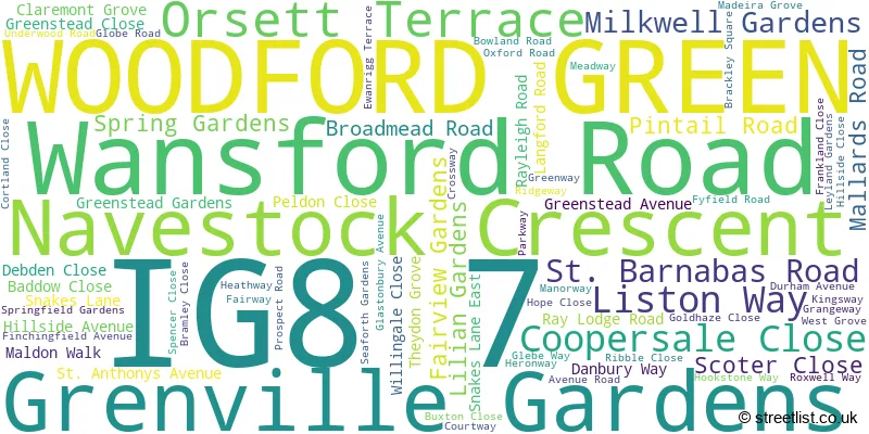
WOODFORD GREEN (74 Streets)
Unofficial Streets or Alternative Spellings
WOODFORD GREEN
CHARTERIS ROAD BEAUMARIS DRIVE COURTLAND CLOSE ELLIOT CLOSE SAINT BARNABAS ROAD STATION APPROACHRedbridge
CHIGWELL ROAD WYNNDALE ROADBUCKHURST HILL
CHERRY TREE RISE HAWTHORN ROAD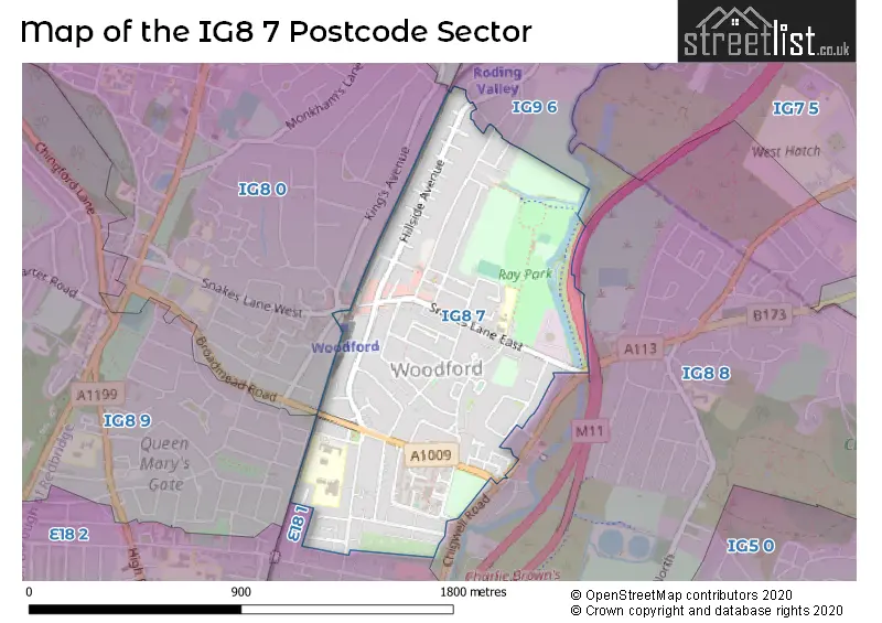
House Prices in the IG8 7 Postcode Sector
| Type of Property | 2018 Average | 2018 Sales | 2017 Average | 2017 Sales | 2016 Average | 2016 Sales | 2015 Average | 2015 Sales |
|---|---|---|---|---|---|---|---|---|
| Detached | £537,500 | 2 | £0 | 0 | £670,000 | 1 | £400,000 | 1 |
| Semi-Detached | £565,394 | 31 | £538,042 | 27 | £525,955 | 22 | £488,016 | 40 |
| Terraced | £511,768 | 42 | £473,009 | 60 | £453,720 | 52 | £400,843 | 70 |
| Flats | £318,167 | 12 | £283,461 | 23 | £266,081 | 29 | £249,545 | 28 |
Important Postcodes IG8 7 in the Postcode Sector
IG8 7DQ is the postcode for FITNESS CENTRE, Woodbridge High School, St. Barnabas Road, SPORTS HALL, Woodbridge High School, St. Barnabas Road, WYNNDALE, Woodbridge High School, St. Barnabas Road, MALLARDS, Woodbridge High School, St. Barnabas Road, Woodbridge High School, St. Barnabas Road, and RODING ARTS CENTRE, Woodbridge High School, St. Barnabas Road
IG8 7JQ is the postcode for WILLOW BLOCK, Ray Lodge Primary School, Snakes Lane East, Ray Lodge Primary School, Snakes Lane East, OAK BLOCK, Ray Lodge Primary School, Snakes Lane East, and KITCHEN BLOCK, Ray Lodge Primary School, Snakes Lane East
IG8 7QH is the postcode for GREEN LODGE RESPITE CARE UNIT, Grove House, 7, Madeira Grove
| The IG8 7 Sector is within these Local Authorities |
|
|---|---|
| The IG8 7 Sector is within these Counties |
|
| The IG8 7 Sector is within these Water Company Areas |
|