The LN12 2 postcode sector is within the county of Lincolnshire.
Did you know? According to the 2021 Census, the LN12 2 postcode sector is home to a bustling 7,884 residents!
Given that each sector allows for 400 unique postcode combinations. Letters C, I, K, M, O and V are not allowed in the last two letters of a postcode. With 271 postcodes already in use, this leaves 129 units available.
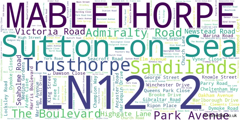
The largest settlement in the LN12 2 postal code is Sutton-on-Sea followed by MABLETHORPE, and Trusthorpe.
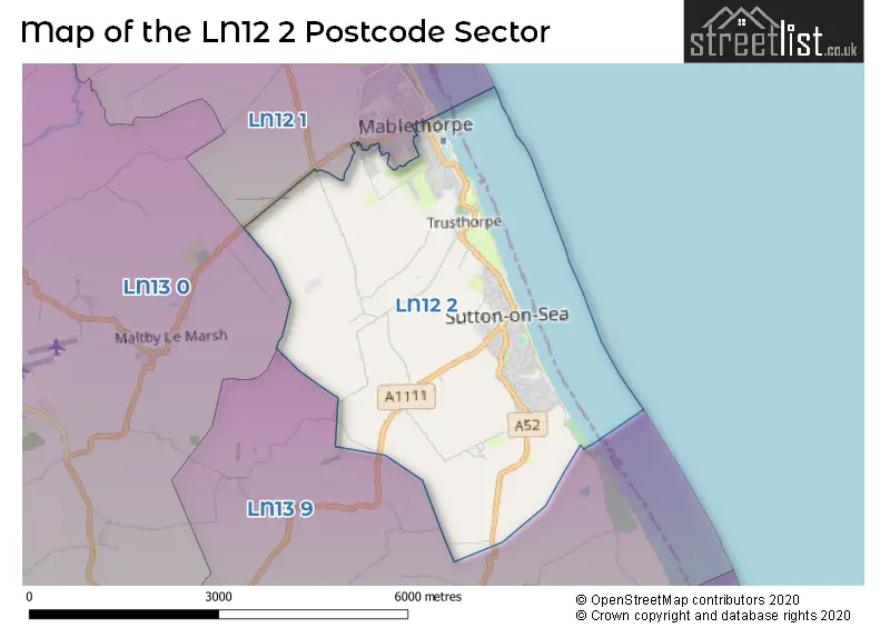
The LN12 2 Postcode shares a border with LN12 1 (MABLETHORPE, Theddlethorpe), LN13 0 (ALFORD, Withern, Maltby Le Marsh) and LN13 9 (ALFORD, Huttoft, Mumby).
The sector is within the post town of MABLETHORPE.
LN12 2 is a postcode sector within the LN1 postcode district which is within the LN Lincoln postcode area.
The Royal Mail delivery office for the LN12 2 postal sector is the Lincoln Delivery Office and Saxilby Scale Payment Delivery Office.
The area of the LN12 2 postcode sector is 7.66 square miles which is 19.84 square kilometres or 4,903.45 square acres.

Map of the LN12 2 Postcode Sector
Explore the LN12 2 postcode sector by using our free interactive map.
| L | N | 1 | 2 | - | 2 | X | X |
| L | N | 1 | 2 | Space | 2 | Letter | Letter |
Official List of Streets
Sutton-on-Sea (97 Streets)
MABLETHORPE (42 Streets)
Trusthorpe (20 Streets)
Sandilands (20 Streets)
Unofficial Streets or Alternative Spellings
Huttoft
HUTTOFT BANK SUTTON ROAD BAMBERS BRIDGE BOHEMIA PROMENADE BROOK DRIVE DAWSONS CLOSE DORSET COURT HIGH GATE HIGH GATE LANE INGS ROAD JORDAN GROVE LANDSDOWNE CLOSE MALBOROUGH DRIVE MASON CLOSE PARK VIRE PROMENADE ROSSA ROAD ROSSAL CLOSE SAINT CLEMENTS CLOSE SAINT FRANCIS GARDENS SANDHURST COURT SOUTH PROMENADE ST PETERS LANE SOUTH STANTON ROAD STUDIO COURTHannah
CRAWCROFT LANEBilsby
SUTTON ROADTrusthorpe
IDEAL BUNGALOWSMABLETHORPE
ALFORD ROADSchools and Places of Education Within the LN12 2 Postcode Sector
Sutton-on-Sea Community Primary School
Community school
Station Road, Mablethorpe, Lincolnshire, LN12 2HU
Head: Mrs Rachel Green
Ofsted Rating: Good
Inspection: 2022-03-23 (792 days ago)
Website: Visit Sutton-on-Sea Community Primary School Website
Phone: 01507441319
Number of Pupils: 159
House Prices in the LN12 2 Postcode Sector
| Type of Property | 2018 Average | 2018 Sales | 2017 Average | 2017 Sales | 2016 Average | 2016 Sales | 2015 Average | 2015 Sales |
|---|---|---|---|---|---|---|---|---|
| Detached | £192,526 | 135 | £178,570 | 164 | £166,854 | 176 | £153,090 | 153 |
| Semi-Detached | £140,265 | 55 | £127,632 | 54 | £122,612 | 55 | £112,165 | 47 |
| Terraced | £111,622 | 16 | £113,256 | 16 | £94,673 | 9 | £70,145 | 10 |
| Flats | £94,814 | 11 | £92,542 | 19 | £95,938 | 8 | £61,000 | 14 |
Important Postcodes LN12 2 in the Postcode Sector
LN12 2DF is the postcode for Springwell Alternative Academy Mablethorpe, Seaholme Road, and Tennyson High School, Seaholme Road
LN12 2HU is the postcode for Sutton-on-Sea Cp School, Station Road, MAIN BUILDING, Sutton-on-Sea Cp School, Station Road, ADMINISTRATIVE BLOCK, Sutton-on-Sea Cp School, Station Road, and MAIN BLOCK, SUTTON ON SEA COMMUNITY PRIMARY SCHOOL, STATION ROAD
| The LN12 2 Sector is within these Local Authorities |
|
|---|---|
| The LN12 2 Sector is within these Counties |
|
| The LN12 2 Sector is within these Water Company Areas |
|