The LS15 9 postcode sector is within the county of West Yorkshire.
Did you know? According to the 2021 Census, the LS15 9 postcode sector is home to a bustling 3,852 residents!
Given that each sector allows for 400 unique postcode combinations. Letters C, I, K, M, O and V are not allowed in the last two letters of a postcode. With 109 postcodes already in use, this leaves 291 units available.
The largest settlements in the LS15 9 postal code are LEEDS and Colton.
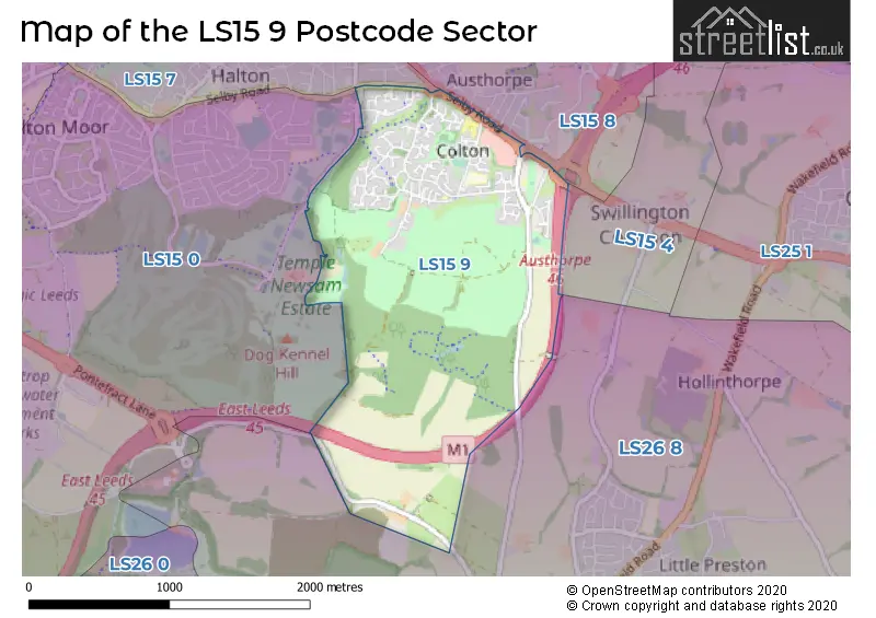
The LS15 9 Postcode shares a border with LS15 0 (LEEDS), LS15 4 (Barwick In Elmet, Scholes, LEEDS), LS15 7 (LEEDS, Halton, Crossgates), LS15 8 (LEEDS, Crossgates) and LS26 8 (Woodlesford, Oulton, Swillington).
The sector is within the post town of LEEDS.
LS15 9 is a postcode sector within the LS15 postcode district which is within the LS Leeds postcode area.
The Royal Mail delivery office for the LS15 9 postal sector is the Seacroft Delivery Office.
The area of the LS15 9 postcode sector is 1.64 square miles which is 4.26 square kilometres or 1,051.73 square acres.
The LS15 9 postcode sector is crossed by the A63 Major A road.
The LS15 9 postcode sector is crossed by the M1 motorway.

Map of the LS15 9 Postcode Sector
Explore the LS15 9 postcode sector by using our free interactive map.
| L | S | 1 | 5 | - | 9 | X | X |
| L | S | 1 | 5 | Space | 9 | Letter | Letter |
Official List of Streets
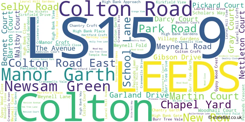
Colton (17 Streets)
LEEDS (79 Streets)
Unofficial Streets or Alternative Spellings
LEEDS
AUSTHORPE AVENUE AUSTHORPE DRIVE AUSTHORPE GROVE AUSTHORPE LANE DETROIT DRIVE HOLLYSHAW LANE PONTEFRACT LANEWoodlesford
NEWSAM GREEN ROADColton
SCHOLARS WAY AUSTHORPE INTERCHANGE CENTURY WAY COLTON LANE COLTON ROAD TO MEYNELL ROAD CRACKED EGG ELM TREE WALK KNIGHTSHILL SKYLINER ROUNDABOUT THE ELM WALKGarforth
SELBY ROADSwillington
BULLERTHORPE LANEWeather Forecast for LS15 9
Press Button to Show Forecast for Colton
| Time Period | Icon | Description | Temperature | Rain Probability | Wind |
|---|---|---|---|---|---|
| 06:00 to 09:00 | Overcast | 10.0°C (feels like 9.0°C) | 13.00% | N 9 mph | |
| 09:00 to 12:00 | Light rain | 12.0°C (feels like 11.0°C) | 55.00% | N 9 mph | |
| 12:00 to 15:00 | Heavy rain shower (day) | 14.0°C (feels like 12.0°C) | 67.00% | NNW 9 mph | |
| 15:00 to 18:00 | Light rain shower (day) | 15.0°C (feels like 13.0°C) | 40.00% | NW 9 mph | |
| 18:00 to 21:00 | Heavy rain shower (day) | 14.0°C (feels like 12.0°C) | 56.00% | NW 7 mph | |
| 21:00 to 00:00 | Light rain | 12.0°C (feels like 11.0°C) | 53.00% | WNW 7 mph |
Press Button to Show Forecast for Colton
| Time Period | Icon | Description | Temperature | Rain Probability | Wind |
|---|---|---|---|---|---|
| 00:00 to 03:00 | Overcast | 11.0°C (feels like 11.0°C) | 19.00% | W 4 mph | |
| 03:00 to 06:00 | Overcast | 11.0°C (feels like 10.0°C) | 18.00% | WSW 4 mph | |
| 06:00 to 09:00 | Overcast | 11.0°C (feels like 10.0°C) | 17.00% | SW 4 mph | |
| 09:00 to 12:00 | Cloudy | 13.0°C (feels like 12.0°C) | 10.00% | SW 7 mph | |
| 12:00 to 15:00 | Overcast | 15.0°C (feels like 14.0°C) | 11.00% | SW 9 mph | |
| 15:00 to 18:00 | Overcast | 16.0°C (feels like 14.0°C) | 12.00% | SW 9 mph | |
| 18:00 to 21:00 | Cloudy | 15.0°C (feels like 14.0°C) | 10.00% | SSW 7 mph | |
| 21:00 to 00:00 | Cloudy | 13.0°C (feels like 12.0°C) | 10.00% | SW 4 mph |
Press Button to Show Forecast for Colton
| Time Period | Icon | Description | Temperature | Rain Probability | Wind |
|---|---|---|---|---|---|
| 00:00 to 03:00 | Cloudy | 12.0°C (feels like 11.0°C) | 10.00% | SE 4 mph | |
| 03:00 to 06:00 | Cloudy | 10.0°C (feels like 9.0°C) | 11.00% | WSW 4 mph | |
| 06:00 to 09:00 | Cloudy | 11.0°C (feels like 10.0°C) | 10.00% | ESE 4 mph | |
| 09:00 to 12:00 | Cloudy | 13.0°C (feels like 12.0°C) | 12.00% | SE 7 mph | |
| 12:00 to 15:00 | Cloudy | 15.0°C (feels like 14.0°C) | 16.00% | SE 7 mph | |
| 15:00 to 18:00 | Cloudy | 15.0°C (feels like 14.0°C) | 17.00% | SE 7 mph | |
| 18:00 to 21:00 | Cloudy | 14.0°C (feels like 13.0°C) | 18.00% | S 7 mph | |
| 21:00 to 00:00 | Cloudy | 13.0°C (feels like 12.0°C) | 12.00% | SSE 7 mph |
House Prices in the LS15 9 Postcode Sector
| Type of Property | 2018 Average | 2018 Sales | 2017 Average | 2017 Sales | 2016 Average | 2016 Sales | 2015 Average | 2015 Sales |
|---|---|---|---|---|---|---|---|---|
| Detached | £294,563 | 23 | £266,125 | 30 | £309,371 | 22 | £240,859 | 17 |
| Semi-Detached | £185,700 | 10 | £181,454 | 12 | £186,499 | 18 | £178,363 | 11 |
| Terraced | £177,762 | 17 | £164,118 | 22 | £149,609 | 28 | £136,958 | 25 |
| Flats | £0 | 0 | £0 | 0 | £0 | 0 | £86,914 | 1 |
Important Postcodes LS15 9 in the Postcode Sector
LS15 9AL is the postcode for Colton Primary School, School Lane, and Colton Primary School, School Lane, Colton
LS15 9JH is the postcode for Colton Mill Medical Centre, Stile Hill Way
LS15 9JQ is the postcode for Driver & Vehicle Licensing Agency, Temple Point, Finch Drive
| The LS15 9 Sector is within these Local Authorities |
|
|---|---|
| The LS15 9 Sector is within these Counties |
|
| The LS15 9 Sector is within these Water Company Areas |
|