The LS28 8 postcode sector is within the county of West Yorkshire.
Did you know? According to the 2021 Census, the LS28 8 postcode sector is home to a bustling 8,309 residents!
Given that each sector allows for 400 unique postcode combinations. Letters C, I, K, M, O and V are not allowed in the last two letters of a postcode. With 202 postcodes already in use, this leaves 198 units available.
The LS28 8 postal code covers the settlement of PUDSEY.
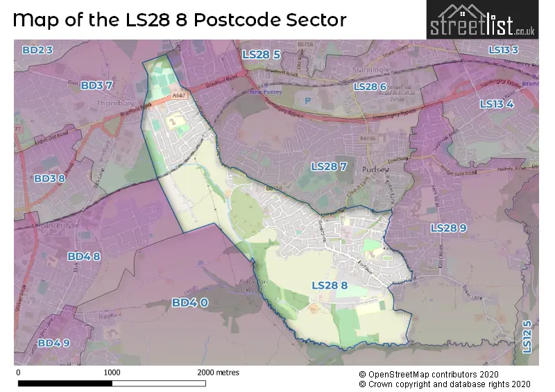
The LS28 8 Postcode shares a border with BD4 0 (BRADFORD, Tong, Tyersal), LS28 9 (PUDSEY), BD4 8 (BRADFORD, Laisterdyke, Tyersal), BD3 7 (BRADFORD, Thornbury) and LS28 7 (PUDSEY, Stanningley).
The sector is within the post town of PUDSEY.
LS28 8 is a postcode sector within the LS28 postcode district which is within the LS Leeds postcode area.
The Royal Mail delivery office for the LS28 8 postal sector is the Pudsey Delivery Office.
The area of the LS28 8 postcode sector is 1.34 square miles which is 3.48 square kilometres or 859.97 square acres.

Map of the LS28 8 Postcode Sector
Explore the LS28 8 postcode sector by using our free interactive map.
| L | S | 2 | 8 | - | 8 | X | X |
| L | S | 2 | 8 | Space | 8 | Letter | Letter |
Official List of Streets
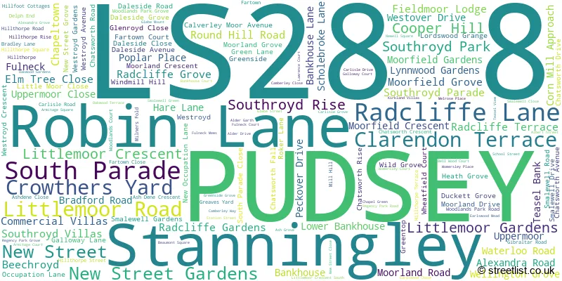
PUDSEY (139 Streets)
Unofficial Streets or Alternative Spellings
PUDSEY
AMBLERS COURT BRICK MILL ROAD CHURCH LANE CROMACK VIEW GROVE ROAD INGHAMS VIEW LITTLEMOOR VIEW LUMBY LANE MOOR GROVE MOUNT TABOR STREET OWLCOTES ROAD PERSEVERANCE STREET SANDRINGHAM AVENUE SHARP ROW SHERIDAN WAY SOUTHROYD VILLAS SUNNYRIDGE AVENUE TOFTS ROAD VALLEY ROAD VICTORIA ROAD WEST PARK WOMERSLEY COURT WOODLANDS COURTBRADFORD
KEEPER LANE SCHOLEBROOK LANE TYERSAL LANE TYERSAL ROADStanningley
BRADFORD ROADSchools and Places of Education Within the LS28 8 Postcode Sector
Greenside Primary School
Community school
Chapeltown, Pudsey, West Yorkshire, LS28 8NZ
Head: Mrs Sarah Fuller
Ofsted Rating: Good
Inspection: 2019-04-18 (1862 days ago)
Website: Visit Greenside Primary School Website
Phone: 01132574509
Number of Pupils: 302
Pudsey Bolton Royd Primary School
Community school
Moorland Grove, Leeds, West Yorkshire, LS28 8EP
Head: Mr Kim Buck
Ofsted Rating: Good
Inspection: 2023-11-15 (190 days ago)
Website: Visit Pudsey Bolton Royd Primary School Website
Phone: 01133862560
Number of Pupils: 468
Southroyd Primary and Nursery School
Foundation school
Littlemoor Crescent, Pudsey, West Yorkshire, LS28 8AT
Head: Miss Kate Prior
Ofsted Rating: Good
Inspection: 2019-11-07 (1659 days ago)
Website: Visit Southroyd Primary and Nursery School Website
Phone: 01133783020
Number of Pupils: 446
House Prices in the LS28 8 Postcode Sector
| Type of Property | 2018 Average | 2018 Sales | 2017 Average | 2017 Sales | 2016 Average | 2016 Sales | 2015 Average | 2015 Sales |
|---|---|---|---|---|---|---|---|---|
| Detached | £284,636 | 22 | £295,990 | 24 | £276,287 | 33 | £250,390 | 31 |
| Semi-Detached | £189,067 | 71 | £178,579 | 59 | £169,134 | 76 | £157,232 | 55 |
| Terraced | £173,575 | 53 | £171,075 | 43 | £140,362 | 48 | £151,169 | 52 |
| Flats | £124,231 | 8 | £125,966 | 15 | £93,950 | 11 | £102,833 | 6 |
Important Postcodes LS28 8 in the Postcode Sector
LS28 8AT is the postcode for Southroyd Primary School, Littlemoor Crescent
LS28 8EP is the postcode for Pudsey Bolton Royd Primary School, Moorland Grove
LS28 8NZ is the postcode for Greenside Primary School, South Parade
| The LS28 8 Sector is within these Local Authorities |
|
|---|---|
| The LS28 8 Sector is within these Counties |
|
| The LS28 8 Sector is within these Water Company Areas |
|
Tourist Attractions within the LS28 8 Postcode Area
We found 1 visitor attractions within the LS28 postcode area
| Fulneck Moravian Settlement |
|---|
| Museums & Art Galleries |
| Museum and / or Art Gallery |
| View Fulneck Moravian Settlement on Google Maps |